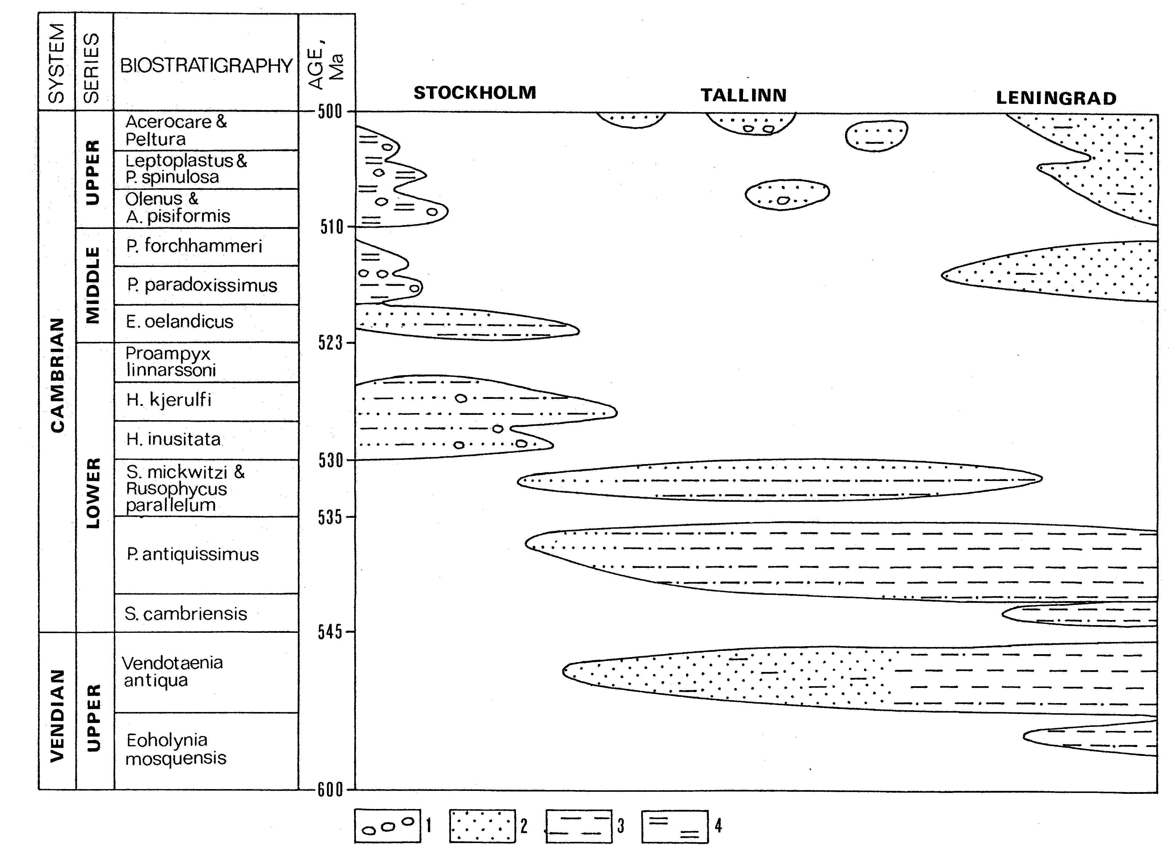
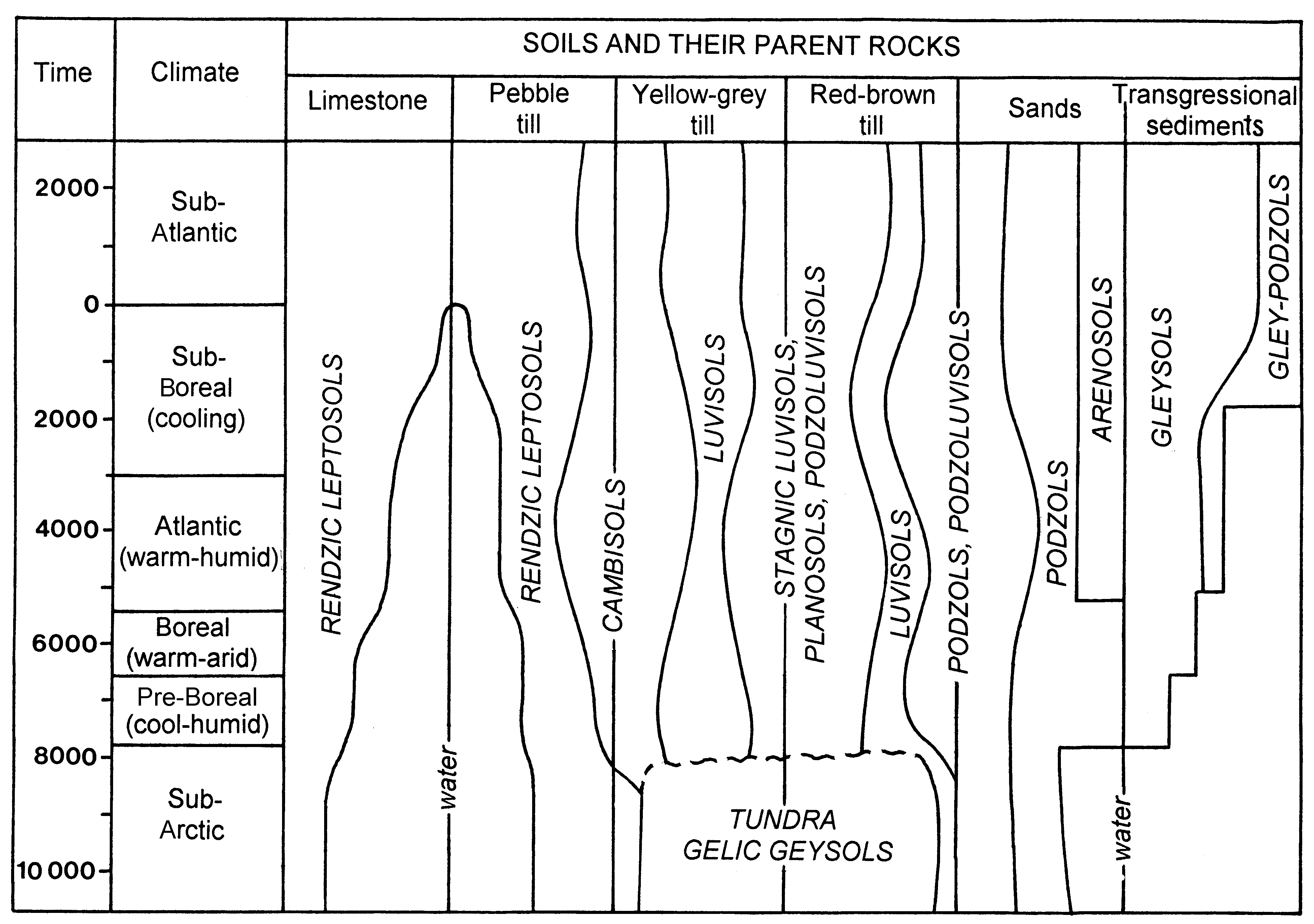
Figures
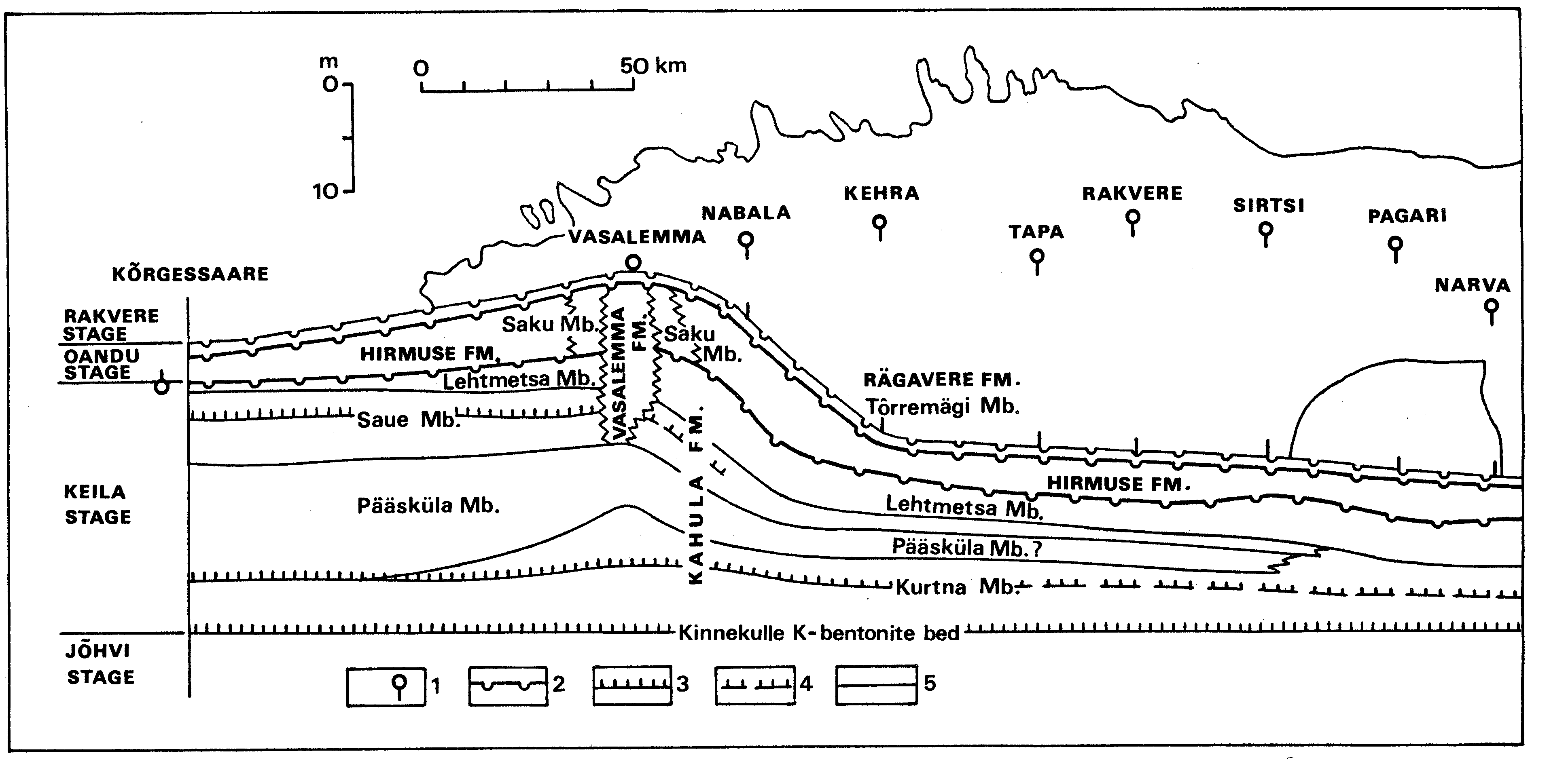
Fig. 1. Scheme of Estonian contemporary topography with isolines drawn at intervals of 50 m: 1 - 0
50; 2 - 50
100; 3 - 100
200; 4 - over 200.
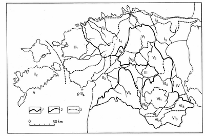
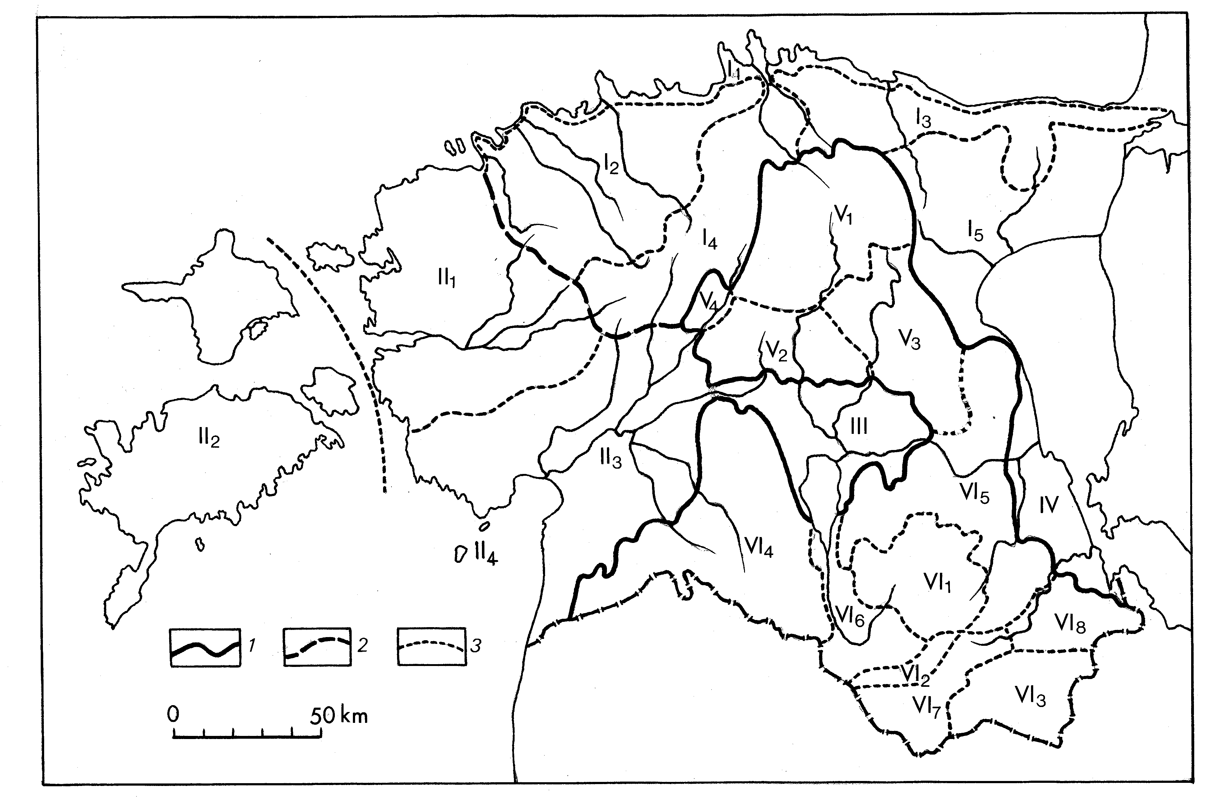
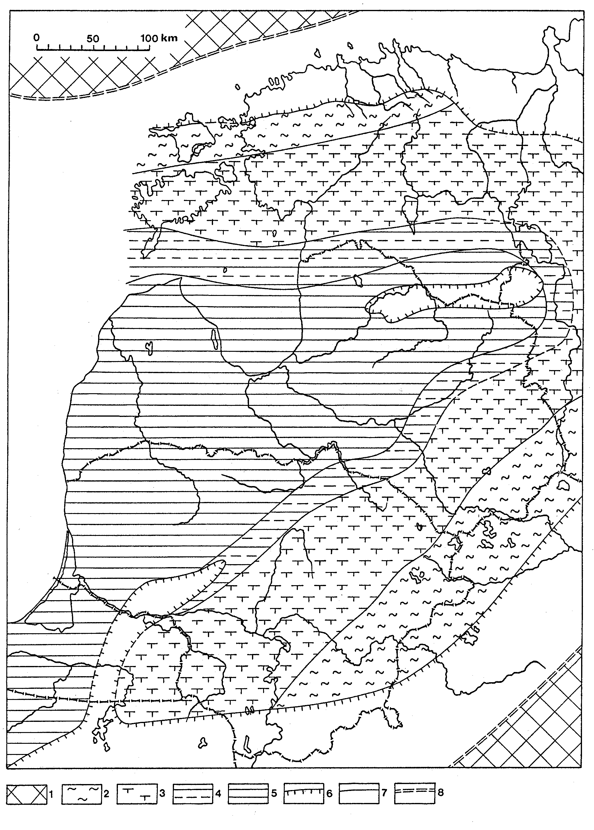
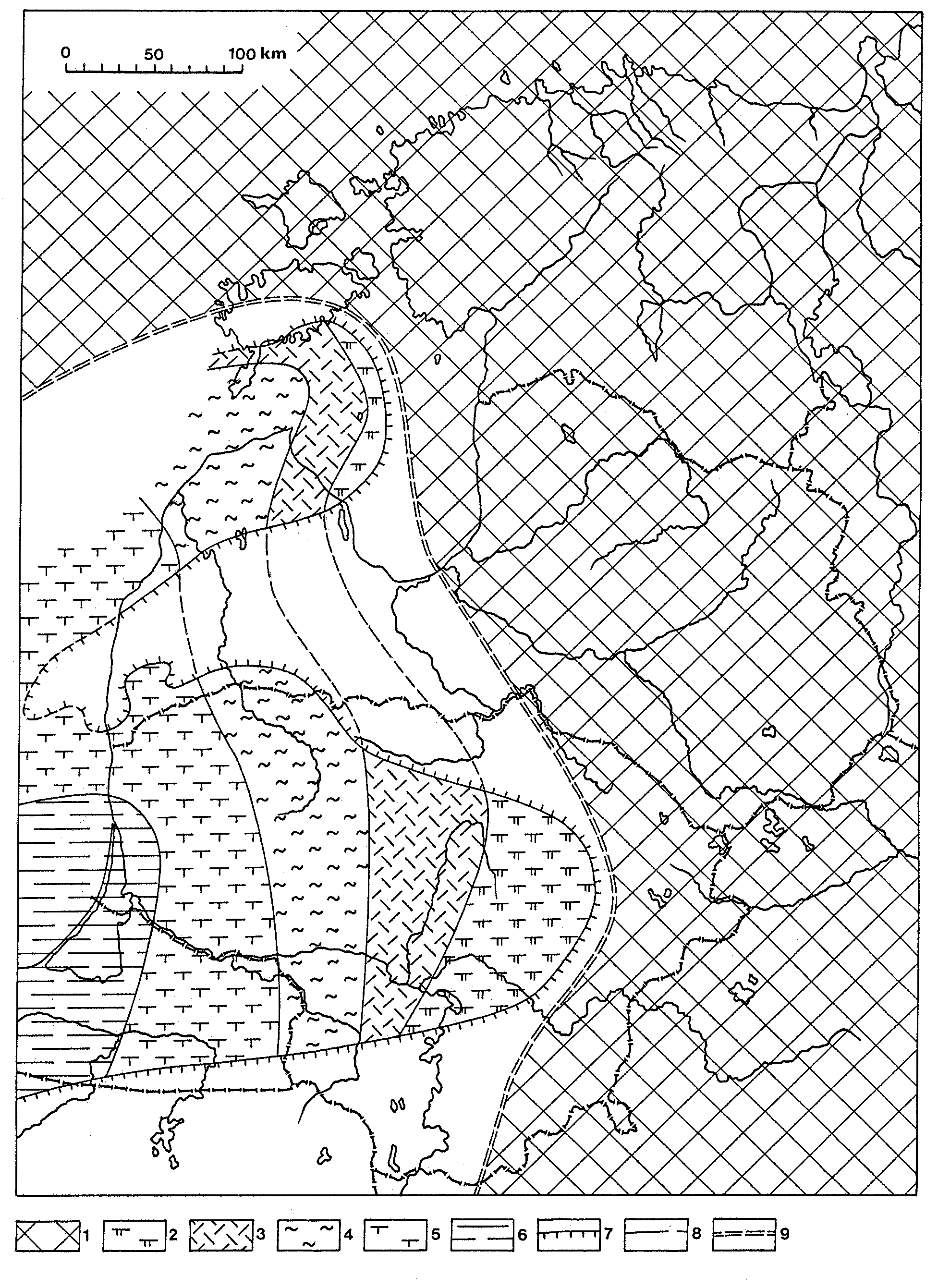
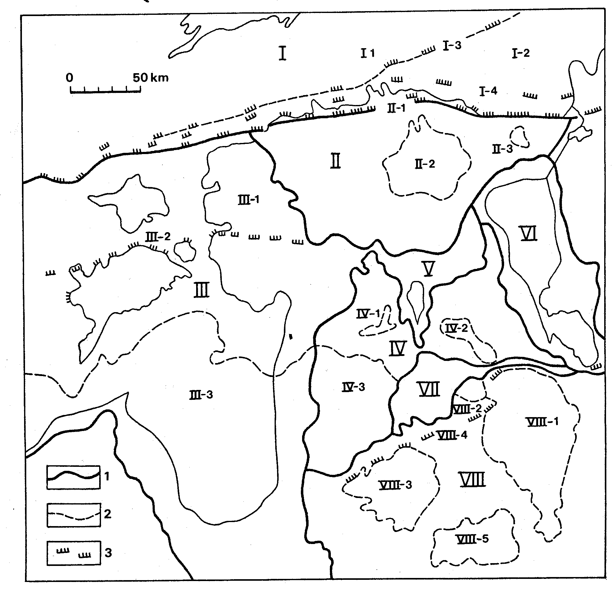
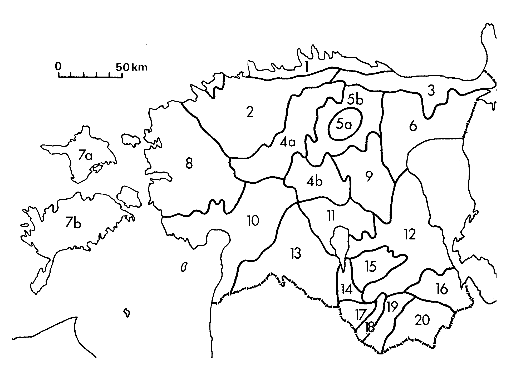
Fig. 2. Landscapes regions of Estonia after E. Varep: 1 - The boundary between Lower and Upper Estonia; 2 - the boundary between North and West Estonia; 3 - boundaries between landscape regions. Lower Estonia. I - North Estonia: I1 - North-Estonian Coastal Plain with the Gulf of Finlands islands; I2 - North-West Estonian Plateau; I3 - North-East Estonian Plateau; I4 - Kõrvemaa; I5 - Alutaguse Lowland; II - West Estonia: II1 - West-Estonian Lowland; II2 - West-Estonian Archipelago; II3 - Pärnu Lowland; II4 - Islands of the Gulf of Riga; III - Võrtsjärv Lowland; IV - Peipsi Coastal Lowland. Upper Estonia. V - Intermediate Estonia: V1 - Pandivere Upland; V2 - Central-Estonian Plain; V3 - Vooremaa; V4 - Türi Drumlin Field; VI - South Estonia: VI1 - Otepää Heights; VI2 - Karula Upland; VI3 - Haanja Heights; VI4 - Sakala Upland; VI5 - South-East Estonian Plain; VI6 - Valga Depression with the Väike-Emajõgi Valley; VI7 - Hargla Depression with the Võru Valley; VI8 - Palumaa Plain.
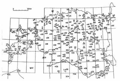
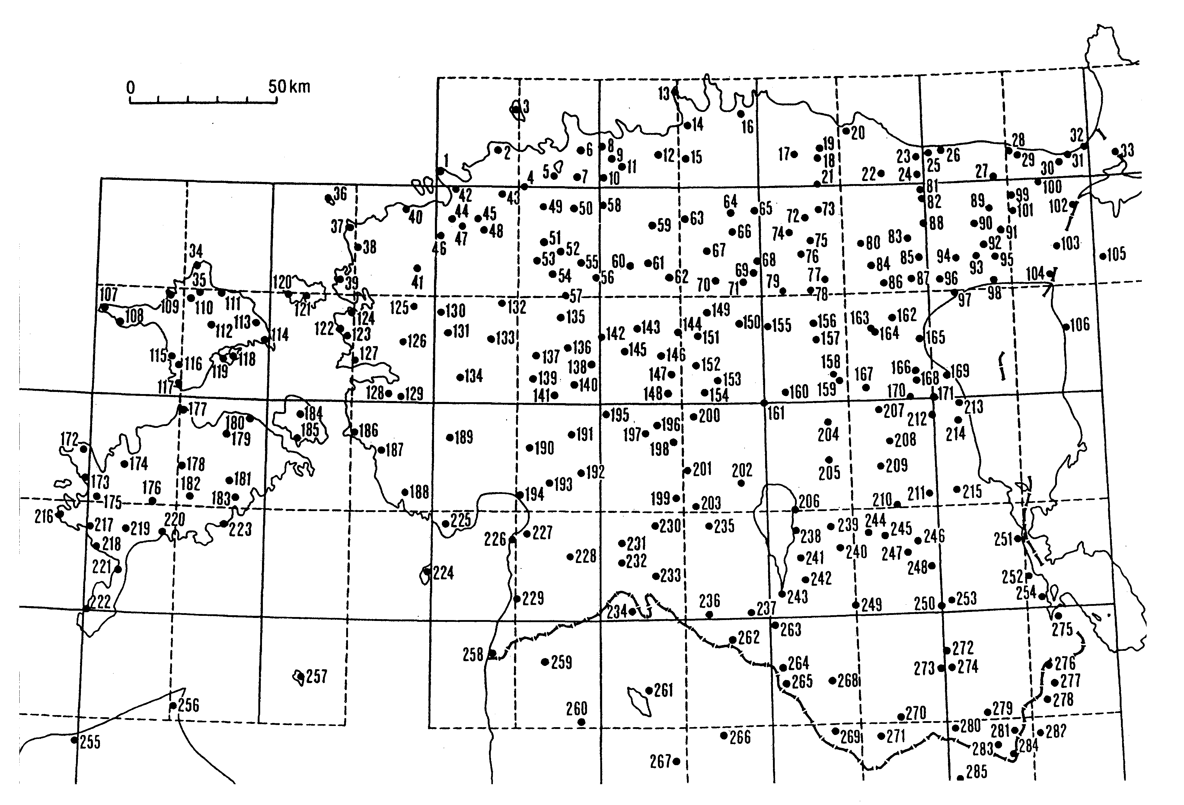
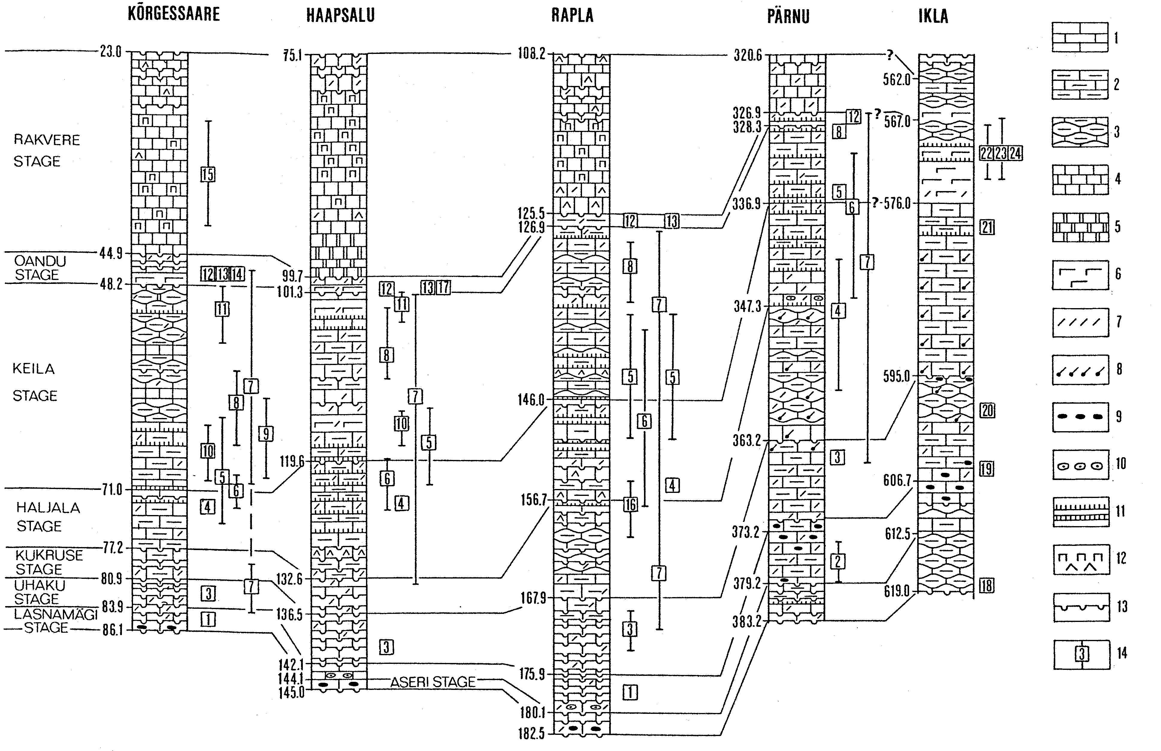
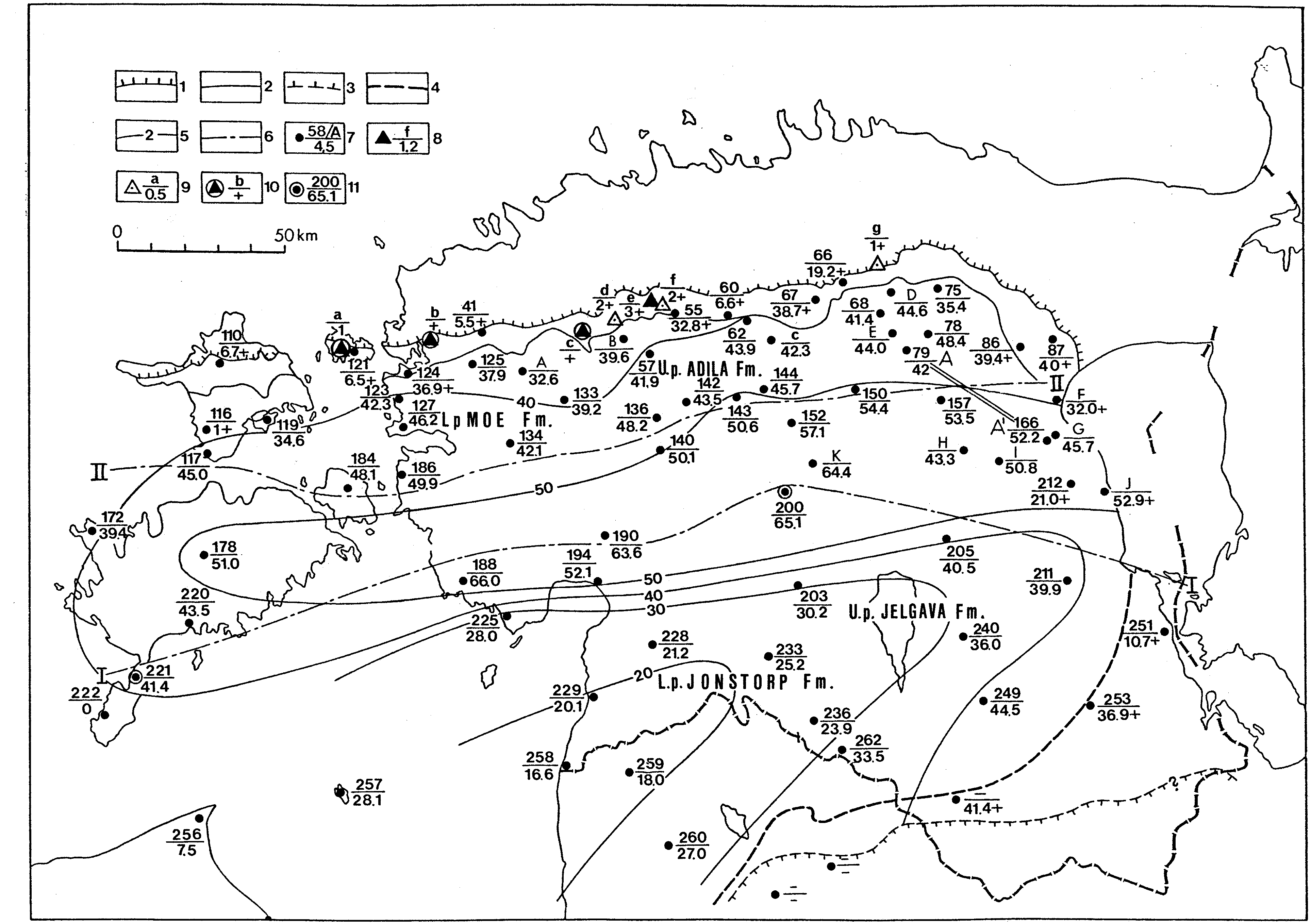
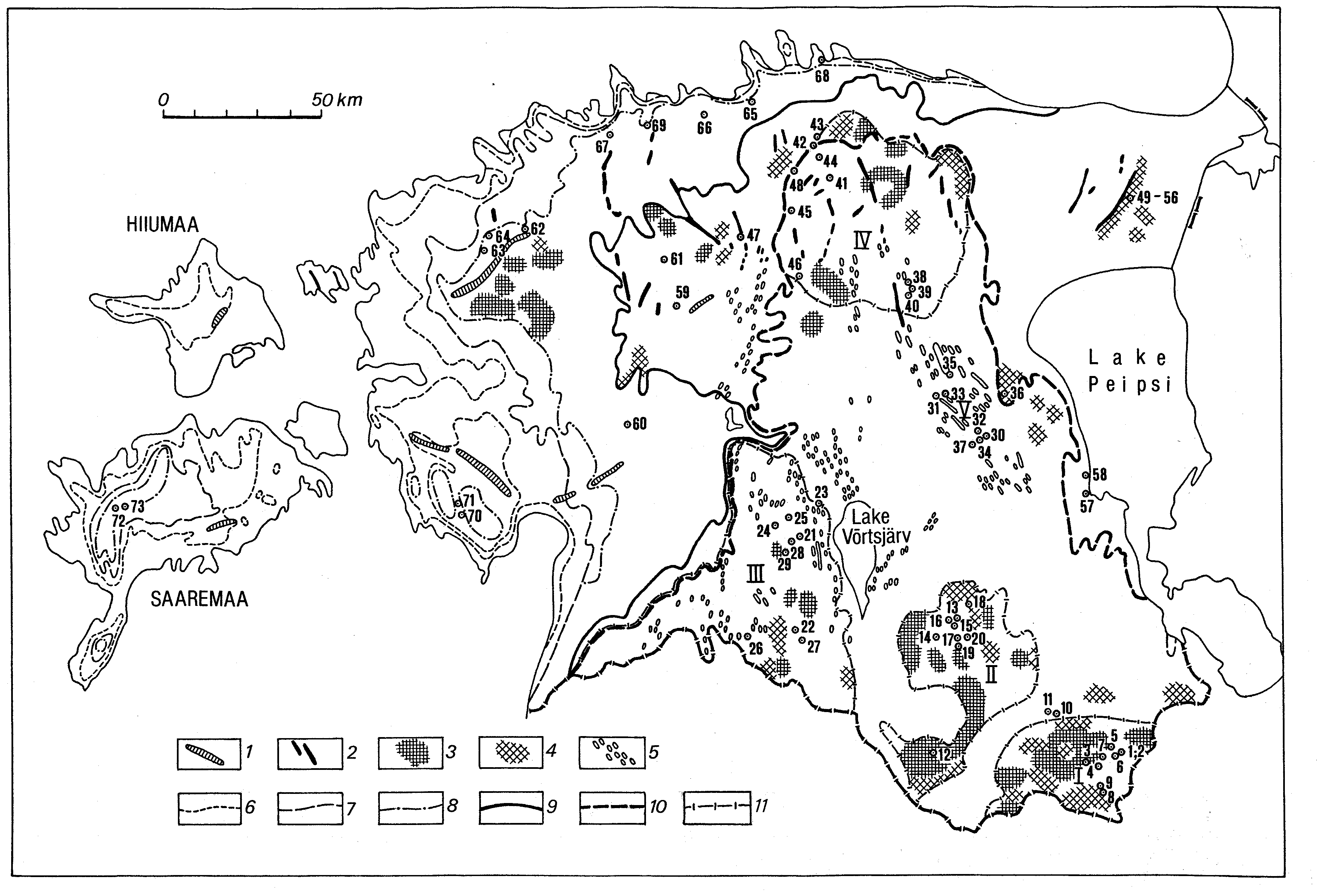
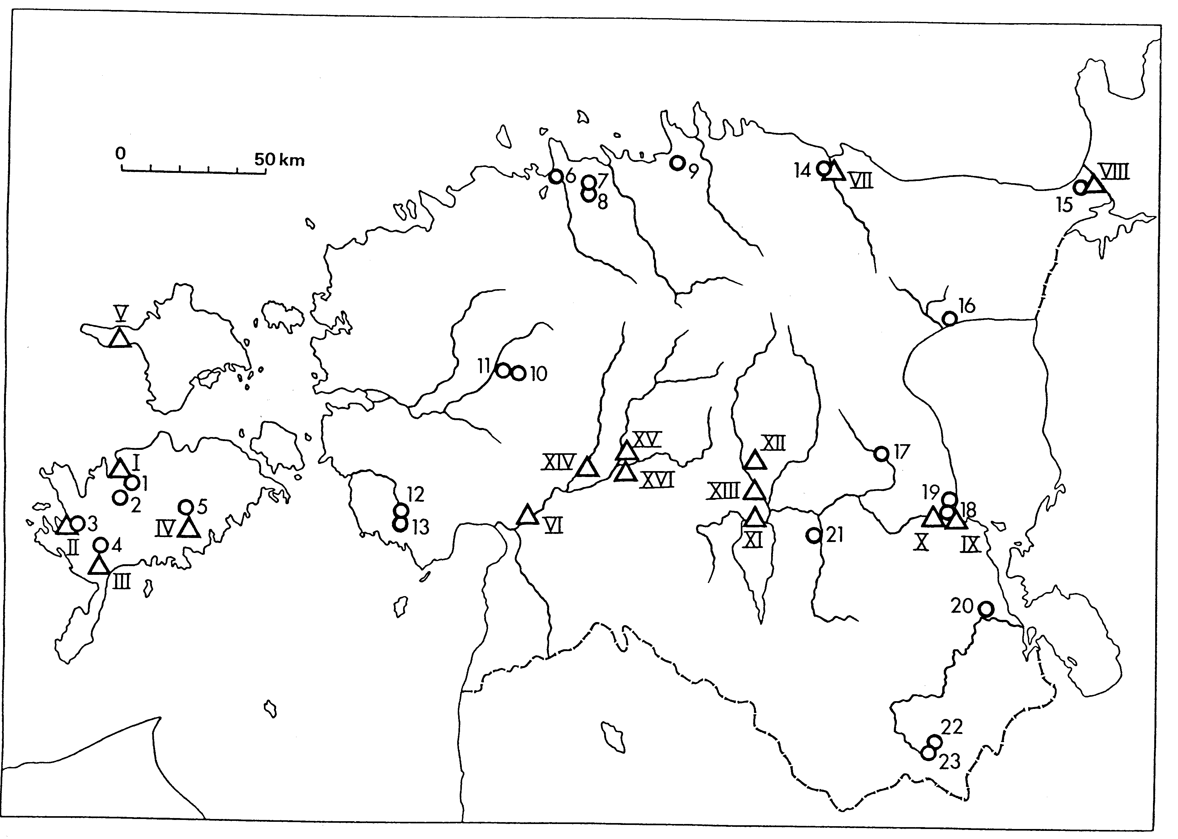
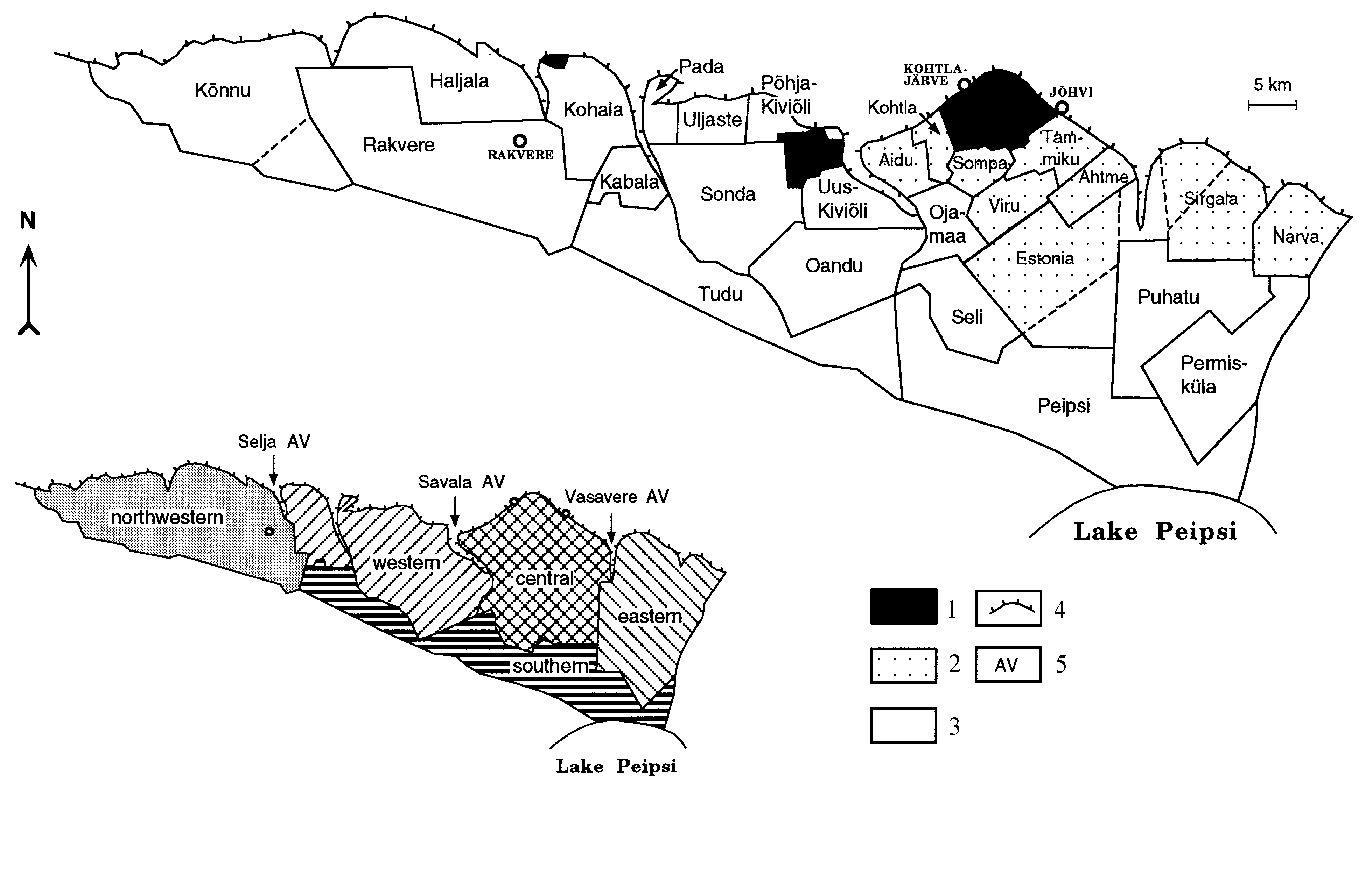
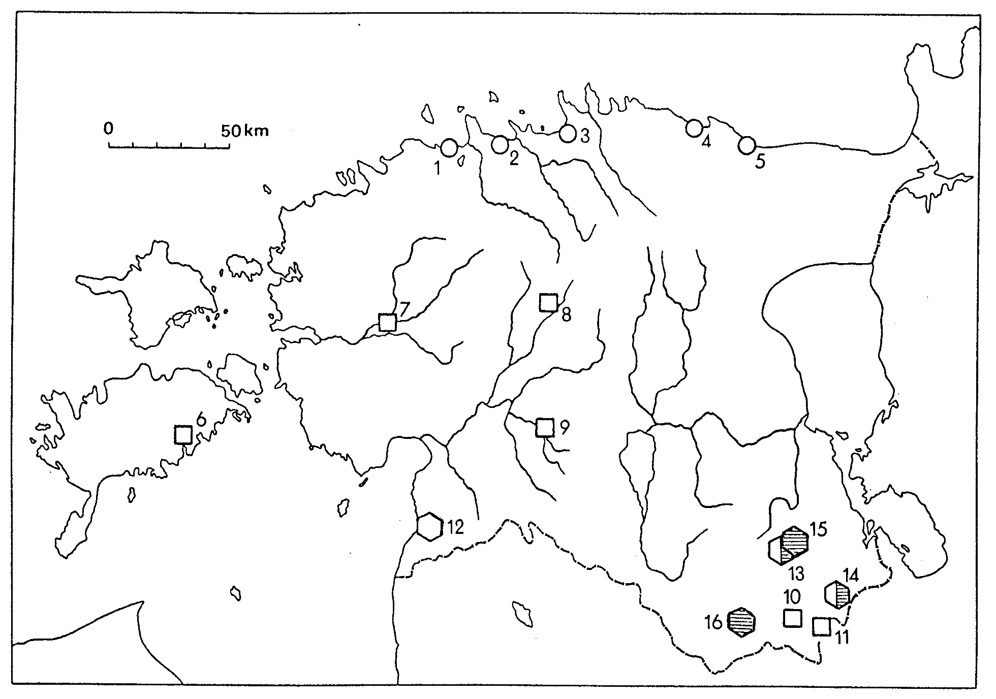
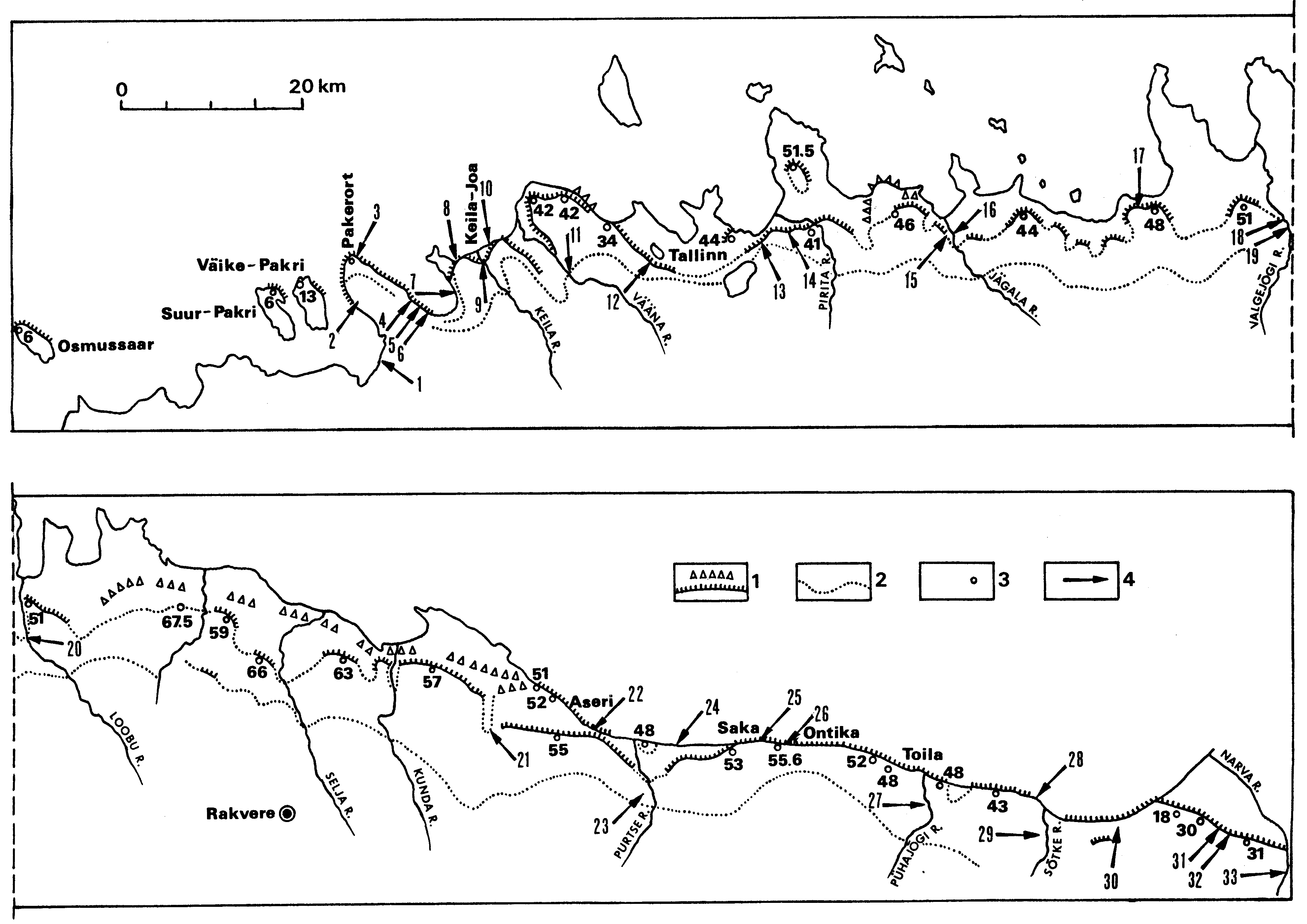
Fig. 3. Location map of main boreholes mentioned in the text. 1 - Pakrineeme, 2 - Muraste, 3 - Naissaare, 4 - Saue, 5 - Ülemiste, 6 - Lasnamägi, 7 - Assaku, 8 - Maardu, 9 - Kostivere, 10 - Aruküla, 11 - Jägala, 12 - Kiiu, 13 - Juminda, 14 - Pudisoo, 15 - Hirvli, 16 - Korjuse, 17 - Vanamõisa, 18 - Põdruse, 19 - Essu, 20 - Kunda, 21 - Rakvere, 22 - Uljaste, 23 - Kestla, 24 - Kiviõli, 25 - Purtse, 26 - Aa, 27 - Jõhvi, 28 - Toila, 29 - Oru, 30 - Sinimäe, 31 - Utria, 32 - Meriküla, 33 - Narva, 34 - Tahkuna, 35 - Kidaste, 36 - Osmussaar, 37 - Põõsaspea, 38 - Riguldi, 39 - Noarootsi, 40 - Vihterpalu, 41 - Seljaküla, 42 - Põllküla, 43 - Keila, 44 - Padise, 45 - Vasalemma, 46 - Audevälja, 47 - Rummu, 48 - Laitse, 49 - Saku, 50 - Nabala, 51 - Hageri, 52 - Lohu, 53 - Adila, 54 - Koigi, 55 - Härgla, 56 - Juuru, 57 - Rapla, 58 - Seli, 59 - Pihkva, 60 - Habaja, 61 - Ardu, 62 - Mustla, 63 - Vetla, 64 - Lehtse, 65 - Tapa, 66 - Ambla, 67 - Järva-Madise, 68 - Vajangu, 69 - Karinu I, 70 - Roosna-Alliku, 71 - Järva-Jaani, 72 - Assamalla, 73 - Koeravere, 74 - Porkuni, 75 - Pandivere, 76 - Väike-Maarja, 77 - Simuna, 78 - Kamariku, 79 - Puhmu, 80 - Roela, 81 - Savala, 82 - Oandu, 83 - Tudu, 84 - Paasvere, 85 - Oonurme, 86 - Venevere, 87 - Enniksaare , 88 - Talumaa, 89 - Pagari, 90 - Mäetaguse, 91 - Kaidma, 92 - Sõrumäe, 93 - Iisaku, 94 - Taga-Roostoja, 95 - Vaikla, 96 - Tudulinna, 97 - Rannapungerja, 98 - Alajõe, 99 - Rausvere, 100 - Viivikonna, 101 - Illuka, 102 - Mustajõe, 103 - Kuningaküla, 104 - Jaama, 105 - Slantsõ, 106 - Verholjane, 107 - Kalana, 108 - Kaleste, 109 - Kõrgessaare, 110 - Kurisuu, 111 - Paluküla, 112 - Määvli, 113 - Värsso, 114 - Soonlepa, 115 - Nurste, 116 - Lassi, 117 - Emmaste, 118 - Kassari, 119 - Orjaku, 120 - Förby, 121 - Hullo, 122 - Pusku, 123 - Asuküla 2, 124 - Haapsalu, 125 - Palivere, 126 - Martna, 127 - Kiideva, 128 - Kirikuküla, 129 - Lihula, 130 - Koluvere, 131 - Kullamaa, 132 - Vaimõisa, 133 - Paeküla, 134 - Rumba, 135 - Raikküla, 136 - Lihuveski, 137 - Valgu, 138 - Lokuta, 139 - Nurme, 140 - Kõnnu, 141 - Kaisma, 142 - Lelle, 143 - Piiumetsa, 144 - Paide, 145 - Käru, 146 - Türi, 147 - Vilita, 148 - Vaki, 149 - Vodja, 150 - Kahala, 151 - Kirila, 152 - Äiamaa, 153 - Taadikvere, 154 - Kabala, 155 - Oostriku, 156 - Vägeva, 157 - Kärde, 158 - Jõgeva, 159 - Ellavere, 160 - Sulustvere, 161 - Põltsamaa, 162 - Ulvi, 163 - Sadala, 164 - Tähkvere, 165 - Tiirikoja, 166 - Ruskavere, 167 - Palamuse, 168 - Halliku, 169 - Aadama, 170 - Saare, 171 - Pala, 172 - Undva, 173 - Jaagarahu, 174 - Mustjala, 175 - Viki, 176 - Kaarmise, 177 - Murika, 178 - Eikla, 179 - Järveküla, 180 - Pulli, 181 - Sakla, 182 - Valjala, 183 - Putla, 184 - Muhu, 185 - Suuremõisa, 186 - Virtsu, 187 - Paatsalu, 188 - Varbla, 189 - Koonga, 190 - Are, 191 - Tootsi, 192 - Jõhve, 193 - Sindi, 194 - Pärnu, 195 - Vändra, 196 - Vanaõue, 197 - Kootsi, 198 - Lahmuse, 199 - Heimtali, 200 - Võhma, 201 - Auksi, 202 - Survaküla, 203 - Viljandi, 204 - Kursi, 205 - Laeva, 206 - Väike-Rakke, 207 - Haavakivi, 208 - Saadjärve, 209 - Kärkna, 210 - Tartu, 211 - Kaagvere, 212 - Nõva, 213 - Kallaste, 214 - Alatskivi, 215 - Kavastu, 216 - Elsa, 217 - Kipi, 218 - Riksu, 219 - Kõrkküla, 220 - Kuressaare, 221 - Kaugatuma, 222 - Ohesaare, 223 - Nässumaa, 224 - Kihnu, 225 - Seliste, 226 - Tahkuranna, 227 - Uulu, 228 - Ristiküla, 229 - Häädemeeste, 230 - Asuküla, 231 - Kanaküla, 232 - Tõlla, 233 - Abja, 234 - Ipiku, 235 - Holstre, 236 - Taagepera, 237 - Tõrva, 238 - Tamme, 239 - Karijärve, 240 - Elva, 241 - Valguta, 242 - Aakre, 243 - Pikasilla, 244 - Kemeri-Loku, 245 - Tatra, 246 - Uniküla, 247 - Sirvaku, 248 - Vastse-Kuuste, 249 - Otepää, 250 - Kioma, 251 - Mehikoorma, 252 - Raigla, 253 - Põlva, 254 - Karisilla, 255 - Ovisi, 256 - Kolka, 257 - Ruhnu, 258 - Ikla, 259 - Staicele, 260 - Buikule, 261 - Burtnieki, 262 - Holdre, 263 - Jõgeveste, 264 - Valga 10, 265 - Valga 324, 266 - Strenài, 267 - Valmiera, 268 - Karula, 269 - Laanemetsa, 270 - Vartu, 271 - Mõniste, 272 - Väimela, 273 - Võru, 274 - Võru-Kubija, 275 - Värska, 276 - Petseri, 277 - Deksino, 278 - Panikovichi, 279 - Tsiistre, 280 - Luutsniku, 281 - Vungi, 282 - Laura, 283 - Hino, 284 - Parmu, 285 - Alúksne.
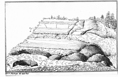
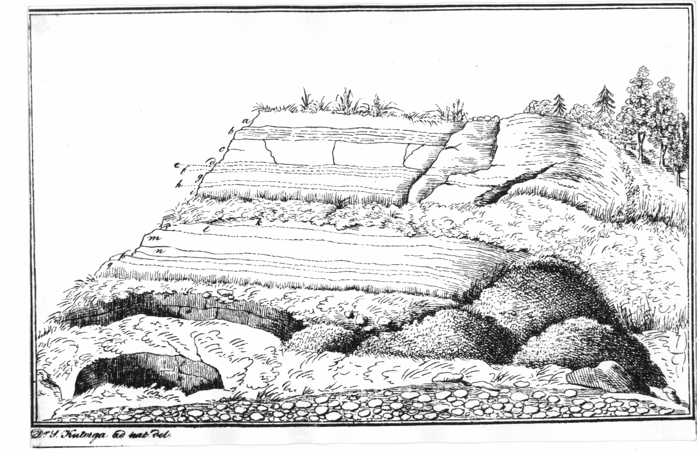
Fig. 4. The oldest sketch to depict the outcrop of Devonian sandstones of the Aruküla Stage at Jaama Street in Tartu. From Kutorga 1835.

Fig. 5. Relations between two megaunits of the Precambrian basement of Estonia: 1 - Svecofennian orogenic complex (Palaeoproterozoic) with the names of the structural zones and postorogenic massives; 2 - anorogenic complex of plutonic rapakivi granites and related rocks with the names of the massives.

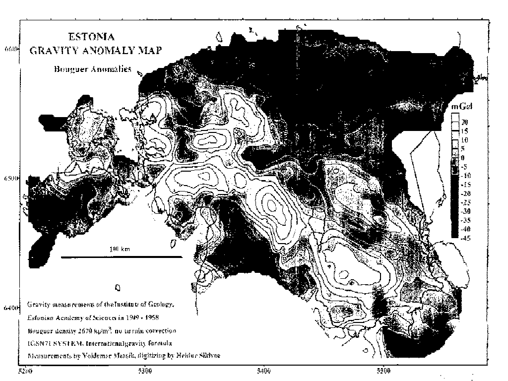
Fig. 6. The gravity anomaly map of Estonia.
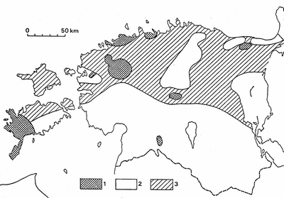
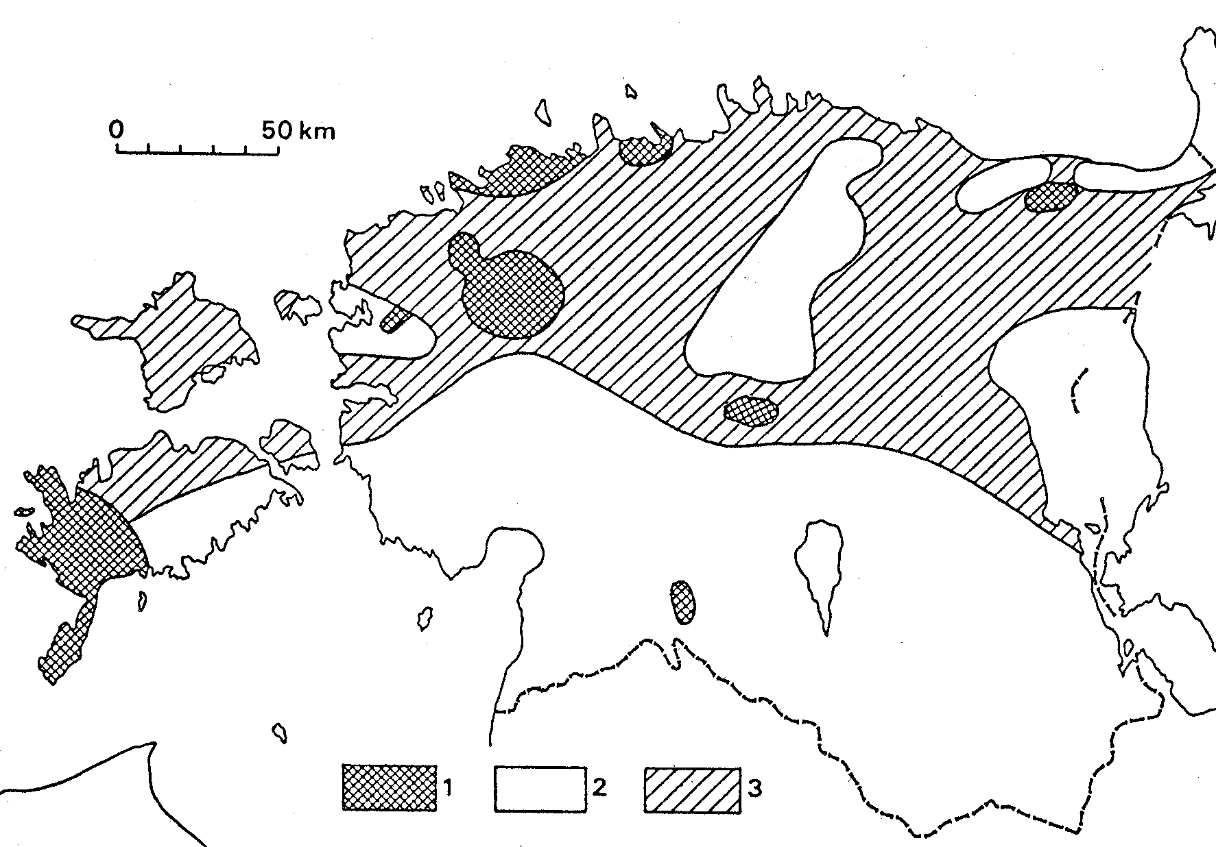
Fig. 7. Metamorphic zonation of the Precambrian basement: 1 - postmetamorphic; 2 - granulite facies; 3 - amphibolite facies.
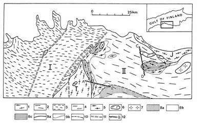
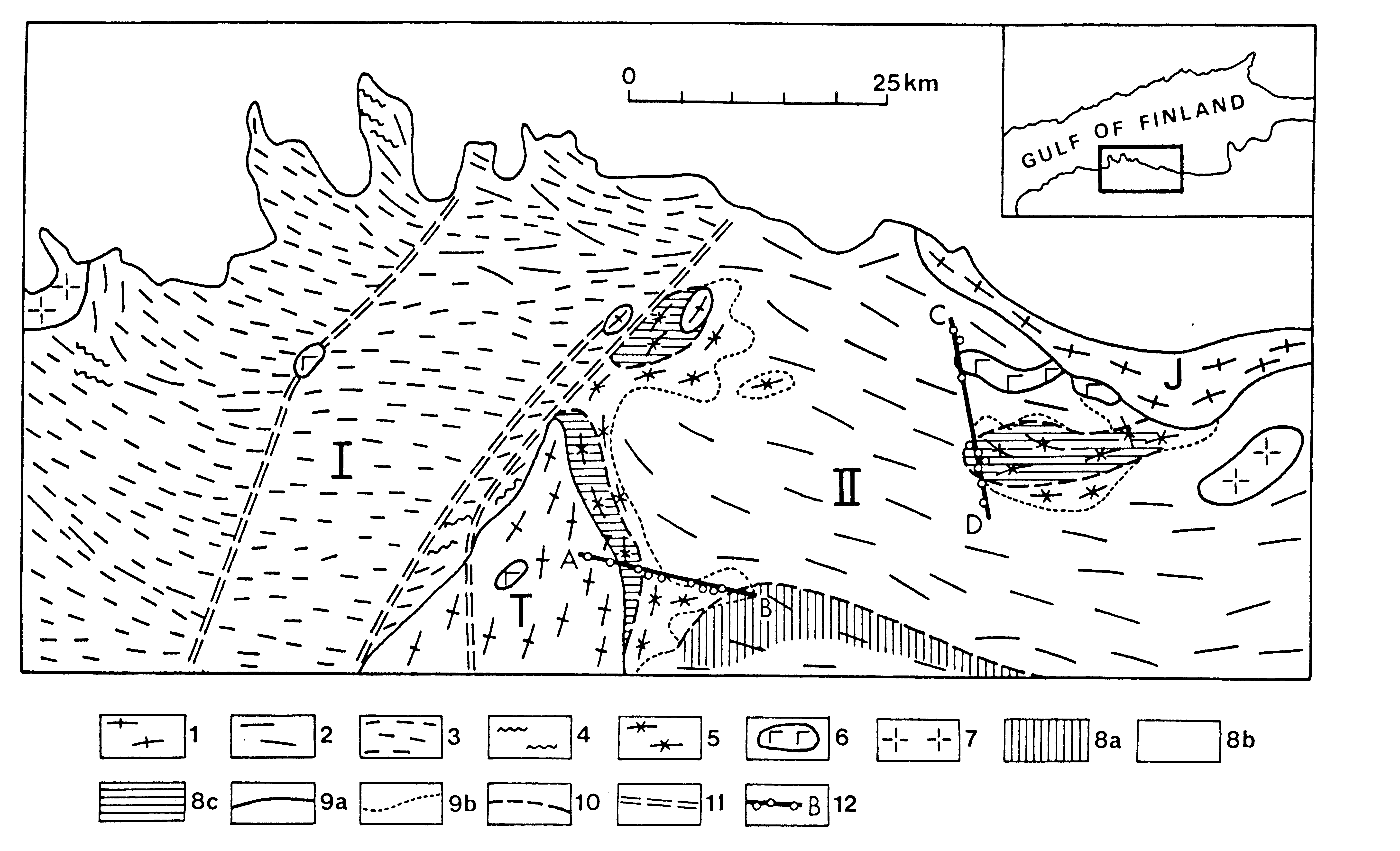
Fig. 8. Zonation of the regional metamorphism in northern Estonia: I - Tallinn Zone; 2 - Alutaguse Zone, T - Tapa and J - Jõhvi blocks. 1 - mafic granulite complexes (Py- and Amph-rich gneisses); 2 - Al-rich (Sill-, Gr-, Cord- and Bi-bearing) gneisses; 3 - acid, intermediate and mafic metavolcanites; 4 - graphite- and sulphide-bearing aluminiferous and micaceous gneisses; 5 - graphite- and sulphide-bearing gneisses (black schists), quartzites, marbles, pyroxene-rocks; 6 - gabbro and gabbronorite; 7 - rapakivi granite; 8 - low/medium (a) and upper (b) amphibolite facies and granulite (c) facies; 9 - boundaries of structural zones (a) and subzones (b); 10 - boundaries between subfacies; 11 - faults; 12 - cross-sections (AB - Assamalla, CD - Uljaste, Fig. 9).
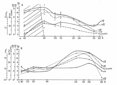
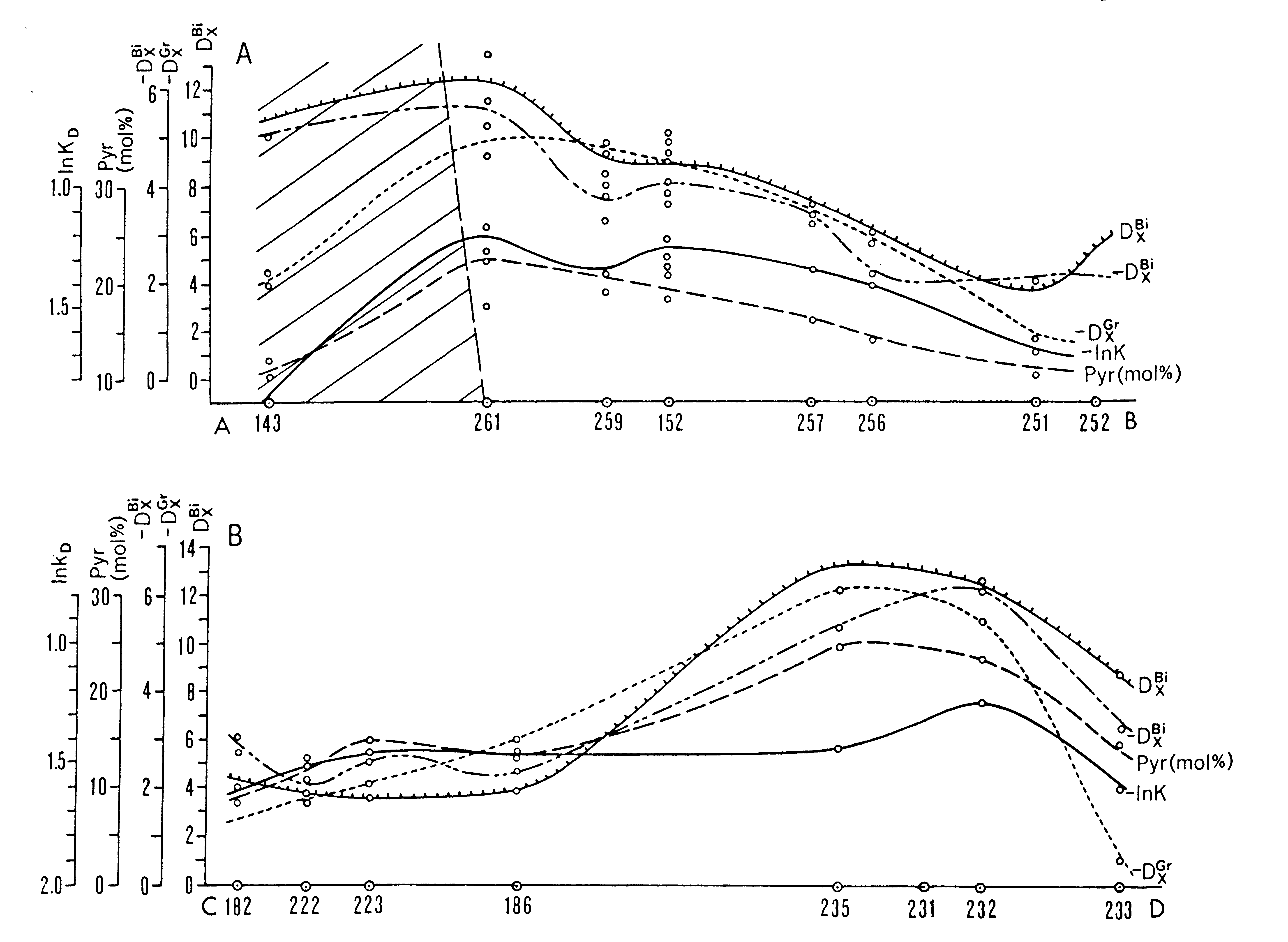
Fig. 9. Metamorphic parameters of Assamalla (A) and Uljaste (B) areas (for location of AB and CD profiles see Fig. 7). 143, 261..., etc. - numbers of drill cores. lnK according to Glebovitsky and Drugova (Glebovickij & Drugova 1979). -DxGr = 8.2 Mn - 8.56Mg - 0.37Ca and -DxBi = 19.56Ti + 1.26Al - 3.89Mg according to Nikitina and Drugova (Nikitina & Drugova 1977), DxBi = 7.876Si - 10.251Al + 17.173Ti - 5.661Fe3 + - 1.404 (OH) - 4.286Fe2+ + 4.524Mg + 4.661K according to Ushakova (Uakova 1971).
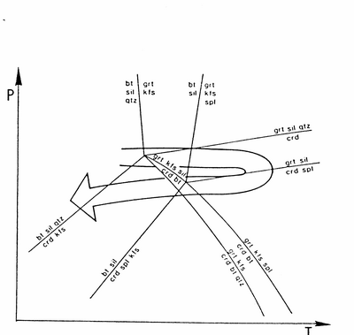
Fig. 10. A schematic locus of PT development of southern Estonian granulites (Höltta & Klein 1991).
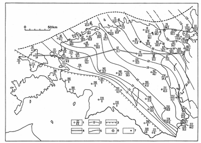
Fig. 11. Distribution and thickness of Vendian rocks: 1 - borehole, the number of borehole (see Fig. 3) in numerator and the thickness of the Vendian rocks in denominator; 2 - isopachs; 3 - limit of the present distribution of rocks; 4 - line of the cross-section (Fig. 12); 5 - line of erosion (northern limit of the present-day distribution of successive Cambrian rocks); 6 - stratotype sections; 7 - local structures where the Vendian rocks are absent.
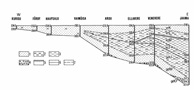
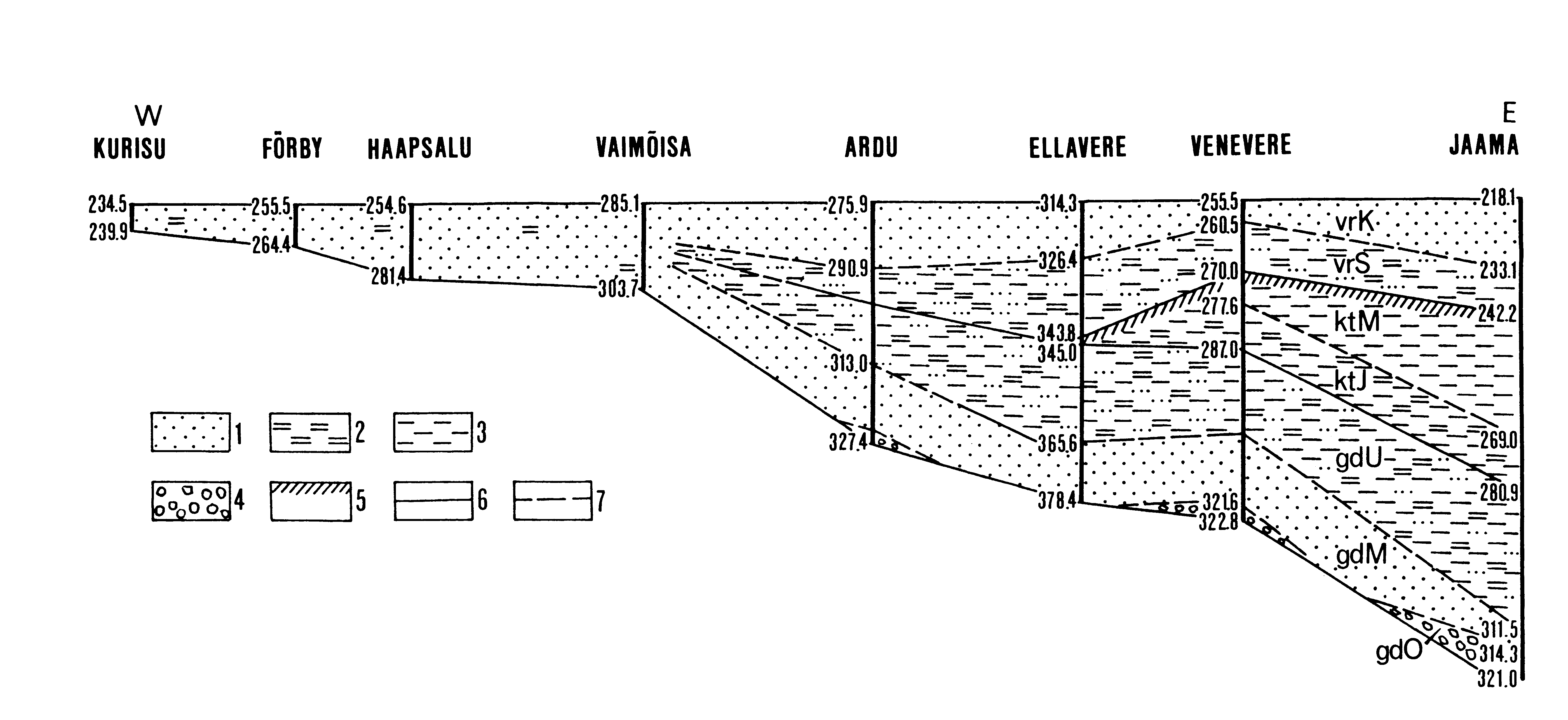
Fig. 12. Latitudinal cross-section of the Vendian strata in northern Estonia: 1 - sandstone; 2 - siltstone; 3 - claystone; 4 - unsorted clastic rocks with coarse-grained constituents; 5 - phenomena of weathering; 6 - boundary between formations; 7 - boundary between members. Indices: gdO - Oru Member, gdM - Moldova Member, gdU - Uusküla Member, ktJ - Jaama Member, ktM - Meriküla Member, vrS - Sirgala Member, vrK - Kannuka Member (see Mens & Pirrus 1980).
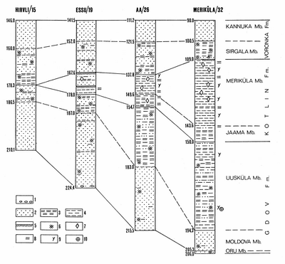
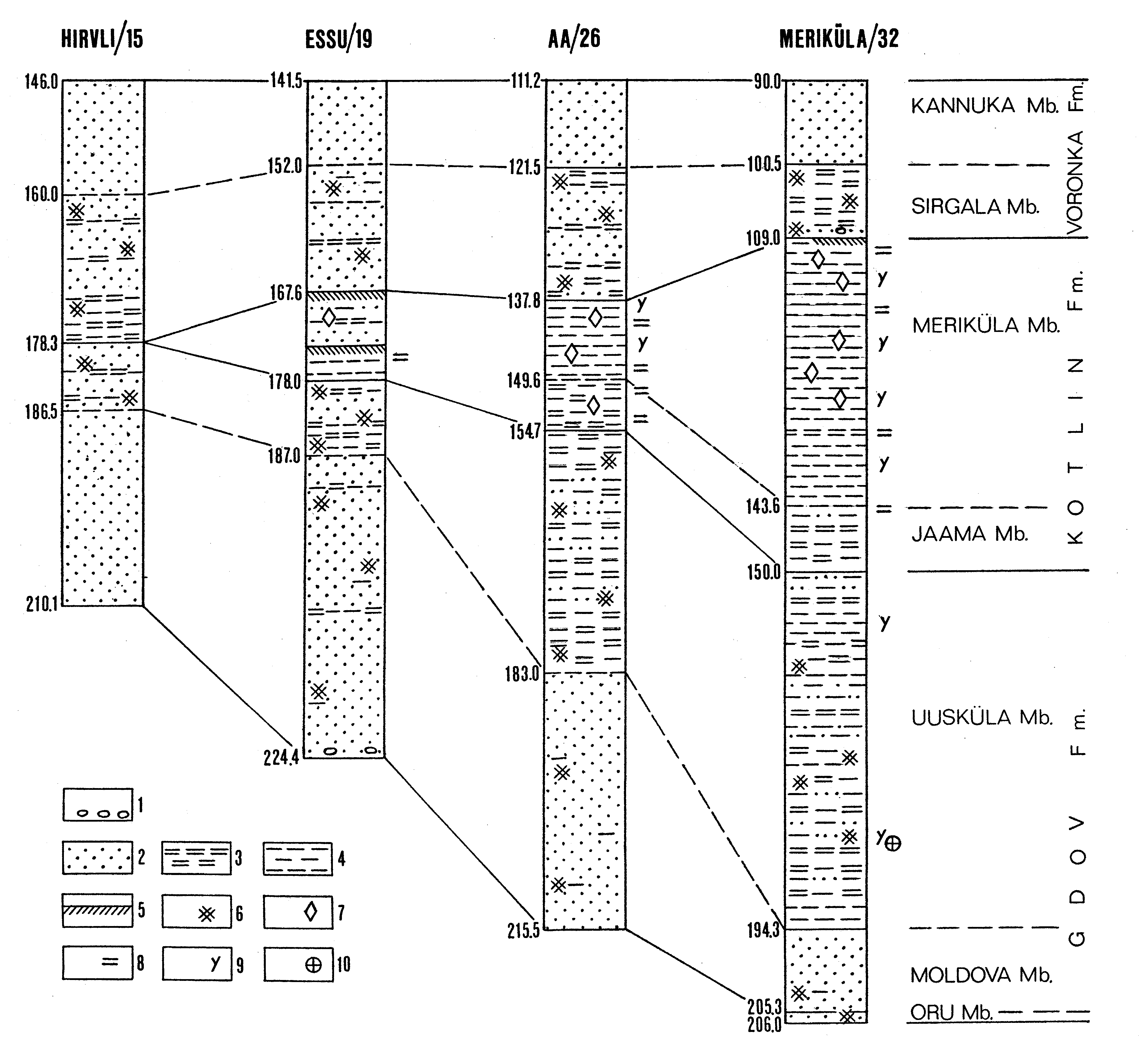
Fig. 13. Correlation of the Vendian boreholes in northern Estonia and the occurrence of fossils: 1 - admixture of coarse-grained constituents in rocks; 2 - sandstone; 3 - siltstone; 4 - claystone; 5 - phenomena of weathering; 6 - variegated (red-coloured) rocks; 7 - siderite nodules; 8 - shapeless films of organic matter; 9 - vendotaenids; 10 - the Kotlin acritarch assemblage.
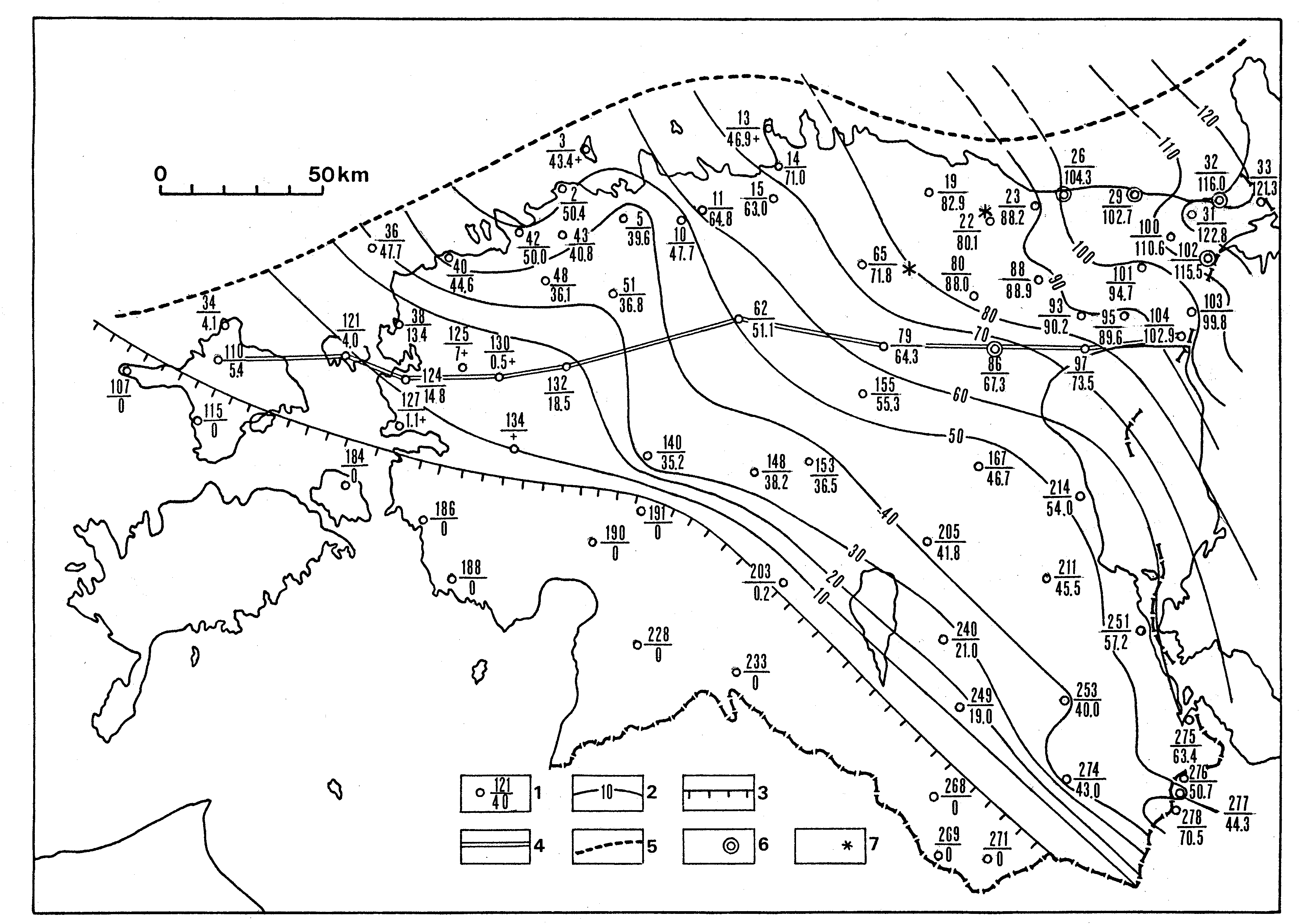
Fig. 14. The distribution and the thickness of the Lontova Stage: 1 - limits of the present-day distribution of rocks; 2 - isopachs; 3 - borehole: the numerator marks the number of borehole (see also Fig. 3) and the denominator shows the thickness of the rocks; 4 - main localities: Ko - Kopli, Ta -Tammneeme, Kk - Kolgaküla, Kn - Kunda, As - Aseri; 5 - stratotype section; 6 - boundary between the Voosi and Lontova formations; 7 - line of cross-section (Fig. 16).
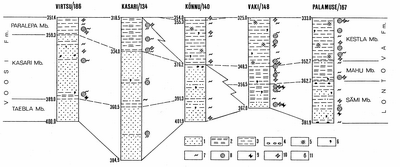
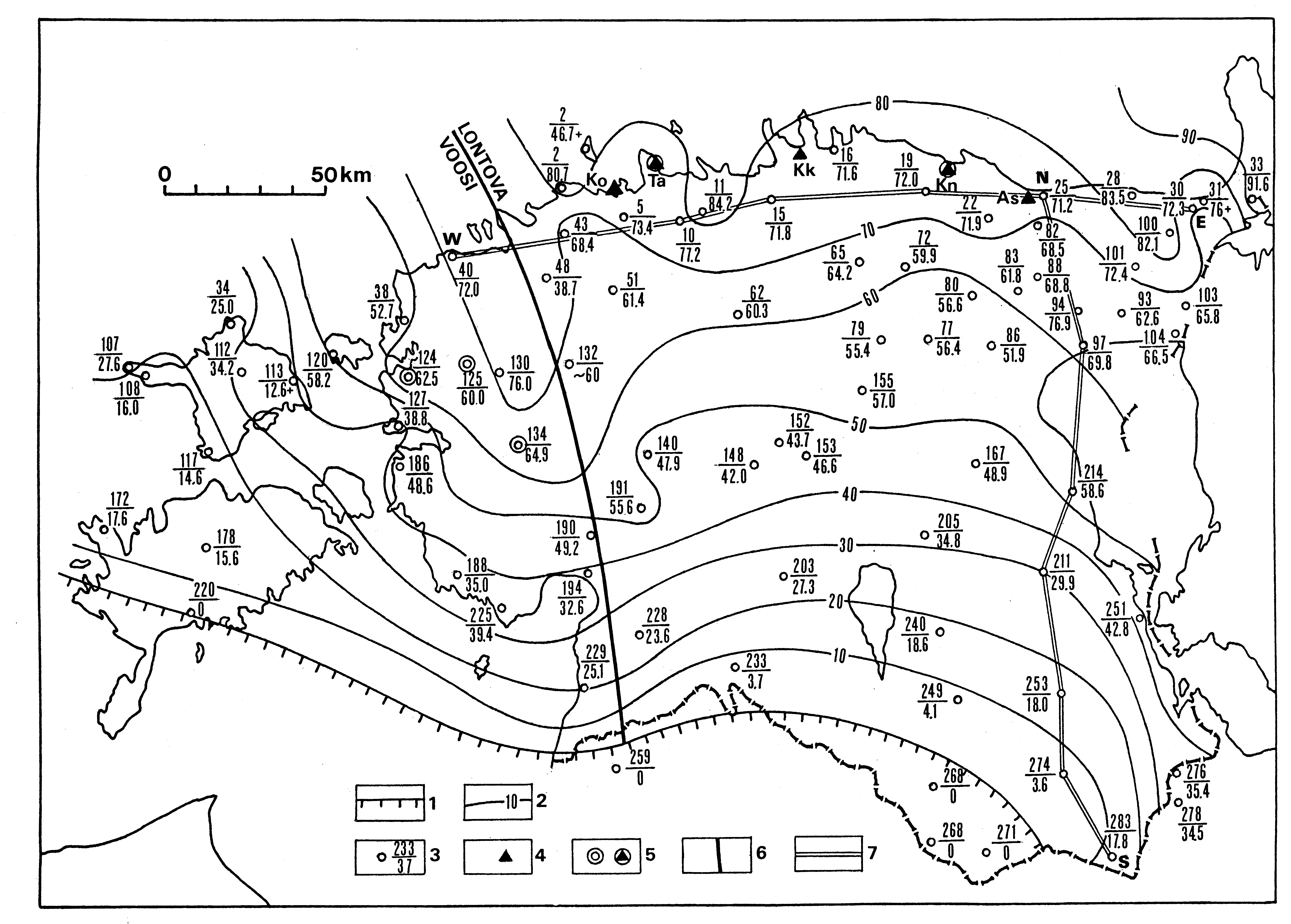
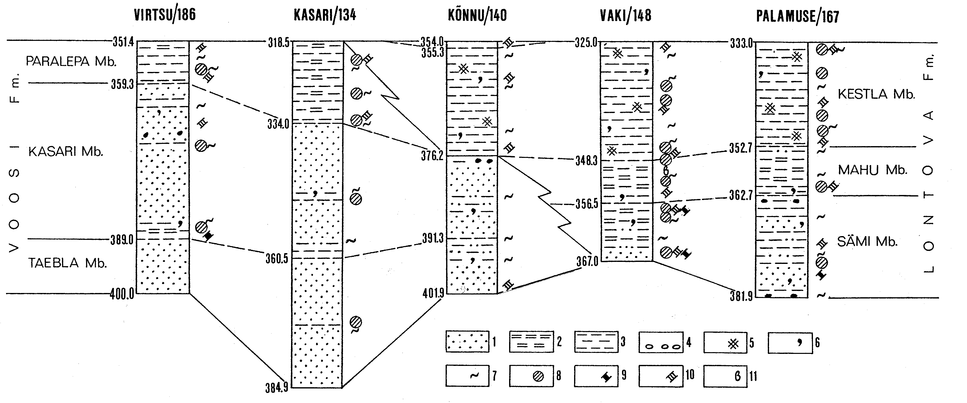
Fig. 15. Correlation of the sections of the Lontova Stage between Virtsu and Palamuse, and the distribution of the most common fossils: 1 - sandstone; 2 - siltstone; 3 - clay; 4 - pebbles; 5 - red-coloured rocks; 6 - glauconite; 7 - ichnites; 8 - Lontova acritarch assemblage; 9 - sabelliditids; 10 - platysolenitids; 11 - Aldanella kunda. The numbers of the boreholes correspond to those in Fig. 14.
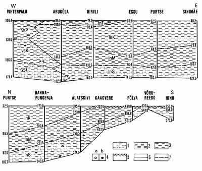
Fig. 16. Latitudinal and meridional cross-sections of the Lontova Stage: 1 - sandstone; 2 - siltstone; 3 - clay; 4 - pebbles: a - clayey, b - phosphatized; 5 - traces of weathering; 6 - boundary of formations; 7 - boundary of members. Indices: vsT - Taebla Member, vsK - Kasari Member, vsP - Paralepa Member, lnS - Sämi Member, lnM - Mahu Member, lnK - Kestla Member, lnT - Tammneeme Member. For location of cross-sections see Fig. 14.
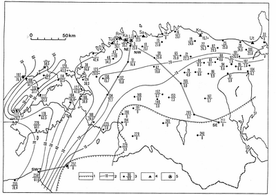
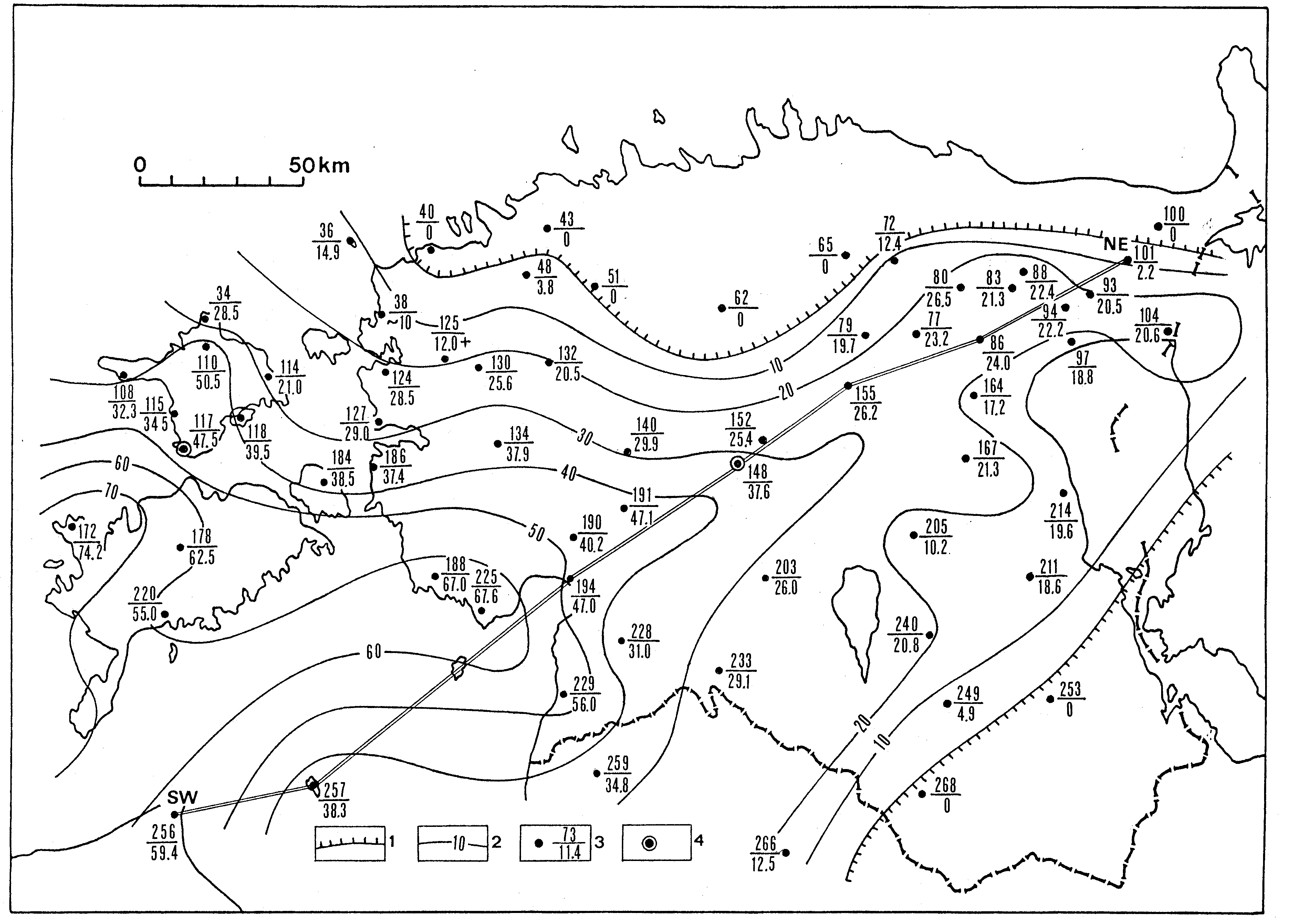
Fig. 17. Distribution and thickness of the Dominopol Stage: 1 - limits of the present-day distribution of rocks in mainland; 2 - isopachs; 3 - borehole: the numerator marks the number of borehole (see also Fig. 3) and the denominator shows the thickness of the stage; 4 - main localities: Tü - Türisalu, Rm - Rannamõisa, Ka - Kakumägi, Lü - Kose-Lükati, Sa - Saviranna, Ku -Kunda, Ut - Utria; 5 - stratotype section. The NE-SW and NW-SE lines indicate transects of stratigraphical cross-sections presented in Fig. 18.
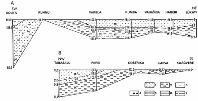
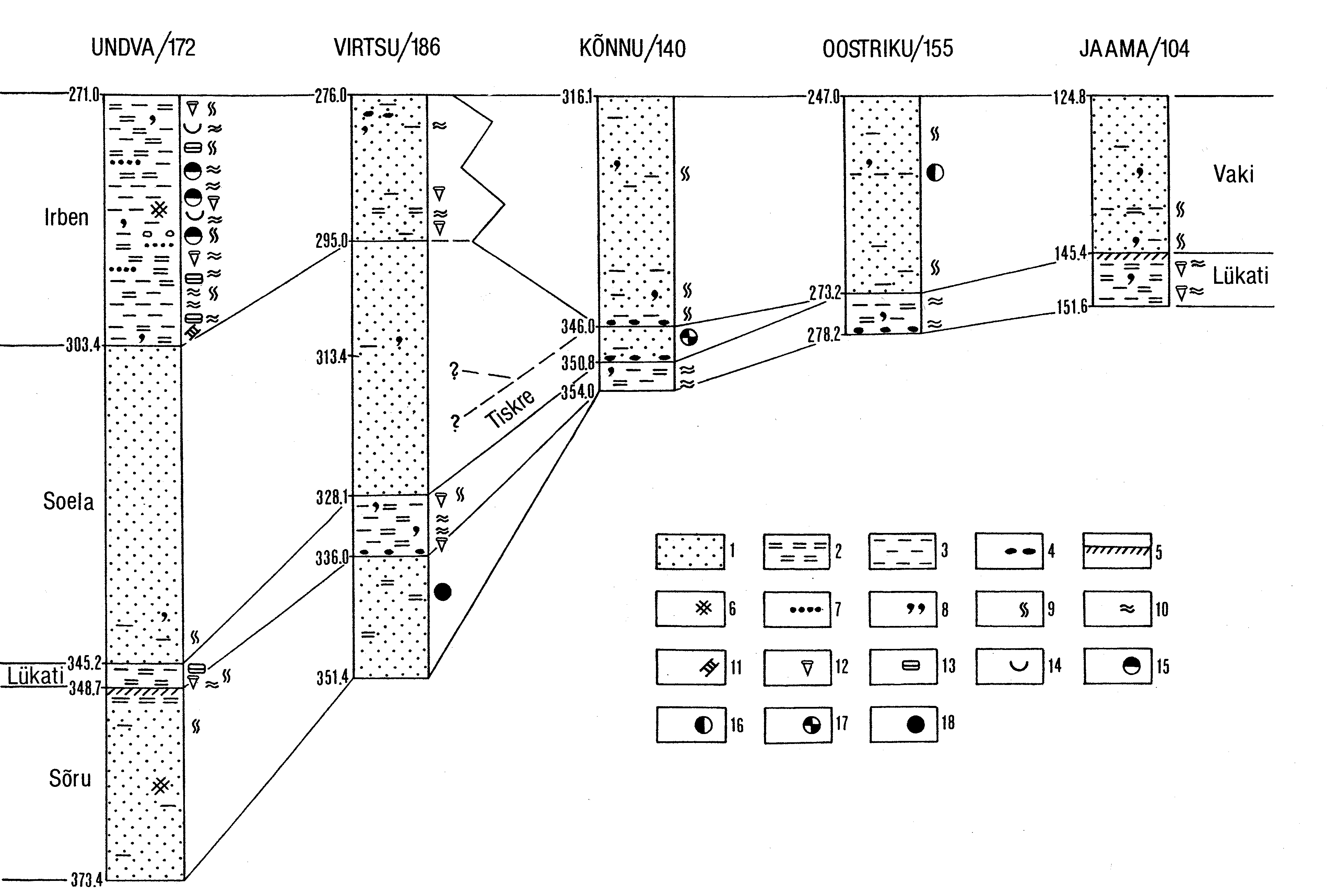
Fig. 18. Cross-section of the Dominopol Stage along SW-NE (A) and NW-SE (B) lines (Fig. 17): 1 - sandstone; 2 - siltstone; 3 - clay; 4 - pebbles; 5 - traces of weathering; 6 - boundary of formations; 7 - boundary of members. Indices: sr - Sõru Formation, lk - Lükati Formation, ts - Tiskre Formation, tsK- Kakumägi Member, tsR - Rannamõisa Member.
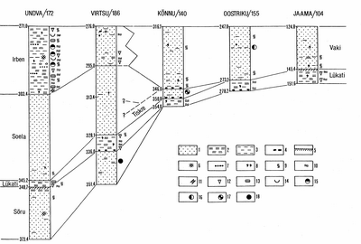
Fig. 19. Correlation of the Dominopol, Ljuboml and Vergale sequences between Undva and Jaama, and distribution of the most common fossils: 1 - sandstone; 2 - siltstone; 3 - clay; 4 - pebbles; 5 - traces of weathering; 6 - red-coloured rocks; 7 - ferruginous oolite; 8 - glauconite; 9 - ichnites of the Skolithos type; 10 - ichnites of the Planolites type; 11 -platysolenitids; 12 - Volborthella; 13 - agglutinated foraminifers (Lycatiella); 14 - fragments of brachiopods; 15 - Vergale acritarch assemblage; 16 - mixed Vergale-Rausvé acritarch assemblage; 17 - pauperized Lükati acritarch assemblage; 18 - Lükati acritarch assemblage. The numbers of the boreholes correspond to those in Figs. 17, 20.
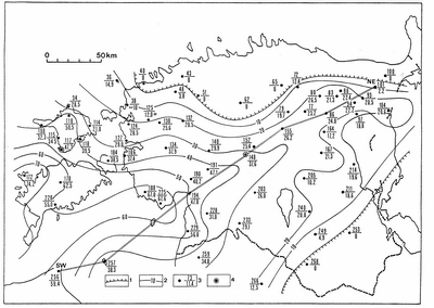
Fig. 20. The distribution and the thickness of the Ljuboml and Vergale stages (Aisciai Group): 1 - limits of present-day distribution; 2 - isopachs; 3 - borehole: the numerator marks the number of borehole (see also Fig. 3) and the denominator of thickness of the stages; 4 - stratotype section. The SW-NE line indicates the transect of the stratigraphical cross-section presented in Fig. 21.
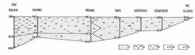
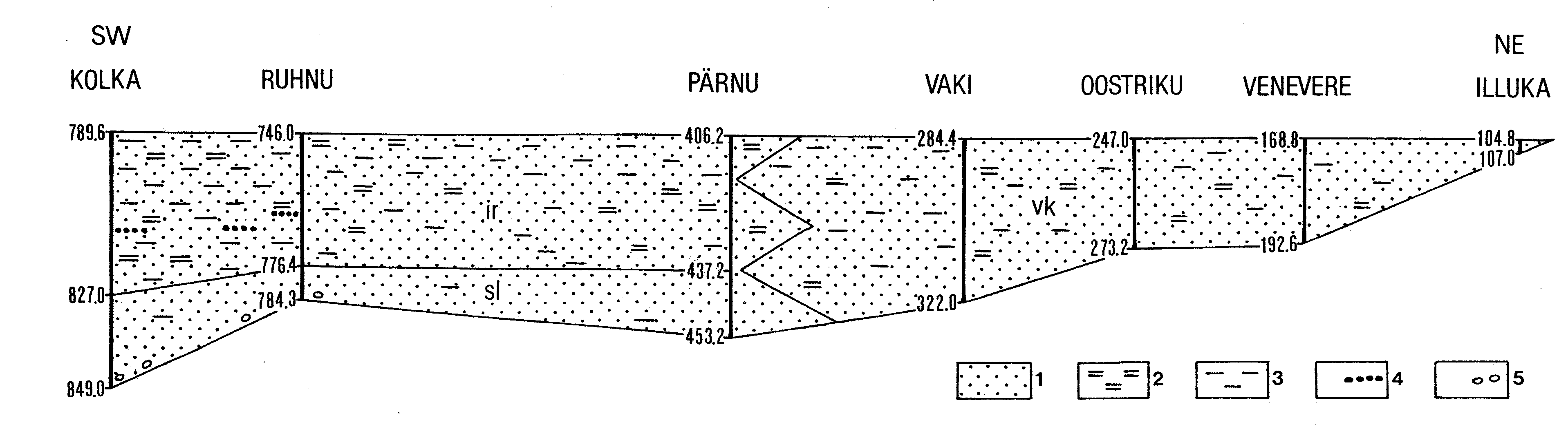
Fig. 21. Cross-section along the SW-NE line of the Aisciai Group (the Ljuboml and Vergale stages): 1 - sandstone; 2 - siltstone; 3 - clay; 4 - ferruginous oolite; 5 - gravel and pebbles. Continuous line indicates the boundary of formations, zigzag line - facial transition. Indices: sl - Soela Formation, ir - Irben Formation, vk- Vaki Formation.
Fig. 22. The distribution and the thickness of the Middle Cambrian: 1 - limits of the present-day distribution of rocks; 2 - isopachs; 3 - borehole: the numerator marks the number of borehole (see also Fig. 3), the denominator shows the thickness of the rocks; 4 - stratotype section; 5 - contour of the transitional area of formations.

Fig. 23. Geographical extension of the palaeontologically determined Upper Cambrian rocks: 1 - lower part of the Kallavere Formation; 2 - Tsitre Formation; 3 - Ülgase Formation; 4 - Petseri Formation; 5 - borehole: the numerator marks the number of borehole (see also Fig. 3), the denominator shows the thickness of the rocks; 6 - stratotype section: outcrop, borehole; 7 - limits of the present-day distribution of rocks; 8 - line of cross-section.
Fig. 24. Approximate boundary of the Ordovician confacies belts. Thin dashed line - the northern limit of the continuous distribution of rocks.
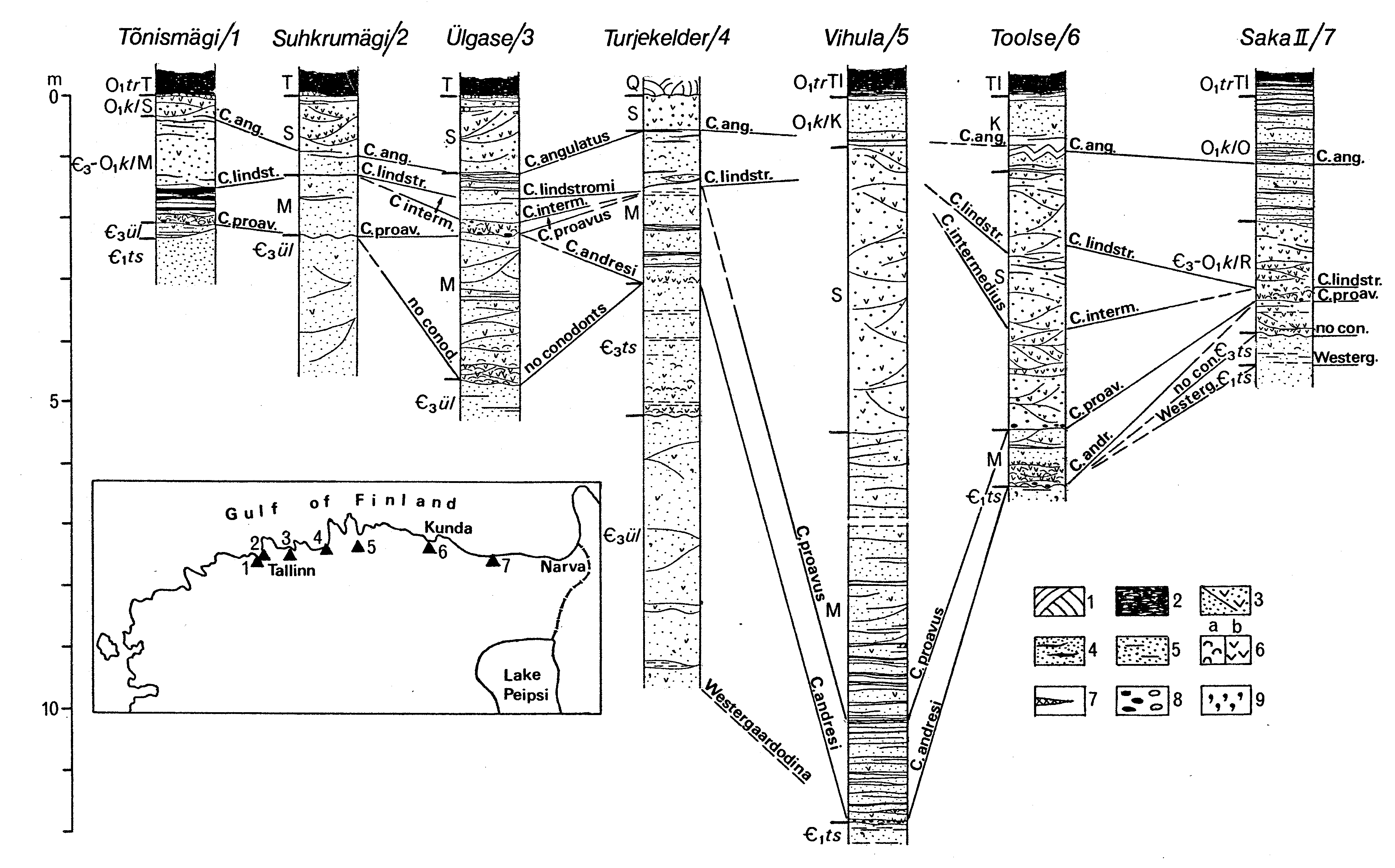
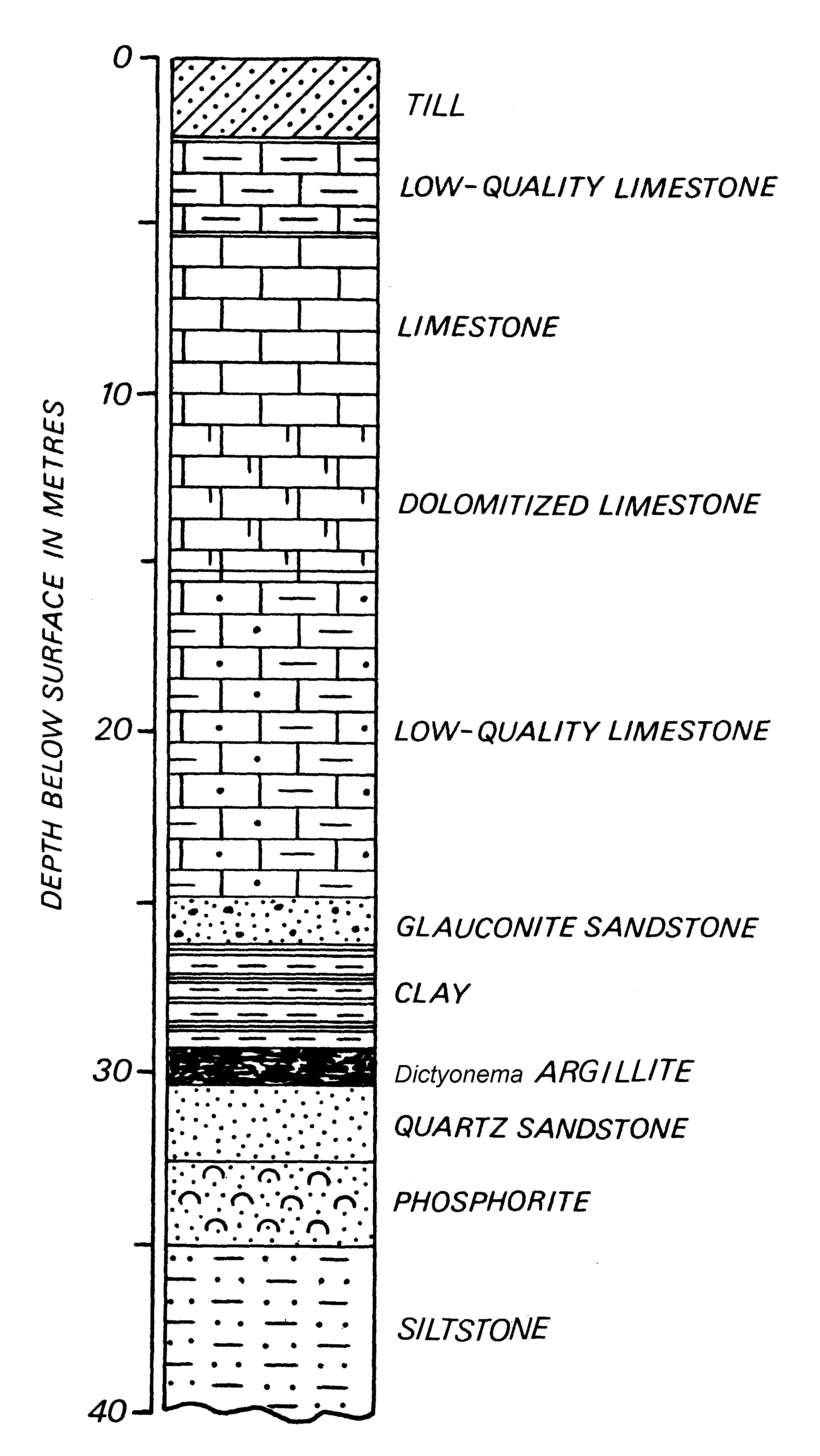
Fig. 25. Conodont zones of Cambrian-Ordovician boundary beds (Kallavere Formation) in North-Estonian outcrops. Lithostratigraphic units: O1trT - Türisalu Formation, Tabasalu Member; O1trTl - Türisalu Formation, Toolse Member; O1klS - Kallavere Formation, Suurjõgi Member; O1klK - Kallavere Formation, Katela Member; O1klO - Kallavere Formation, Orasoja Member; C3-O1klM - Kallavere Formation, Maardu Member; C3-O1klR - Kallavere Formation, Rannu Member; C3ts - Tsitre Formation; C3ül - Ülgase Formation. 1 - Quaternary deposits; 2 - dark argillite (Dictyonema Shale); 3 - quartzose sandstone with phosphatic brachiopod fragments, cross-bedded; 4 - quartzose sandstone with dark argillite interbeds; 5 - clay interbeds in sandstone; 6 - phosphatic brachiopods, a) complete valves, b) fragments; 7 - pyrite lenses; 8 - quartzose sandstone pebbles (phosphatic ones marked with dark colour); 9 - glauconite.
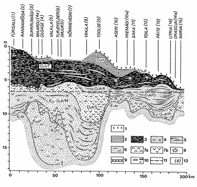
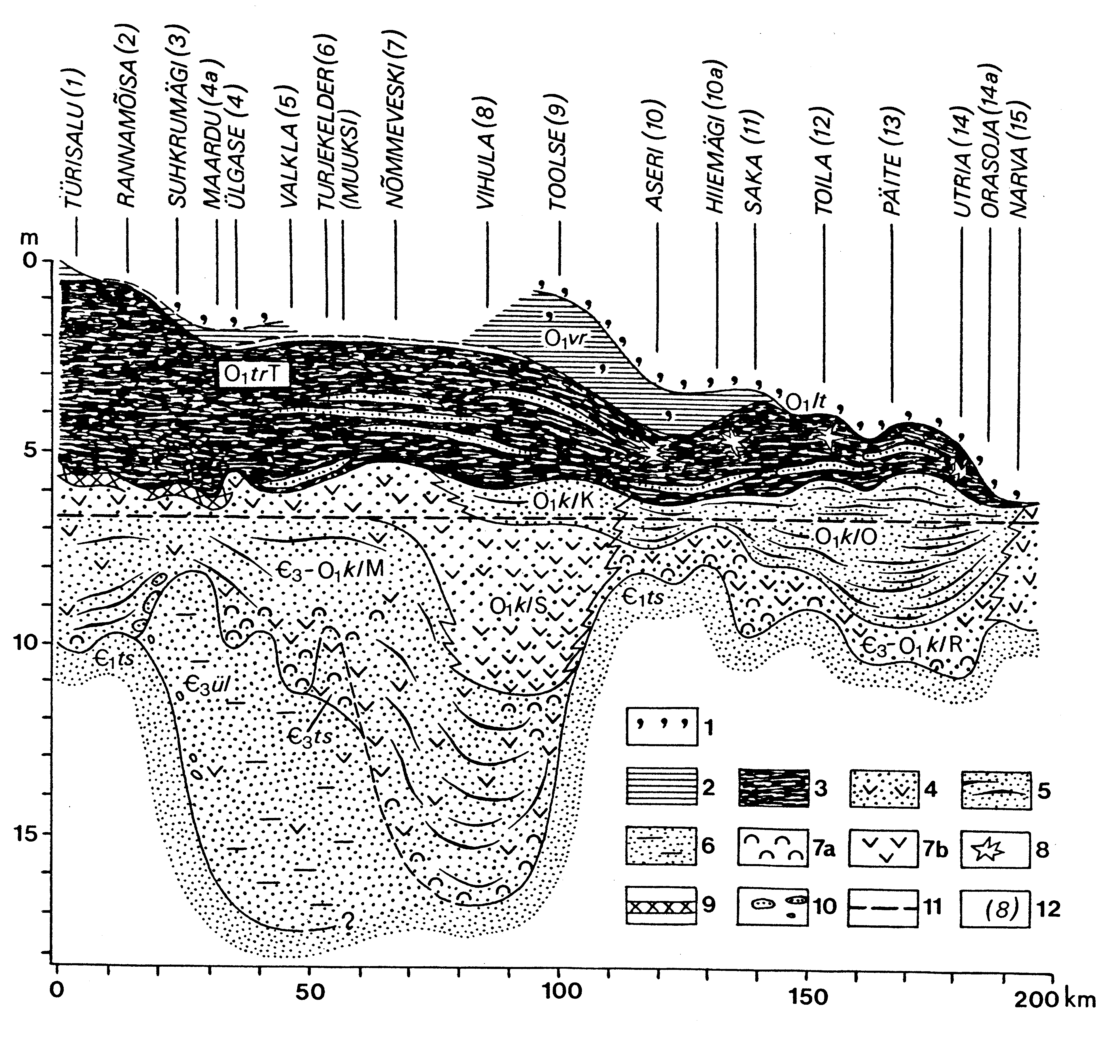
Fig. 26. Cross-section of the Tremadoc in the Baltic-Ladoga Klint outcrops. Formations and members: O1lt - Leetse Formation; O1vr - Varangu Formation; for explanation of indexes O1trT, O1trTl, O1klS, C3-O1klM, O1klK, O1klO, C3-O1klR, C3ts, C3ül, C1ts see Fig. 25. 1 - glauconitic sandstone; 2 - compact claystone; 3 - argillite (Dictyonema Shale); 4 - quartzose sandstone with fragments of phosphatic brachiopods (Obolus Sandstone); 5 - quartzose sandstone with interbeds of Dictyonema Shale; 6 - quartzose sandstone with clayey interbeds; 7 - phosphatic brachiopods: a) complete valves, b) fragments (debris); 8 - anthraconite; 9 - pyrite layer; 10 - pebbles, sometimes phosphatized; 11 - lower boundary of the Cordylodus angulatus Zone; 12 - number of outcrop (see Figs 27, 28, 29).
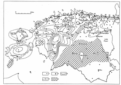
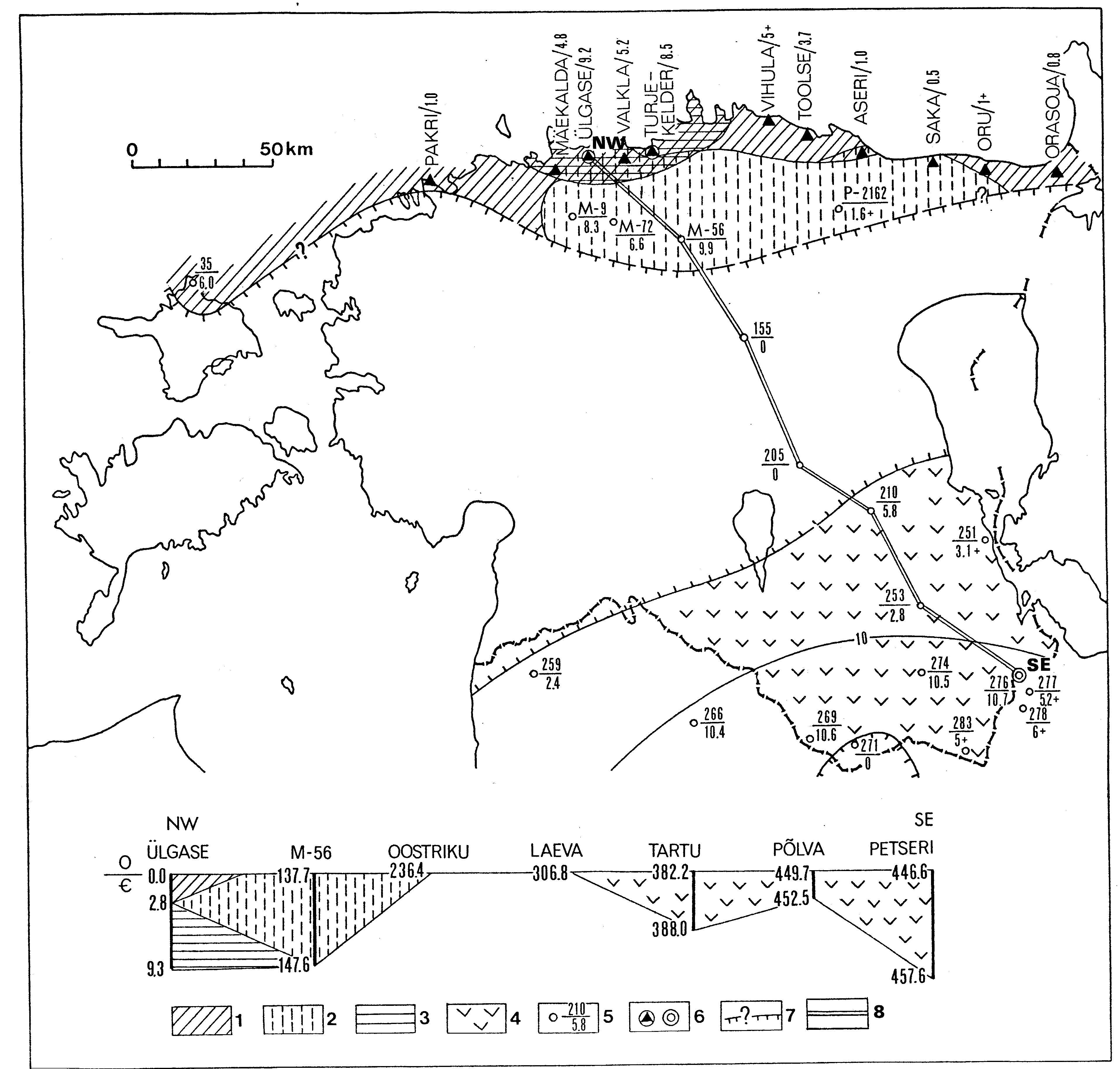
Fig. 27. Sketch-map showing the present distribution and the thickness of the Kallavere Formation: 1 - borehole; 2 - outcrop; 3 - North-Estonian Klint; 4 - isopachyte (m); 5 - area, where the Kallavere Formation is missing. Outcrops: 1- Türisalu; 2 - Rannamõisa; 3 - Hundikuristik (Suhkrumägi); 4 - Ülgase; 5 - Valkla; 6 - Turjekelder; 7 - Nõmmeveski; 8 - Vihula; 9 - Toolse; 10 - Aseri; 11 - Saka; 12 - Toila; 13 - Päite; 14 - Utria; 15 - Narva.
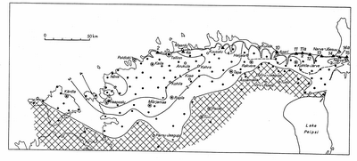
Fig. 28. Sketch-map showing the present distribution and the thickness of the Türisalu Formation. Outcrops: 2 - Rannamõisa; 4a - Maardu quarry; 7 - Nõmmeveski; 10 - Aseri; 11 - Saka; 11a - Valaste; 12 - Toila; 13 - Päite; 14 - Utria; 14a - Orasoja; 15 - Narva. For legend see Fig. 27.

Fig. 29. Sketch-map showing the present distribution and the thickness of the Varangu Formation. Outcrops: 1 - Türisalu; 1a - Pakri Cape; 2 - Rannamõisa; 4a - Maardu quarry; 7 - Nõmmeveski; 10 - Aseri; 10a - Hiiemäe; 11 - Saka. For legend see Fig. 27.
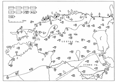
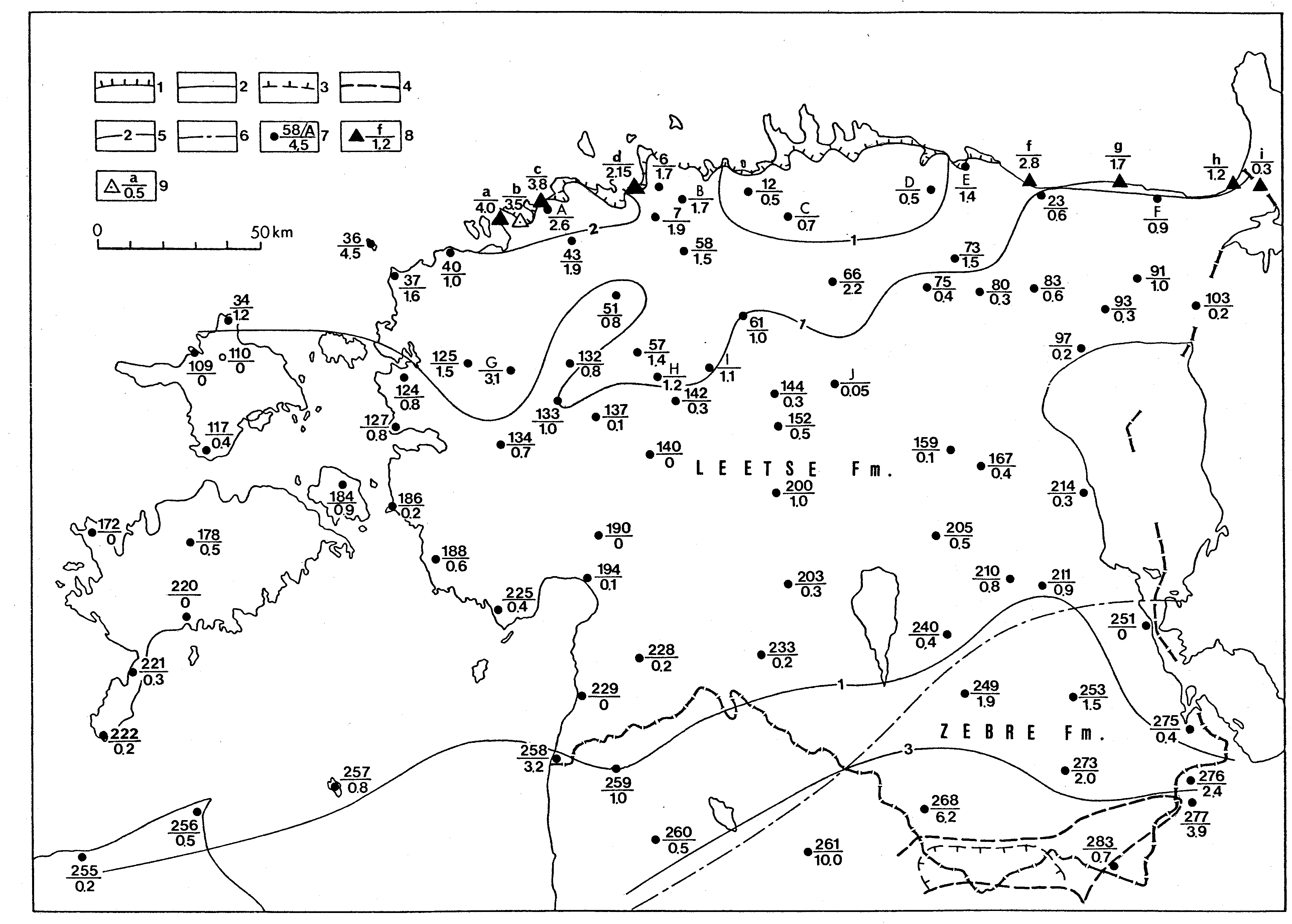
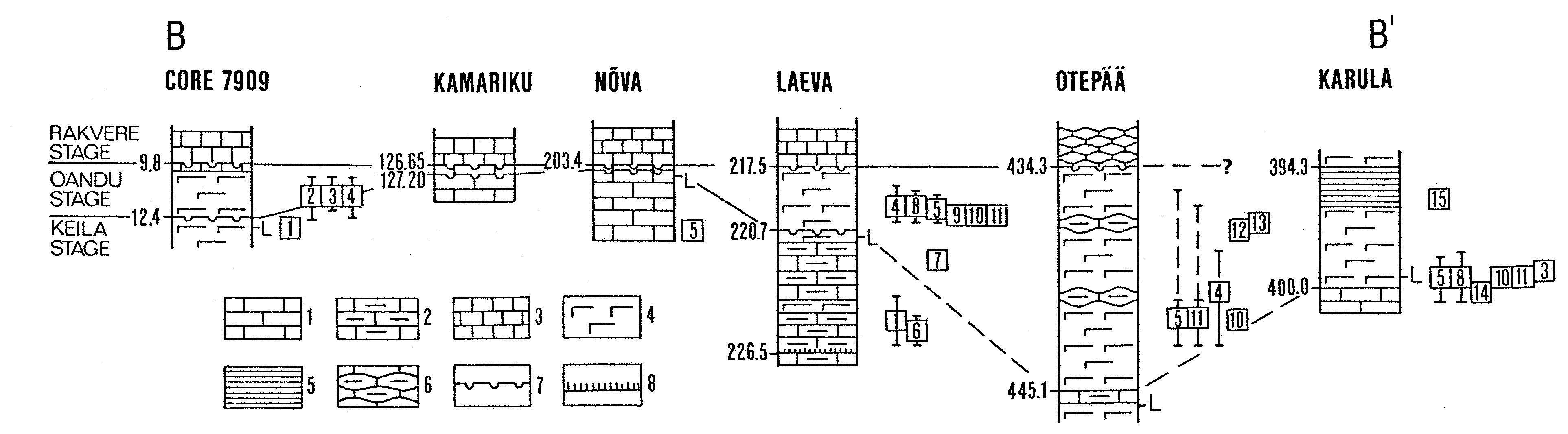
Fig. 30. Sketch-map showing the present distribution and the sum thickness of the Hunneberg and Billingen stages. The thicknesses here and on Figs. 34 and 36 are based on the published data (Rõõmusoks 1960, Orviku1960a, Männil 1966, Rõõmusoks 1983, a.o.) and unpublished data by L. Põlma. 1 and 2 - outer and inner border of the outcrop area; 3 and 4 - outer and inner border of the area where the unit has incomplete thickness on the Lokno Elevation; 5 - isopachyte (m); 6 - approximate boundary between the distribution areas of the formations; 7 - core section, the number (see Fig. 3) or index (A .., a..) in the numerator and thickness of the stage (or stages) in metres in the denominator; 8 - outcrop, the index in the numerator and thickness of the unit in the denominator; 9 - the same of the type section. Outcrops: a -Väike- Pakri Island, type section of the Pakri Formation; b - Leetse, type section of the Leetse Formation; c - Keila-Joa; d - Mäekalda; f - Aseri; g - Ontika; h - Tõrvajõe; i - Narva. Core sections: A - Keila-Joa; B - Saha-Loo; C - Pillapalu; D - Essu; E - Kunda; F - Voka; G - Maidla; H - Keava; I - Vahastu; J - Kahala II.
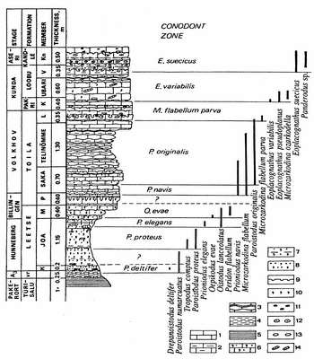
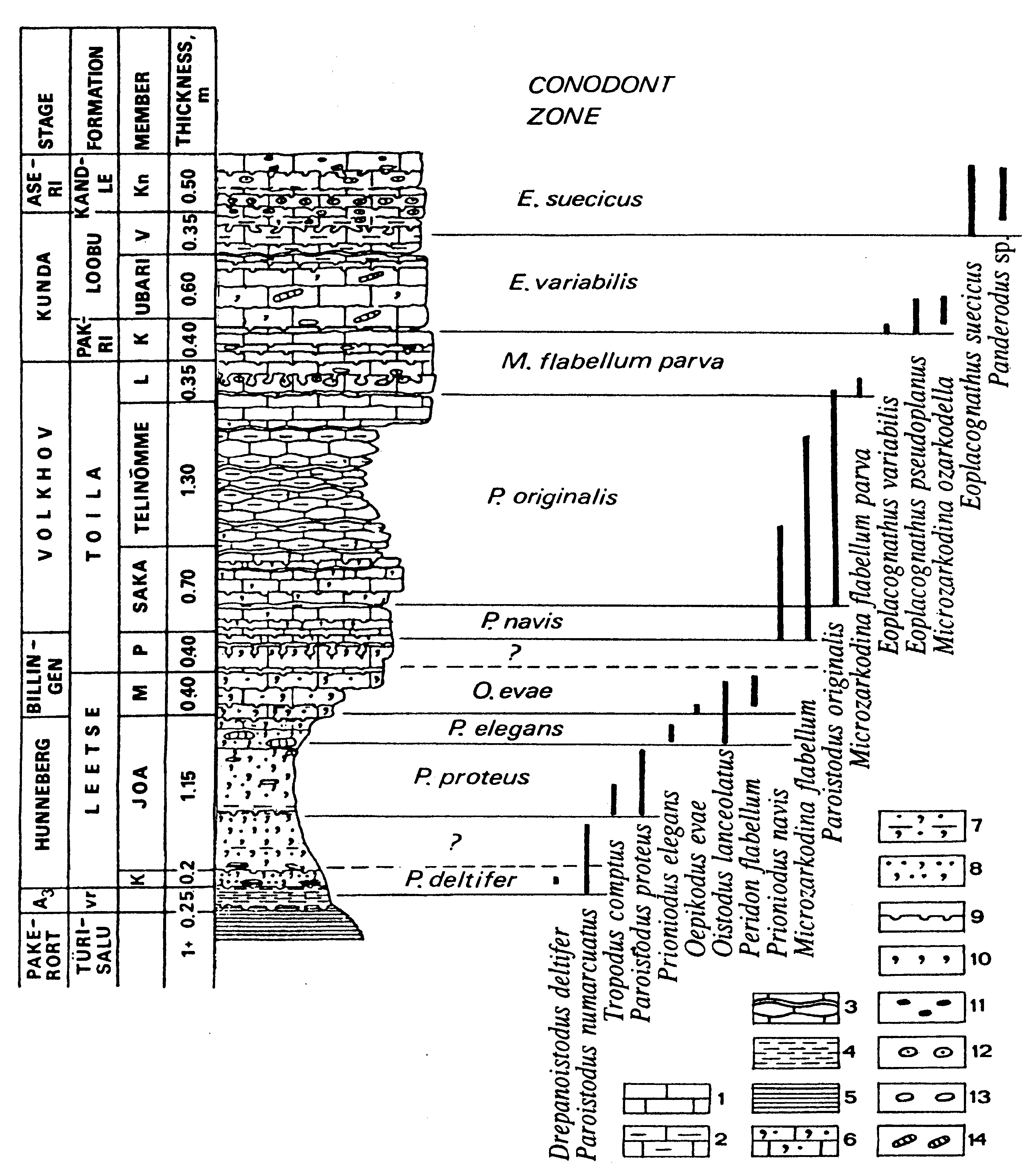
Fig. 31. The lower part of the Mäekalda section (Tallinn) with the conodont zonation and range of selected species (Einasto et al. 1966). Indices of stratigraphic units: A3 - Varangu Stage, vr - Varangu Formation; members: K - Klooga, M - Mäeküla, P - Päite, L - Lahepera, K - Kallaste, V - Valgejõe, Kn - Künnapõhja. Legend: 1 - limestone; 2 - argillaceous limestone; 3 - nodular limestone with clayey interbeds; 4 - clay; 5 - argillite; 6 - sandy glauconitic limestone; 7 - clayey glauconitic sand; 8 - glauconitic siltstone; 9 - discontinuity surface; 10 - glauconite; 11 - goethitic ooids; 12 - phosphatic ooids; 13 - pebbles; 14 - cephalopods.

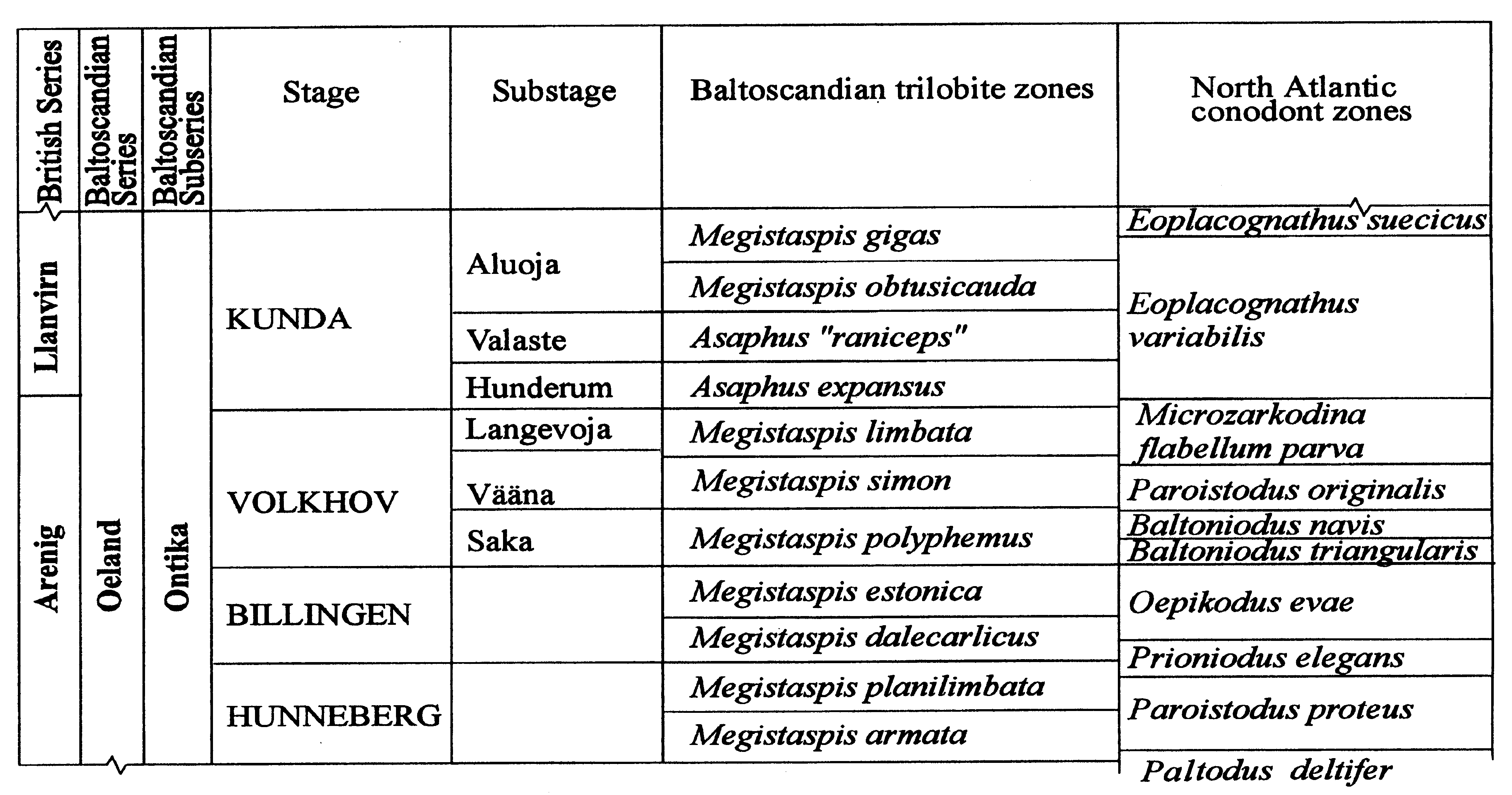
Fig. 32. The Ontika trilobite zonation and its correlation with the conodont zones (compiled after Tjernvik 1956, Jaanusson 1982, Männik & Viira 1990, Löfgren, 1996, Nielsen 1995).

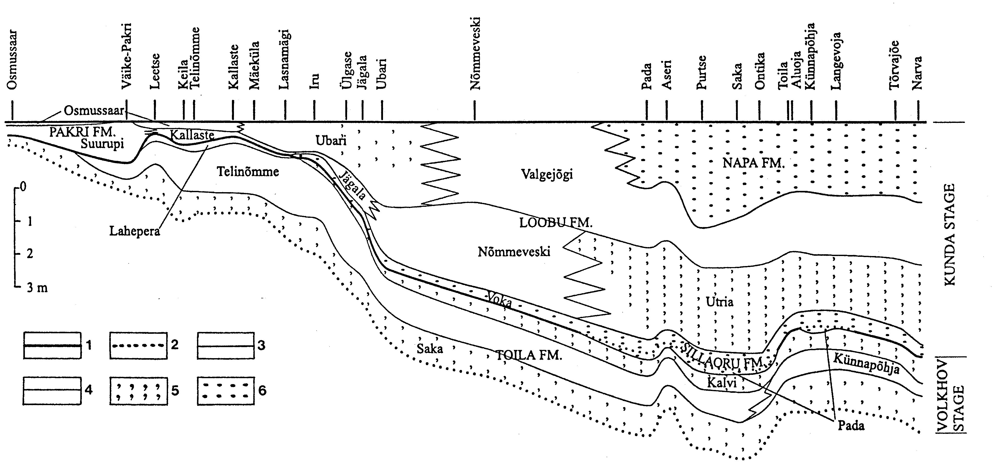
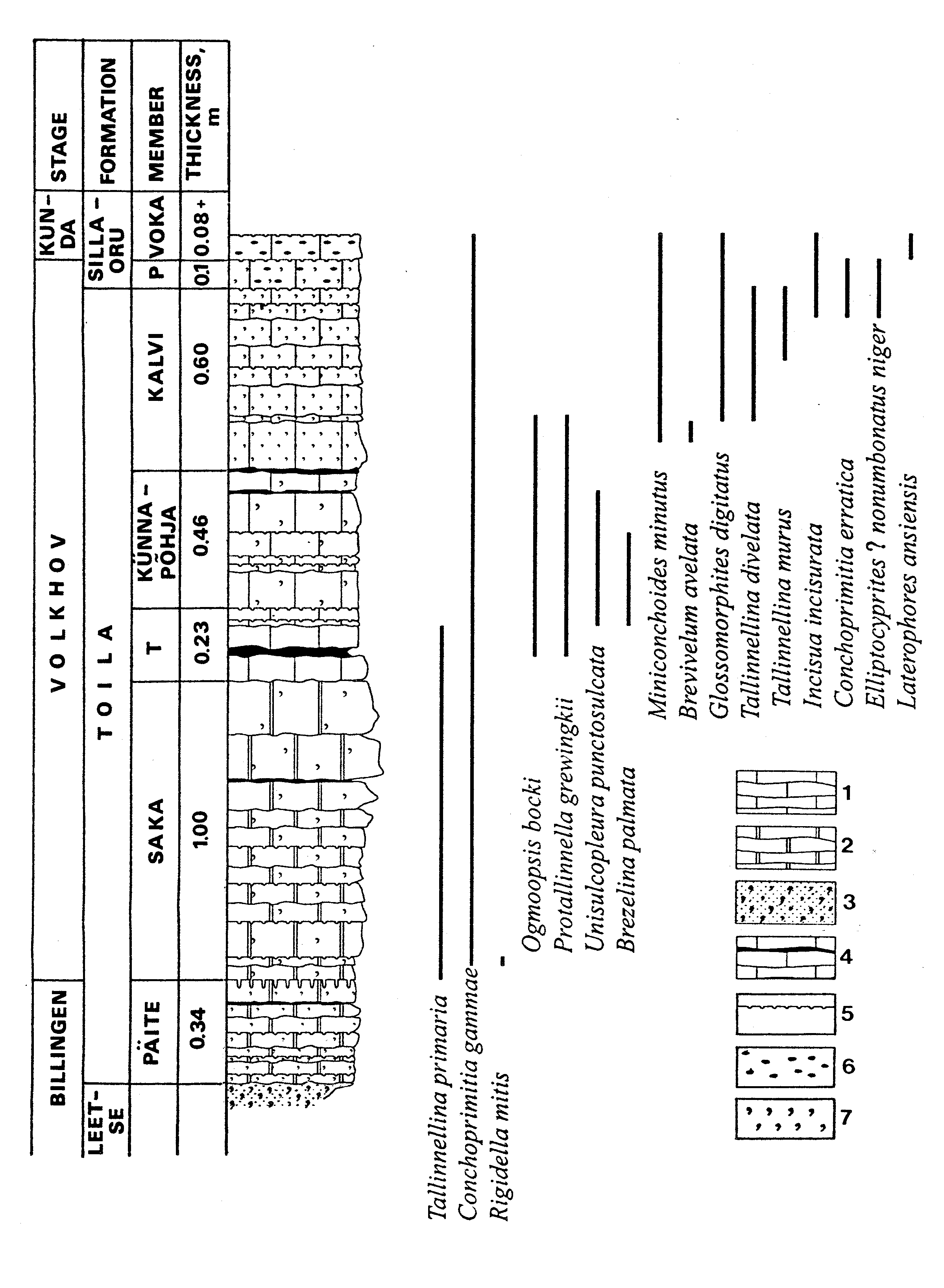
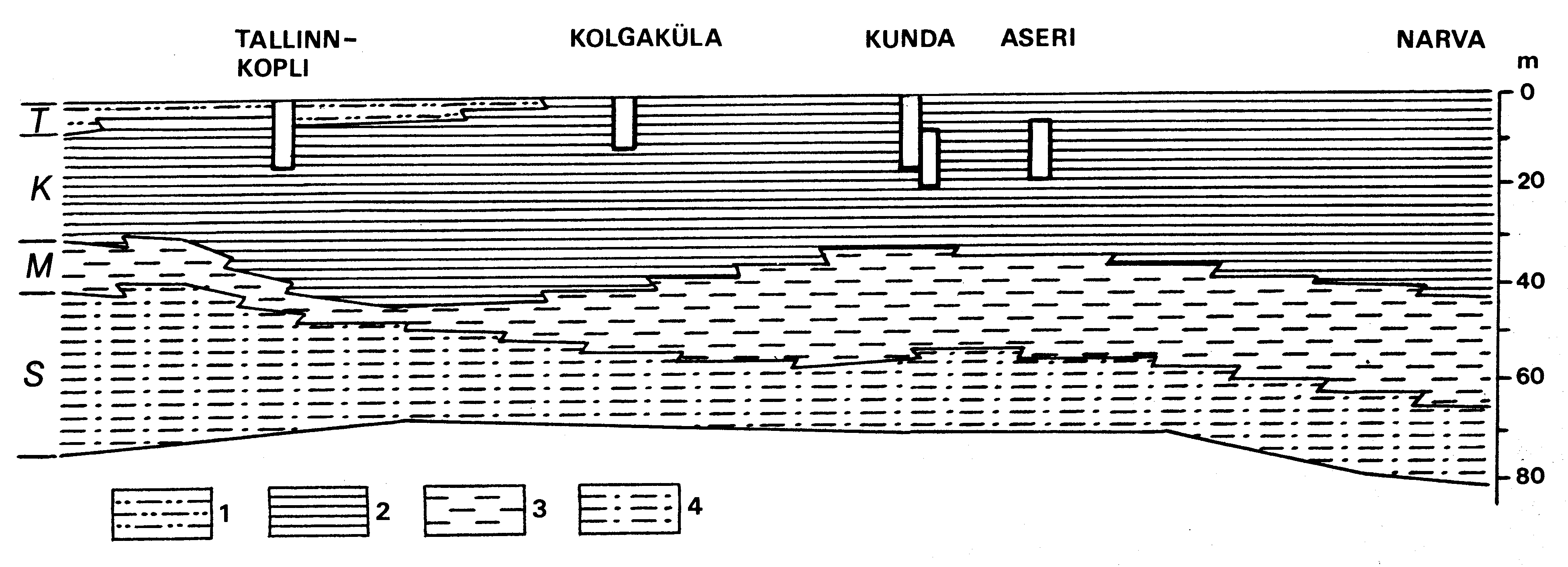
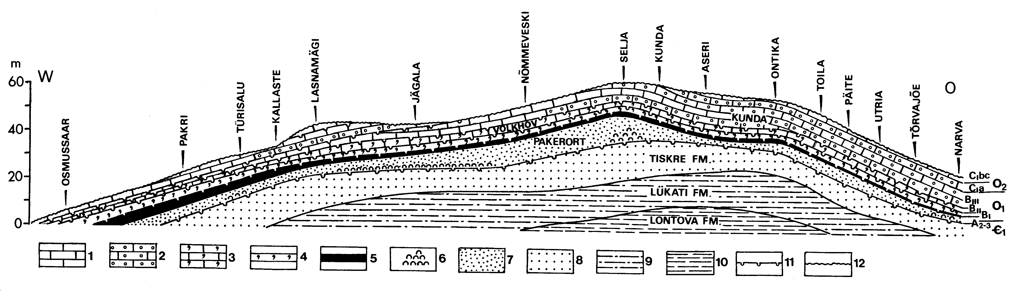
Fig. 33. Stratigraphical profile of the Volkhov and Kunda stages in northern Estonia, from west (Osmussaar, a on Fig. 34) to east (Narva, w), showing the distribution of formations and members, by Orviku (Orviku 1960a) and Rõõmusoks (1983), modified. Legend: 1 - intraformational stage boundary; 2 - interformational stage boundary; 3 - formation boundary; 4 - member boundary; 5 - glauconite; 6 - goethitic ooids; formation - block letters, member - small letters.
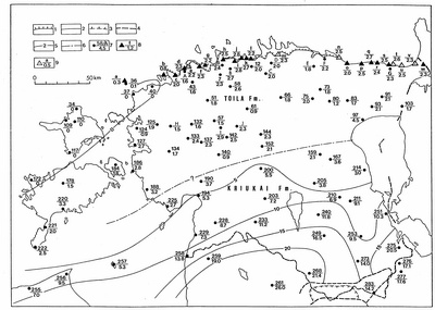
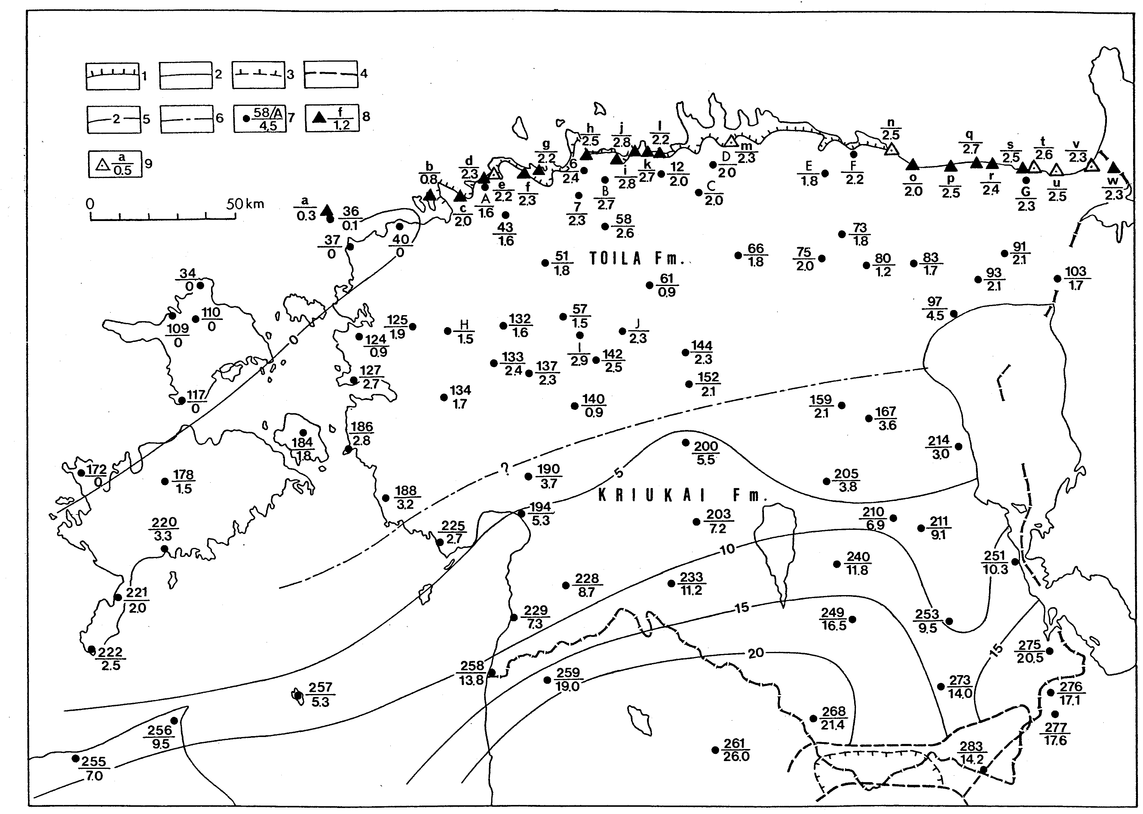
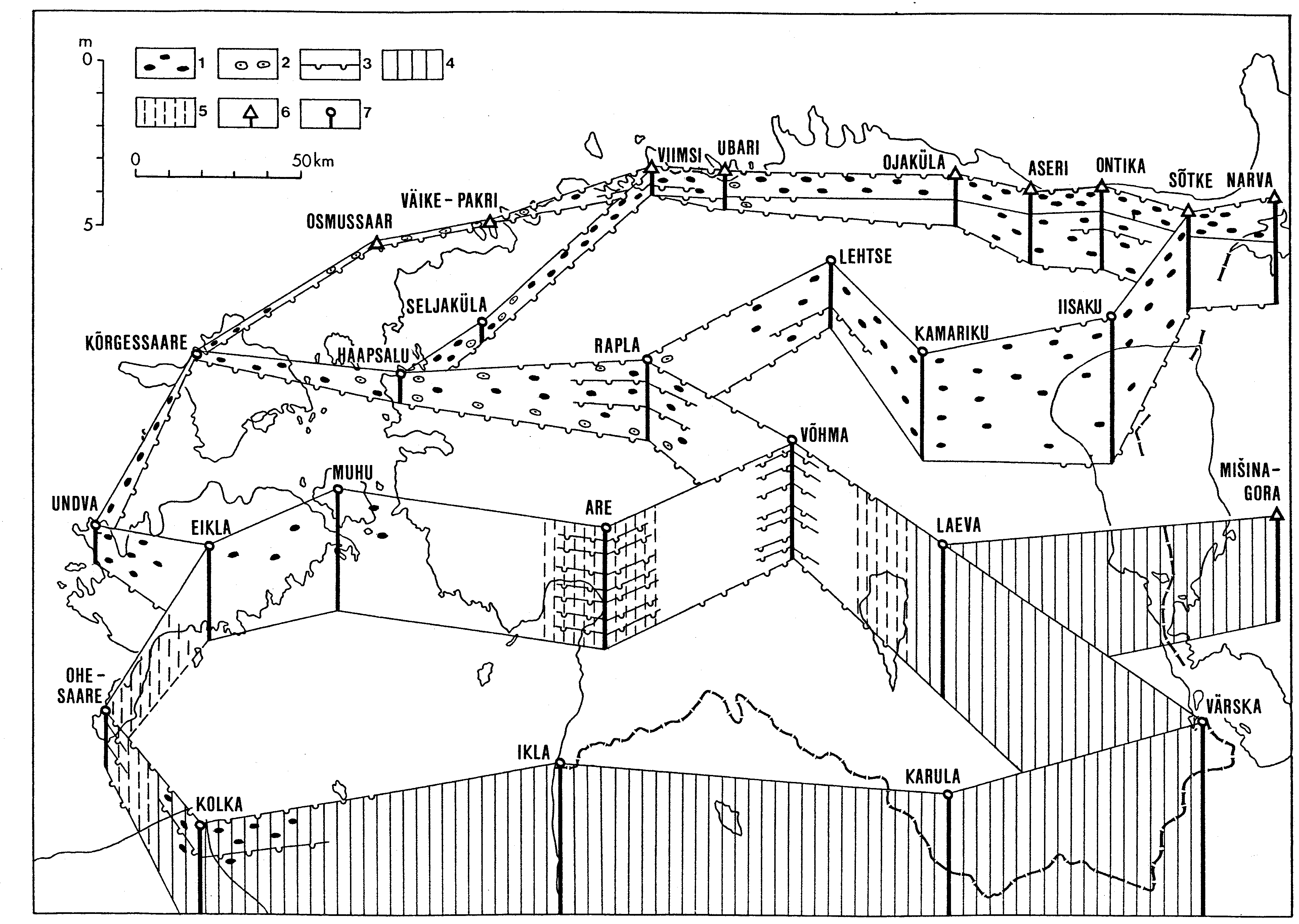
Fig. 34. Sketch-map showing the present distribution and the thickness of the Volkhov Stage. Legend 1- 9 see Fig. 30. Outcrops: a - Osmussaar, b - Väike-Pakri, c - Leetse, d - Keila-Joa, e - Telinõmme, type section of the Telinõmme Member, f - Kallaste, g - Mäeküla, h - Lasnamägi, i - Iru, j - Ülgase, k - Jägala, l - Ubari, m - Nõmmeveski, type section of the Nõmmeveski Member, n - Pada, type section of the Pada Member, o - Aseri, p - Purtse, q - Saka, type section of the Saka Member, r - Ontika, s - Toila and Aluoja, t - Künnapõhja, type section of the Künnapõhja Member, u - Langevoja, type section of the Langevoja Substage, v - Tõrvajõe, w - Narva; core sections: A - Keila-Joa, B - Saha-Loo, C - Pillapalu, D - Kemba, E - Essu, G - Voka, H - Maidla, I - Keava, J - Vahastu.
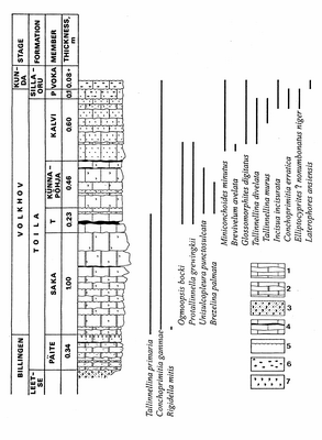
Fig. 35. The ranges of ostracodes in the Saka section. Legend: 1 - limestone; 2 - dolomite; 3 - glauconite sandstone; 4 - clayey interbeds in limestone; 5 - discontinuity surface; 6 - goethitic ooids; 7 - glauconite; T - Telinõmme Member, P - Pada Member.
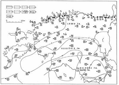
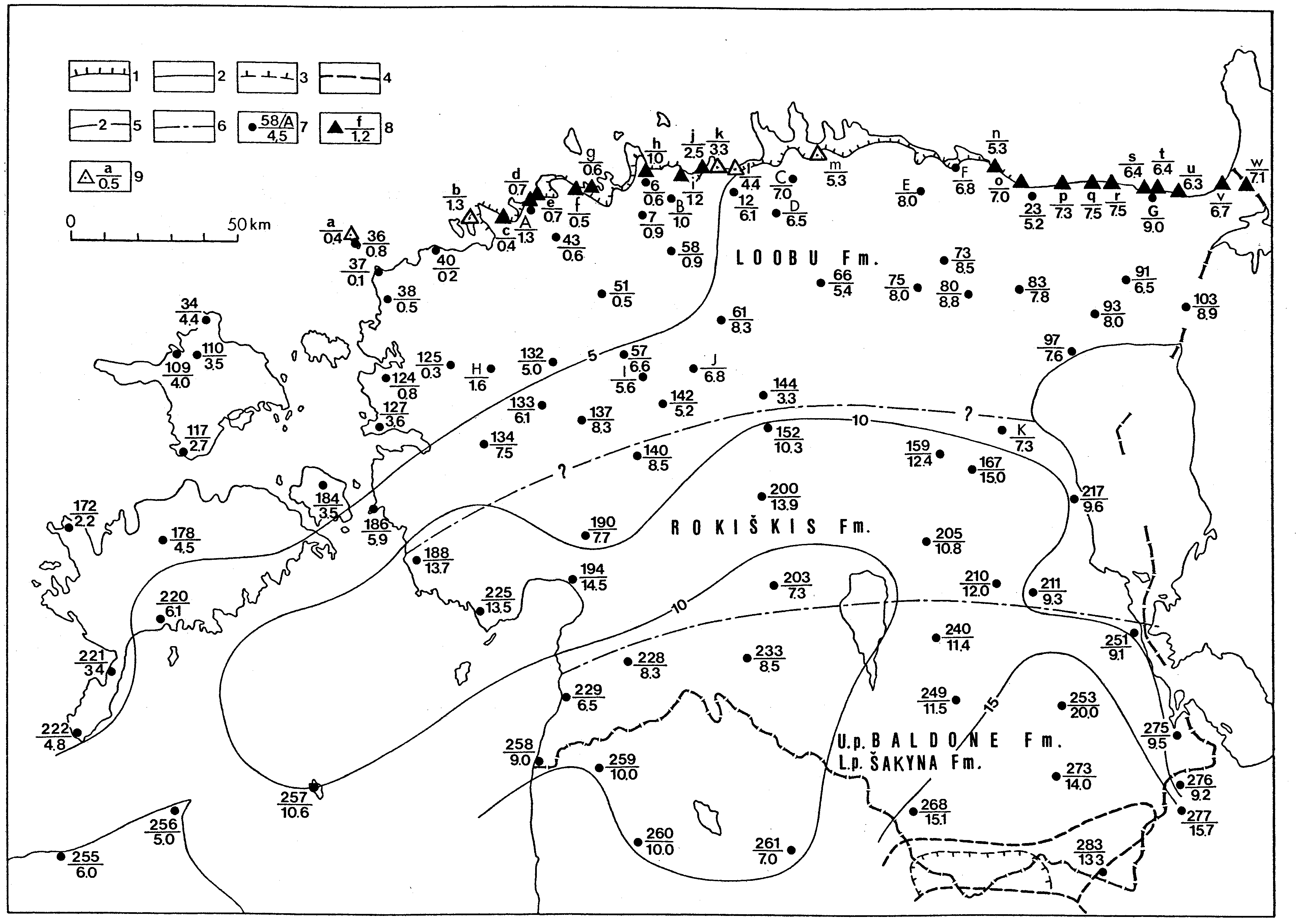
Fig. 36. Sketch-map showing the present distribution and the thickness of the Kunda Stage. Legend 1 - 9 see Fig. 30. Outcrops (a - w) see Fig. 33; among them a - Osmussaar, type section of the Osmussaar Member, b - Väike -Pakri, type section of the Pakri Member, k - Jägala, type section of the Jägala Member, l - Ubari, type section of the Ubari Member, m - Nõmmeveski, type section of the Nõmmeveski Member; core sections: A - Keila-Joa, B - Saha-Loo, C - Kemba, D - Pillapalu, E - Essu, F - Kunda, G - Voka, H - Maidla, I - Keava, J -Vahastu. The signs L. p. and U.p show whether the unit forms the lower or upper part of the stage.
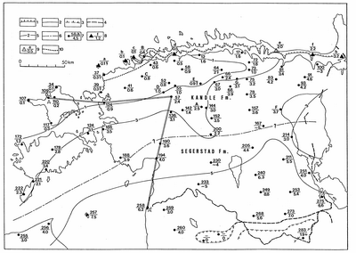
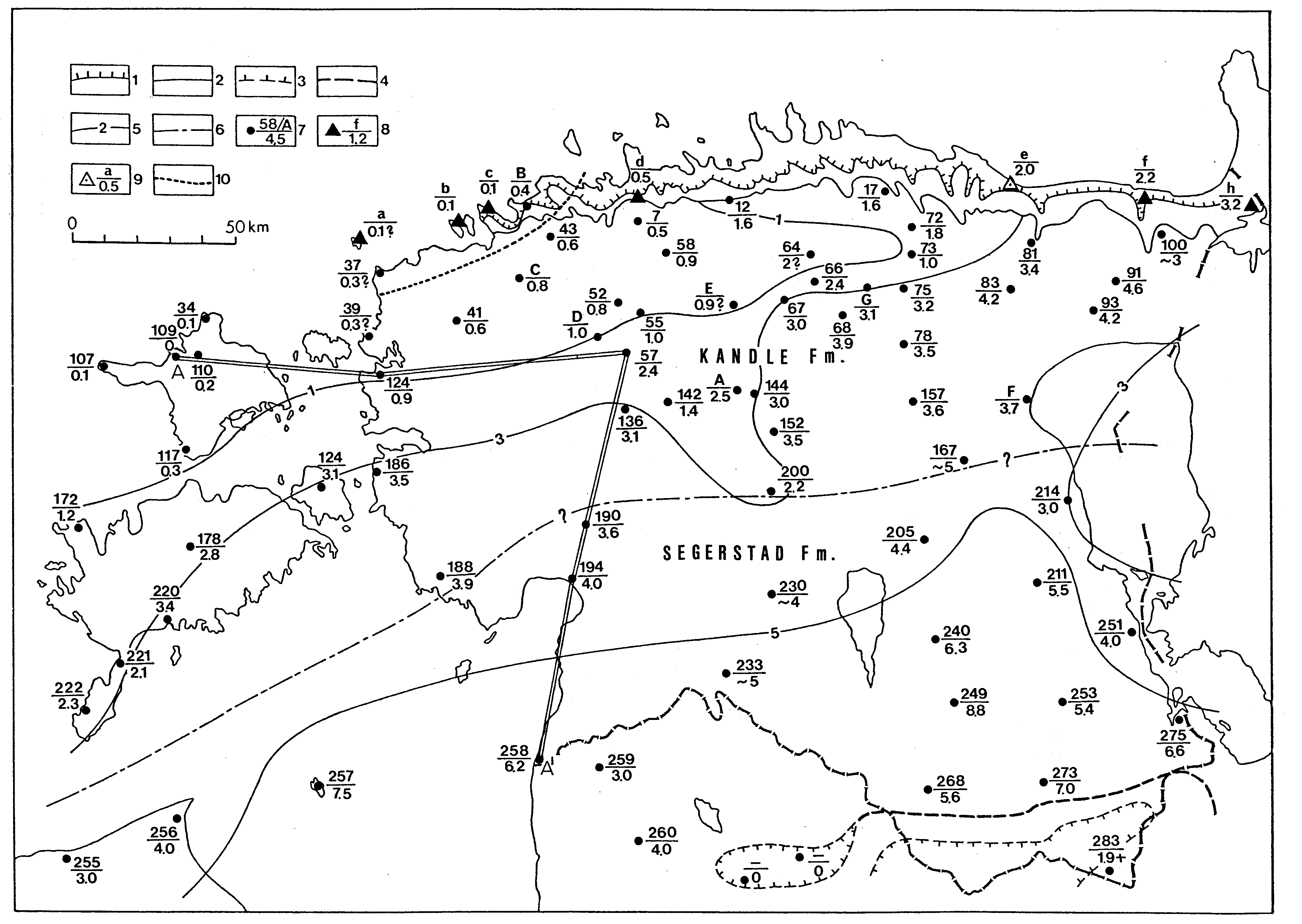
Fig. 37. Sketch-map showing the present distribution and the thickness of the Aseri Stage. Legend 1 - 9 see Fig. 30; 10 - southern limit of the sandy rocks. Here and on the following figures the thickness of the stages is based on different publications (Männil 1966, Rõõmusoks 1960, 1970 a. o. ) and unpublished data. Outcrops: a - Osmussaar, b - Väike-Pakri, c - Pakri Cape, d - Lasnamägi. e - Aseri, type section of the Aseri Stage, f - Voka, h - Narva; core sections: A - Väätsa, B - Keila Joa, C - Munalaskme, D - Oela, E - Atla, F - Mustvee, G - Tamsalu. Profile line A - A, see Fig. 40.
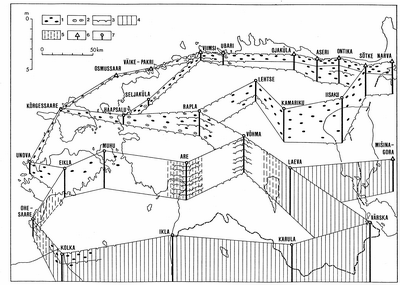
Fig. 38. Sketch-map showing the sections of the Aseri Stage: 1 - goethitic ooids; 2 - phosphatic ooids; 3 - discontinuity surface; 4 - red-coloured and 5 - mottled limestones; 6 - outcrop; 7 - core section.
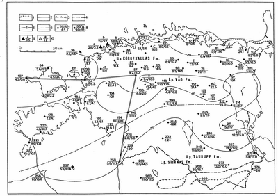
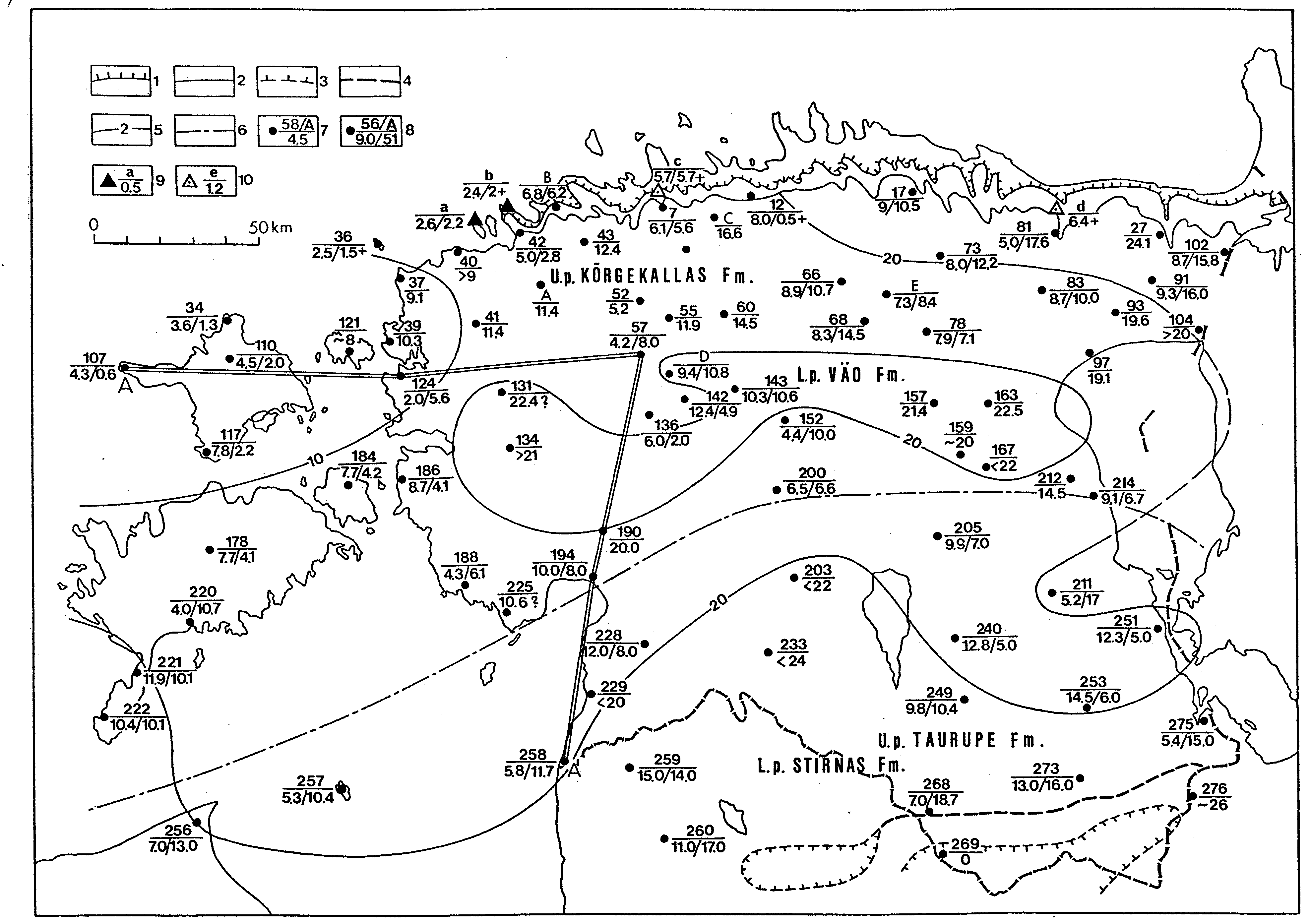
Fig. 39. Sketch-map showing the present distribution and the sum thickness of the Lasnamägi and Uhaku stages. Legend 1 - 6, 9 and 10 see Fig. 30; 7 - borehole, the number (see Fig. ) or index (A...F) in the numerator and the sum thickness of the Lasnamägi and Uhaku stages in the denominator, 8 - the same, but the denominator shows the thickness of the Väo (first number) and Kõrgekallas formations (second number). Outcrops: a - Väike-Pakri, b - Pakri Cape, c - Lasnamägi, type section of the Lasnamägi Stage, d - Uhaku, type section of the Uhaku Stage; core sections: A - Munalaskme, B - Keila-Joa, C - Raasiku, D - Keava, E - Tamsalu. Sections on the profile line A - A see Fig. 40. The signs L. p. and U. p show whether the unit forms the lower or upper part of the described interval.
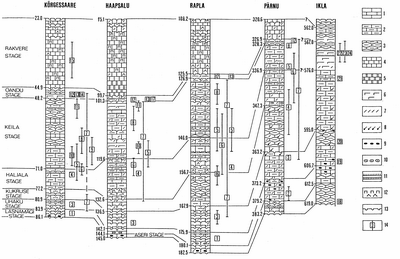
Fig. 40. Correlation of the Middle Ordovician sequences on the line A-A (see Fig. 39). Legend: 1 - limestone; 2 - argillaceous limestone; 3 - nodular argillaceous limestone; 4 - micritic (aphanitic) limestone; 5 - dolomite; 6 - calcareous marl; 7 - skeletal sand; 8 - pyritized skeletal sand; 9 - goethitic ooids; 10 - phosphatic ooids; 11 - K -bentonite; 12 - pyritized spots (upper sign), kukersite kerogen (lower sign); 13 - discontinuity surface; 14 - number and stratigraphical interval of selected fossils: 1 - Christiania oblonga, 2 - Lituites lituus, 3 - Clitambonites squamatus, 4 - Bilobia? sp., 5 - Mastopora concava, 6 - Pyritonema subulare, 7 - Sowerbyella sp. sp., 8 - Keilamena? sp. 9 - Saukrodictya sp., 10 - Baltocrinus hrevicaensis, 11 - Horderleyella? kegelensis, 12 - Howellites sp., 13 - Vellamo oanduensis, 14 - Kjaerina orvikui, 15 - Holtedahlina sp., 16 - Bekkerina? sp., 17 - Ilmarinia sp., 18 - Asaphus (Neoasaphus) platyurus, 19 - Illaenus chiron, 20 - Christiania sp., 21 - Bimuria aff. peregirina, 22 - Platystrophia rava, 23 - Skenidioides sp., 24 - Haplosphaeronis sp.
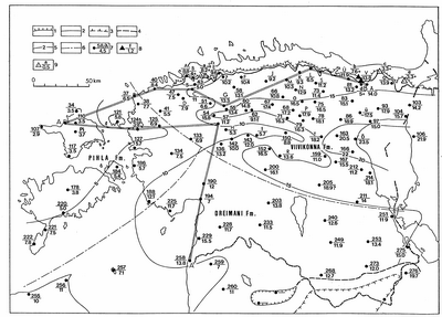
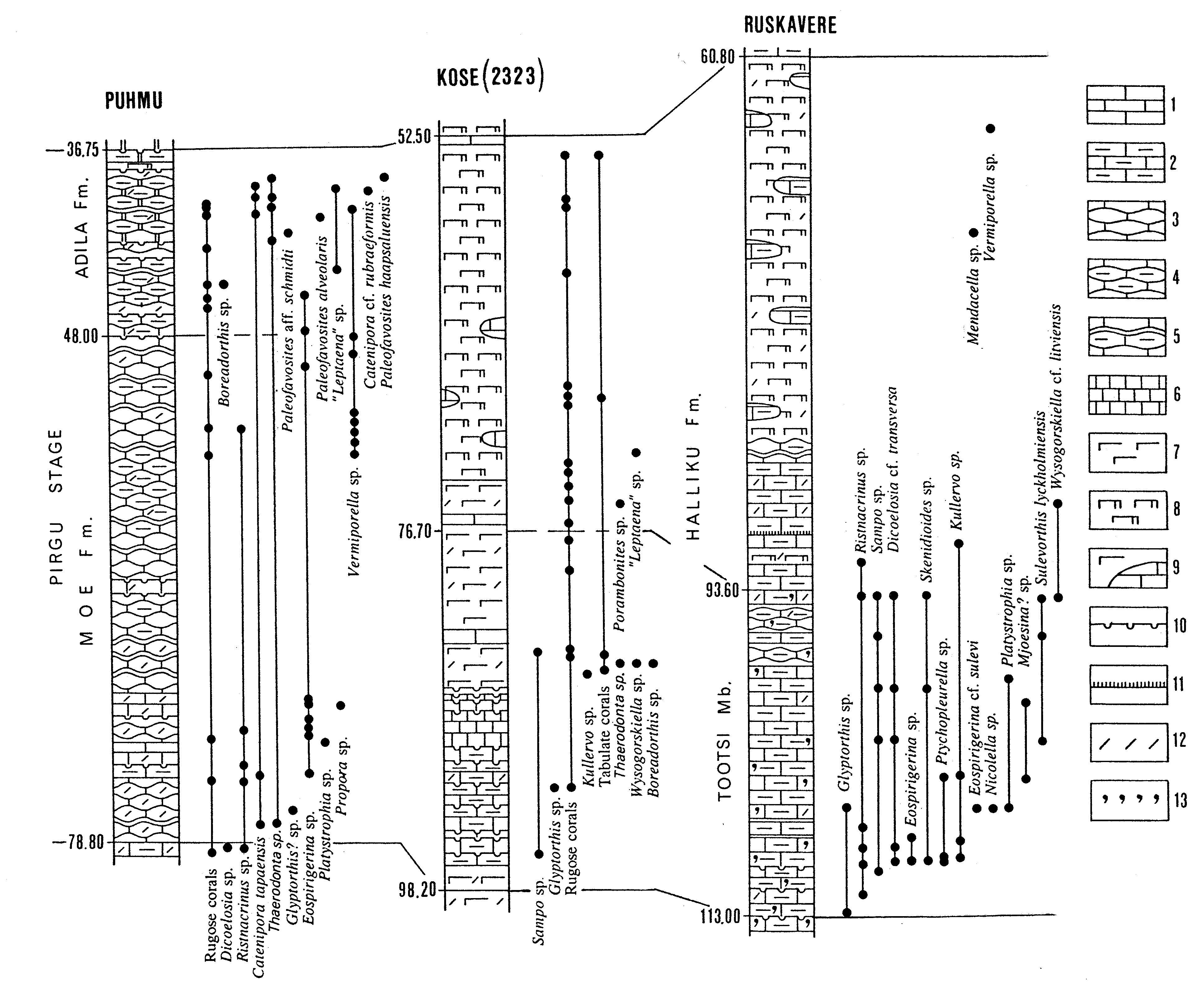
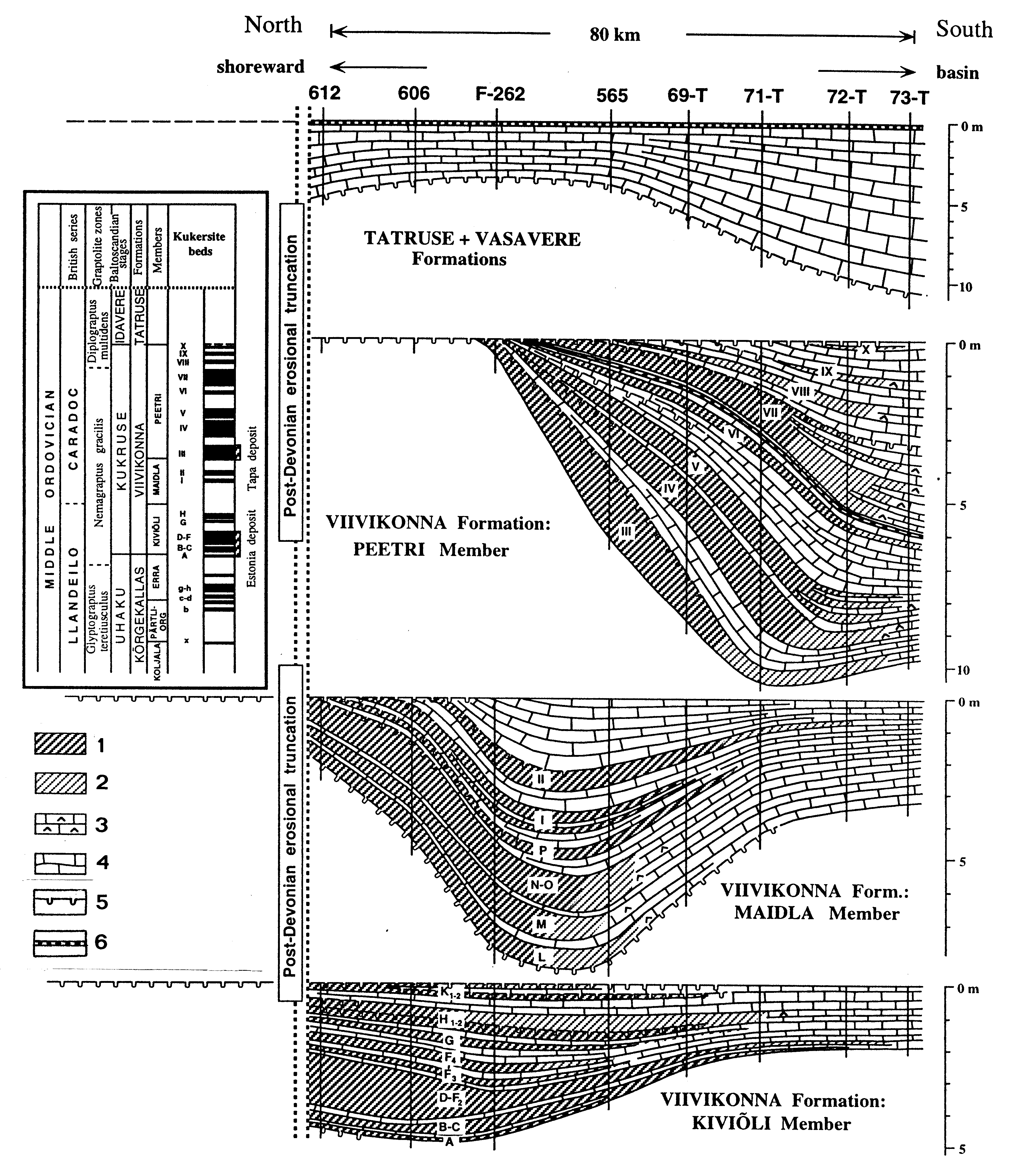
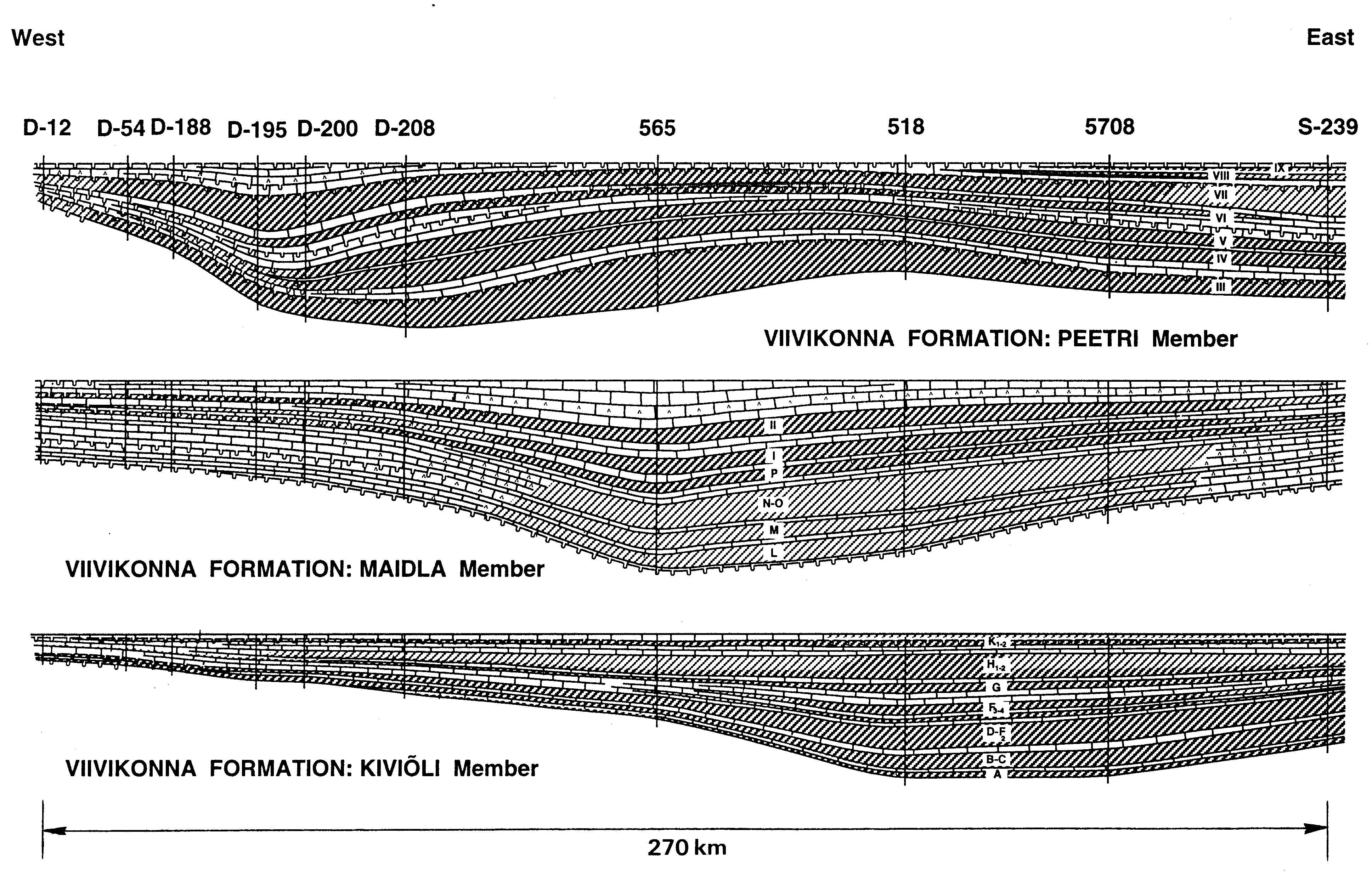
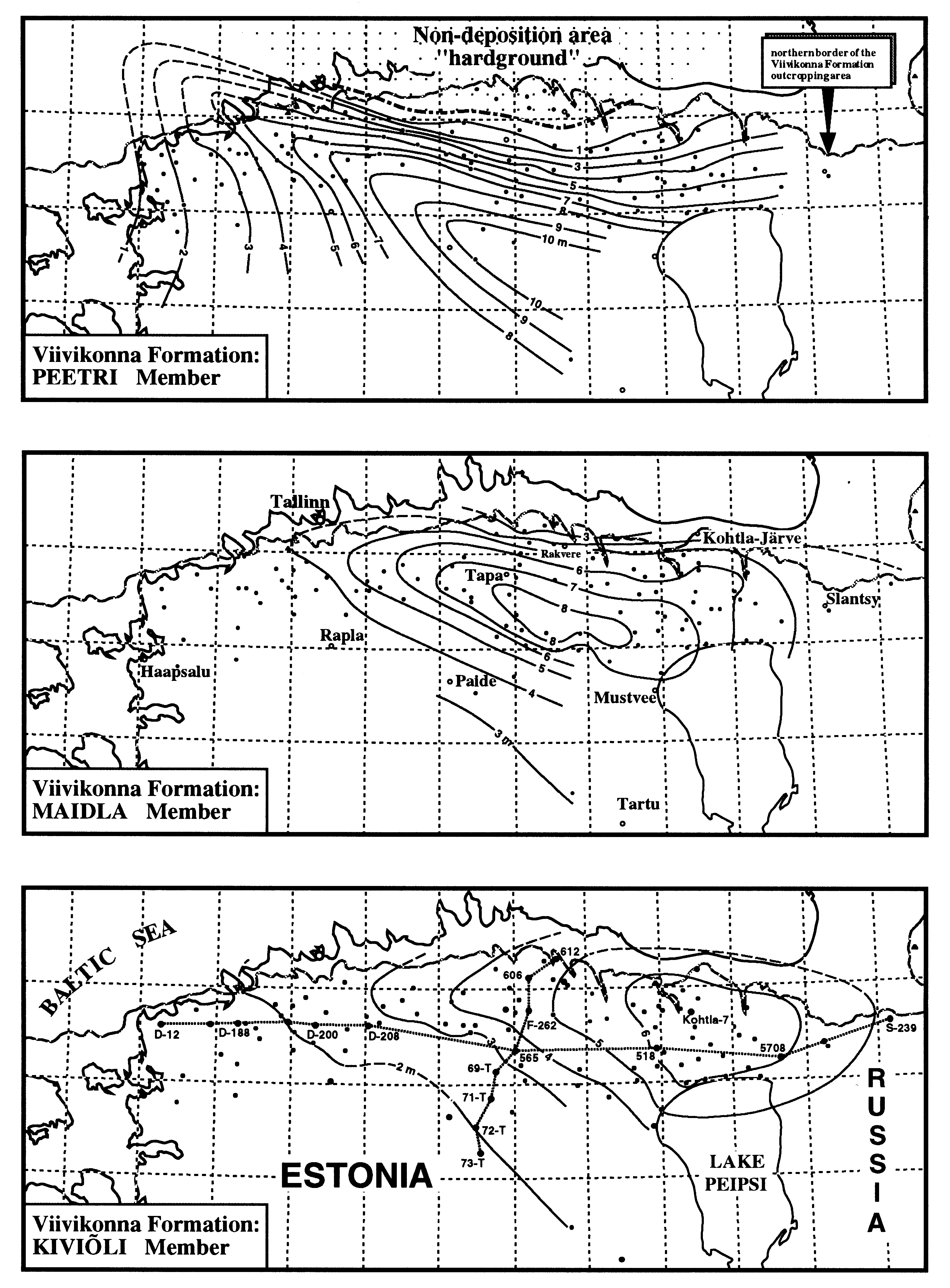
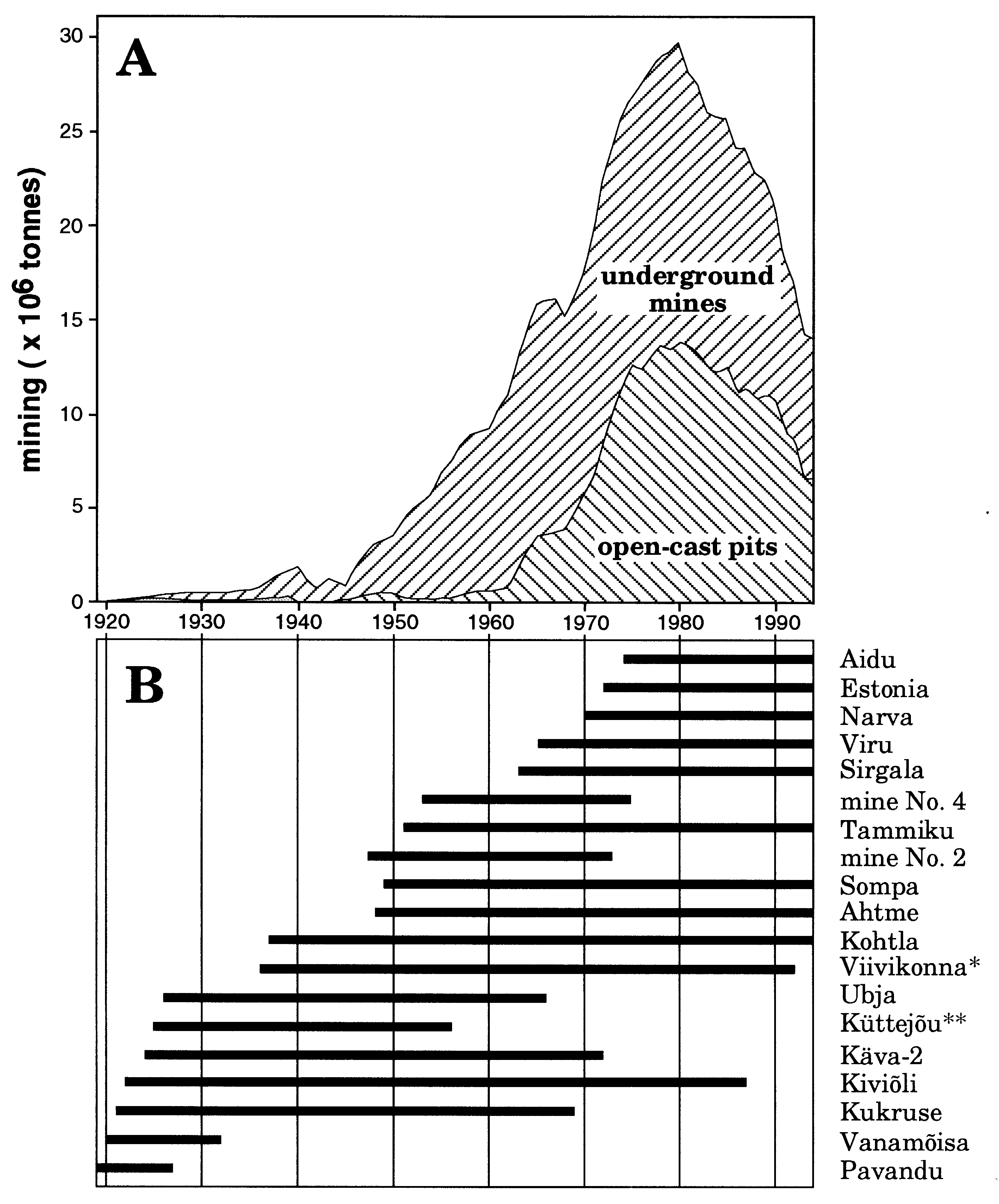
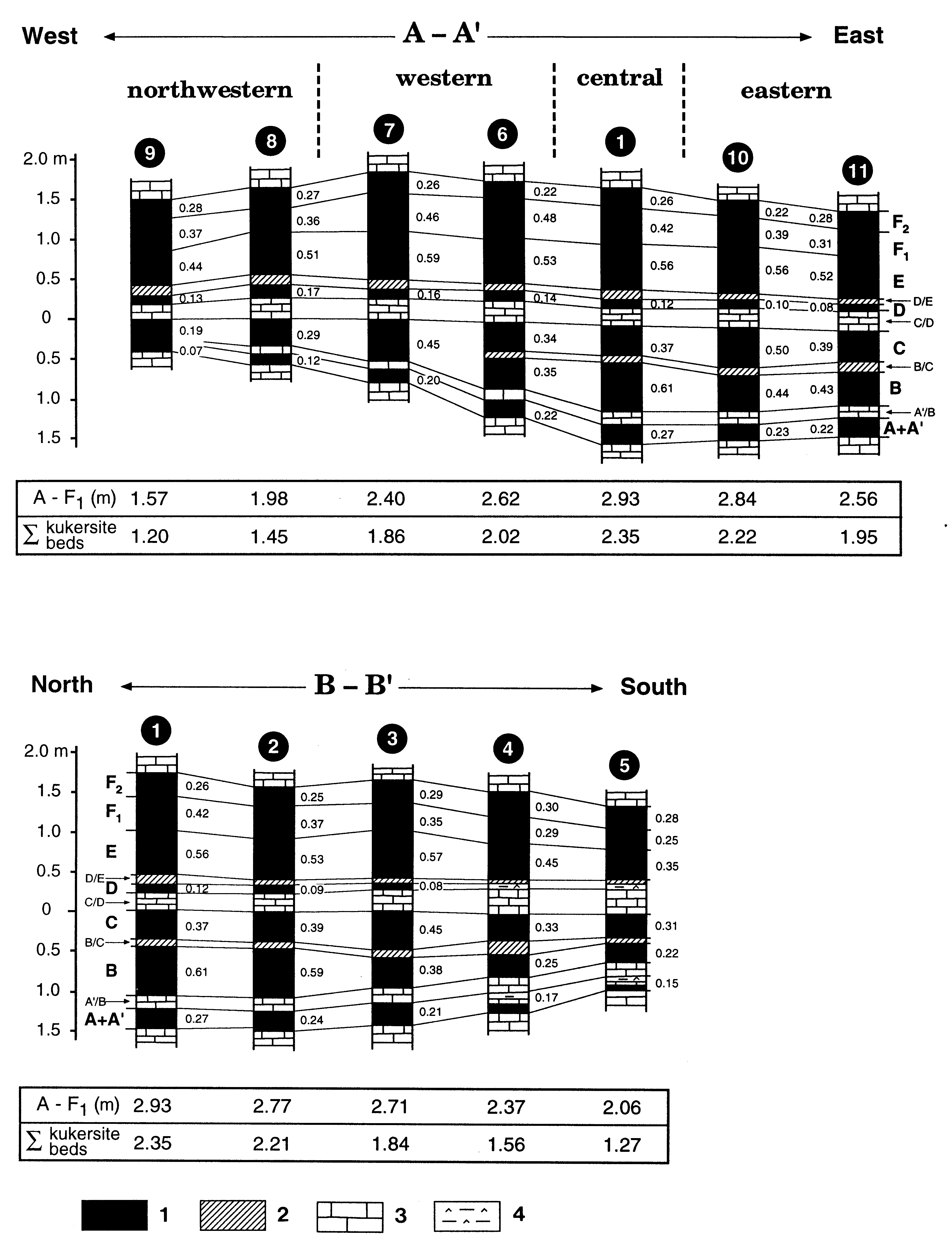
Fig. 41. Sketch-map showing the present distribution and thickness of the Kukruse Stage. Legend 1-9 see Fig. 30. Outcrops: a - Peetri, type section of the Peetri Member, b - Küttejõu quarry, type section of the Kiviõli Member, c - Kukruse, type section of the Kukruse Stage, d - Purtse River bank, type section of the Maidla Member, e - Viivikonna, type section of the Viivikonna Formation; core sections: A - Keila-Joa, B - Humala, C - Ohtu, D - Munalaskme, E - Mõigu, F - Raasiku, G - Lõiuse, H - Keava, I - Väätsa, J - Pillapalu, K - Kihlevere, L - Tatruse, M - Palaoja, N - Saksi (F-262), O - Tamsalu, P - Raigu, Pi - Pihla, type section of the Pihla Formation, R - Imavere, S - Tõrma, T - No 165T, U - Kihlevere, V - Oandu (506), Õ - Mustvee, Ä - Kohtla, Ö - Ruskavere, Ü - Tagajõe. Sections on the profile line A-Asee Fig. 40; on the line A - B Fig. 42.
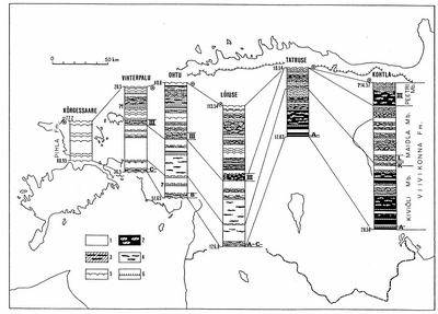
Fig. 42. The composition and correlation of the Kukruse Stage on the line A-B (see Fig. 41): 1 - pure limestone; 2 - kukersite with carbonate noduls; 3 - kerogeneous limestone with kukersite noduls; 4 - kukersite noduls; 5 - discontinuity surface; 6 - K-bentonite in the Vihterpalu and Lõiuse cores. Compiled after Männil and Bauert (Männil & Bauert 1986). A, B, C, D, K, L, III - indices of kukersite seams.
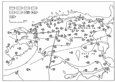
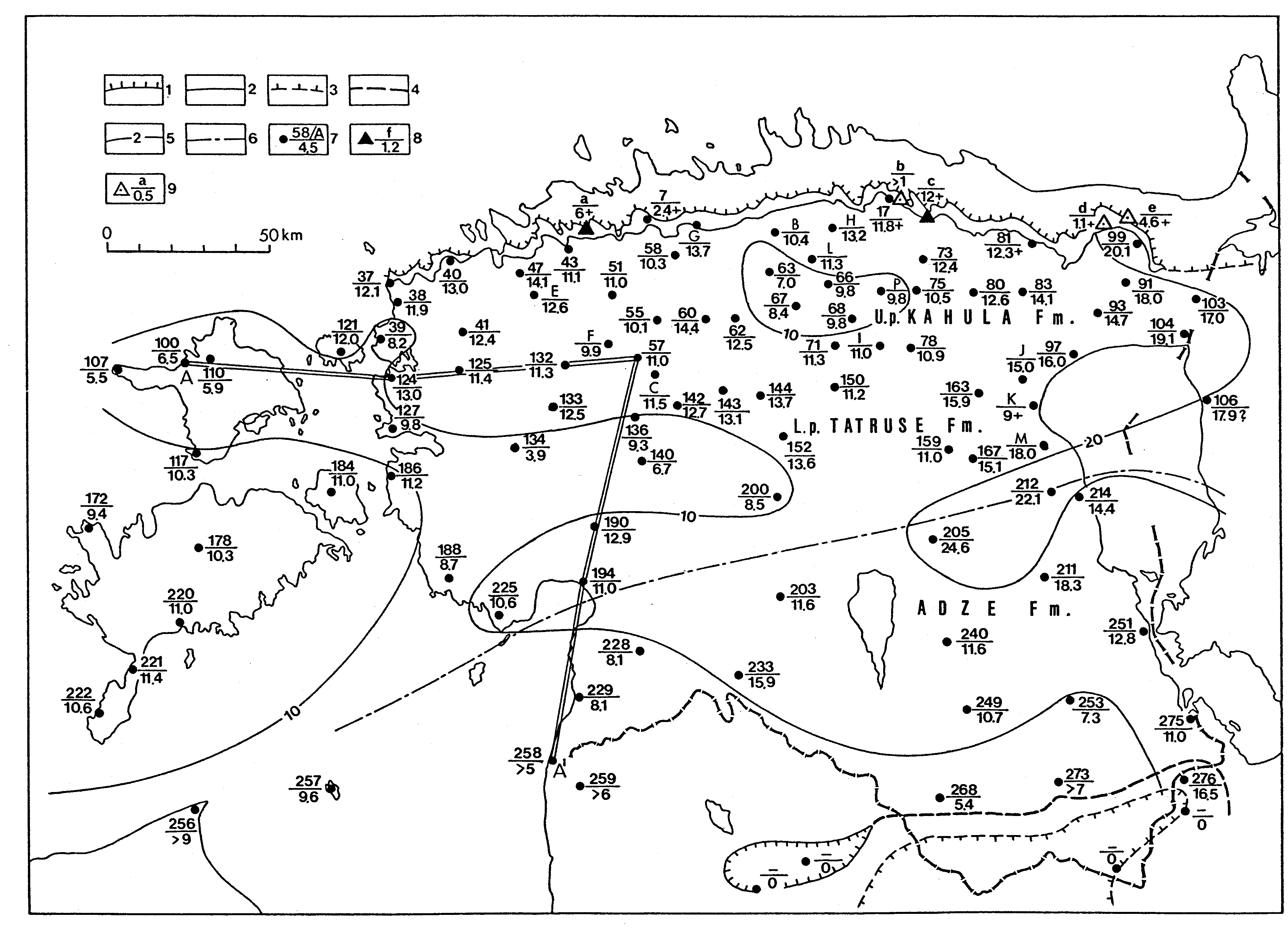
Fig. 43. Sketch-map showing the present distribution and the thickness of the Haljala Stage. Legend 1 - 9 see Fig. 30. Outcrops: a - Peetri, b - Idavere, type section of the Idavere Substage, c - Aluvere, d - Kahula, type section of the Kahula Formation, e - Kämbemägi, type section of the Jõhvi Substage; core sections: A - I see Fig. 44, J - Piilsi, K - Mustvee, L - Lehtse, M - Kose. Sections on the profile line A - Asee Fig. 40. The signs L. p. and U. p show whether the unit forms the lower or upper part of the stage.
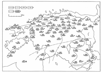
Fig. 44. Sketch-map showing the present distribution of the Haljala Stage and the thickness of the Idavere and Jõhvi substages: 1 and 2 - limits of the distribution of the Haljala Stage in the outcrop and subsurface area; 3 - isopachyte of the Idavere Substage; 4 - isopachyte of the Jõhvi Substage; 5 - approximate northern boundary of the Adze Formation; 6 - core section, number or index in the numerator, thickness of the Idavere (first number in the denominator) and Jõhvi (second number in the denominator) substages.
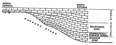
Fig. 45. Meridional cross-section of the lower Idavere Substage and distribution of the chitinozoan zones (Hints et al. 1994).
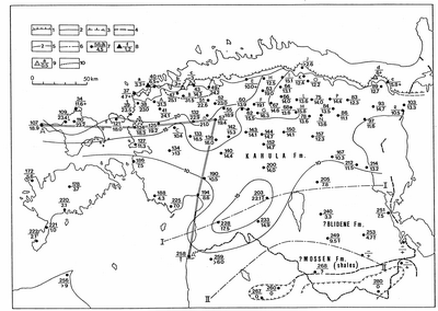
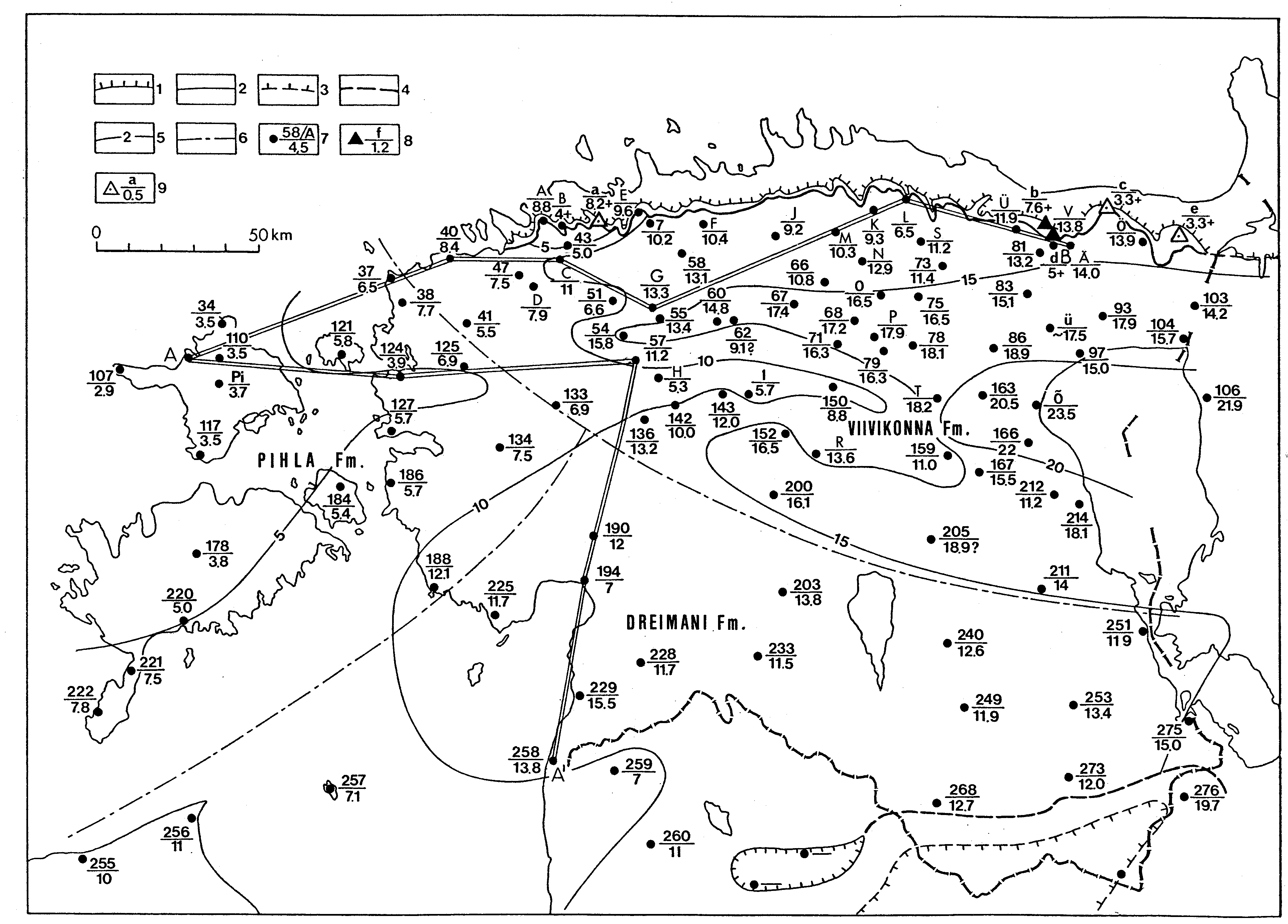
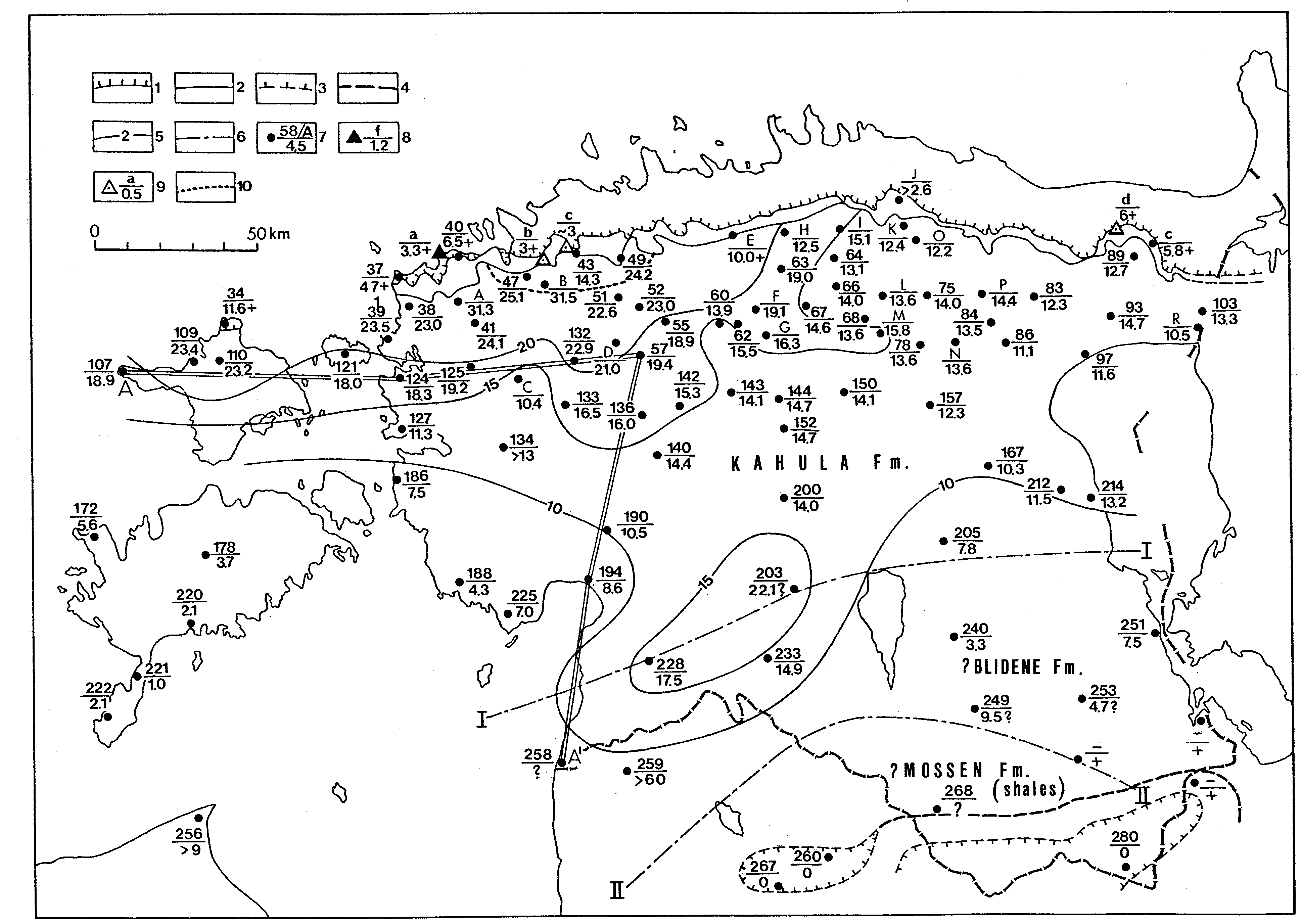
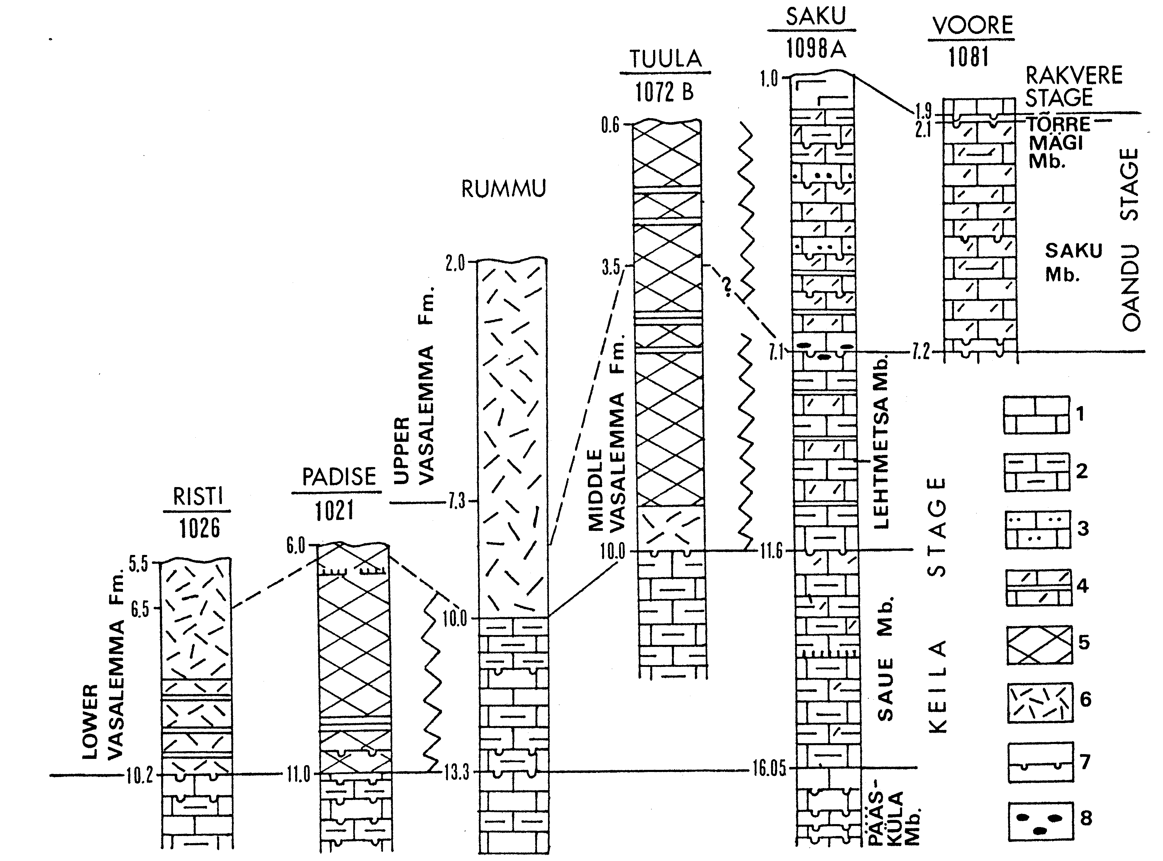
Fig. 46. Sketch-map showing the present distribution and the thickness of the Keila Stage. Legend 1- 9 see Fig. 30; 10 - southern border of the Vasalemma Formation. Outcrops: a - Ristna b - Vasalemma, type section of the Vasalemma Formation, c - Keila, type section of the Keila Stage, d - Kahula, type section of the Kahula Formation, e - Rausvere; core sections: A - Kaldamäe, B - Munalaskme, C - Maidla, D - Oela, E - Kehra, F - Atla, G - Mustla, H - Pillapalu, I - Palaoja, J - No 269, K - No 150, L - Tamsalu, M - Raigu, N - No 542, O - Tõrma, P - Viru-Roela, R - Permisküla. Sections on the line A-A see Fig. 40. Line I - I - approximate southern boundary of the Kahula Formation, II - II - northern border of the distribution of black shales of the Mossen Formation, which supposedly may have in places the Keila Age (see Meidla 1996).
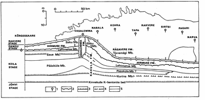
Fig. 47. Profile of the Keila and Oandu stages in northern Estonia from west (Kõrgessaare) to east (Narva), compiled by Põlma et al. 1988. Legend: 1 - core section; 2 - discontinuity surface; 3 - K-bentonite; 4 - discontinous K-bentonite; 5 - boundary between units.

Fig. 48. Correlation of the Keila and Oandu stages in the distribution area of the Vasalemma Formation (Hints 1996). Legend: 1 - limestone; 2 - argillaceous limestone; 3 - sandy limestone; 4 - organodetrital limestone with argillaceous interlayer; 5 - massive limestone of the mud mound; 6 - massive organodetrital limestone (cystoid limestone); 7 - discontinuity surface; 8 - pebbles. Other signs in the log see Fig. 40.
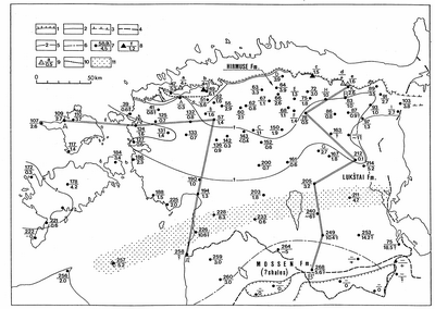
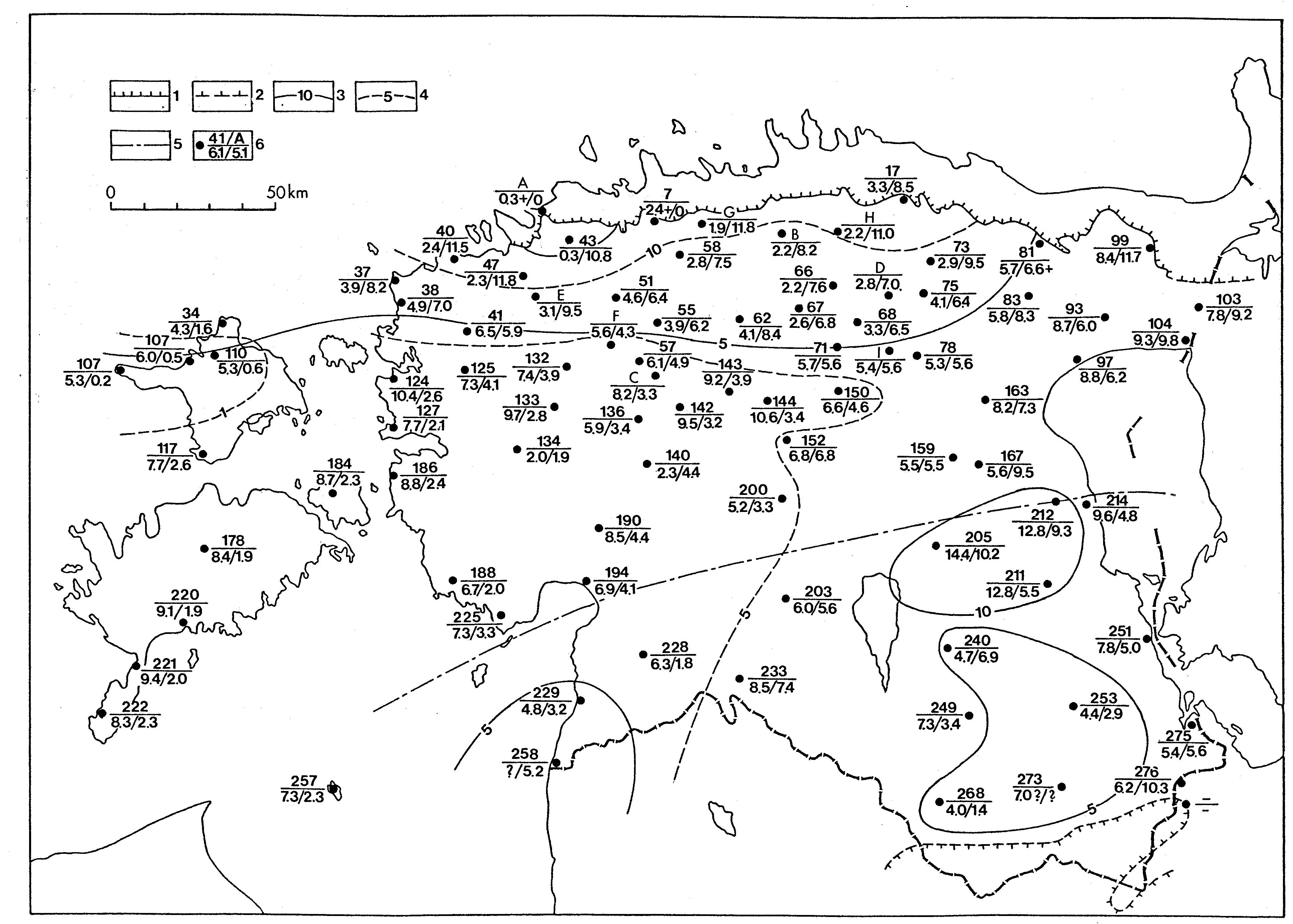
Fig. 49. Sketch-map showing the present distribution and the thickness of the Oandu Stage. Legend 1- 9 see Fig. 30; 10 - boundary of the distribution area of the Vasalemma Formation; 11 - distribution area of the sandy limestones in the boundary beds of the Keila and Oandu stages (Ainsaar 1995). Outcrops: a - Vasalemma, type section of the Vasalemma Formation, b - Saku, c - Rakvere (Ussimägi), d - Hirmuse, type section of the Hirmuse Formation, e - Oandu, type section of the Oandu Stage; core sections: A - Munalaskme, B - Oela, C - Paide, D - Palaoja, E - Tamsalu, F - Raigu, G - Ellamaa, H - Viru-Roela, J - Permisküla. Sections on the profil line A-A see Fig. 40, on line B-B - Fig. 51.

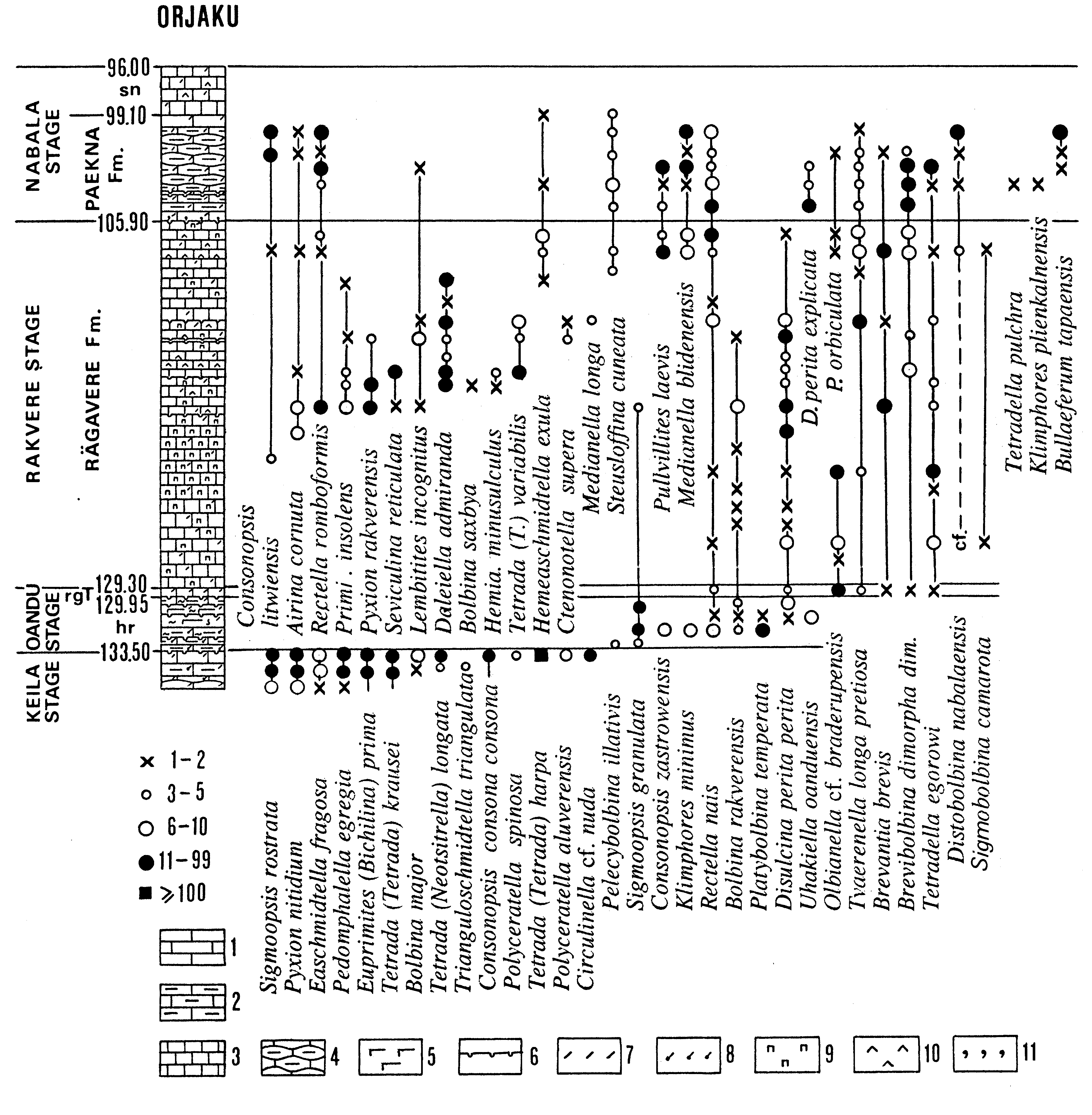
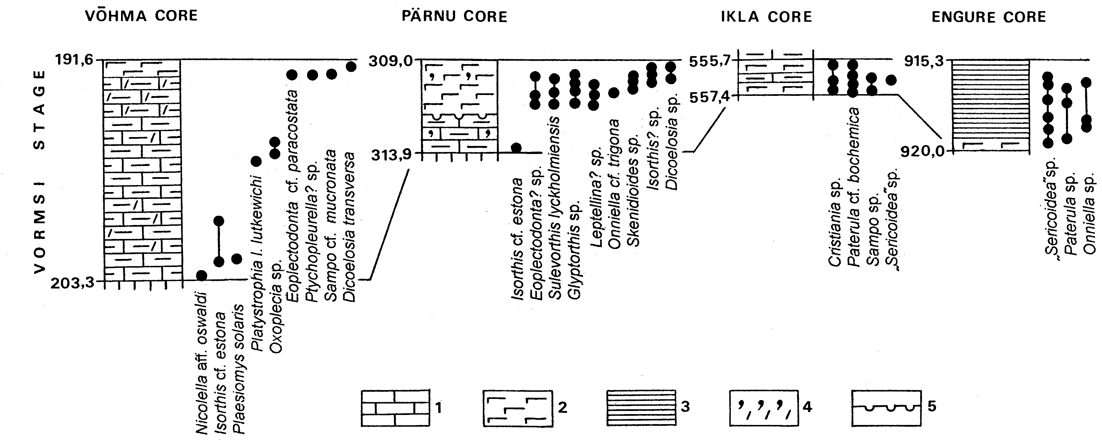
Fig. 50. The distribution of selected ostracodes in the Orjaku core section (by Meidla 1996). Legend: 1 - limestone; 2 - argillaceous limestone; 3 - micritic (aphanitic) limestone; 4 - argillaceous nodular limestone; 5 - carbonate marl; 6 - discontinuity surface; 7 - skeletal detritus; 8 - pyritized skeletal detritus; 9 - pyrite mottles; 10 - kukersite kerogen; 11 - glauconite. The symbols showing the approximate number of specimens are given in the lower left corner. Indices of stratigraphical units: rgT - Tõrremägi Member of the Rägavere Formation, hr - Hirmuse Formation, sn - Saunja Formation.
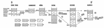
Fig. 51. Correlation of the Oandu Stage on the line B-B (see Fig. 49) and the distribution of selected fossils: 1 - Horderleyella? sp., 2 - Sowerbyella tenera, 3 - Rhactorthis kaagverensis, 4 - Howellites wesenbergensis, 5 - Skenidioides sp., 6 - Keilamena? sp., 7 - Leptaena sp., 8 - Leptellina? sp., 9 - Camerella sp., 10 - Platystrophia rava, 11 - Onniella longa, 12 - Reushella magna, 13- Leptaena sp., 14 - Oanduporella sp., 15 - Onniella sp. (cf. bamcrofti); l - uppermost finds of Leiosphaeridia. Legend: 1 - limestone; 2 - argillaceous limestone; 3 - micritic (aphanitic) limestone; 4 - marl; 5 - black shale; 6 - argillaceous nodular limestone; 7 - discontinuity surface; 8 - K-bentonite.
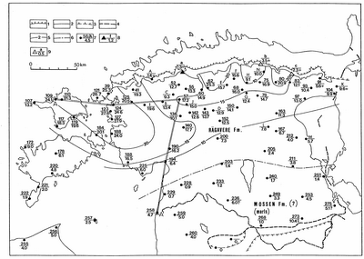
Fig. 52. Sketch-map showing the present distribution and the thickness of the Rakvere Stage. Legend 1- 9 see Fig. 30. Outcrops: a - Nabala, b - Rägavere, type section of the Rakvere Stage and Rägavere Formation, c - Piilse on the Oandu River bank, type section of the Piilse Formation; core sections: A - Munalaskme, B - Vaimõisa, C - Oela, D - Väätsa, E - Järva-Madise, F - Ambla, G - Raigu, H - Tamsalu, I - Risti-Maidla, J - Keava, K - Kuningaküla, L - Ellavere, M - Alatskivi, N - Koeravere. Sections on the profile line A - A see Fig. 40.
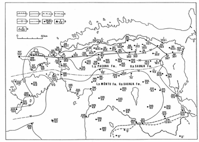
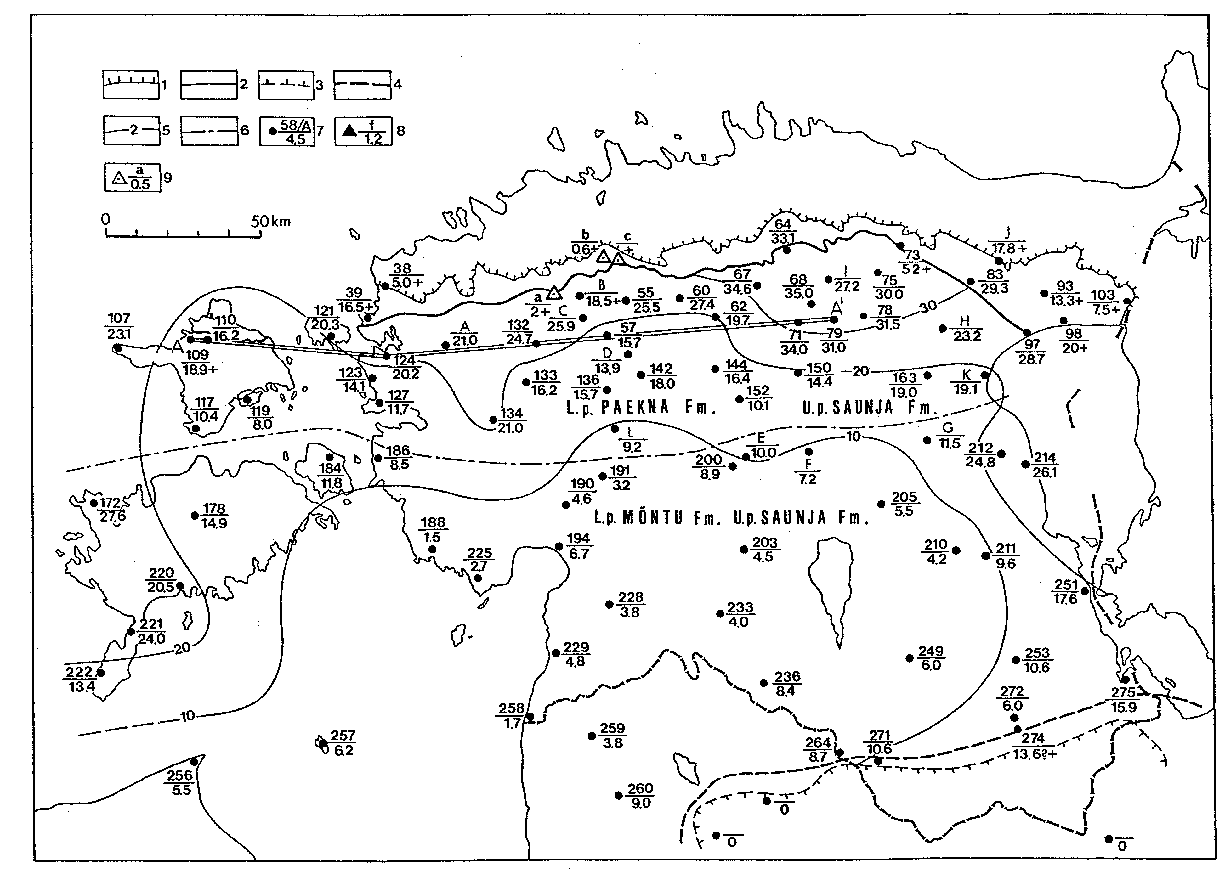
Fig. 53. Sketch-map showing the present distribution and the thickness of the Nabala Stage. Legend 1- 9 see Fig. 30. Outcrops: a - Mõnuste (Saunja), type section of the Saunja Formation; b - Paekna, type section of the Paekna Formation, c - Nabala (Nõmmeküla), type section of the Nabala Stage, core sections: A - Palivere, B - Adila, C - Oela, D - Keava, E - Koksvere, F - Põltsamaa, G - Palamuse, H - Venevere, I - Tamsalu, J - Piilsi, K - Mustvee, L - Kõnnu. The signs L. p. and U. p show whether the unit forms the lower or upper part of the stage.
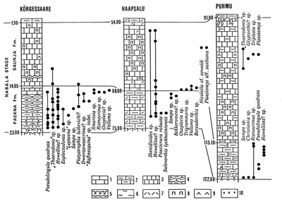
Fig. 54. Correlation of the Nabala Stage on the line A-A (see Fig. 53) and the distribution of selected macrofossils. Legend: 1 - limestone; 2 - argillaceous limestone; 3 - micritic (aphanitic) limestone; 4 - nodular argillaceous limestone; 5 - discontinuity surface; 6 - burrows; 7 - skeletal detritus; 8 - pyrite mottles; 9 - kukersite kerogen; 10 - glauconite.

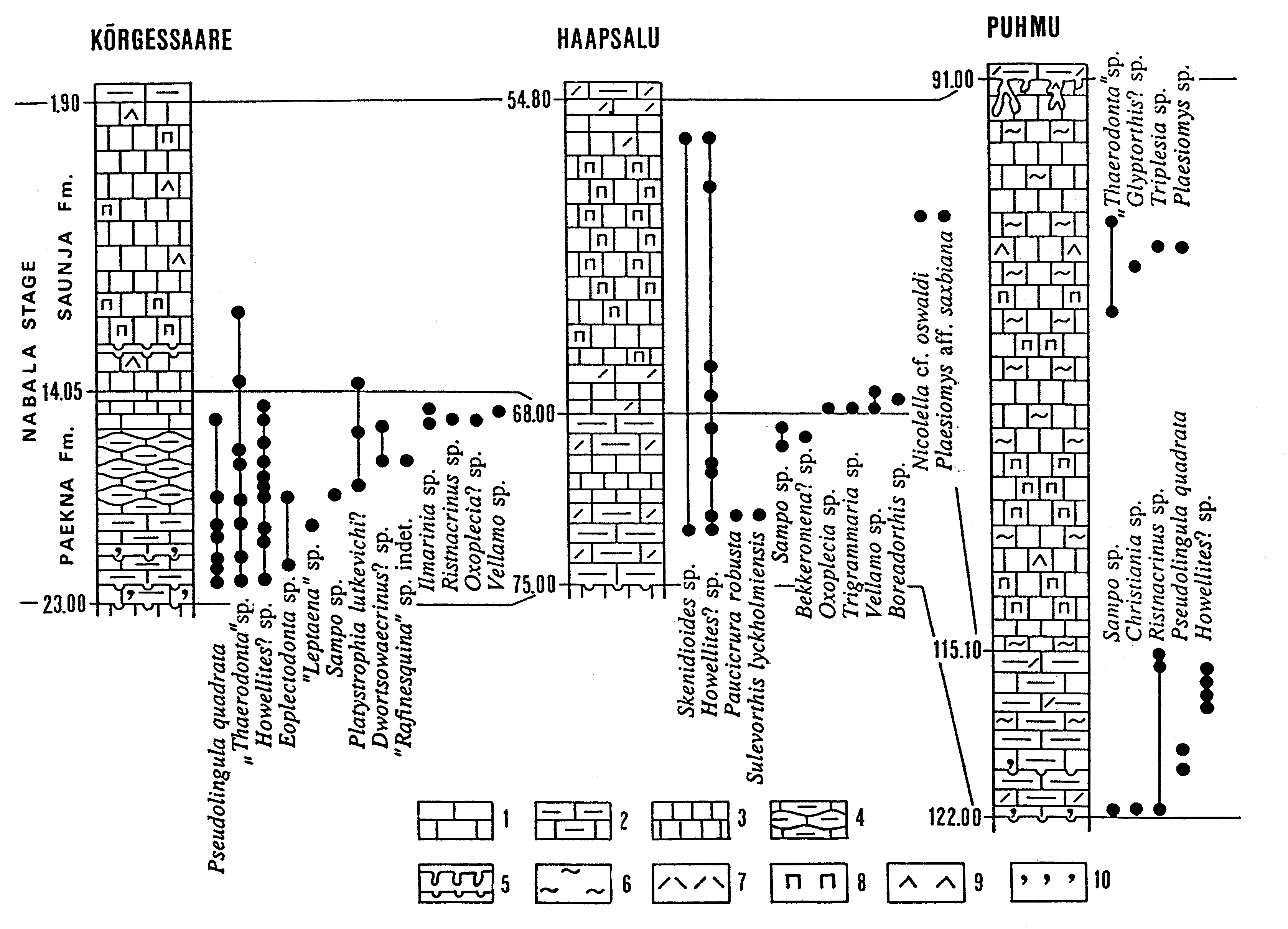
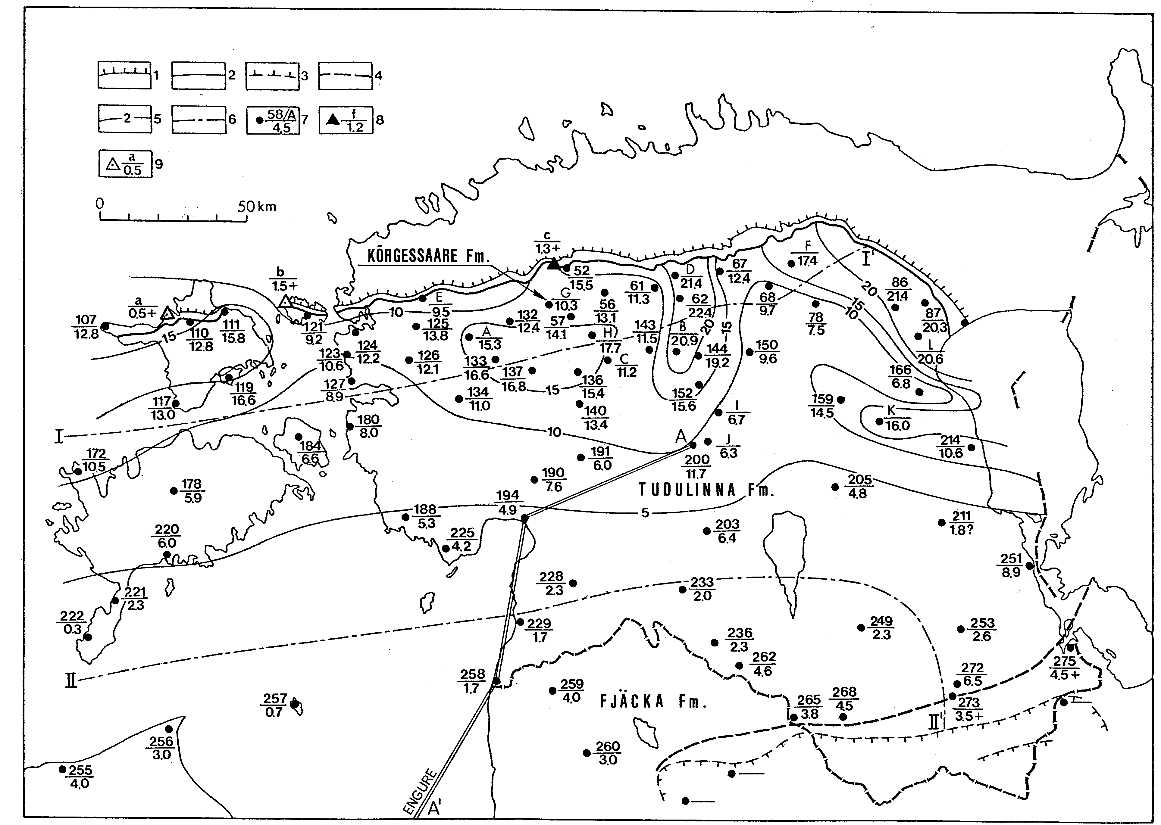
Fig. 55. Sketch-map showing the present distribution and the thickness of the Vormsi Stage. Legend 1- 9 see Fig. 30. Outcrops: a - Kõrgessaare, type section of the Kõrgessaare Formation, b - Saxby, type section of the Vormsi Stage, c - Urge; core sections: A - Maidla, B - Väätsa, C - Lelle, D - Atla, E - Seljaküla, F - Tamsalu, G - Oela, H - Keava, I - Kabala, J - Koksvere, K - Palamuse, L - Piilsi, 78 - Kamariku, type section of the Tudulinna Formation. Line I-I- northern limit of the distribution of the Tudulinna Formation, II- II- northern limit of the distribution of the Fjäcka Formation. Sections on the line A-A see Fig. 56.
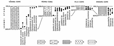
Fig. 56. Correlation of the Vormsi Stage on the line A-A (Fig. 55) and the distribution of macrofossils: 1 - argillaceous limestones; 2 - marls; 3 - black shales; 4 - glauconite grains (the upper sign) and skeletal detritus (the lower sign); 5 - discontinuity surface.

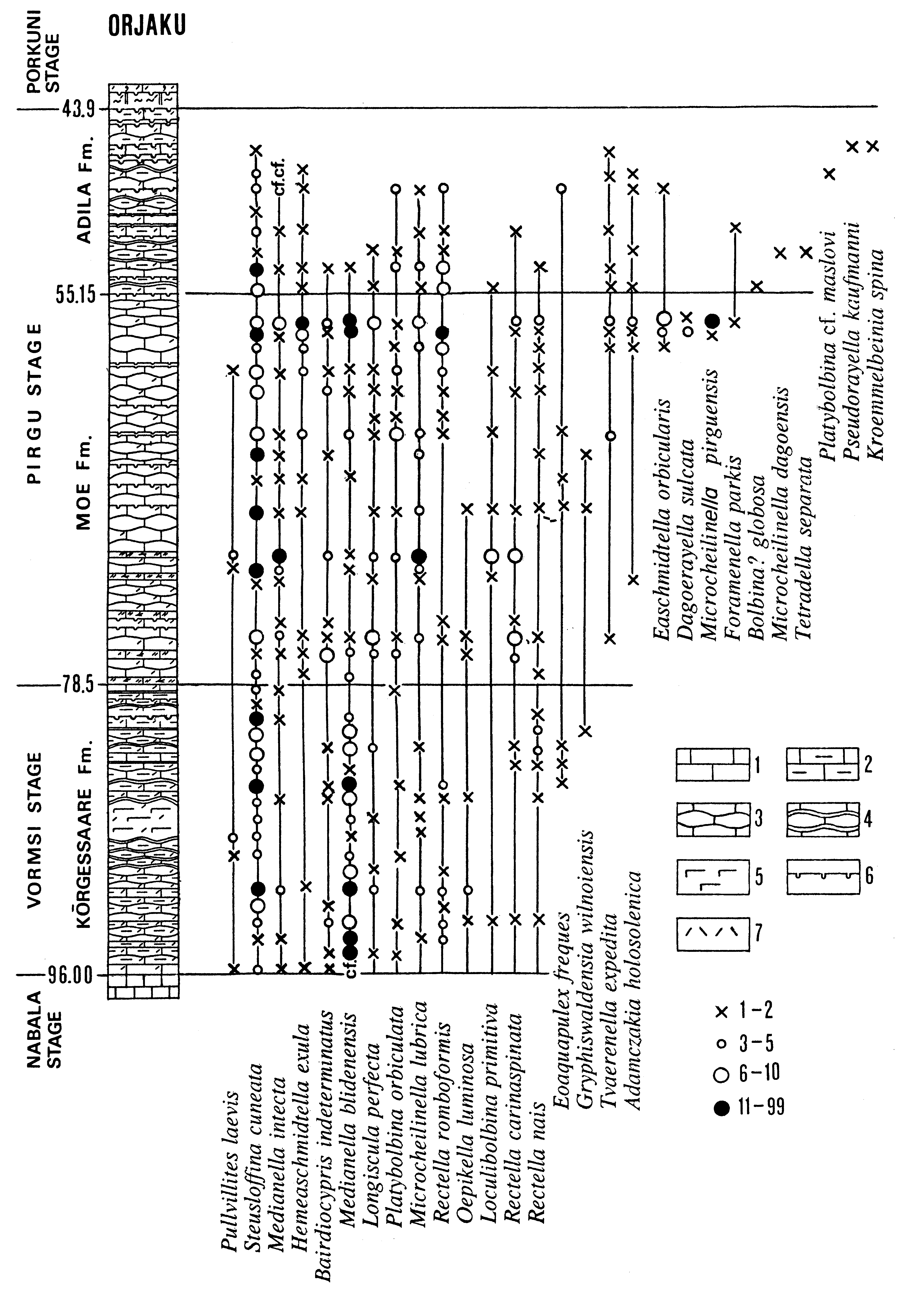
Fig. 57. Distribution of ostracodes in the Orjaku core (by Meidla 1996). Legend: 1 - limestone; 2 - argillaceous limestone; 3 - nodular limestone; 4 - nodular limestone with clayey interbeds; 5 - marl; 6 - discontinuity surface; 7 - skeletal detritus.
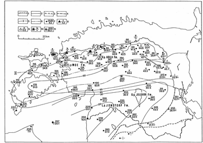
Fig. 58. Sketch-map showing the present distribution and the thickness of the Pirgu Stage. Legend 1- 9 see Fig. 30; 10 - outcrop of mud mound and reef, index in the numerator, thickness in the denominator; 11 - the same in the core section. I - I - northern limit of the distribution of the red-coloured and mottled limestones (Jonstorp and Jelgava formations), II - II - southern limit of the distribution of the sections of North Estonian type (Moe and Adila formations). Sections on the line A-A see Fig. 59. Outcrops: a - Hoitberg, b - Niibi, c - Ruunavere, d - Adila, e - Lohu, f - Pirgu, type section of the Pirgu Stage, g - Moe, type section of the Moe Formation; core sections: A - Risti, B - Oela, C - Mustla, D - Tamsalu, E - Raigu, F - Mustvee, G - Kose, H - Ellavere, I - Palamuse, J - Alatskivi. The signs L. p. and U. p show whether the unit forms the lower or upper part of the stage. Sections on line A - A see Fig. 59.
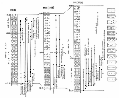
Fig. 59. Correlation of the Pirgu Stage and distribution of macrofossils. Legend: 1 - limestone; 2 - argillaceous limestone; 3 - nodular limestone; 4 - argillaceous nodular limestone; 5 - nodular limestone with clayey intercalations; 6 - micritic (aphanitic) limestone; 7 - marl; 8 - dolomitic marl; 9 - marl with limestone nodules; 10 - discontinuity surface; 11 - K-bentonite; 12 - skeletal detritus; 13 - glauconite.

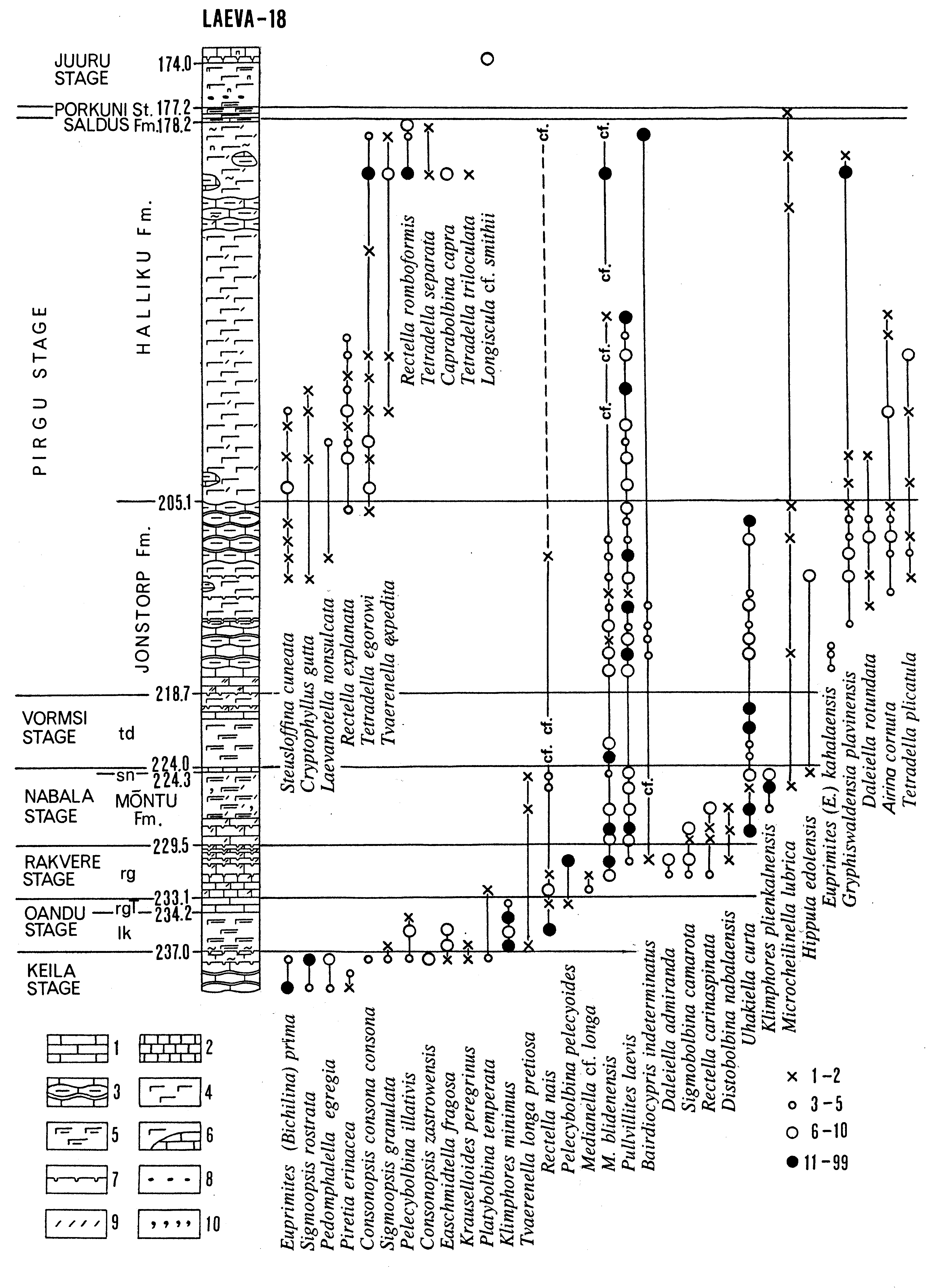
Fig. 60. Distribution of selected ostracodes in the Laeva-18 core section (by Meidla 1996). Legend: 1 - nodular argillaceous limestone; 2 - micritic (aphanitic) limestone; 3 - nodular limestone with clayey intercalations; 4 - marl; 5 - argillaceous marl; 6 - marl with carbonate nodules; 7 - discontinuity surface; 8 - pebbles; 9 - skeletal detritus; 10 - glauconite. The symbols showing the approximate number of specimens are given in the lower right corner. Abbreviations of stratigraphical units: formations lk - Luktai, rg - Rägavere, sn - Saunja, td - Tudulinna; rgT - Tõrremägi Member of the Rägavere Formation.
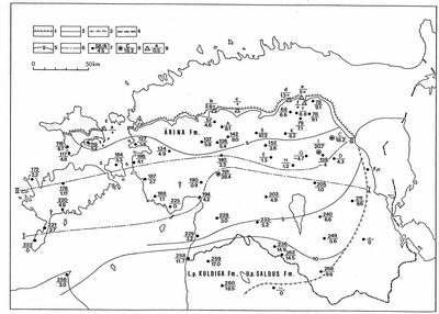
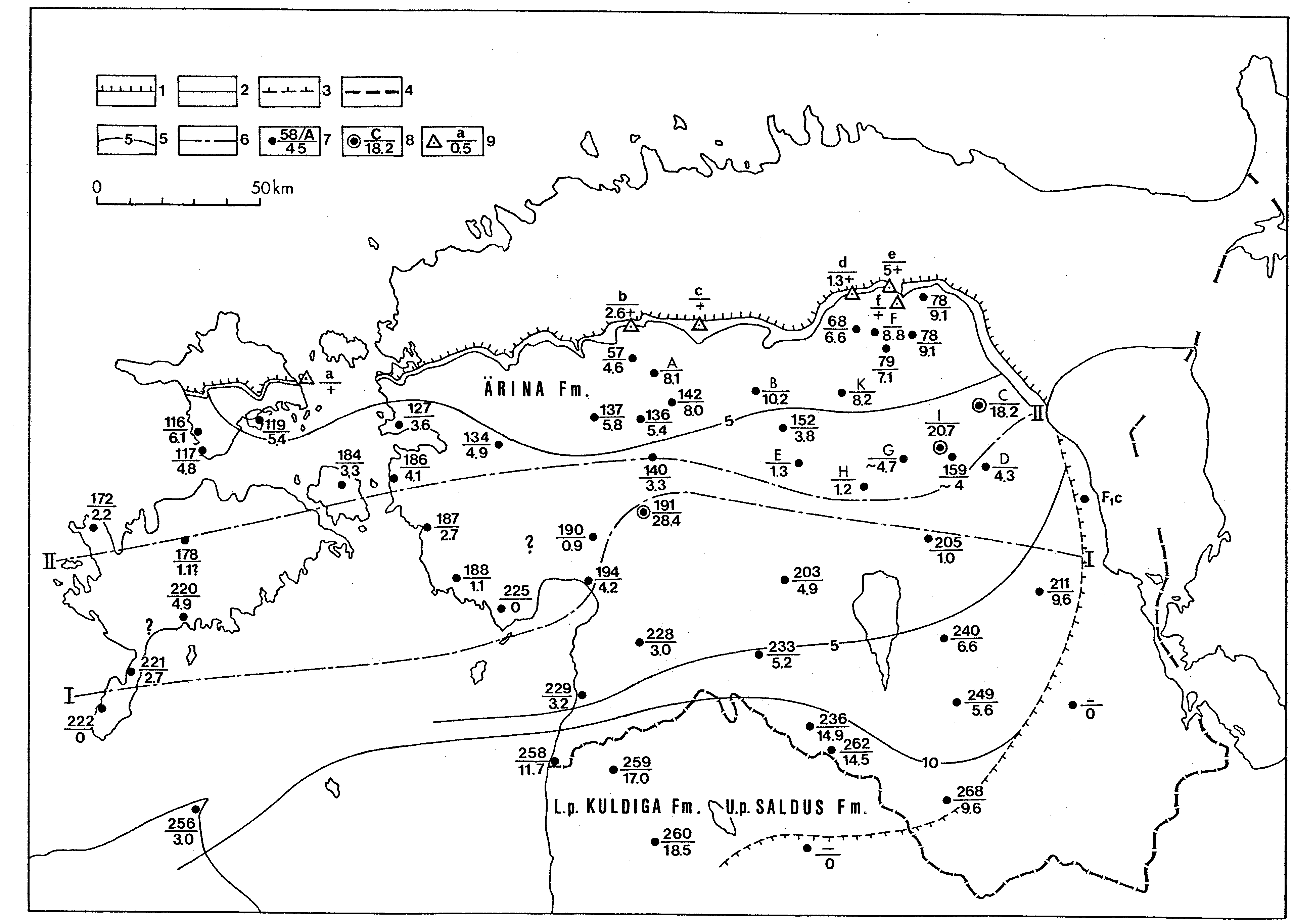
Fig. 61. Sketch-map showing the present distribution and the thickness of the Porkuni Stage. Legend 1 - 7 see Fig. 30; 8 and 9 - core and outcrop with type section, number or index in the numerator, thickness in the denominator. Outcrops: a - Vohilaid, b - Röa, type section of the Röa Member, c - Siuge, type section of the Siuge Member, d - Tõrevere, type section of the Tõrevere Member, e - Porkuni, type section of the Porkuni Stage, f - Ärina, type section of the Ärina Formation; core sections: A - Keava, B - Paide, C - Sadala, D - Palamuse, E - Kabala, F - Raigu, G - Aidu, H - Põltsamaa, I - Jõgeva, K - Kahala. Line I I - approximate northern boundary of the Saldus Formation (Oraspõl´d 1975b), II - II - approximate southern boundary of the reef complex (Ärina Formation without the Röa Member). The signs L. p. and U. p. show whether the unit forms the lower or upper part of the stage.
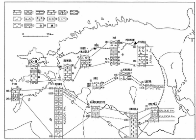
Fig. 62. Correlation and subdivisions of the Porkuni Stage. Letters on the right side of the logs mark formations: A - Adila and Vr - Varbola, and members: Kb - Kabala, R - Röa, V - Vohilaid, S - Siuge, T - Tõrevere, K - Koigi, Km - Kamariku. Legend: 1 - limestone; 2 - argillaceous limestone; 3 - limestone with clayey intercalation; 4 - dolomite; 5 - argillaceous dolomite; 6 - nodular limestone; 7 - marl; 8 - reef; 9 - silty limestone; 10 - carbonate ooids; 11 - skeletal detritus; 12 - burrows; 13 - discontinuity surface; 14 - core section; 15 - outcrop.
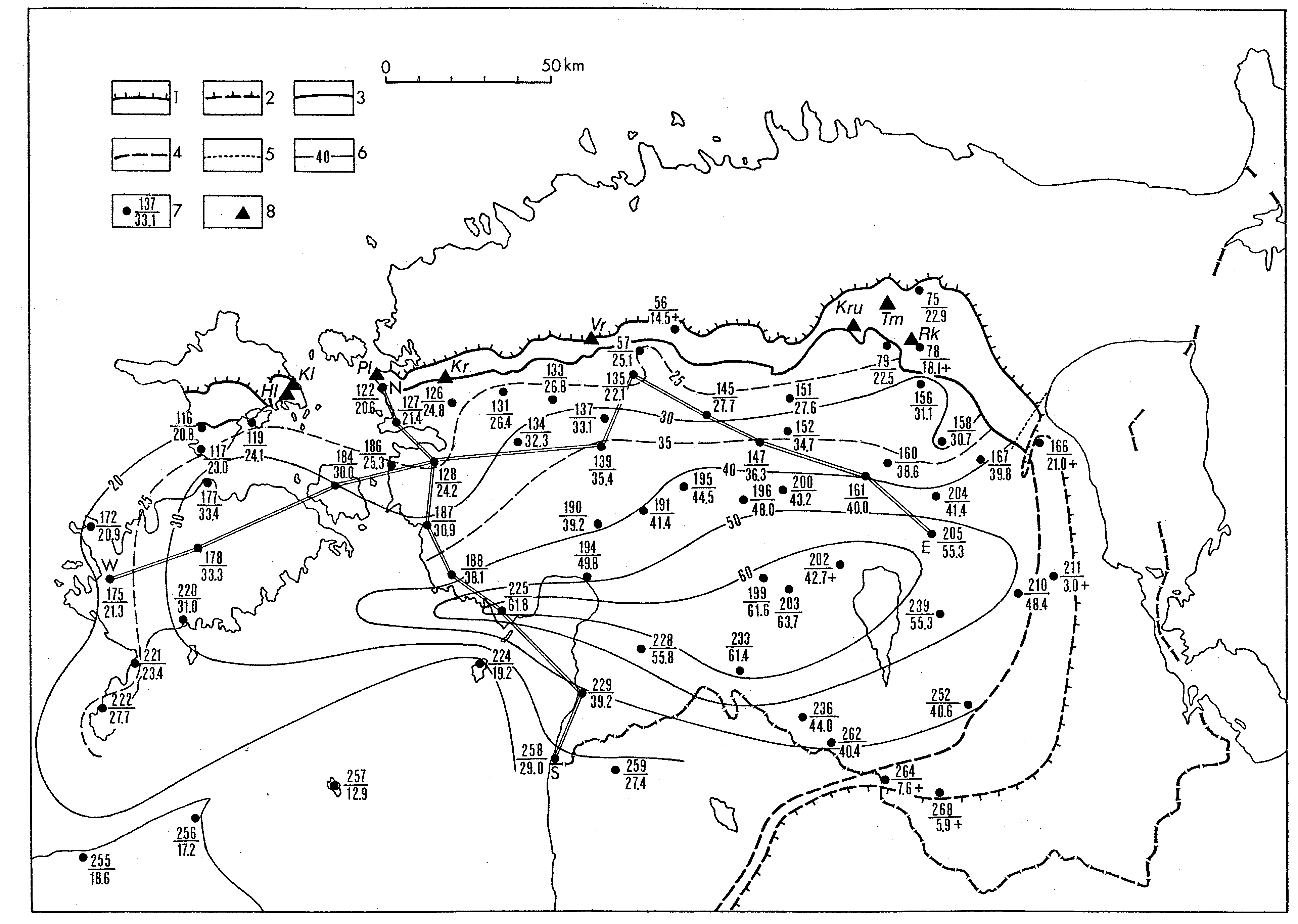
Fig. 63. Sketch-map showing the present distribution and the thickness of the Juuru Stage in Estonia. NS and WE indicate transects of stratigraphical cross-sections presented in Figs. 64 and 65, respectively. Numerator marks the number of the borehole, denominator shows the thickness of the stage in metres. 1 - contour of rock distribution; 2 - contour of subsurface distribution; 3 - limit of outcrop belt; 4 - limit of pre-Devonian erosion; 5 - margin of the Devonian cover; 6 - isopach; 7 - borehole; 8 - exposure locality: Kl - Kallasto, Hl - Hilleste, Pl - Pullapää, Kr - Kirimäe, Vr - Varbola, Kru - Karinu, Tm - Tamsalu, Rk - Rakke.
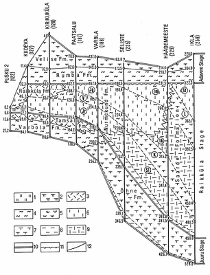
Fig. 64. Meridional (NS) stratigraphical cross-section of the Llandovery: Juuru, Raikküla and Adavere regional stages. For location of cross-section see Fig. 63. Stratigraphical abbreviations of beds: Jr - Järva-Jaani, V - Vändra, Jg - Jõgeva, Im - Imavere; and members: Sl - Slìtere, K - Kolka, Ik - Ikla, L - Lemme, St - Staicele. Legend: 1 - dolostone; 2 - argillaceous dolostone; 3 - sparitic limestone; 4 - biomicritic limestone; 5 - coquinoid limestone; 6 - micritic limestone; 7 - marlstone; 8 - mudstone; 9 - limestone/mudstone intercalation; 10 - stage boundary; 11 - stratigraphical hiatus; 12 - the present denudation surface.
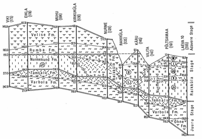
Fig. 65. Latitudinal (WE) stratigraphical cross-section of the Llandovery: Juuru, Raikküla and Adavere regional stages. For location of cross-section see Fig. 63, for legend see Fig. 64.
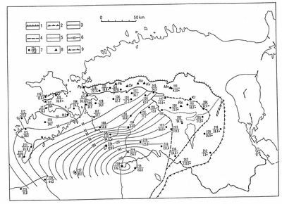
Fig. 66. Sketch-map showing the present distribution and the thickness of the Raikküla Stage in Estonia. Numerator marks the number of the borehole, denominator shows the thickness of the stage in metres. 1 - contour of rock distribution; 2 - contour of subsurface distribution 3 - limit of outcrop belt; 4 - limit of pre-Devonian erosion; 5 - margin of the Devonian cover; 6 - isopach; 7 - borehole; 8 - exposure locality; 9 - extension limit of the Mõhküla beds. Localities: Ps - Pusku, Pk - Pakamägi, Or - Orgita, Rk - Raikküla-Paka, Kv - Keava, Mn - Mündi, Kl - Kalana, Rs - Röstla.
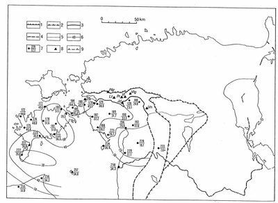
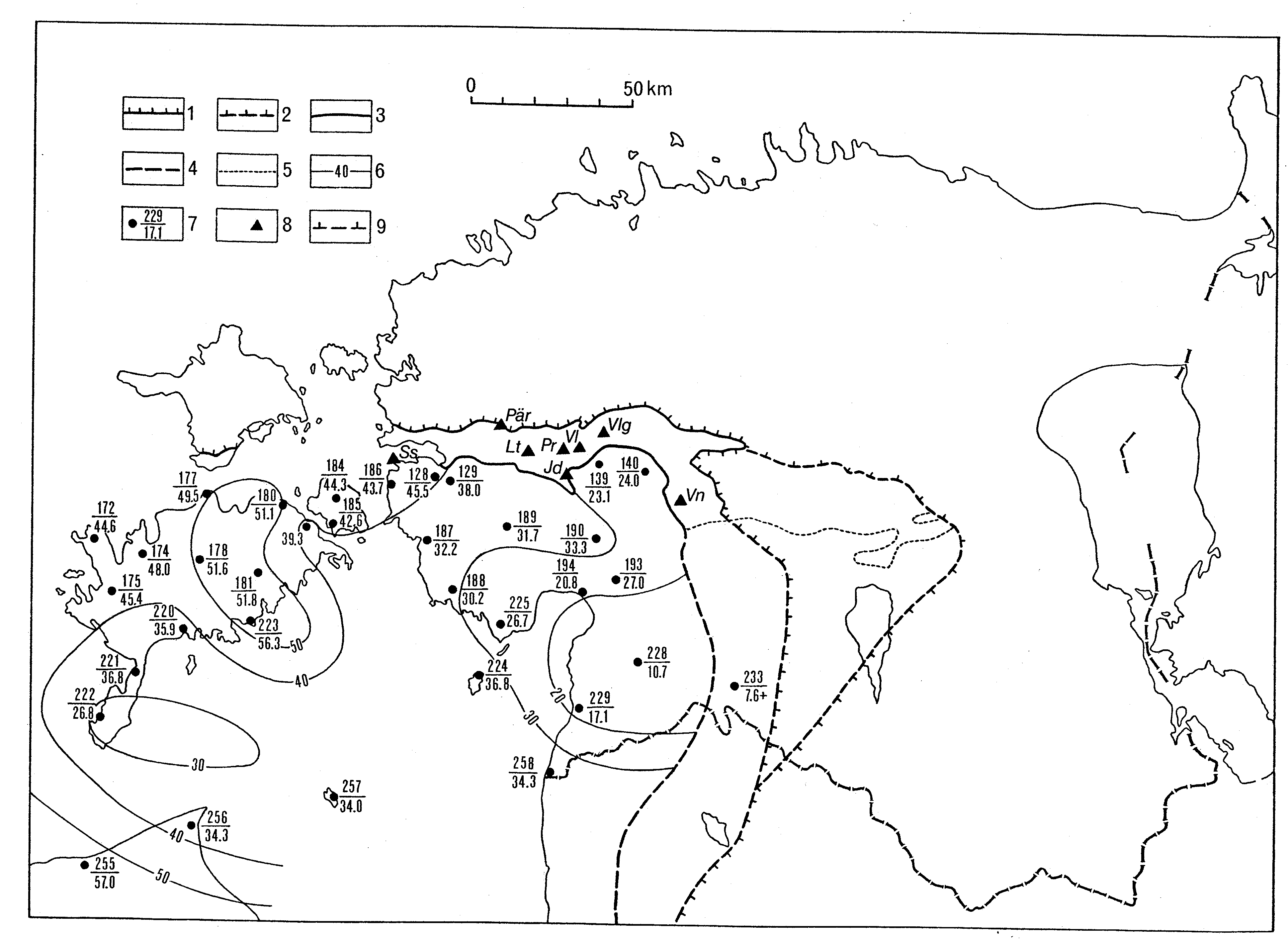
Fig. 67. Sketch-map showing the present distribution and the thickness of the Adavere Stage in Estonia. Numerator marks the number of the borehole, denominator shows the thickness of the stage in metres. 1 - contour of rock distribution; 2 - contour of subsurface distribution; 3 - limit of outcrop belt; 4 - limit of pre-Devonian erosion; 5 - margin of the Devonian cover; 6 - isopach; 7 - borehole; 8 - exposure locality; 9 - extension limit of the Mõhküla beds. Localities: Ss - Saastna, Pär - Päri, Lt - Lätiküla, Pr - Päärdu, Vl - Velise, Vlg - Valgu, Vn - Vändra.
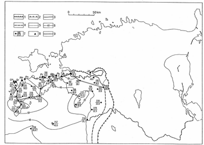
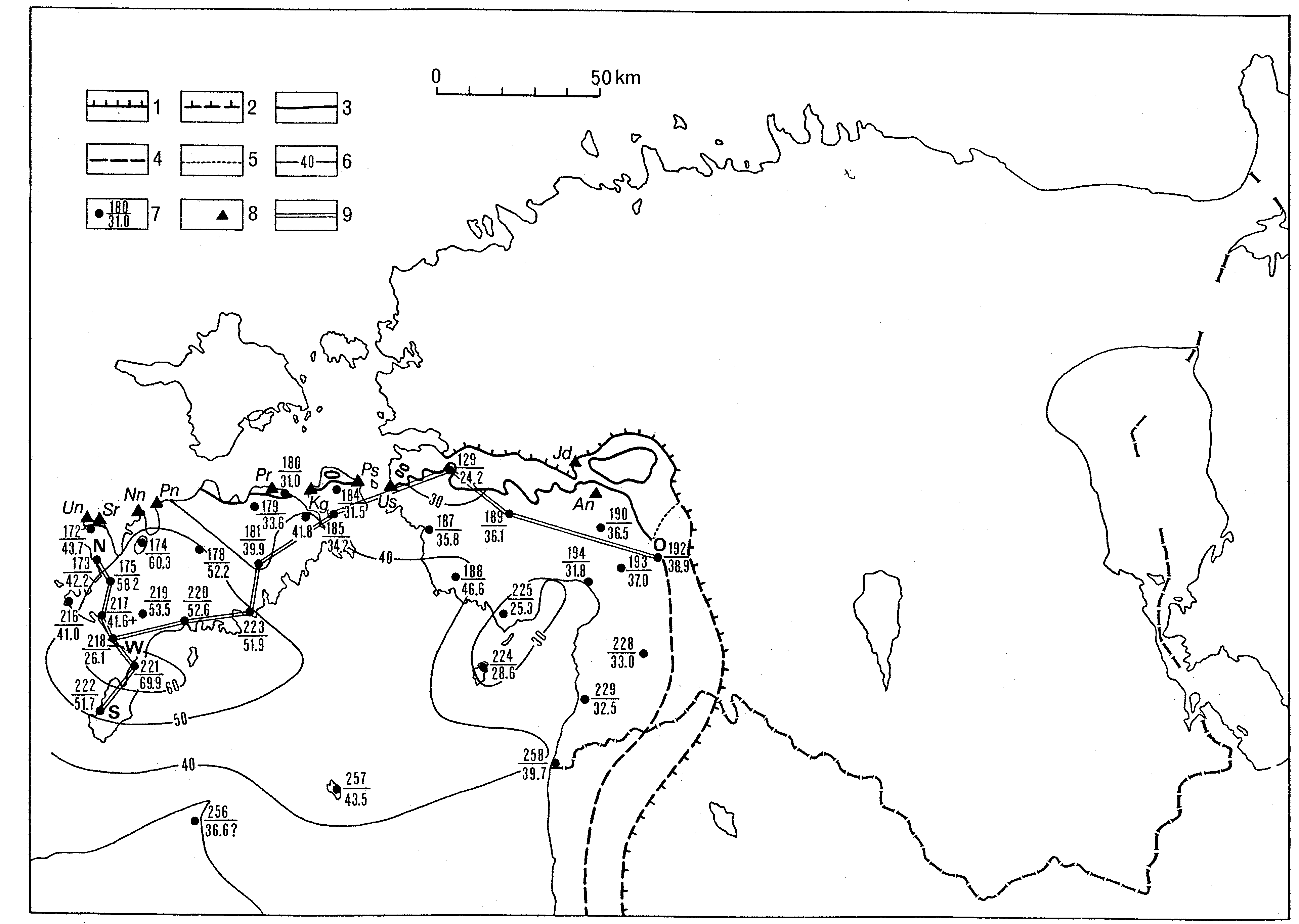
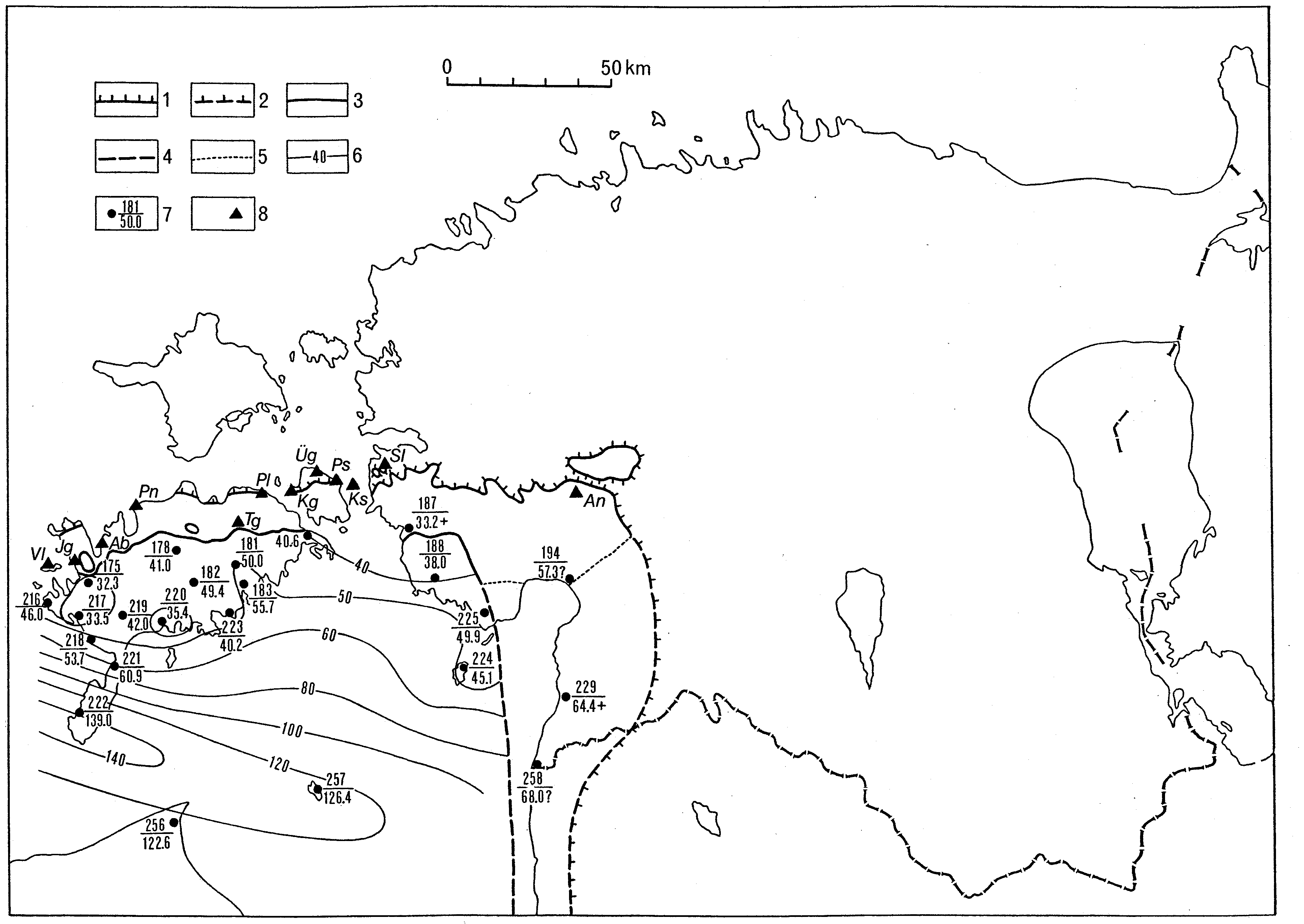
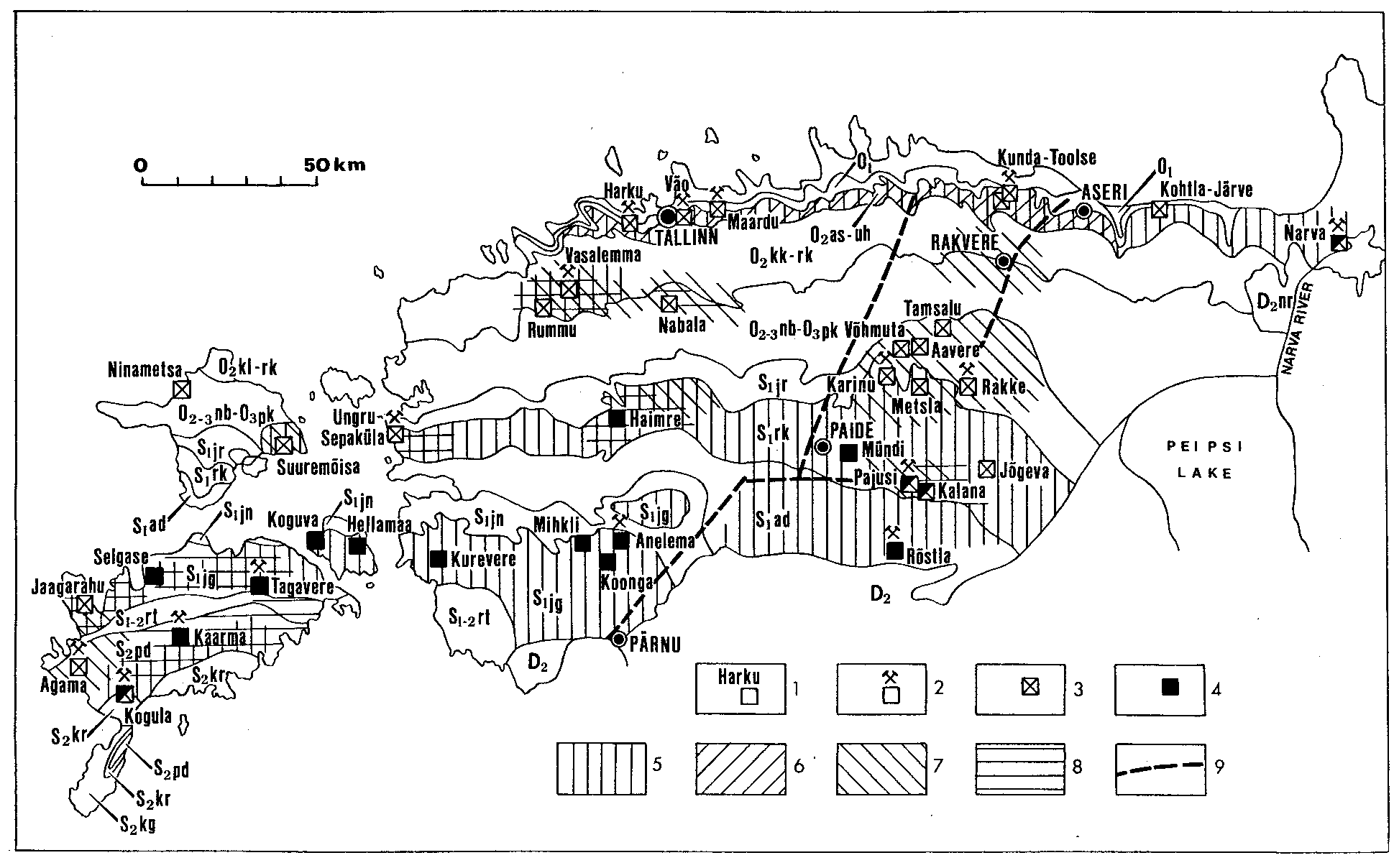
Fig. 68. Sketch-map showing the present distribution and the thickness of the Jaani Stage in Estonia. NS and WO indicate transects of stratigraphical cross-sections presented respectively in Figs. 69 and 70. Numerator marks the number of the borehole, denominator shows the thickness of the stage in metres. 1 - contour of rock distribution; 2 - contour of subsurface distribution; 3 - limit of outcrop belt; 4 - limit of pre-Devonian erosion; 5 - margin of the Devonian cover; 6 - isopach; 7 - borehole; 8 - exposure locality: Un - Undva, Sr - Suuriku, Nn - Ninase, Pn - Panga, Pr - Paramaja, Kg - Koguva, Ps - Püssina, Us - Uisu, Jd - Jädivere, An - Anelema, 9 - transect of cross-section.
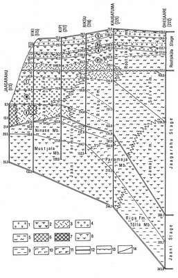
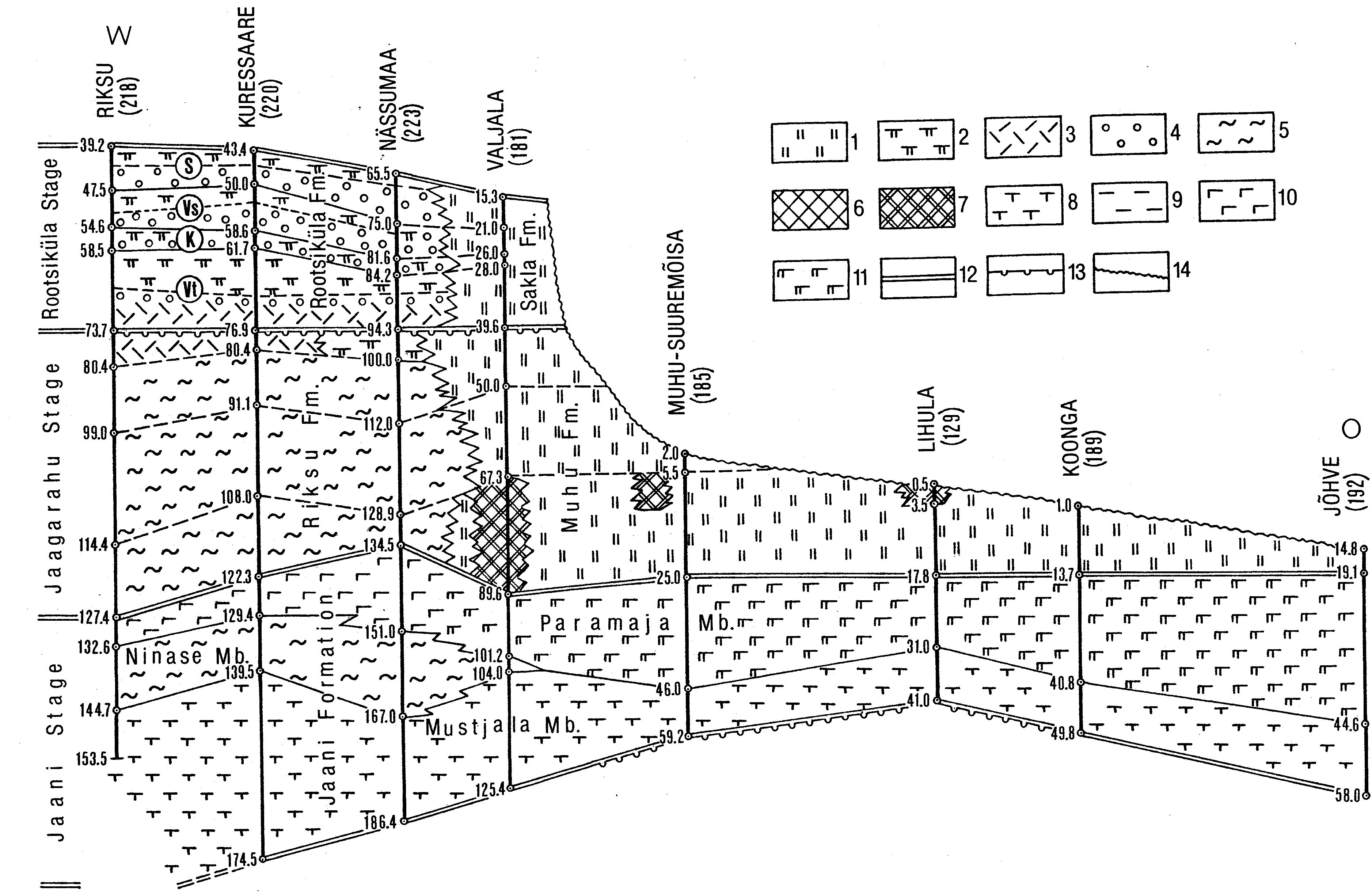
Fig. 69. Meridional (NS) stratigraphical cross-section of Wenlock: Jaani, Jaagarahu and Rootsiküla regional stages. For location of cross-section see Fig. 68. Abbreviations of beds: V - Vilsandi, M - Maasi, T - Tagavere, Vt - Viita, K - Kuusnõmme, Vs - Vesiku, S - Soeginina. 1 - dolostone; 2 - argillaceous dolostone; 3 - skeletal grainstone; 4 - pelletal-skeletal limestone; 5 - biomicritic limestone; 6 - reef limestone; 7 - reef dolomite; 8 - argillaceous marlstone; 9 - mudstone; 10 - argillaceous limestone, calcareous marl; 11 - dolomitic marl; 12 - stage boundary; 13 - stratigraphical hiatus; 14 - the present denudation surface.
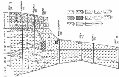
Fig. 70. Latitudinal (WE) stratigraphical cross-section of the Wenlock Jaani, Jaagarahu and Rootsiküla regional stages. For location of cross-section see Fig. 68. Abbreviations of beds: Vt - Viita, K - Kuusnõmme, Vs - Vesiku, S - Soeginina. 1 - dolostone; 2 - argillaceous dolostone; 3 - skeletal grainstone; 4 - pelletal-skeletal limestone; 5 - biomicritic limestone; 6 - reef limestone; 7 - reef dolomite; 8 - argillaceous marlstone; 9 - mudstone; 10 - argillaceous limestone, calcareous marl; 11 - dolomitic marl; 12 - stage boundary; 13 - strati-graphical hiatus; 14 - the present denudation surface.

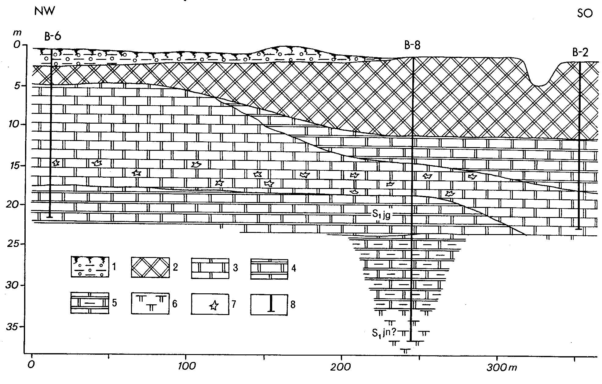
Fig. 71. Sketch-map showing the present distribution and the thickness of the Jaagarahu Stage in Estonia. Numerator marks the number of the borehole, denominator shows the thickness of the stage in metres. 1 - contour of rock distribution; 2 - contour of subsurface distribution; 3 - limit of outcrop belt; 4 - limit of pre-Devonian erosion; 5 - margin of the Devonian cover; 6 - isopach; 7 - borehole; 8 - exposure locality: Vl - Vilsandi, Jg - Jaagarahu, Ab - Abula, Pn - Panga, Tg - Tagavere, Pl - Pulli, Kg - Koguva, Üg - Üügu, Ps - Püssina, Ks - Kesselaid, Sl - Saluvere, An - Anelema.
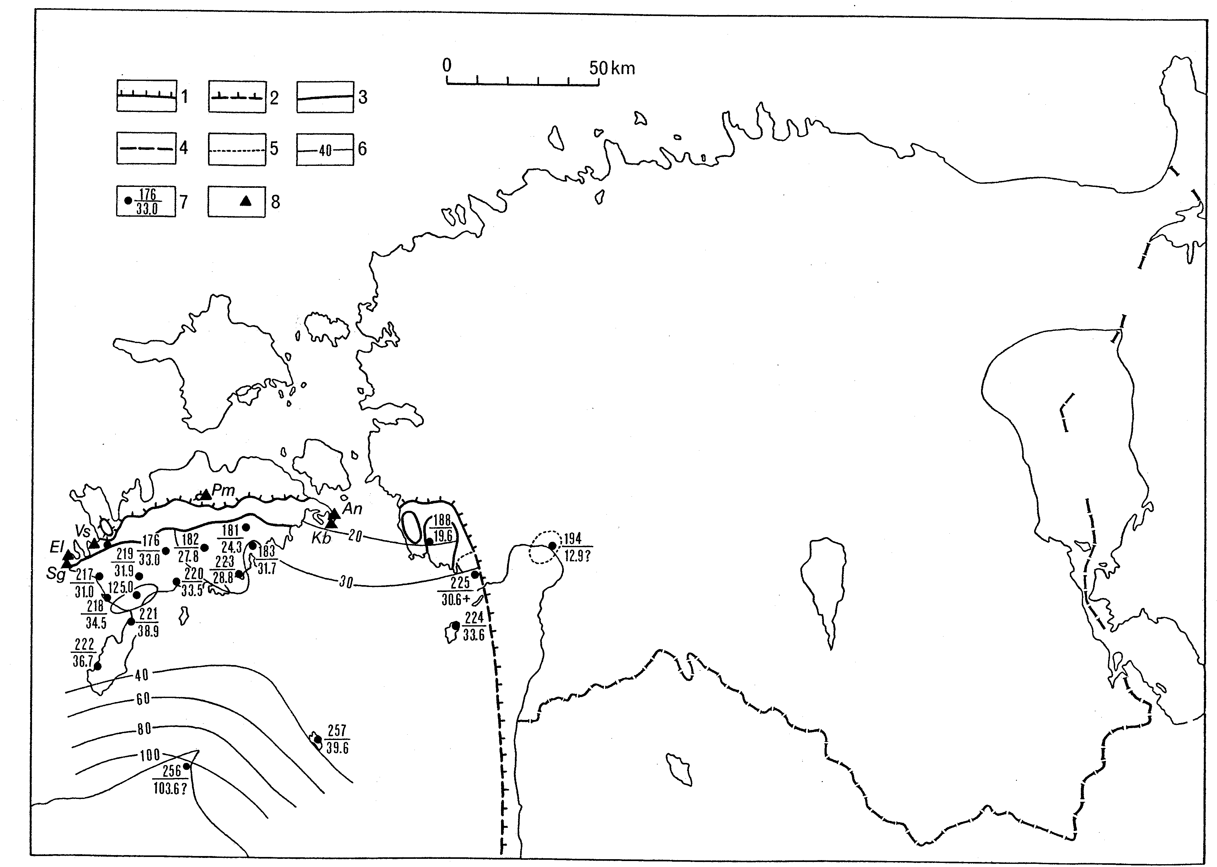
Fig. 72. Sketch-map showing the present distribution and the thickness of the Rootsiküla Stage in Estonia. Numerator marks the number of the borehole, denominator shows the thickness of the stage in metres. 1 - contour of rock distribution; 2 - contour of subsurface distribution; 3 - limit of outcrop belt; 4 - limit of pre-Devonian erosion; 5 - margin of the Devonian cover; 6 - isopach; 7 - borehole; 8 - exposure locality: Sg - Soeginina, El - Elda, Vs - Vesiku, Pm - Pamma, Kb - Kübassaare, An - Anikaitse.
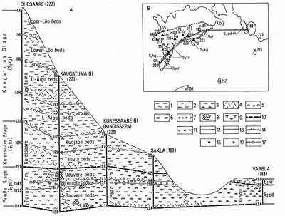
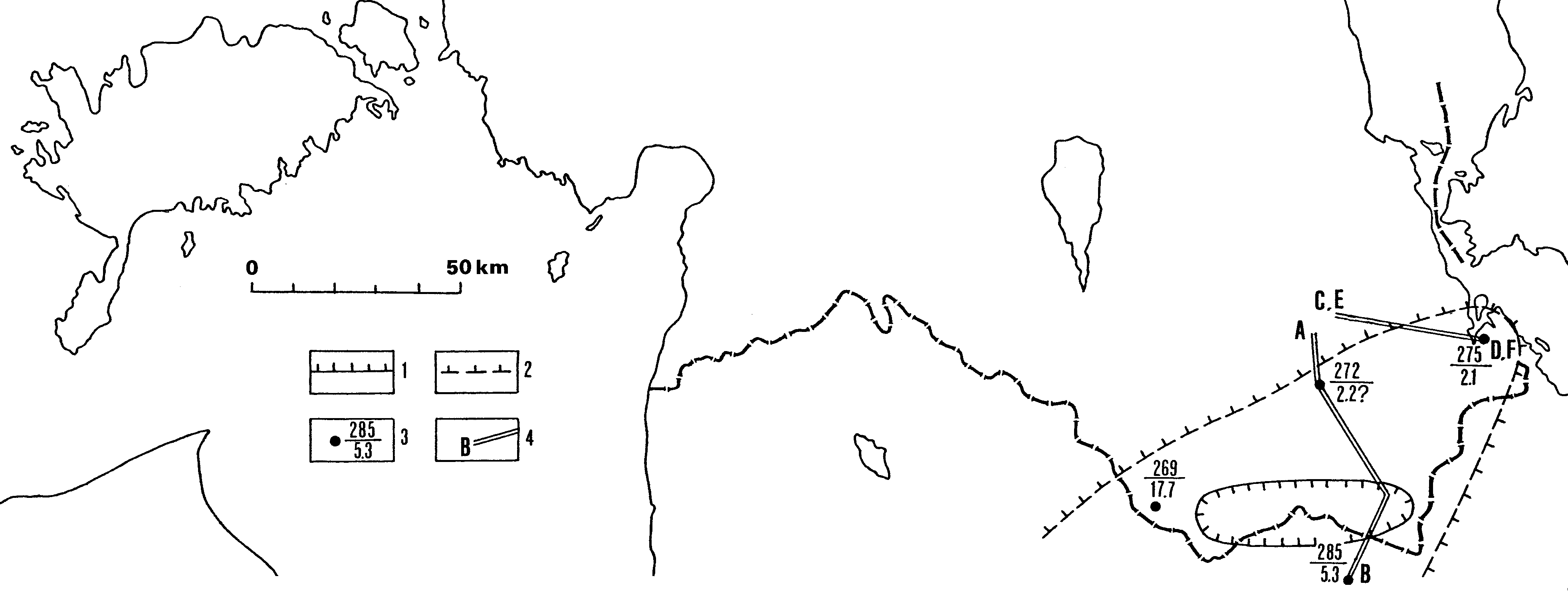
Fig. 73. Stratigraphical cross-section of the Upper Silurian Ludlow and Pridoli rocks (A) and location of outcrops, boreholes and exposures (B) (by R. Einasto). For the names and numbers of boreholes see Table 9: 1 - marlstone; 2 - nodular biomicritic limestone; 3 - argillaceous dolomite; 4 - skeletal (crinoidal) grainstone; 5 - coquinoid limestone; 6 - lithoclastic rudstone (conglomerate); 7 - pelletal-skeletal limestone; 8 - reef limestone; 9 - dolomitic marlstone; 10 - stratigraphical hiatus; 11 - discontinuity surface; 12 - lithostratigraphical boundary; 13 - stage boundary; 14 - limits of outcrops of the regional stages: Paadla (S2pd), Kuressaare (S2kr), Kaugatuma (S2kg), Ohesaare (S2oh); 15 - localities: Kt - Katri, Rm - Riiumägi, Lm - Lümanda, Kg - Kogula, Kr - Kaarma, Ud - Uduvere, Äg - Äigu, Kgt - Kaugatuma, Lõ - Lõu, Oh - Ohesaare; 16 - borehole; 17 - transect of stratigraphical cross-section (A).

Fig. 74. Sketch-map showing the present distribution and the thickness of the Tile Stage in Estonia. AB, CD and EF indicate part of the transects of stratigraphical cross-sections presented in figures 75, 76 and 77. Numerator at the borehole sign marks the number (see Fig. 3 for section names), denominator shows the thickness of the stage in metres. 1 - contour of rocks distribution today; 2 - contour of presumable rock distribution; 3 - borehole; 4 - transect of cross-section.

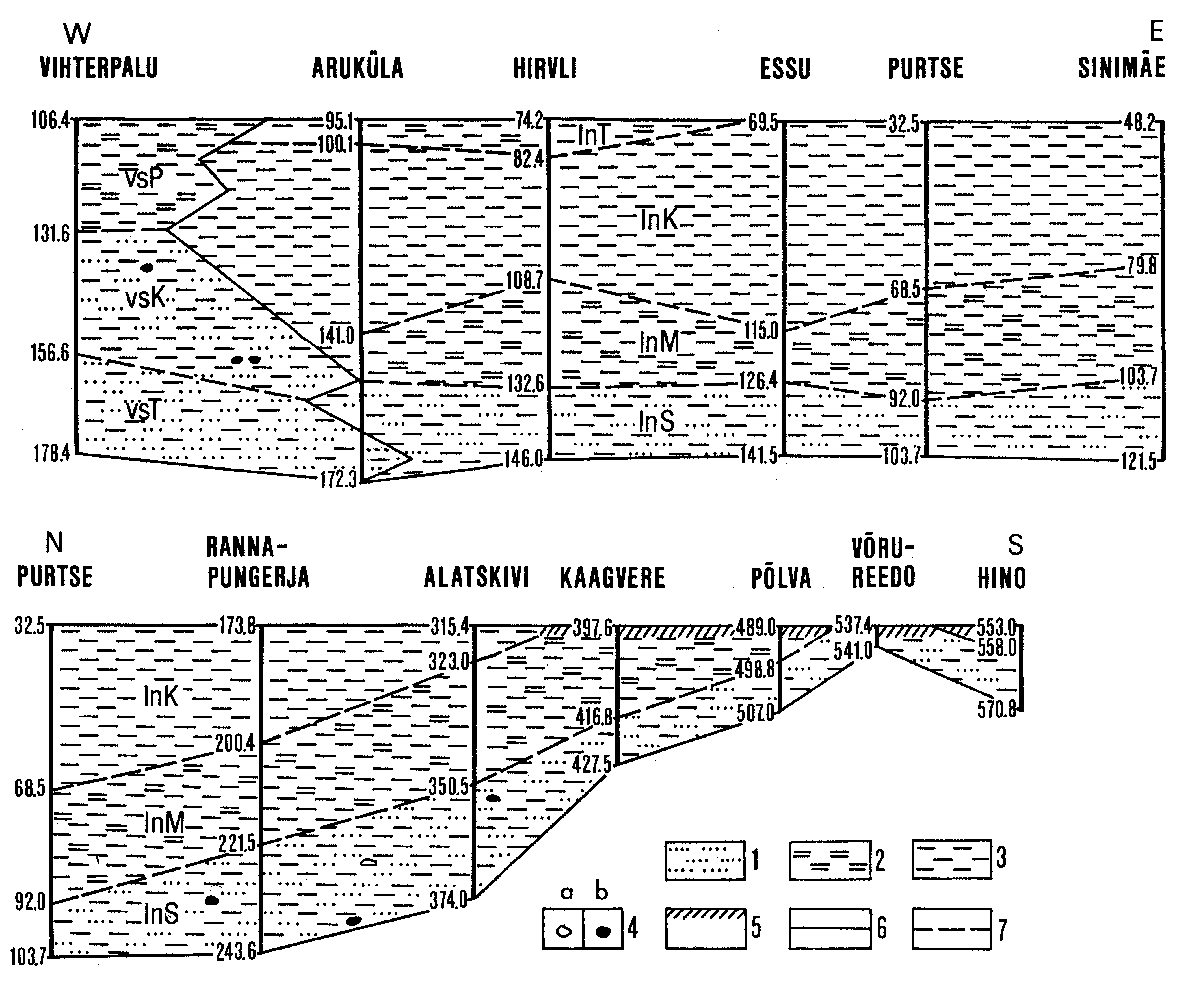
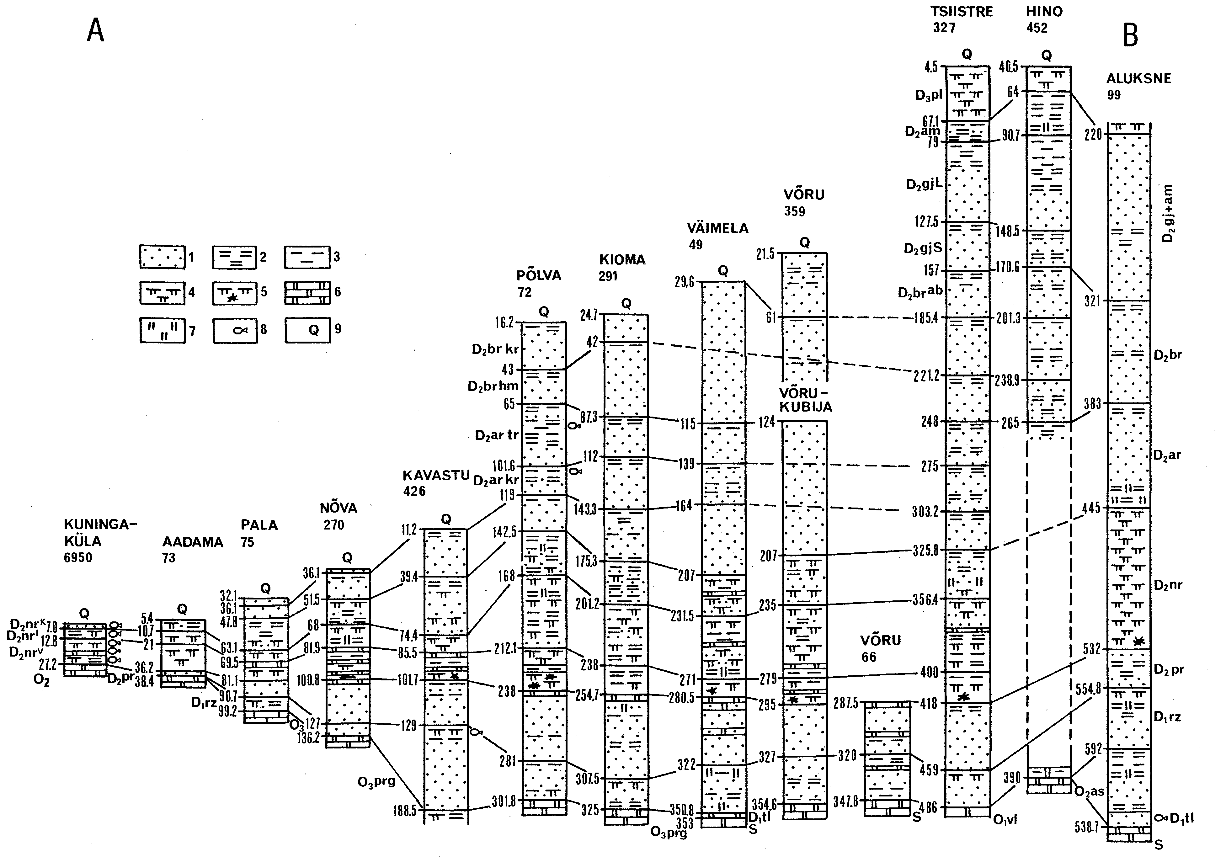
Fig. 75. Meridional stratigraphical cross-section (AB) comprising the whole Devonian sequence. For location of the cross-section see Fig. 82. Boreholes: Kuningaküla - 103, Aadama - 169, Pala - 171, Nõva - 212, Kavastu - 215, Põlva - 253, Kioma - 250, Väimela - 272, Võru - 273, Võru-Kubija - 274, Tsiistre - 279, Hino - 283 and Aluksne - 285. Numbers under the name of borehole correspond to its initial number. Separated are Volkhov Stage (O1vl), Middle Ordovician (O2), Aseri Stage (O2as), Upper Ordovician (O3), Pirgu Stage (O3prg), Silurian (S); Tile (D1tl), Rezekne (D1rz), Narva (D2nr), Aruküla (D2ar), Burtnieki (D2br), Gauja (D2gj), Amata (D2am) and Plavinas (D3pl) stages; Vadja (D2nrv), Leivu (D2nrl) and Kernavé (D2nrk) substages of the Narva Stage; Viljandi (D2ar vl), Kureküla (D2ar kr) and Tarvastu (D2ar tr) beds of the Aruküla Stage; Härma (D2br hm) and Koorküla (D2br kr) beds and Abava Substage (D2brab) of the Burtnieki Stage; Sietiði (D2gj S) and Lode (D2gj L) members of the Gauja Stage. 1 - sandstone; 2 - siltstone; 3 - clay; 4 - dolomitic marl; 5 - sedimentary breccia; 6 - dolomite; 7 - dolomitic matrix; 8 - fish remains; 9 - Quaternary deposits.
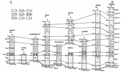
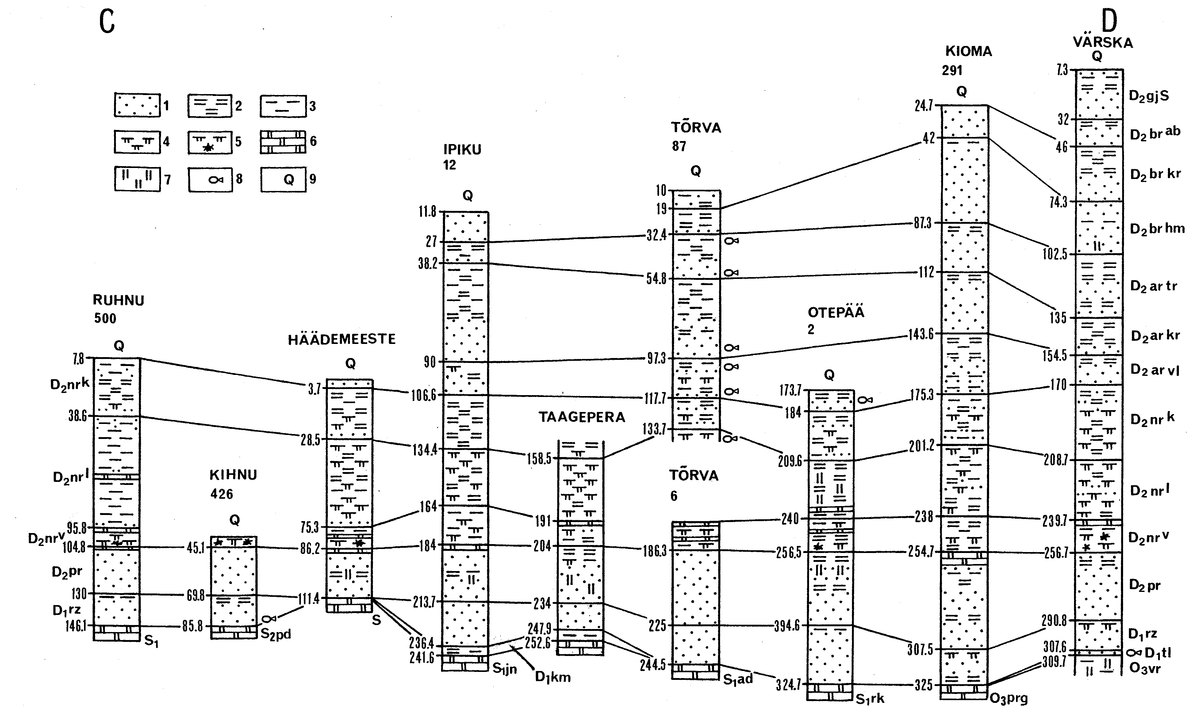
Fig. 76. Latitudinal stratigraphical cross-section (CD) comprising the whole Devonian sequence. For location of the cross-section see Fig. 80. Boreholes: Ruhnu - 257, Kihnu - 224, Häädemeeste - 229, Ipiku - 234, Taagepera - 236, Tõrva (two boreholes) - 237, Ote-pää - 249, Kioma - 250 and Värska - 275. Numbers under the name of borehole correspond its initial number. Separated are Vormsi (O3vr) and Pirgu (O3prg) stages; Silurian (S), Lower Silurian (S1); Raikküla (S1rk), Adavere (S1ad), Jaani (S1jn) and Paadla (S2pd) stages; Tile (D1tl), Kemeri (D1km), Rezekne (D1rz) and Pärnu (D2pr) stages; Vadja (D2nrv), Leivu (D2nrl) and Kernavé (D2nrk) substages of the Narva Stage; Viljandi (D2ar vl), Kureküla (D2ar kr) and Tarvastu (D2ar tr) beds of the Aruküla Stage; Härma (D2br hm) and Koorküla (D2br kr) beds of the Burtnieki Stage; Abava Substage (D2brab) of the Burtnieki Stage and Sietiði Member (D2gj S) of the Gauja Stage. 1 - sandstone; 2 - siltstone; 3 - clay; 4 - dolomitic marl; 5 - sedimentary breccia; 6 - dolomite; 7 - dolomitic matrix; 8 - fish remains; 9 - Quaternary deposits.

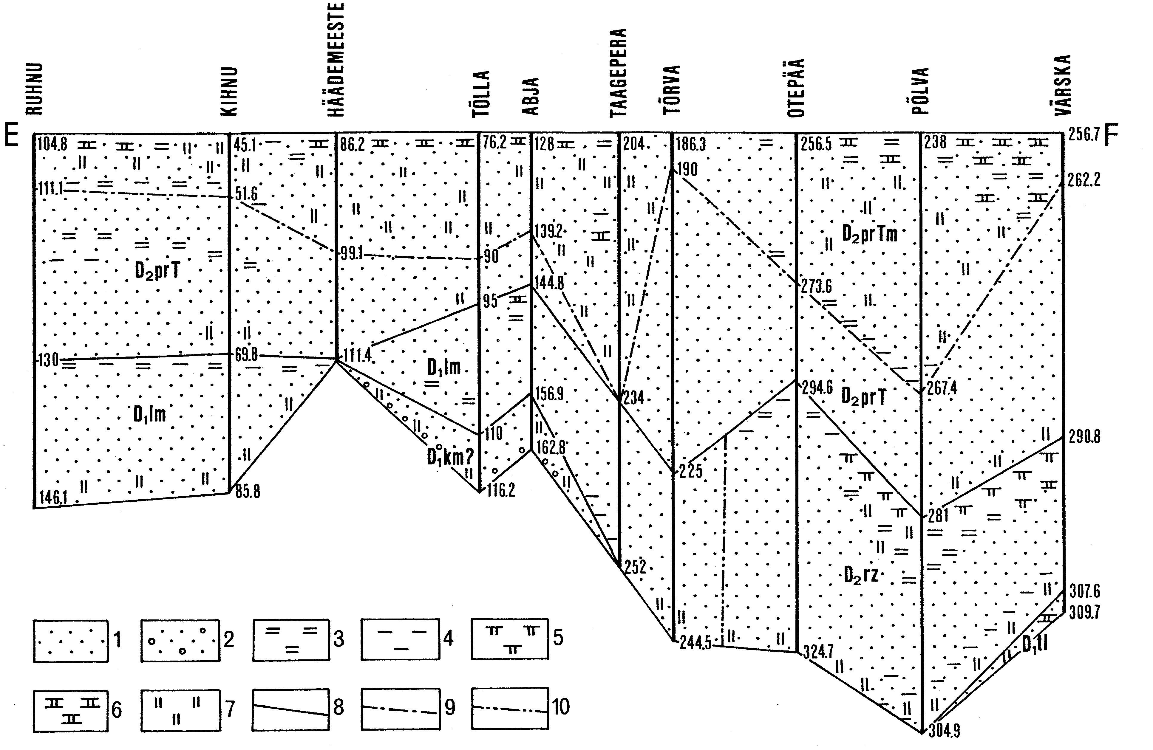
Fig. 77. Longitudinal stratigraphical cross-section (EF) comprising the Tile (D1tl) and Kemeri (D1km) stages, Lemsi (D1lm) and Rezekne (D1rz) formations of the Rezekne Stage, and Tori (D2prT) and Tamme (D2prTm) members of the Pärnu Stage. For location of the section see Fig. 80. Boreholes: Ruhnu - 257, Kihnu - 224, Häädemeeste - 229, Tõlla - 232, Abja - 233, Taagepera - 236, Tõrva - 237, Otepää - 249, Põlva - 253 and Värska - 275. 1 - sandstone; 2 - conglomeratic sandstone; 3 - siltstone; 4 - clay; 5 - dolomitic marl; 6 - dolomite; 7 - dolomitic matrix; 8 - boundary between stages; 9 - boundary between the Rezekne and Lemsi formations; 10 - boundary between the Tori and Tamme members.
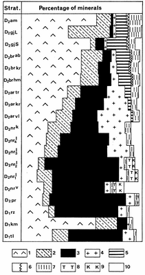
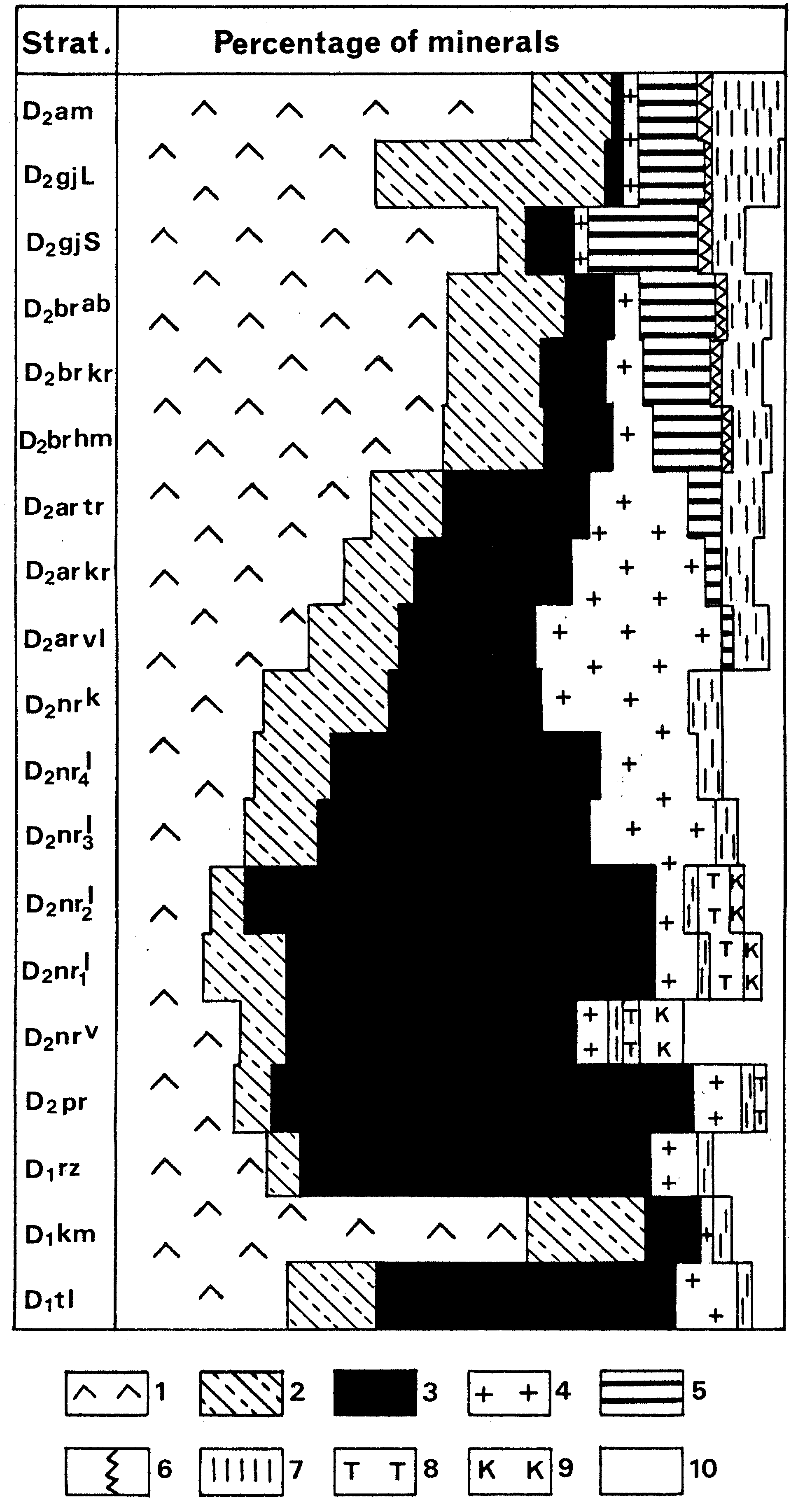
Fig. 78. Mineralogical changes of heavy detrital minerals in the vertical section from the Tile to Amata stages. Stratigraphical indices: D1tl - Tile, D1km - Kemeri, D1rz - Rezekne and D2pr - Pärnu stages; D2nrv - Vadja Substage; D2nr1l - bed one, D2nr2l - bed two, D2nr3l - bed three and D2nr4l bed four of the Leivu Substage; D2nrk - Kernavé Substage; D2ar vl - Viljandi, D2ar kr - Kureküla and D2ar tr - Tarvastu beds of the Aruküla Stage; D2br hm - Härma and D2br kr - Koorküla beds of the Burtnieki Stage; D2brab - Abava Substage; D2gjS - Sietini and D2gjL - Lode members of the Gauja Stage; D2am - Amata Stage. 1 - zircon; 2 - tourmaline; 3 - garnet; 4 - apatite; 5 - staurolite; 6 - kyanite; 7 - rutile; 8 - titanite; 9 - corundum; 10 - varia.

Fig. 79. Sketch-map showing the presumable present distribution and the thickness of the Kemeri Stage in Estonia. CD and EF indicate part of transects of stratigraphical cross-sections presented in Figs. 76 and 77. Numerator at the borehole sign marks the number (see Fig. 3 for section names), denominator - the thickness of the stage in metres. 1 - contour of presumable rock distribution; 2 - borehole; 3 - transect of cross-section.
Fig. 80. Sketch-map showing the present distribution and thickness of the Rezekne Stage in Estonia. AB, CD and EF indicate transects of stratigraphical cross-sections presented in Figs. 75, 76 and 77. Numerator at the borehole sign marks its number (see Fig.3 for section names), denominator - the thickness of the stage in metres. 1 - contour of rock distribution; 2 - isopach; 3 - boundary between the Rezekne and Lemsi formations; 4 - borehole; 5 - transect of cross-section.
Fig. 81. Sketch-map showing the present distribution and the thickness of the Pärnu Stage in Estonia. AB, CD and EF indicate transects of stratigraphical cross-sections presented in Figs. 75, 76 and 77. Numerator at the borehole sign marks its number (see Fig.3 for section names), denominator - the thickness of the stage in metres. 1 - contour of rock distribution; 2 - limit of outcrop belt; 3 - isopach; 4 - borehole; 5 - outcrop (2 - Oore dairy); 6 - type section (1 - Tori); 7 - transect of cross-section.
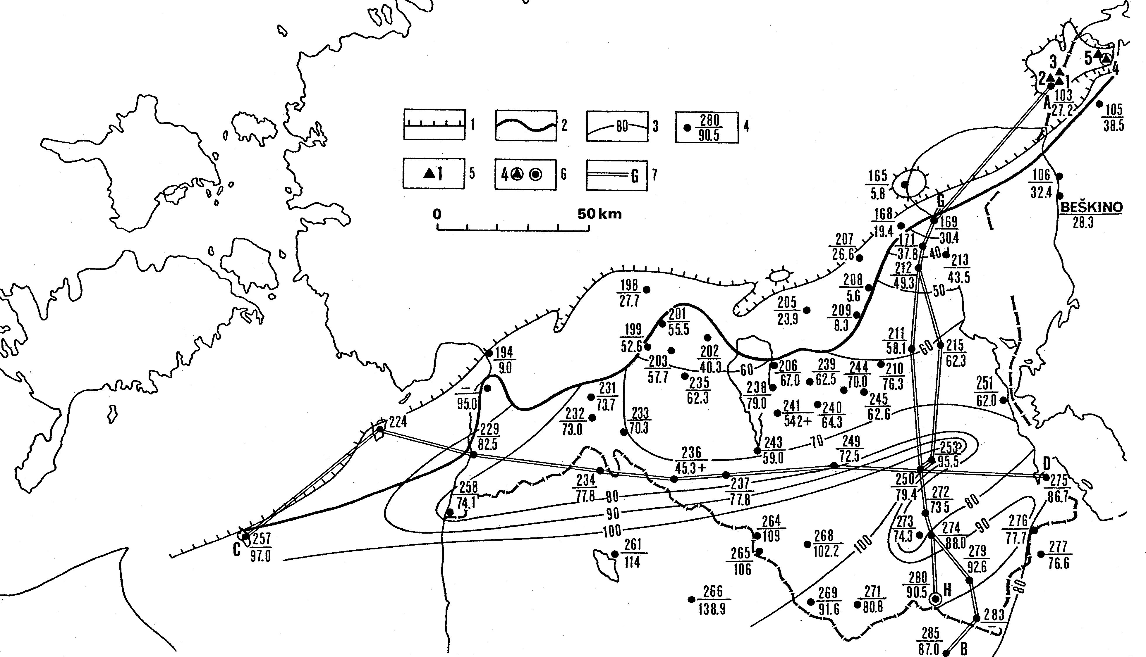
Fig. 82. Sketch-map showing the present distribution and the thickness of the Narva Stage in Estonia. AB, CD and GH indicate transects of stratigraphical cross-sections presented in Figs. 75, 76 and 83. Numerator at the borehole sign marks its number (see Fig. 3 for section names), denominator - the thickness of the stage in metres. 1- contour of rock distribution; 2 - limit of outcrop belt; 3 - isopach; 4 - borehole; 5 - outcrop (1 - Narva River; 2 - Gorodenka Brook; 3 - Poruni River; 5 - Sirgala quarry); 6 - type section (4 - Narva quarry); 7 - transect of cross-section.

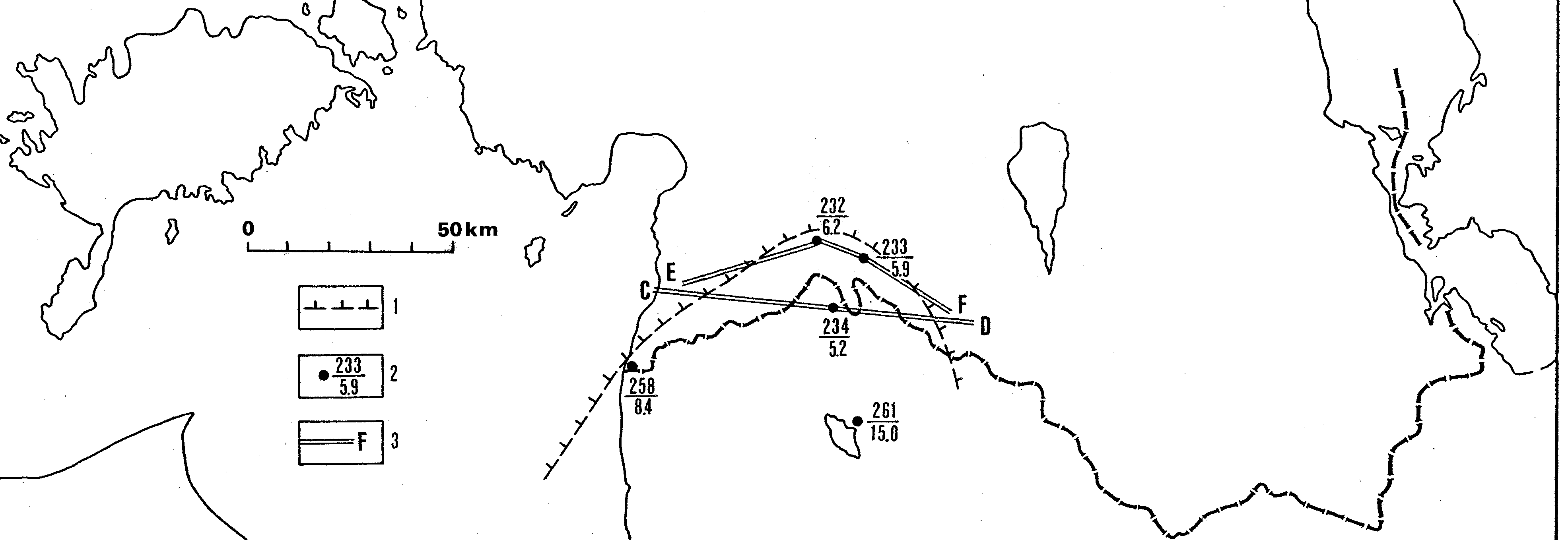
Fig. 83. Stratigraphical cross-section (GH) of Narva Stage from Aadama (north) to Luutsniku (south). For location of the section see Fig. 82. Boreholes: Aadama - 169, Pala - 171, Nõva - 212, Kaagvere - 211, Kioma - 250, Väimela - 272, Võru-Kubija - 274, Luutsniku - 280. Stratigraphical indices: D2nrV - Vadja Member; D2nrL1, D2nrL2, D2nrL3 and D2nrL4 - beds of Leivu Member; D2nrK - Kernavé Member. 1 - sandstone; 2 - siltstone; 3 - clay; 4 - dolomitic marl; 5 - sedimentary breccia; 6 - dolomite; 7 - dolomitic matrix; 8 - boundary between members; 9 - boundary between the beds of the Leivu Member.
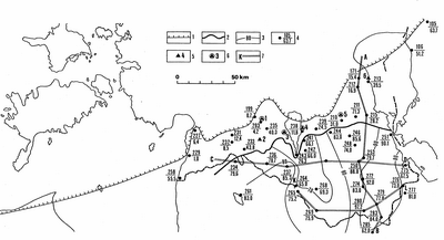
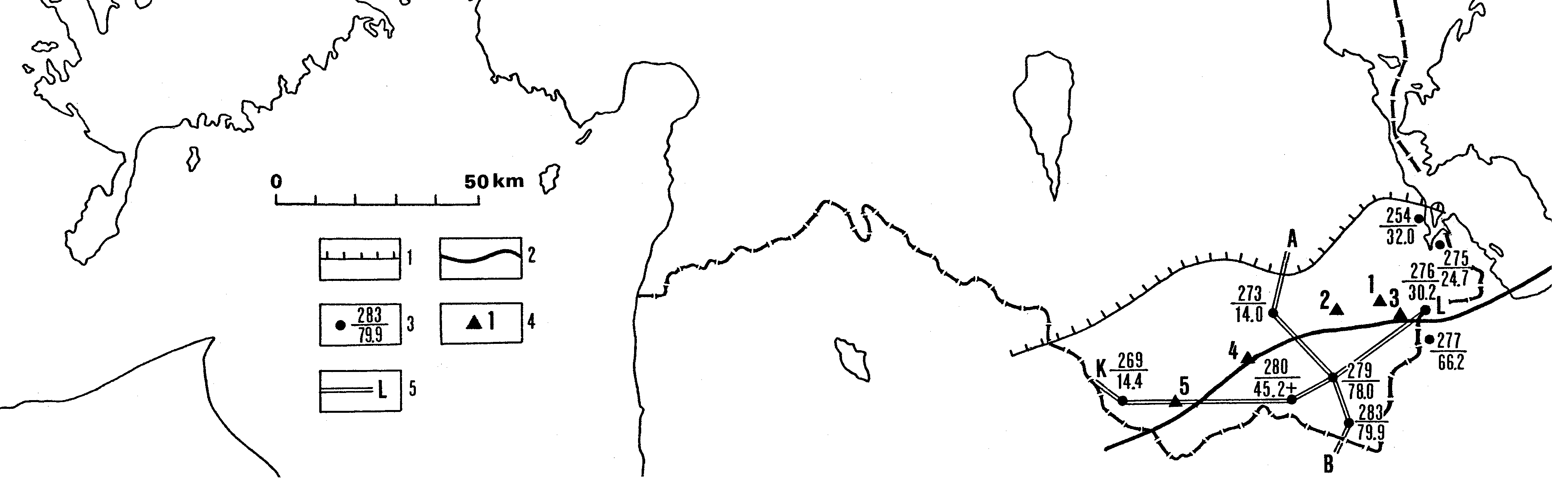
Fig. 84. Sketch-map showing the present distribution and the thickness of the Aruküla Stage in Estonia. AB, CD and KL indicate transects of stratigraphical cross-sections presented in Figs. 75, 76 and 85. Numerator at the borehole sign marks its number (see Fig.3 for section names), denominator - the thickness of the stage in metres. 1 - contour of rock distribution; 2 - limit of outcrop belt; 3 - isopach; 4 - borehole; 5 - outcrop (2 - Õisu); 6 - type section (1 - Viljandi; 3 - Tarvastu; 4 - Tamme; 5 - Tartu Jaani Cemetery/Aruküla caves); 7 - transect of the cross-section.
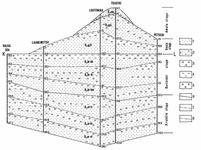
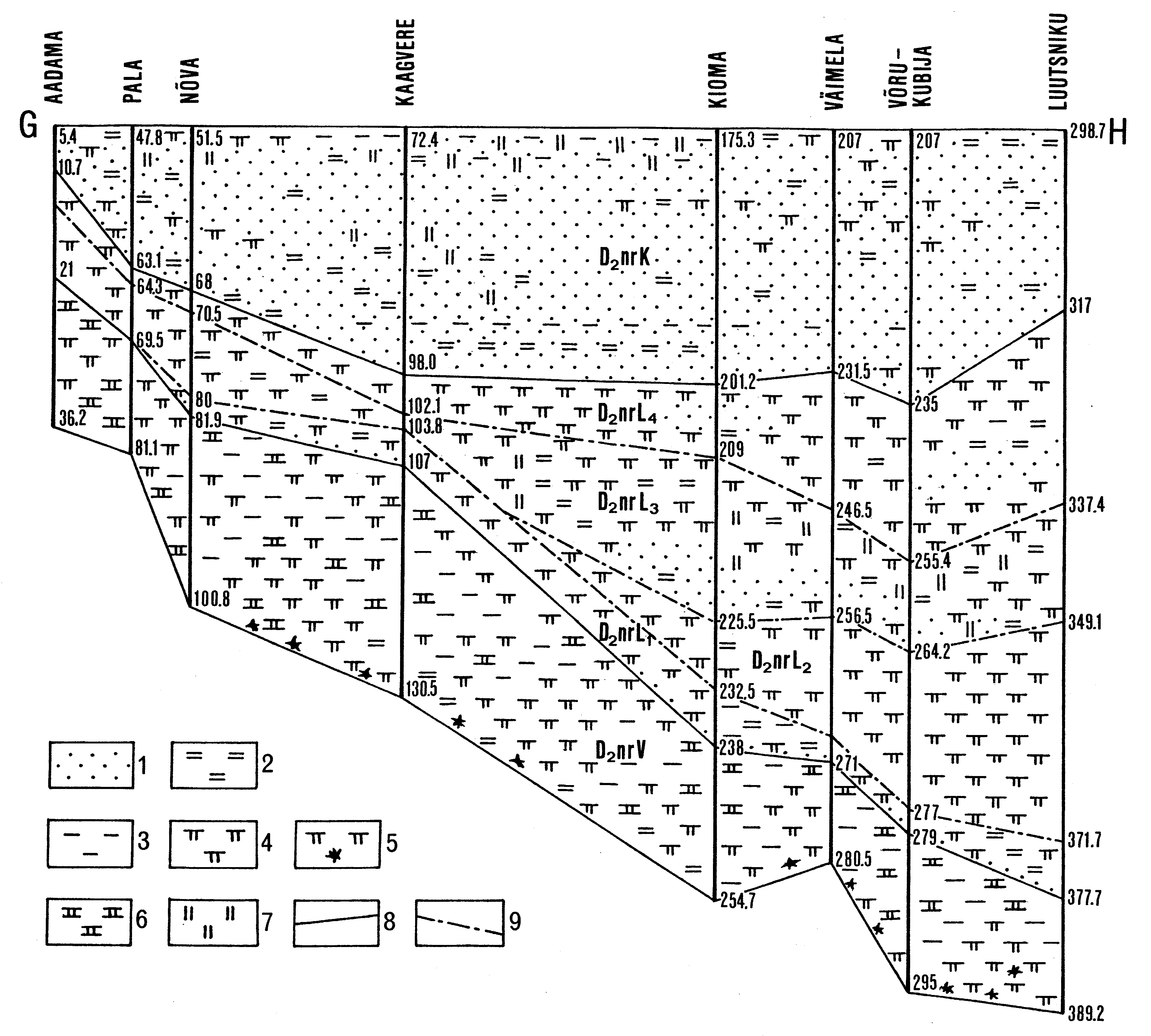
Fig. 85. Stratigraphical cross-section (KL) from Valga-324 (west) to Petseri (east), comprising the Aruküla, Burtnieki, Gauja and Amata stages. For location of the section see Fig. 84. Boreholes: Valga - 265, Laanemetsa - 269, Luutsniku - 280, Tsiistre - 279 and Petseri - 276. Stratigraphical indices: D2ar vl - Viljandi, D2ar kr - Kureküla, D2ar tr - Tarvastu, D2br hm - Härma and D2br kr - Koorküla beds; D2brab - Abava Substage; D2gj S - Sietiði and D2gj L - Lode members; D2am - Amata Stage. 1 - sandstone; 2 - conglomeratic sandstone; 3 - siltstone; 4 - clay; 5 - dolomitic matrix; 6 - boundary between stages; 7 - boundary between beds (substages); 8 - boundary between members.
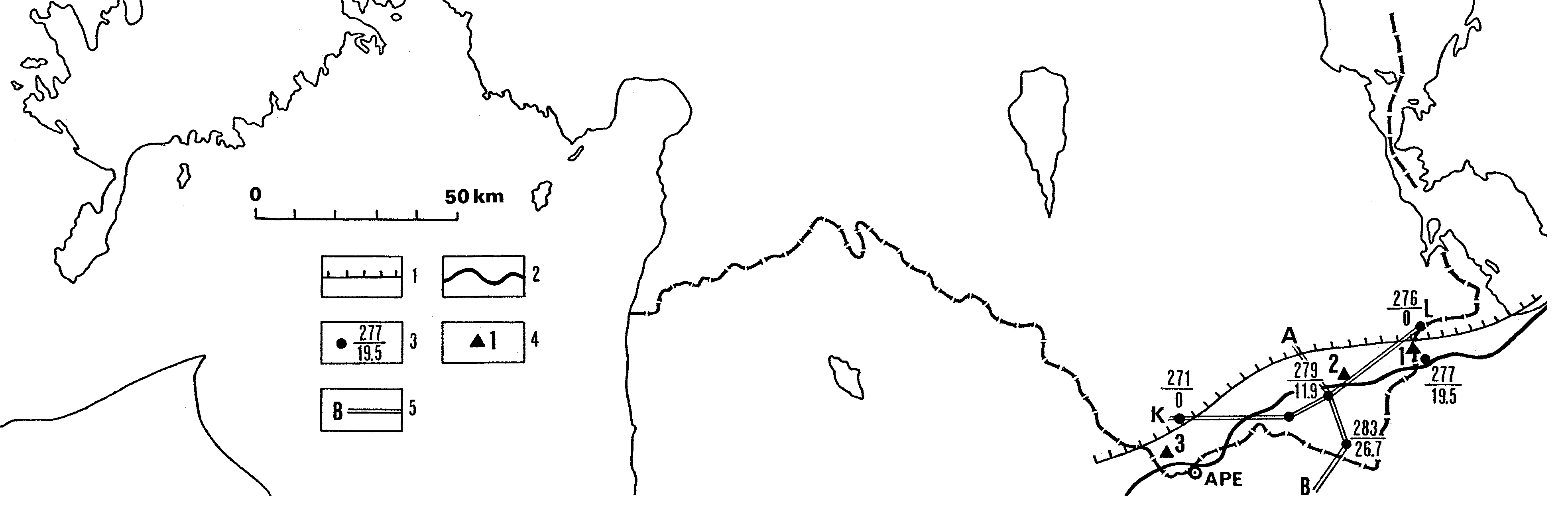
Fig. 87. Sketch-map showing the present distribution and the thickness of the Gauja Stage in Estonia. AB and KL indicate part of the transects of stratigraphical cross-sections presented in Figs 75 and 85. Numerator at the borehole sign marks its number (see Fig. 3 for section names), denominator - the thickness of the stage in metres. 1 - contour of rock distribution; 2 - limit of outcrop belt; 3 - borehole; 4 - outcrop (1 - Piusa glass sand quarries; 2 - Piusa River; 3 - Tuhkvitsa Brook; 4 - Pärlijõgi River; 5 - Mustjõgi River); 5 - transect of the cross-section.
Fig. 88. Sketch-map showing the present distribution and the thickness of the Amata Stage in Estonia. AB and KL indicate part of the transects of stratigraphical cross-sections presented in Figs 75 and 85. Numerator at the borehole sign marks its number (see Fig. 3 for section names), denominator - the thickness of the stage in metres. 1 - contour of rock distribution; 2 - limit if outcrop belt; 3 - borehole; 4 - outcrop (1 - Loosi; 2 - Vastseliina; 3 - Karisöödi); 5 - transect of the cross-section.

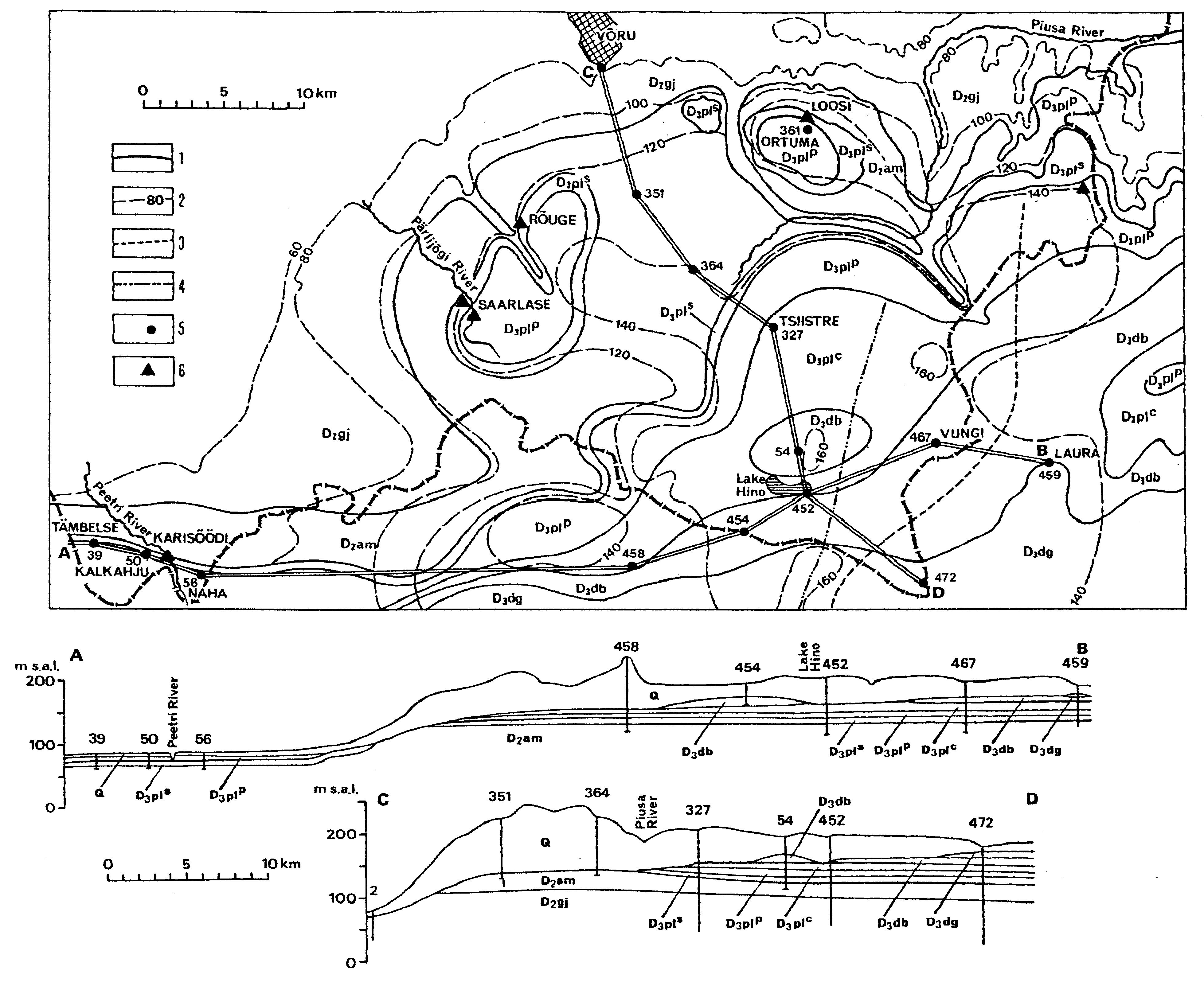
Fig. 89. Bedrock map of southeastern Estonia with geological cross-sections AB (latitudinal) and CD (meridional). Stratigraphical indices: D2gj - Gauja Stage, D2am - Amata Stage, D3pls - Snetnaya Gora Substage, D3plp - Pskov Substage, D3plc - Chudovo Substage, D3db - Dubniki Stage, D3dg - Daugava Stage. 1- boundary of stages and substages; 2 - isoline of bedrock relief; 3 - boundary of dolomitic (west) and limestone (east) facies of the Pskov Substage; 4 - boundary of dolomitic (west) and limestone (east) facies of the Chudovo Substage; 5 - borehole; 6 - outcrop.
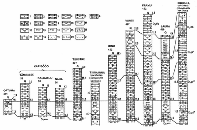
Fig. 90. Correlation of the Upper Devonian sections. For location of the sections see Fig. 89. Numbers under the name of borehole correspond to its initial number. Stratigraphical indices: D2am - Amata Stage, D3pls - Snetnaya Gora Substage, D3plp - Pskov Substage, D3plc - Chudovo Substage, D3db - Dubniki Stage, D3dg - Daugava Stage, Q - Quaternary deposits. 1 - limestone; 2 - argillaceous limestone; 3 - dolomitic limestone; 4 - nodular limestone; 5 - dolomite; 6 - argillaceous dolomite; 7 - silty dolomite; 8 - sandy dolomite; 9 - calcitic dolomite; 10 - nodular dolomite; 11 - marl; 12 - dolomitic marl; 13 - argillaceous dolomitic marl; 14 - silty dolomitic marl; 15 - clay; 16 - calcitic clay; 17 - dolomitic clay; 18 - siltstone; 19 - sandstone; 20 - gypsum; 21 - pyritized hardground.
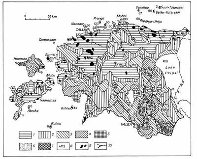
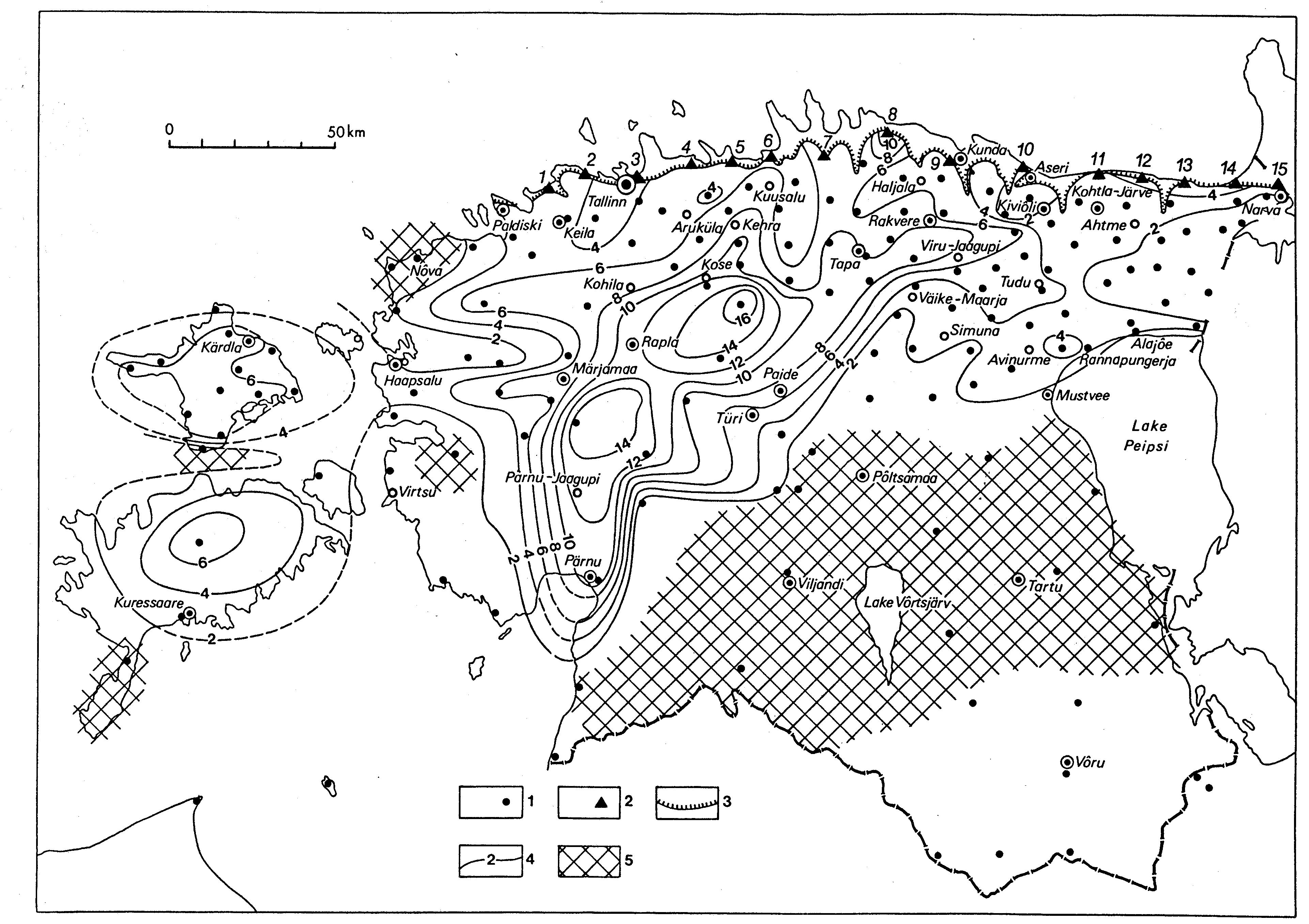
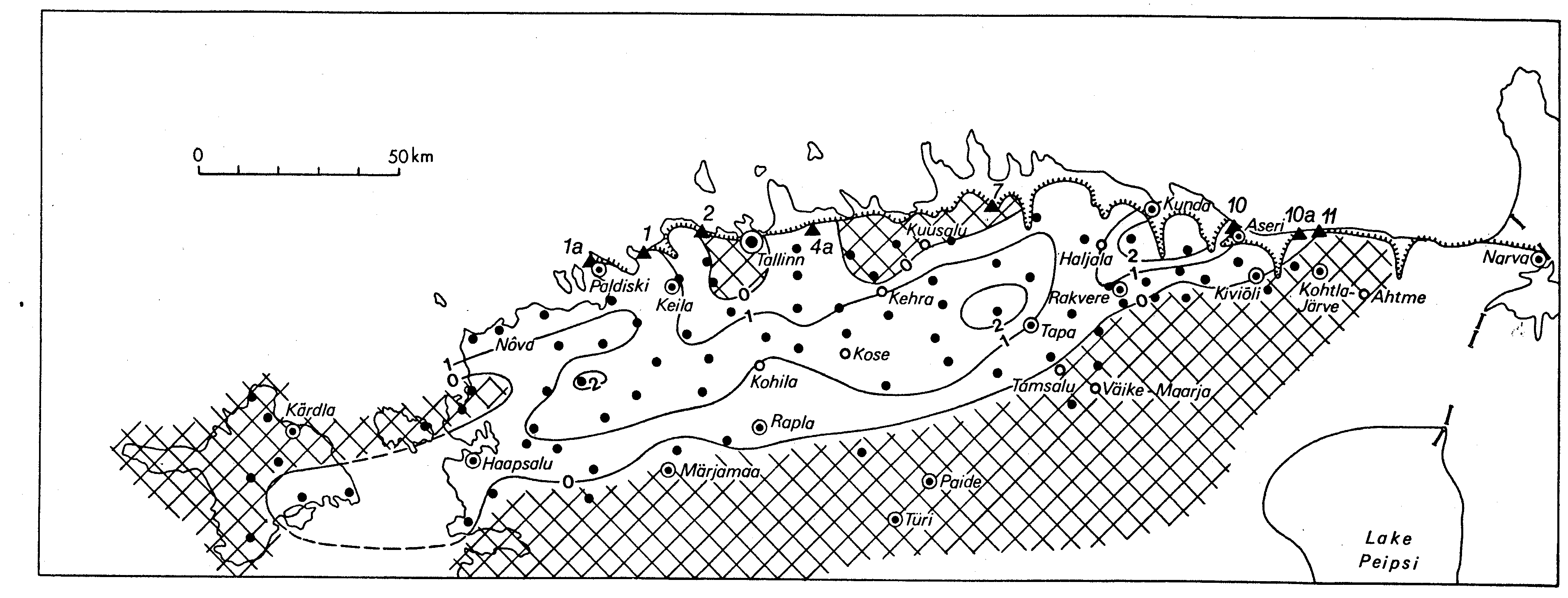
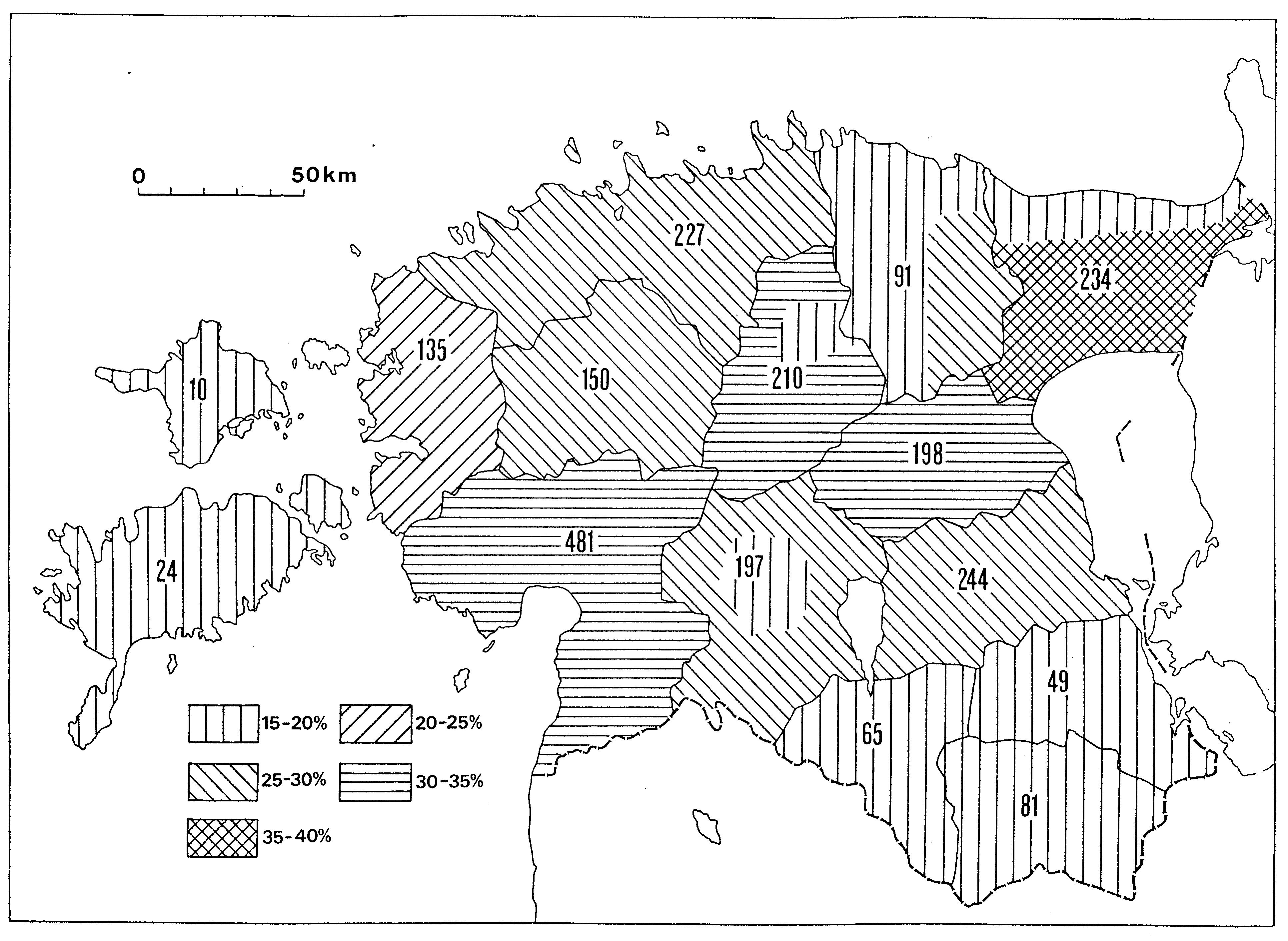
Fig. 91. Thickness of the Quaternary deposits: 1 - below 5 m; 2 - from 5 to 10 m; 3 - from 10 to 20 m; 4 - from 20 to 40 m; 5 - from 40 to 60 m; 6 - from 60 to 80 m; 7 - over 80 m; 8 - boreholes with the thickness of the Quaternary deposits; 9 - alvars; 10 - buried valleys.
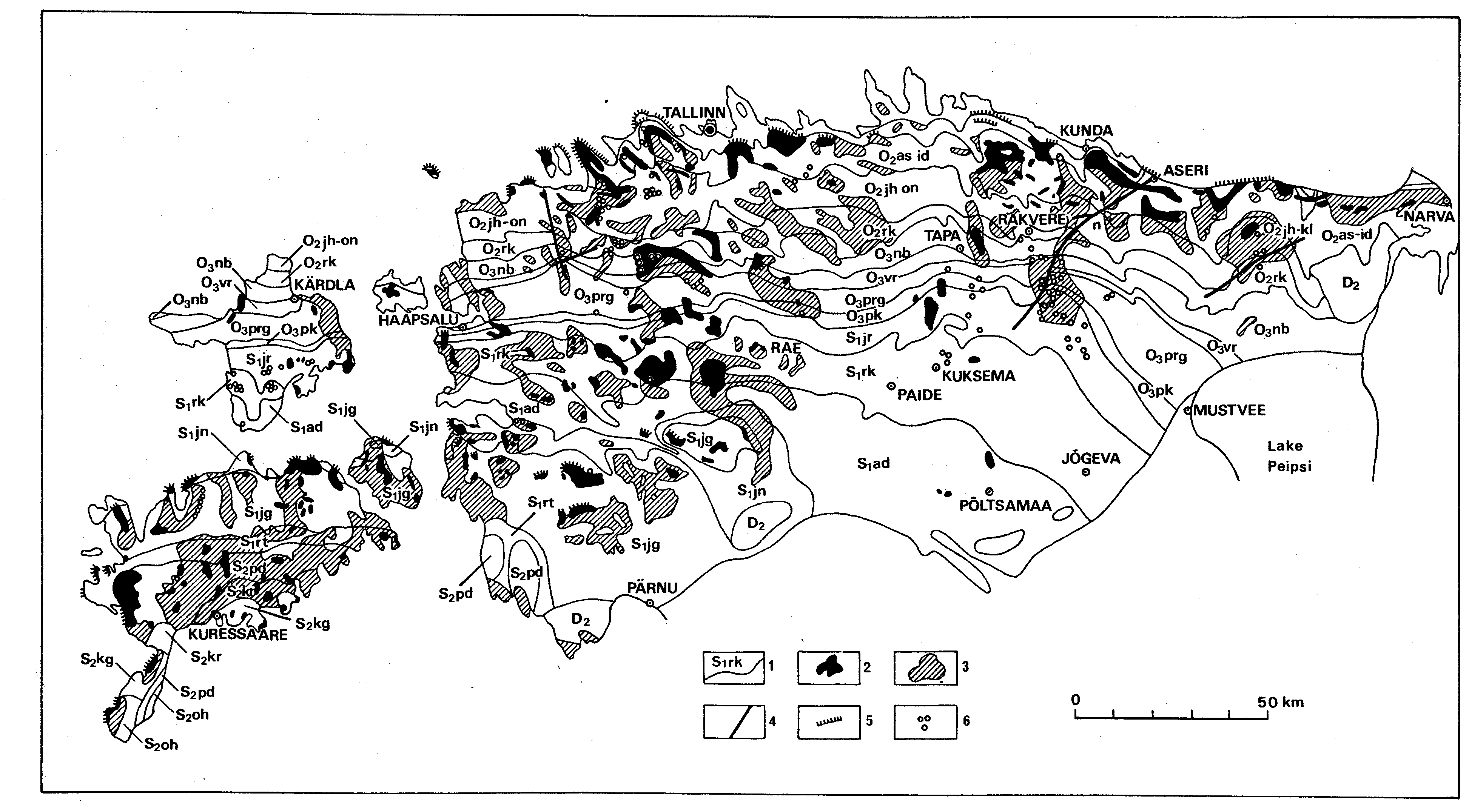
Fig. 92. The map of Quaternary deposits: g - till, f - glaciofluvial, lg - glaciolacustrine, m - marine, a - alluvial, l - lacustrine, b - boggy, t - technogenous; black - Pre-Quaternary.
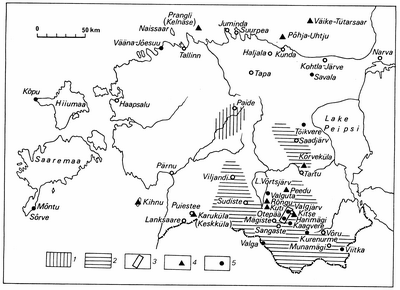
Fig. 93. Areal stratotypes of the Järva (1), Ugandi (2) and Sangaste (3) glacial formations and location of the main interglacial (4) and interstadial (5) sequences.
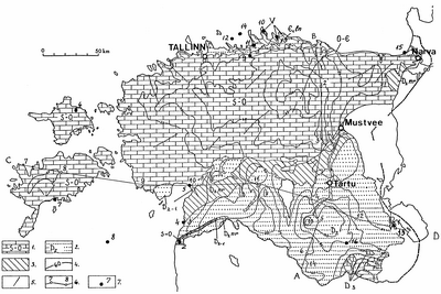
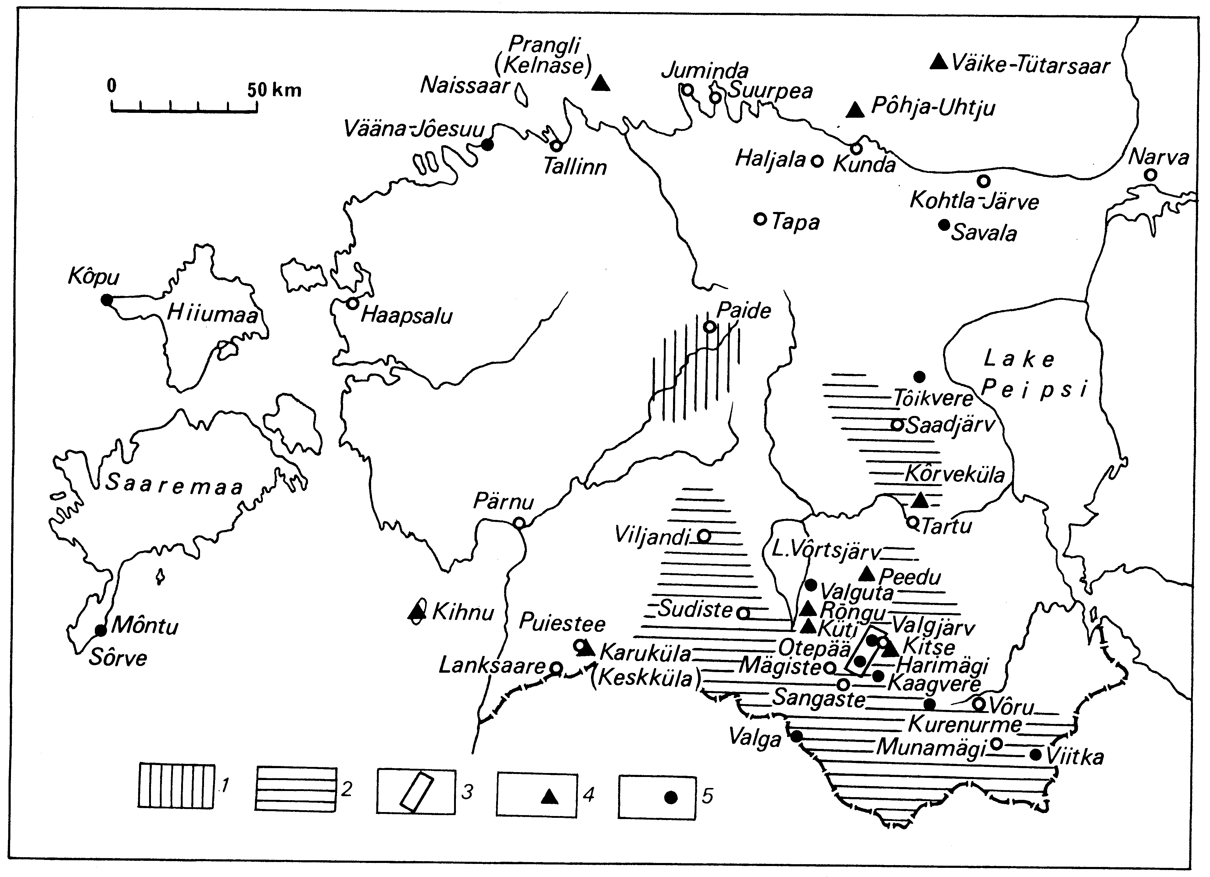
Fig. 94. Hydrogeological sketch-map of Estonian bedrock, distribution of aquifers and aquitards: 1 - carbonaceous (limestone, dolomite, marl), and 2 - terrigenous (sandstone, siltstone) water-bearing rocks; 3 - sporadically water-bearing and impermeable rocks; 4 - contours of the groundwater table and potentiometric surface a.s.l., m; 5 - tectonical fault; 6 - section line; 7 - mineral water deposit (see also Table 20): 1 - Värska, 2 - Ikla, 3 - Arumetsa, 4 - Häädemeeste, 5 - Pärnu, 6 - Kärdla, 7 - Kuressaare, 8 - Ruhnu Island, 9 - Hirvli, 10 - Pärispea, 11 - Pudisoo, 12 - Rammu Island, 13 - Käsmu, 14 - Põhja-Uhtju Island, 15 - Meriküla, 16 - Võru. For indices see Table 17. Compiled by R. Perens.
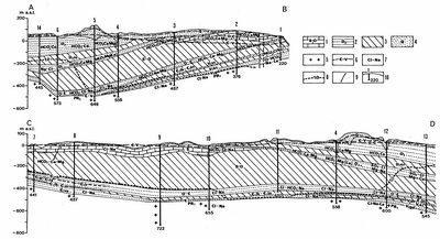
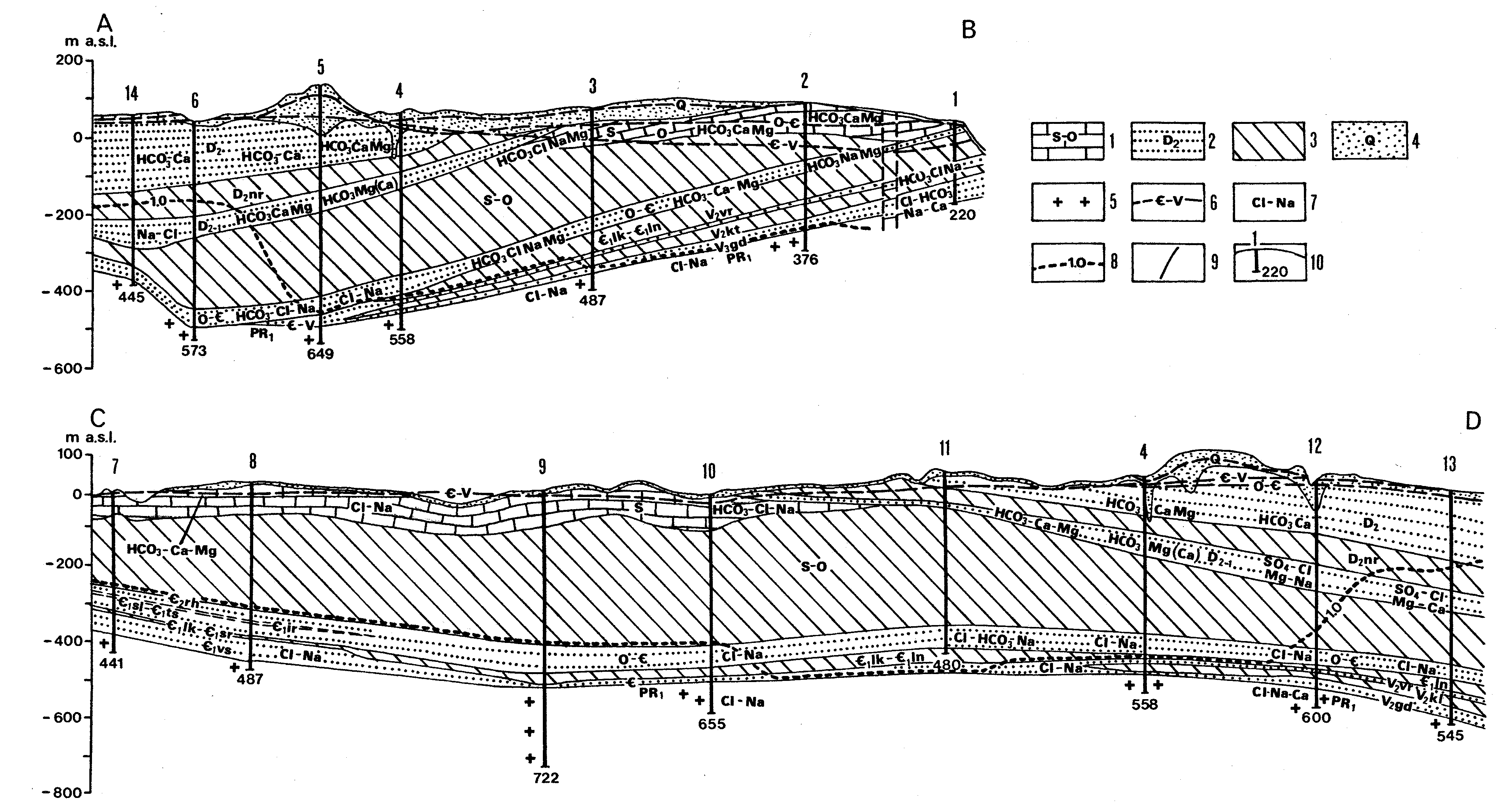
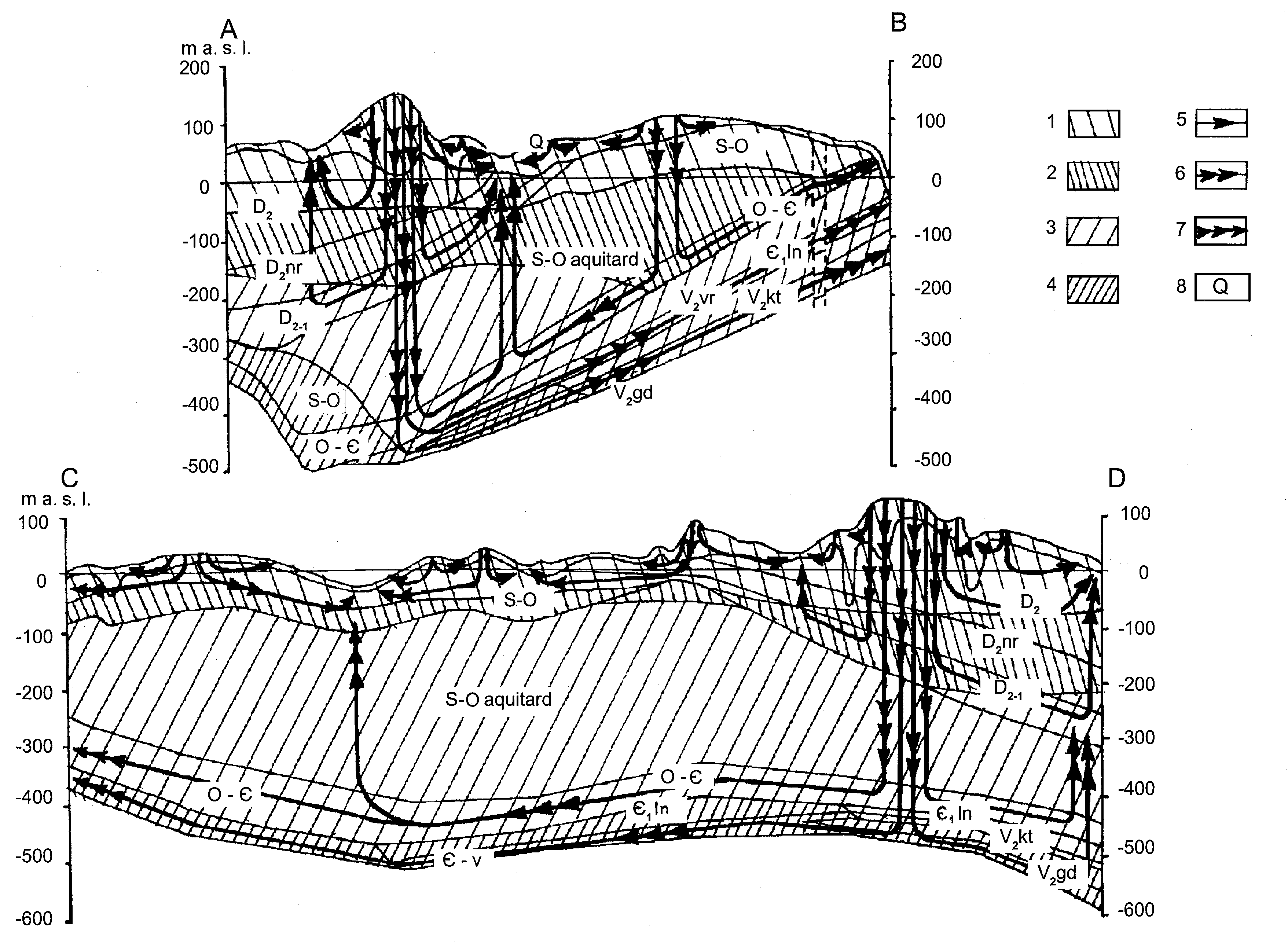
Fig. 95. Hydrogeological cross-sections of Estonian bedrock: 1 - carbonaceous (limestone, dolomite, marl), and 2 - terrigenous (sandstone, siltstone) water-bearing rocks; 3 - sporadically water-bearing and impermeable rocks; 4 - Quaternary deposits; 5 - crystalline basement; 6 - contours of the groundwater table and potentiometric surface; 7 - hydrochemical type of water; 8 - distribution limit of fresh groundwater; 9 - tectonical fault; 10 - boring, upper figure shows the number on the map, lower figure - depth, m. For indices see Table 17. Compiled by R. Perens.
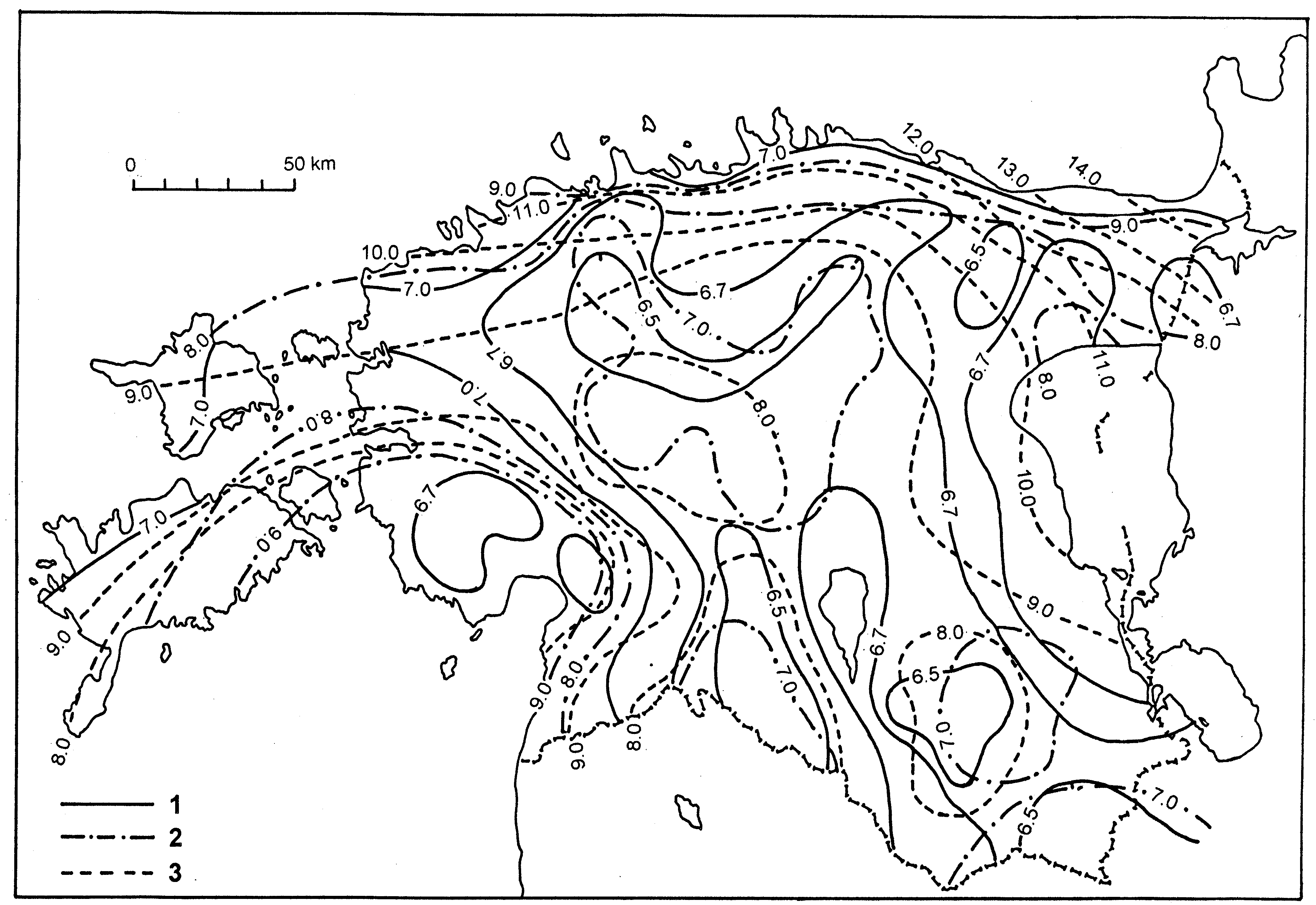
Fig. 96. Silurian-Ordovician aquifer system: 1 - boundary of the aquifer system; 2 - boundary of water-bearing rocks; 3 - 6 - transmissivity, m2/d: 3 - up to 100; 4 -100...200; 5 - 200...500; 6 - more than 500; 7 - isoline of the height of aquifer roof a.s.l.; 8 - contour of the groundwater table and potentiometric surface, a.s.l., m. Compiled by R. Perens.
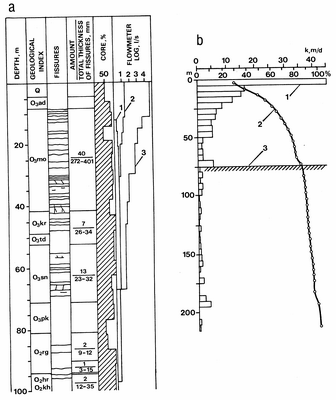
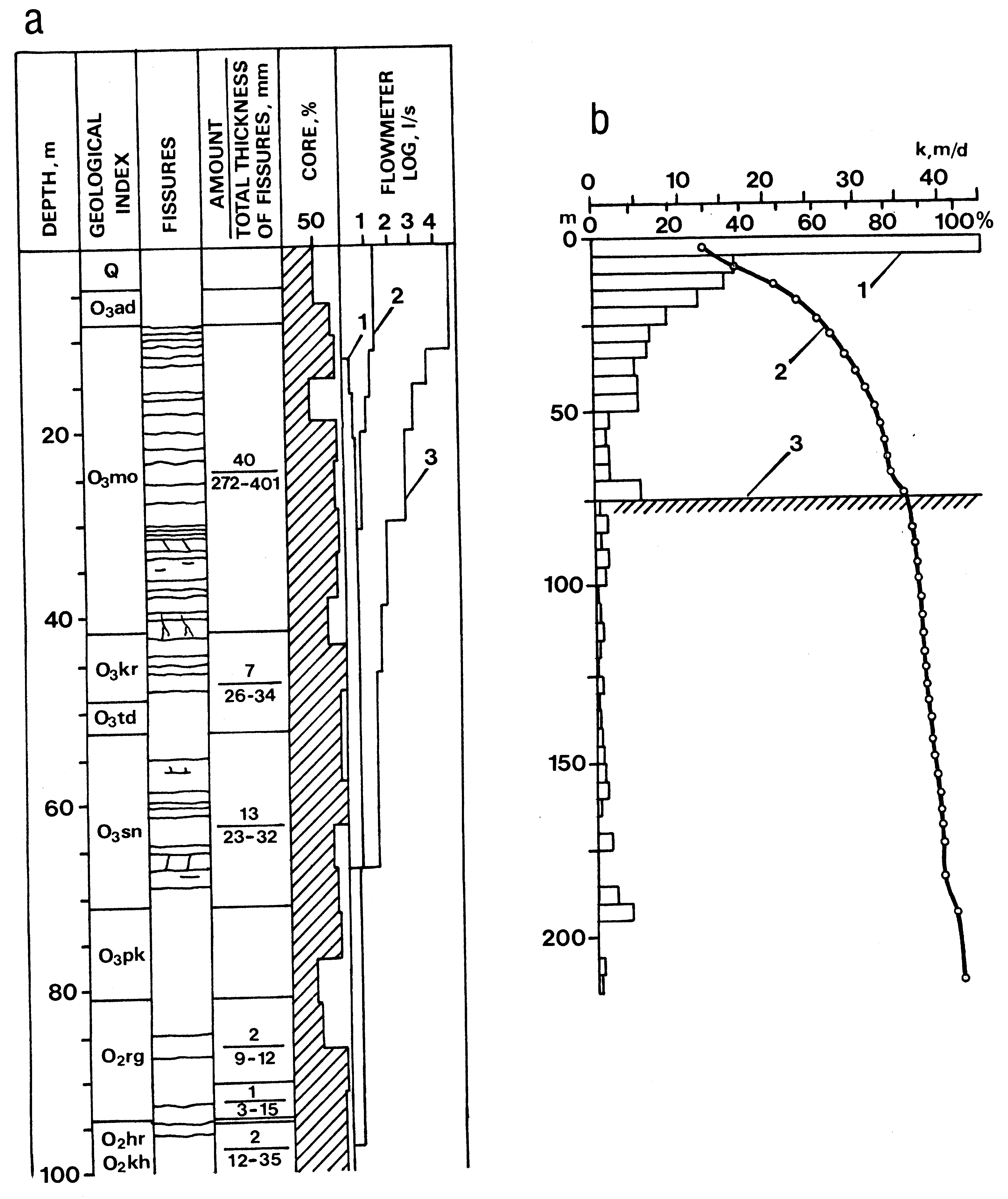
Fig. 97. Results of flowmeter logging: a) Geological section of Paasvere boring (southern portion of the Pandivere Upland), fissurization by television device and groundwater discharge into boring: 1 - flowmeter log under natural conditions; 2 - 3 - the same during pumping. Q - Quaternary cover; O3 - Upper Ordovician; O2 - Middle Ordovician; formations: ad - Adila, mo - Moe, kr - Kõrgessaare, td - Tudulinna, sn - Saunja, pk - Paekna, rg - Rägavere, hr - Hirmuse, kh - Kahula. b) Conductivity of carbonate rocks and the impact of bedding depth on total transmissivity: 1 - mean conductivity of weighed depth intervals (k), m/d; 2 - cumulative graph of transmissivity, %; 3 - the boundary of the most water-abundant portion of the section. Compiled by R. Perens.
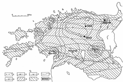
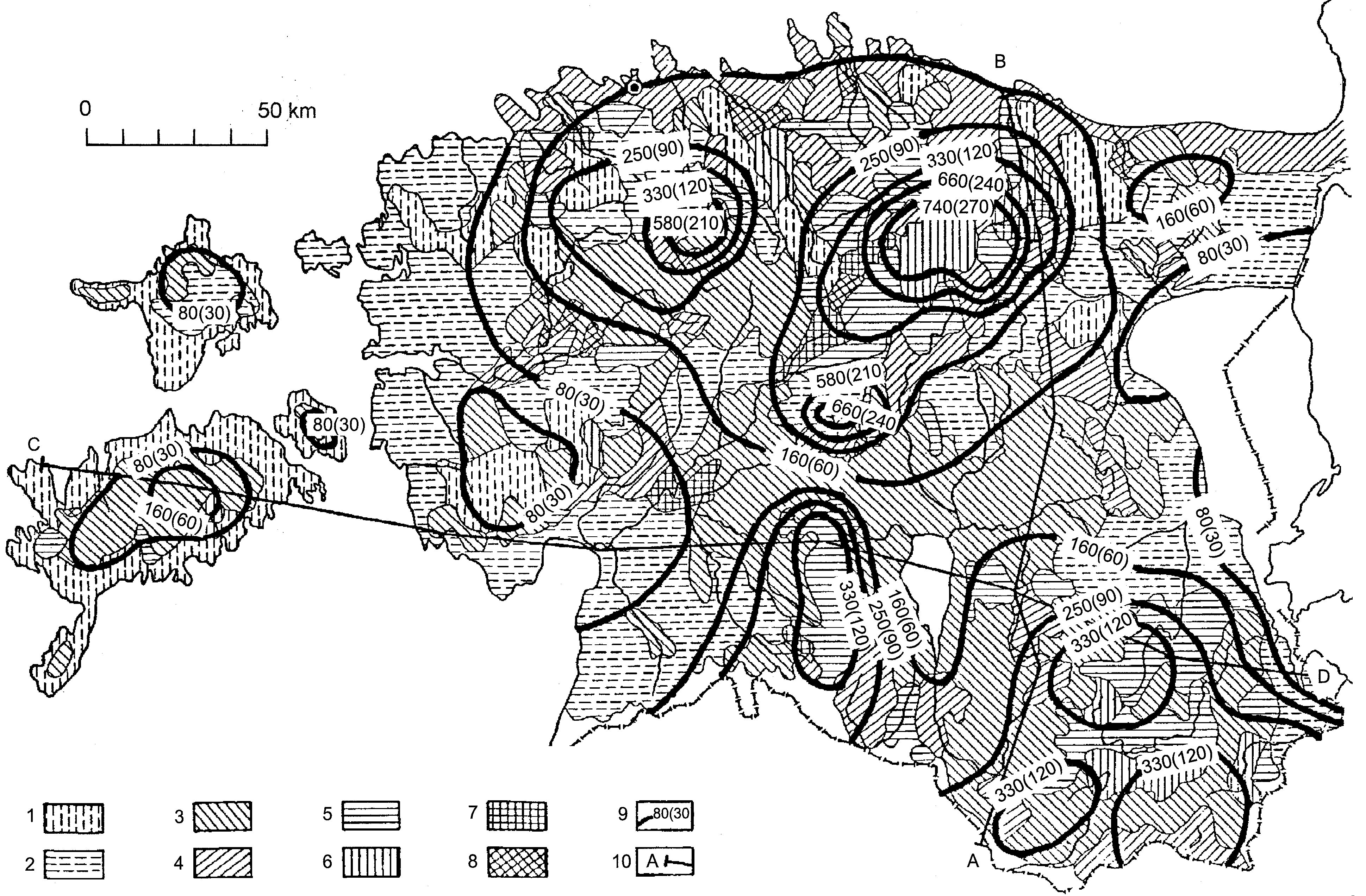
Fig. 98. Ordovician-Cambrian aquifer system: 1 - boundary of the aquifer system; 2 - isoline of the height of the roof of the aquifer system a.s.l., m; 3 - thickness of the aquifer system, m; 4 - boundary of brackish water; 5 - isoline of the height of the potentiometric surface a.s.l. in 1995, m; 6-7 - transmissivity, m2/d: 6 - >50; 7 - <50; 8 - observation wells: 885 - Jõhvi, 999 - Väike-Maarja, 1052 - Tooma. Compiled by R. Perens.
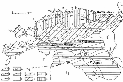
Fig. 99. Cambrian-Vendian aquifer system: 1 - boundary of the aquifer system; 2 - western boundary of the clays of the Kotlin Formation; 3 - western boundary of the clays of the Lontova Formation; 4 - boundary of Vendian rocks; 5 - isoline of the height of the roof of the aquifer system a.s.l., m; 6 - isoline of the thickness of the aquifer system, m; 7- isoline of the height of the potentiometric surface a.s.l. in 1995, m; 8-10 - transmissivity, m2/d: 8 - up to 100, 9 - 100...300, 10 - more than 300. Compiled by R. Perens.

Fig. 100. Net infiltration and groundwater discharge to the channel network: 1- 8 - intensity of groundwater discharge, m3/(d×km2): 1 - 30...40, 2 - >40...90, 3 - >90...170, 4 - >170...260, 5 - >260...430, 6 - >430...600, 7 - >600...800, 8 - >800...1700; 9 - isoline of the net infiltration intensity, m3/(d×km2), in brackets mm per year; 10 - line of the cross-section of groundwater flow zones (on Fig. 101). Compiled by L. Vallner.
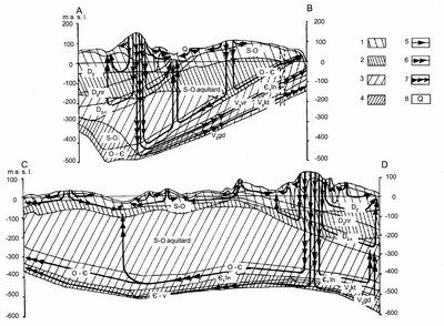
Fig. 101. Vertical zoning of groundwater flow: 1 - subzone of fast flow; 2 - subzone of moderate flow; 3 - subzone of slow flow; 4 - subzone of very slow flow; 5-7 - systems of groundwater flow: 5 - local, 6 - intermediate, 7 - regional; 8 - index of hydrogeological unit, see Table 17. Compiled by L. Vallner.
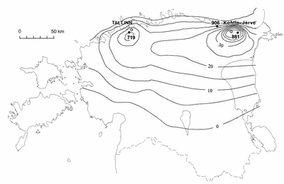
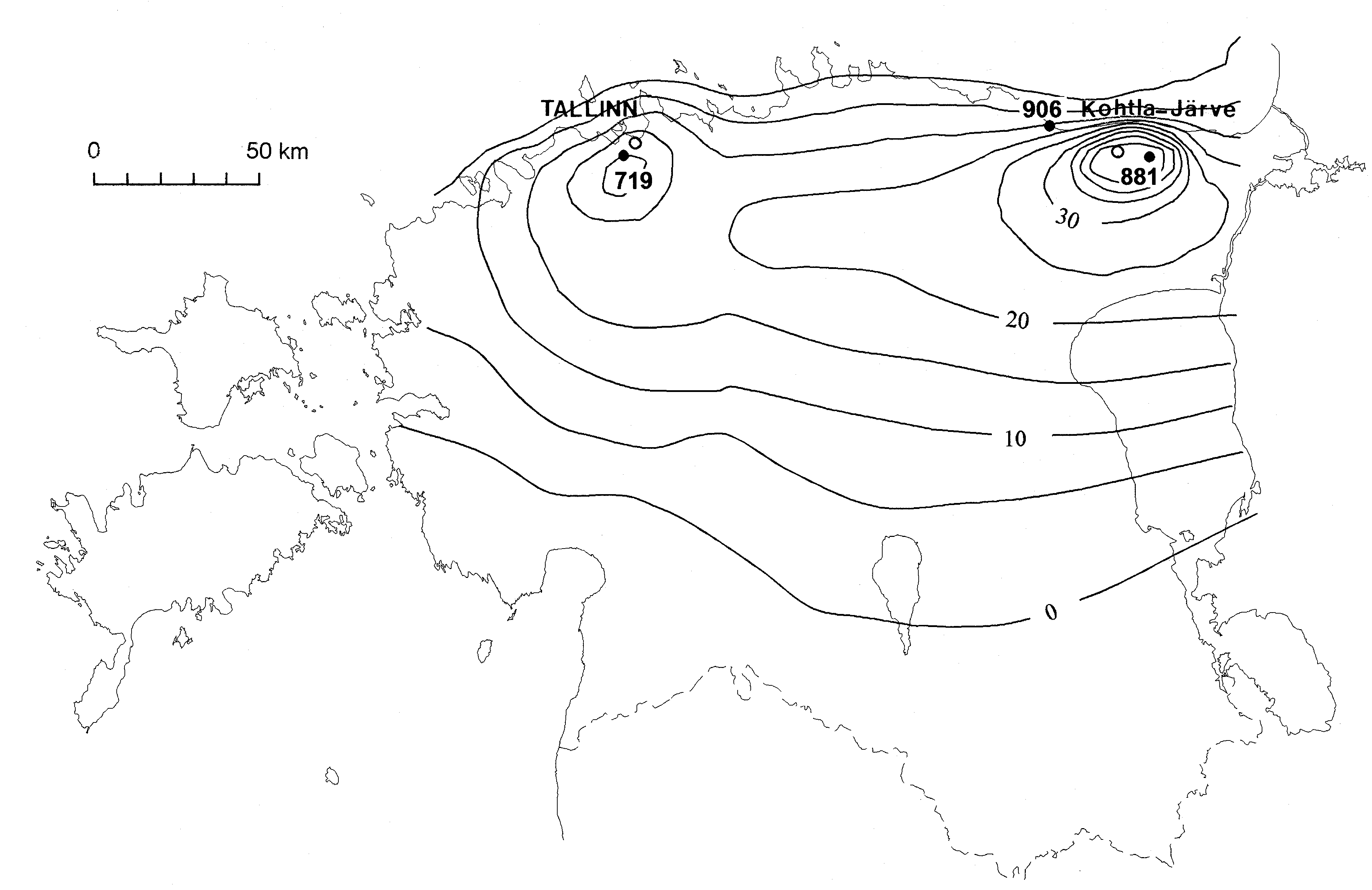
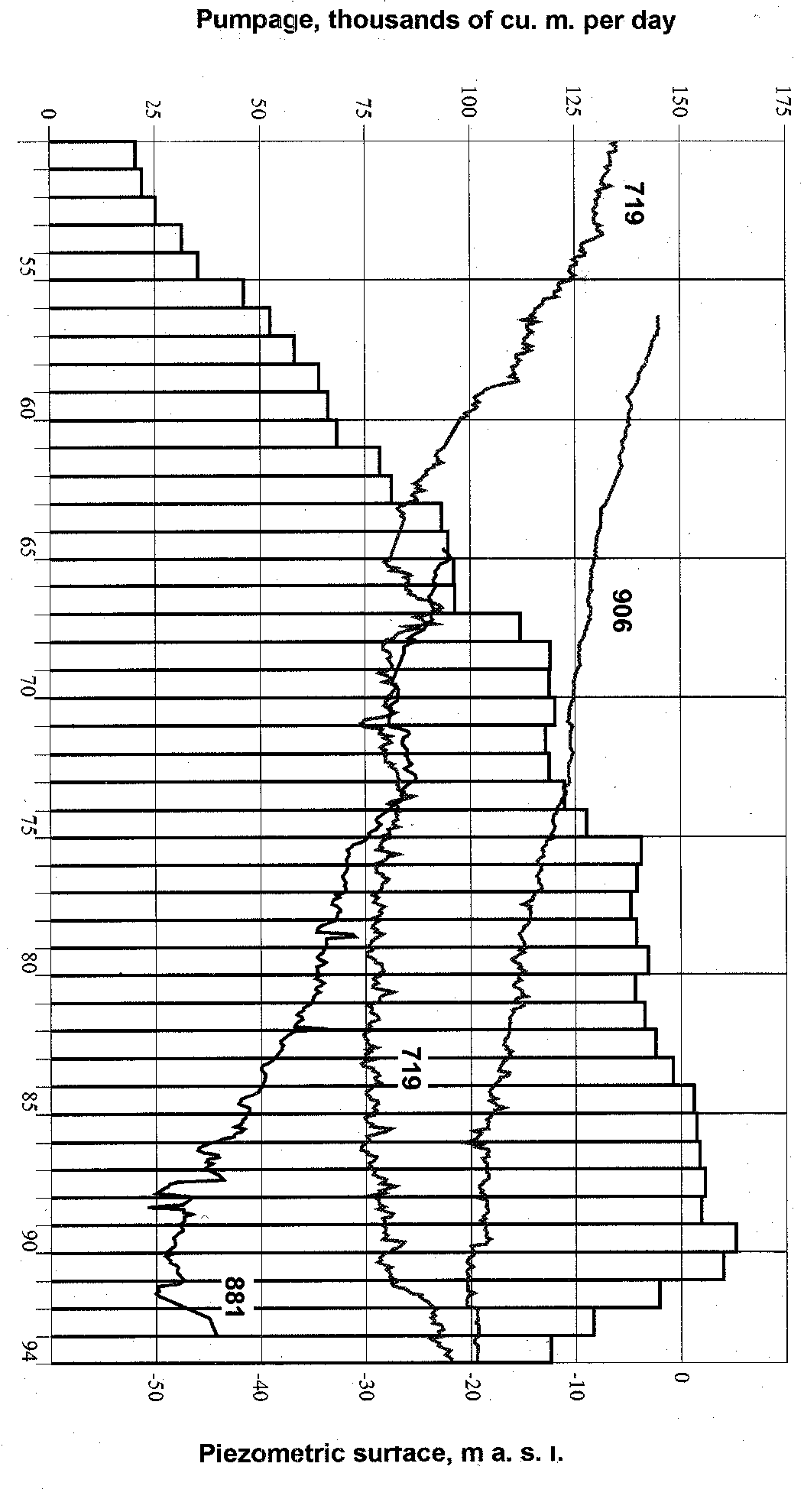
Fig. 102. Drawdown of the Cambrian-Ordovician aquifer system in 1994, m. Black circles mark observation wells: 719 - Tallinn, 906 - Purtse, 881 - Sompa. Compiled by L. Savitski.
Fig. 103. Sketch of groundwater budget: 1- aquifer or aquifer system with hydrogeological indices (see Table 17); 2 - groundwater flow to the Quaternary cover (striped) and out of it (unstriped), the arrow shows the flow direction, discharge corresponds to the width of the flow shown in the figure (see the scale, m3/s); 3 - pumpage of groundwater; 4 - discharge through springs; 5 - direct discharge to the sea; a - recharge from precipitation; b - induced recharge from streams; c - induced recharge from the Gulf of Finland; d - discharge to the channel network. Compiled by L. Vallner.
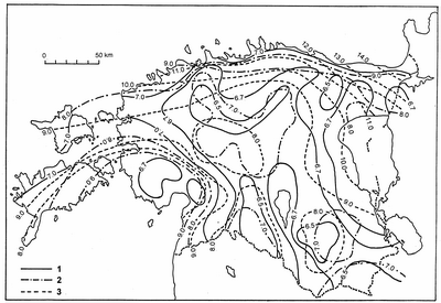
Fig. 104. Geotemperature isoterms (oC) in Estonia (Jürima 1984). Depth from the ground, m: 1 - 50; 2 - 100; 3 - 200.
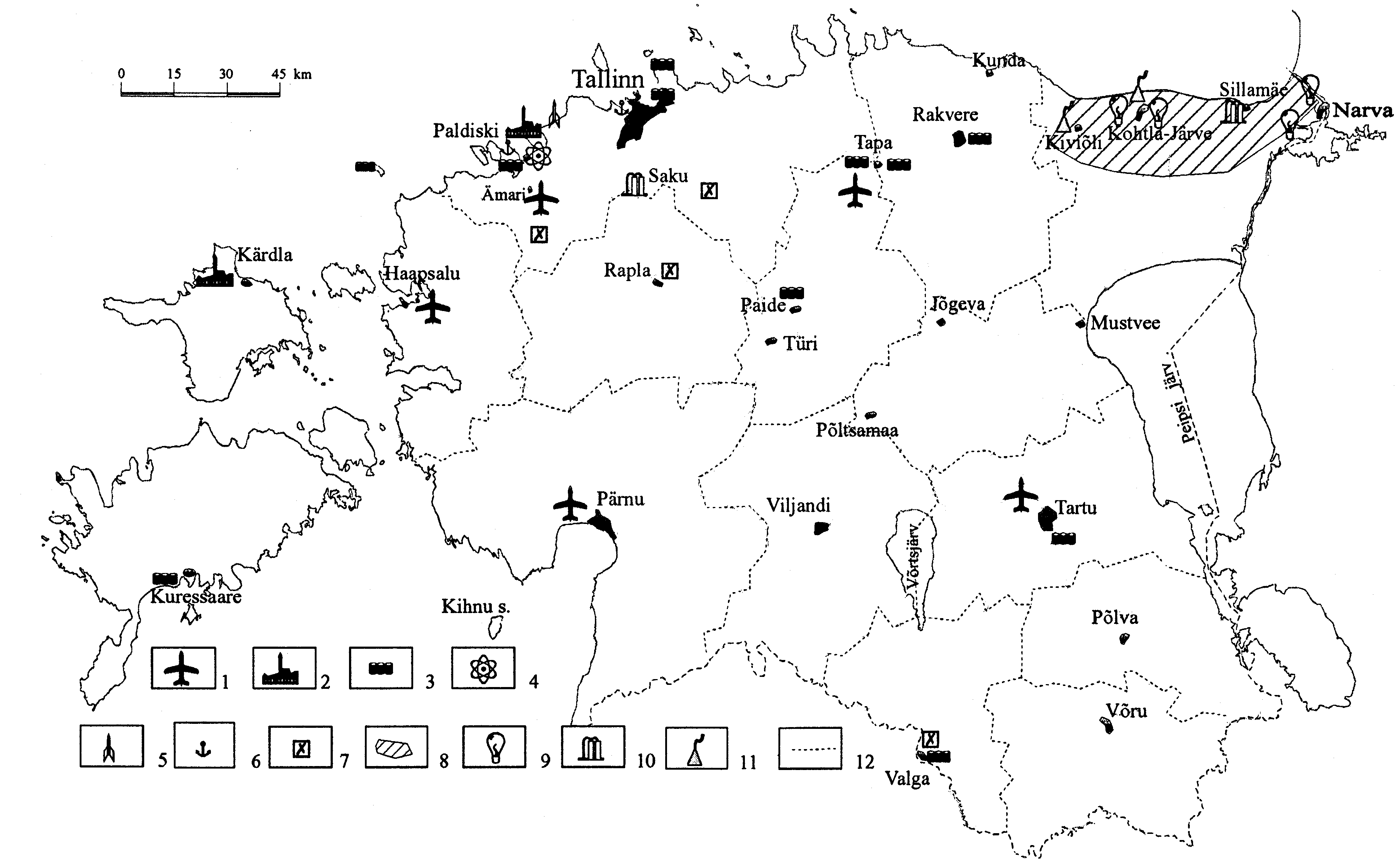
Fig. 105. Significant point-pollution sources: 1- airfield; 2 - boiler house; 3 - fuel depository; 4 - nuclear reactor, liquidated; 5 - missile base, liquidated; 6 - harbour; 7 - asphalt concrete works; 8 - industrial region of North-East Estonia; 9 - power station; 10 - radioactive waste depository; 11 - oil shale processing enterprise; 12 - boundary of the county. Compiled by the joint-stock company MAVES.
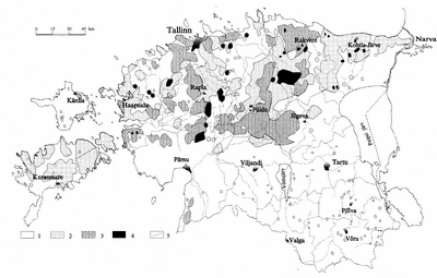
Fig. 106. Distribution of nitrates in groundwater to a depth of 30...100 m from the ground in 1990: 1-4 - concentration of nitrates in groundwater, mg/l: 1 - <4; 2 - 4...20; 3 - 20...45; 4 - >45; 5 - boundary of the county. Compiled by L. Savitskaja.
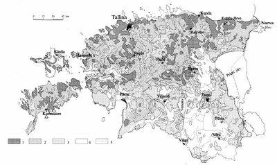
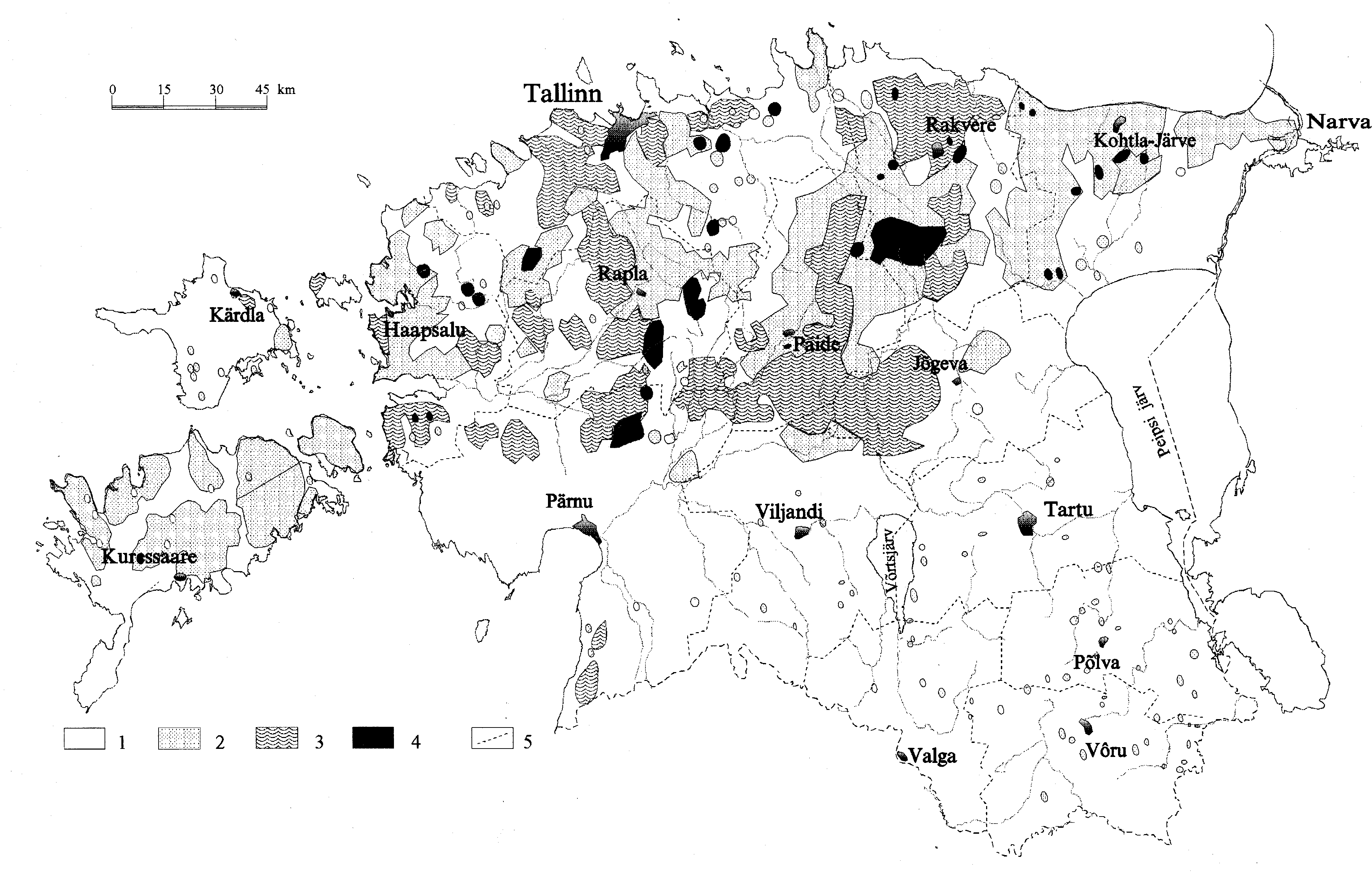
Fig. 107. Degree of groundwater protection: 1 - unprotected; 2 - weakly protected; 3 - moderately protected; 4 - protected. Compiled by L. Savitskaja.
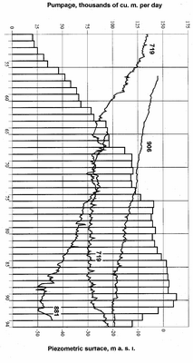
Fig. 108. Total pumpage from the Cambrian-Vendian aquifer system and change of the head in observation wells 719, 881 and 906 (see Fig. 102). Compiled by L. Savitski.
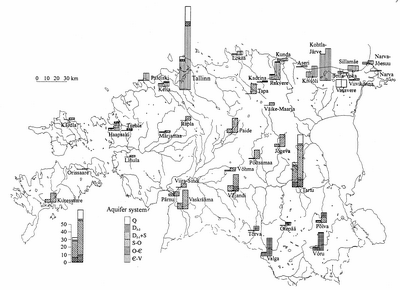
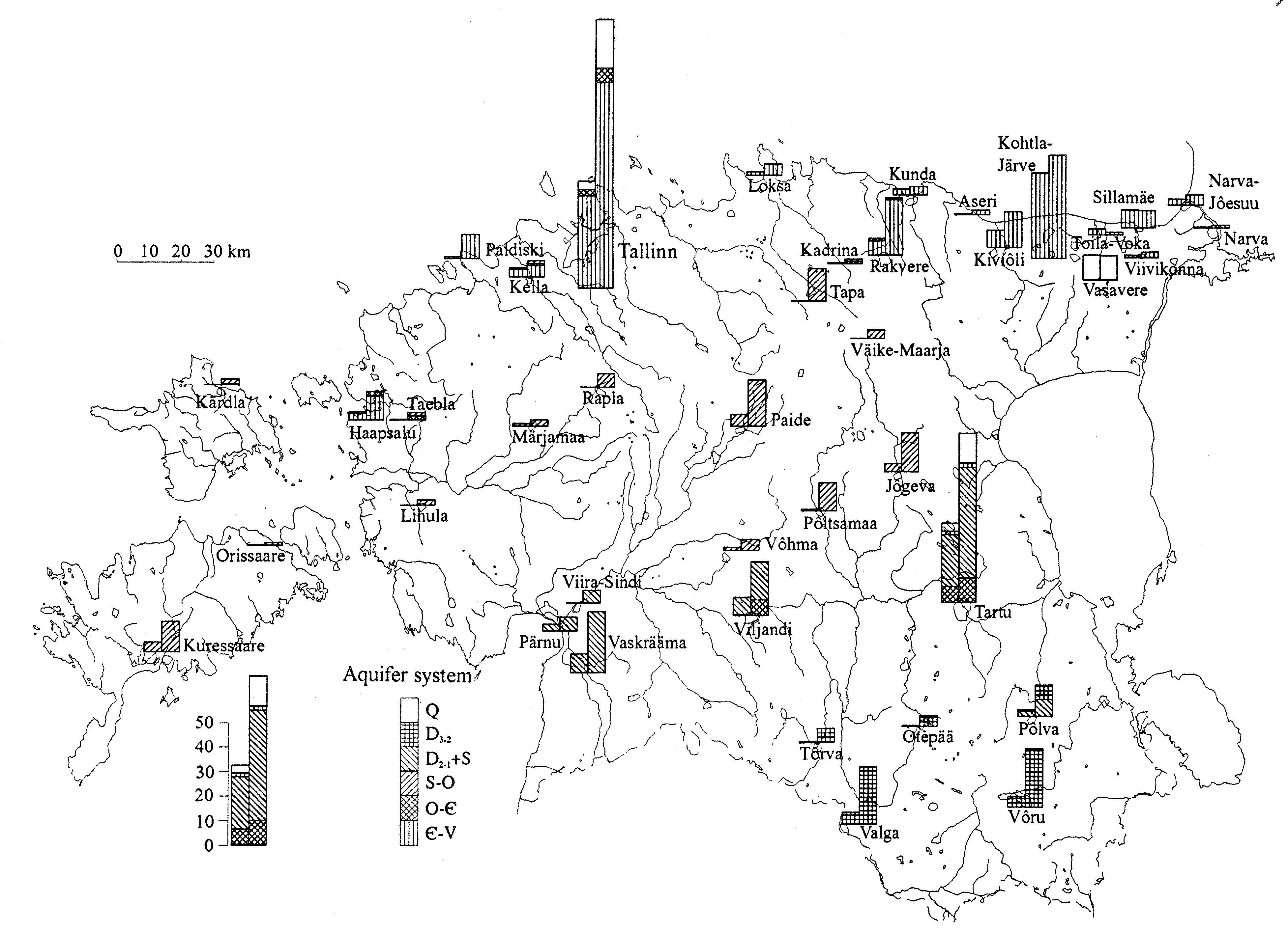
Fig. 109. Groundwater safe yield (right diagram) and actual pumping rate, thousands of m3/d (left diagram). Compiled by L. Savitski.

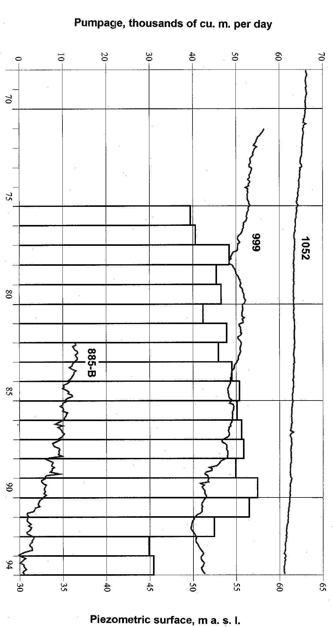
Fig. 110. Total pumping from the Ordovician-Cambrian aquifer system and change of the head in observation wells 885-B (Jõhvi), 999 (Väike-Maarja) and 1052 (Tooma). See also Fig. 98. Compiled by L. Savitski.
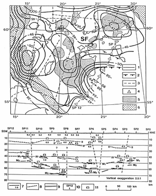
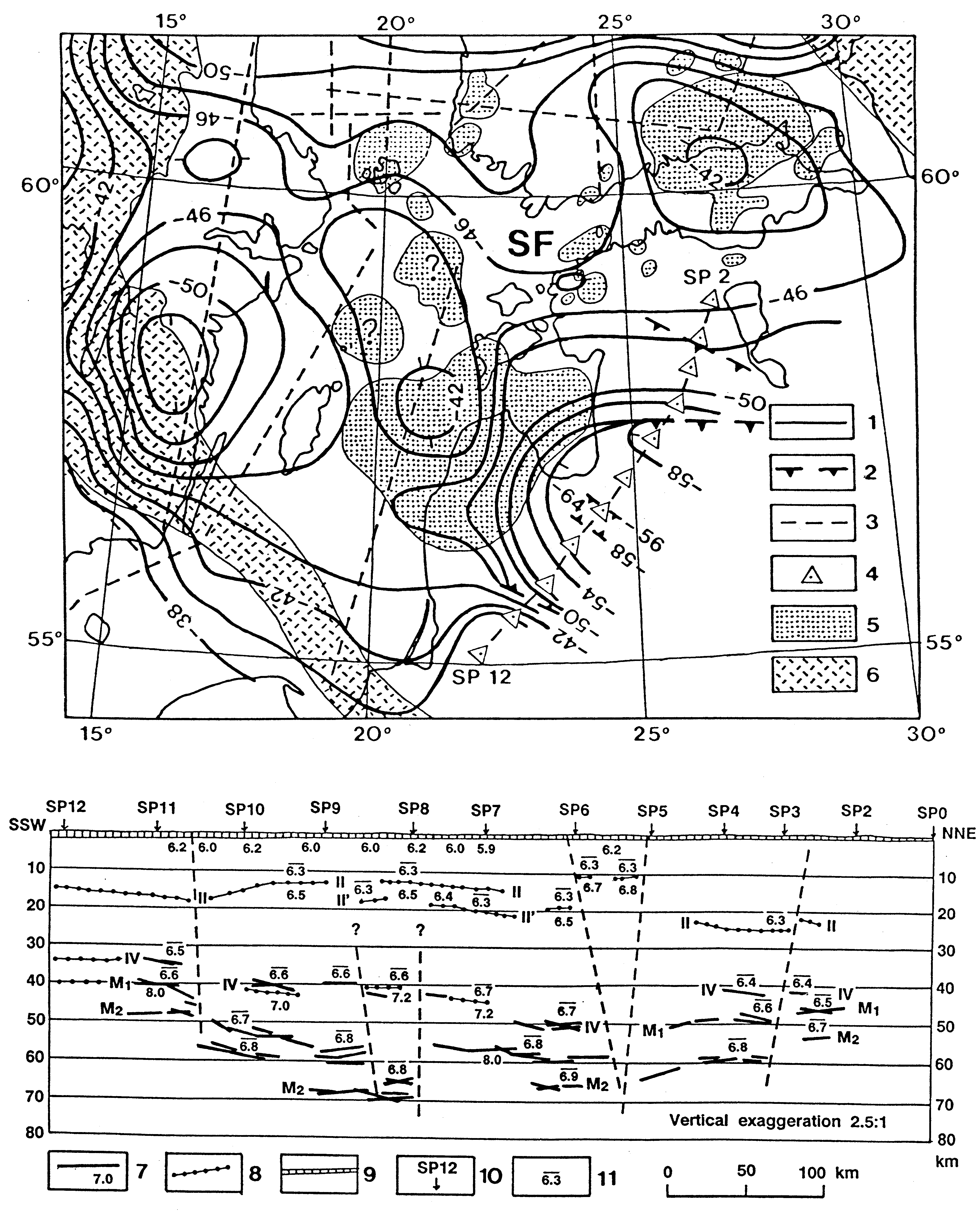
Fig. 111. Crustal structure of East Baltic; map (modified from Korja 1995) and section (from Ankudinov et al. 1994, simplified): 1 - contour on top of the Moho in kilometres; 2 - deep-seated fault; 3 - deep seismic sounding line; 4 - shotpoint on the Sovetsk - Kohtla-Järve profile; 5 - rapakivi granite and related rocks; 6 - boundary zone of the Svecofennian Domain (SF); 7 - refraction discontinuities, velocity of P waves in km/s immediately below the discontinuity; 8 - reflection discontinuities; 9 - sedimentary cover; 10 - shotpoint; 11 - average velocity of upper media. II - Conrad discontinuity, IV - discontinuity in lower crust, M - Mohoroviàiá discontinuity.

Fig. 112. Location of the magnetotelluric sites (from Andra et al. 1974) with the depth of the highly conducting regions in the mantle in kilometres. Arrows show the average polarization angles for the telluric field.
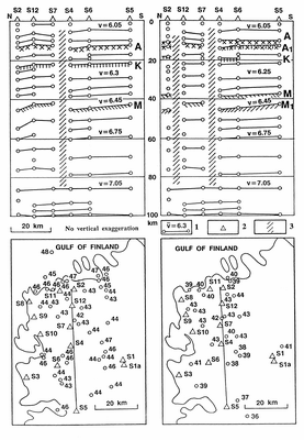
Fig. 113. Maps with Moho depths in kilometres and crustal sections, northwestern Estonia (left: from Bulin 1978; right: from Bulin et al. 1980): 1 - discontinuity with average velocity of upper media; 2 - seismic station; 3 - assumed deep-seated fault. K - Conrad discontinuity, M - Mohoroviàiá discontinuity, A - discontinuity in upper crust.
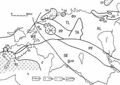
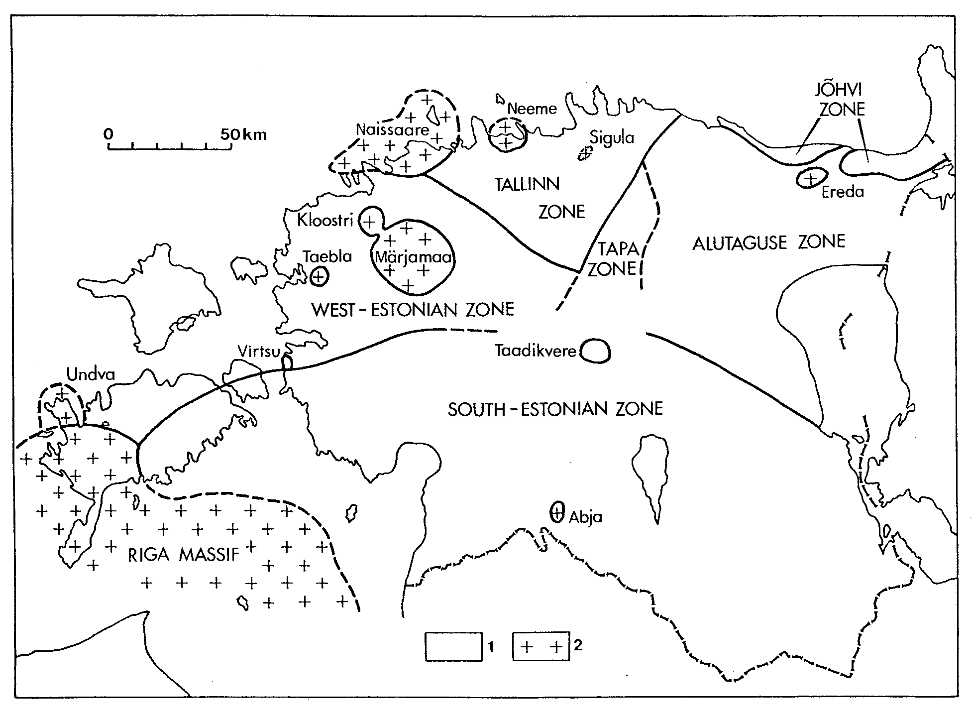
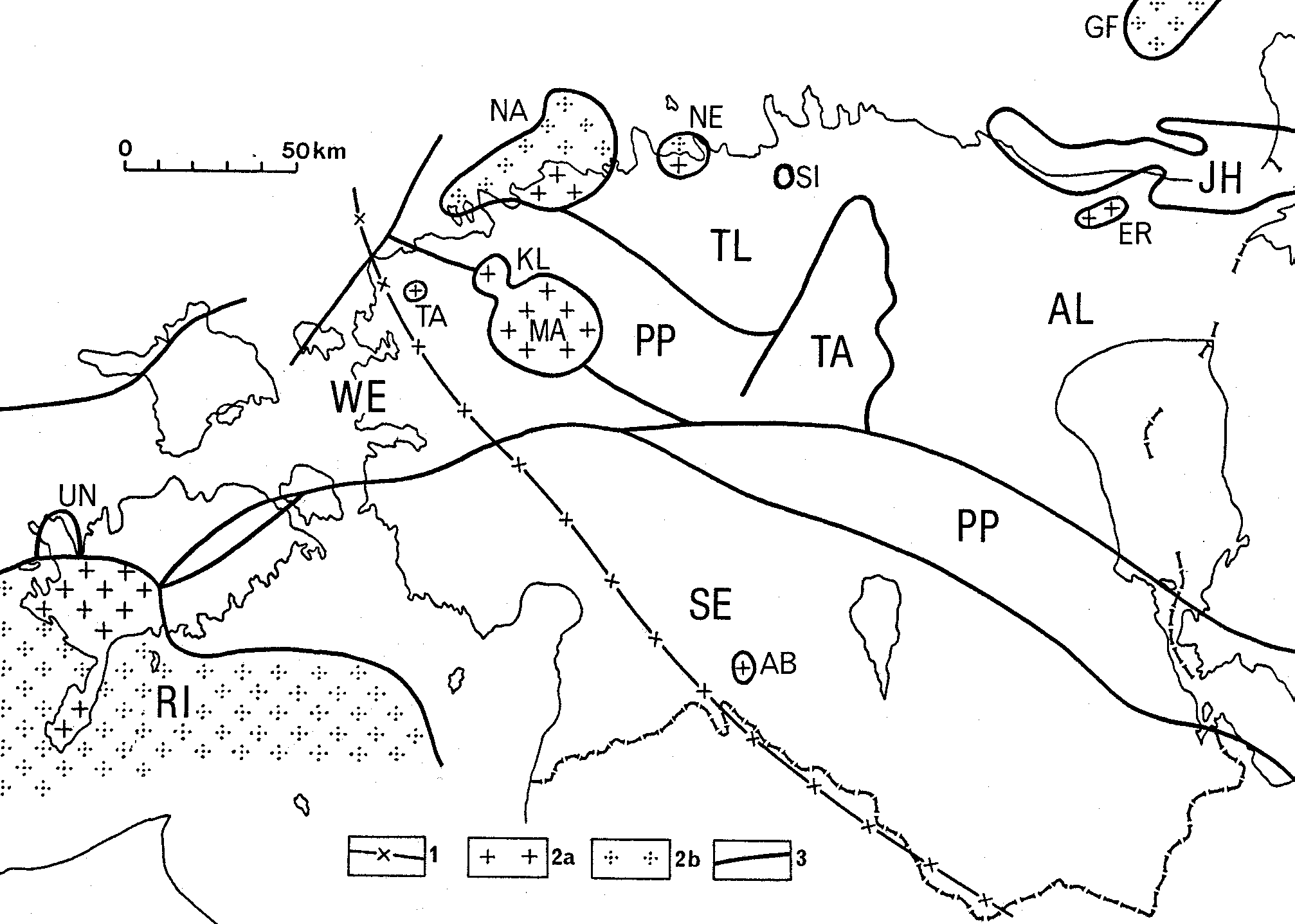
Fig. 114. Structural zoning of the Palaeoproterozoic orogenic basement and location of Palaeoproterozoic to Mesoproterozoic anorogenic igneous rocks: 1 - possible boundary of the Vyborg and Riga rapakivi subprovinces; 2 - plutons and volcanic sheets of rapakivi granite and related rocks in onshore (a) and offshore (b) areas; 3 - major faults. Zones and blocks: TL - Tallinn, AL - Alutaguse, TA - Tapa, JH - Jõhvi, PP - Paldiski-Pskov, SE - South Estonia, WE - West Estonia. Igneous structures of rapakivi and related rocks: GF - Gulf of Finland, ER - Ereda, NE - Neeme, NA - Naissaar, MÄ - Märjamaa, KL - Kloostri, SI - Sigula, TA - Taebla, AB - Abja, RI - Riga, UN - Undva.
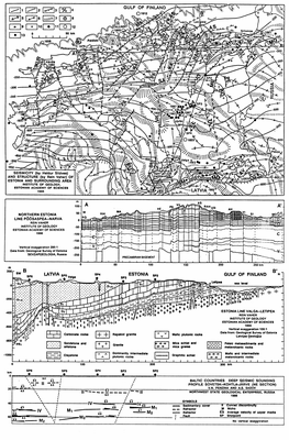
Fig. 115. Seismicity and structure of Estonia and surrounding area; map (After Sildvee & Vaher 1995, improved) and sections: 1 - contour on top of the Precambrian basement; 2 - updip limit of the sedimentary bedrock; 3 - flexure above a basement fault; 4 - deep-seated fault: U - upthrown side, D - downthrown side; 5-7 trend of Bouguer anomaly : high (5), low (6), gradient (7); 8 - crater; 9 - dome; 10 - borehole finished in the basement; 11 - shotpoint; 12, 13 - earthquakes: macroseismic (12), instrumental (13). Q - Quaternary; D - Devonian; O - Ordovician; C - Cambrian; V - Vendian; PR - Palaeoproterozoic basement. Zones of disturbances: AA - Aaspere, AH - Ahtme, AS - Aseri, BU - Burtnieki, EL - Elva, HA - Haapsalu, HI - Hilleste, JÕ - Jõgeva, KA - Kahala, KAI - Kaiu, KAS - Kassari, KO - Kokora, KU - Kuremäe, KUR - Kurisu, KÄ - Kärla, LA - Laeva, LO - Lokno, MA - Maardu, MO - Monastyrek, MU - Mustvee, MÕ - Mõniste, OR - Orissaare, PA - Paide, PE - Peipsi, PS - Pskov, PU- Puikule, PÕ - Põõsaspea, PÄ - Pärnu, RA - Rakvere, RAH - Rahkla, RAP - Rapla, SIG - Sigula, SI - Sirgala, SM - Smiltene, SU - Surju, SÕ - Sõmeru, SÄ - Särevere, TA - Tartu, UD - Udriku, VA - Valmiera, VE - Vetla, VIH - Vihterpalu, VI - Viivikonna, VII - Viitna, VIL - Viljandi, VIR - Virunurme, ZA - Zagrive. For legend see also Fig. 111.
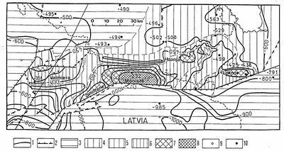
Fig. 116. Valmiera-Lokno Uplift (by Rein Vaher): 1 - contour on top of the Precambrian basement; 2 - flexure above a basement fault; 3-8 - pre-Devonian geology: Silurian (3), Upper Ordovician (4), Middle Ordovician (5), Lower Ordovician (6), Cambrian and/or Vendian (7), Palaeoproterozoic (8); 9 - borehole finished in Silurian, Ordovician, Cambrian or Vendian rocks; 10 - borehole finished in the basement.
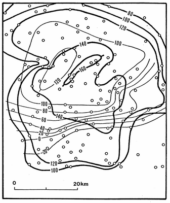
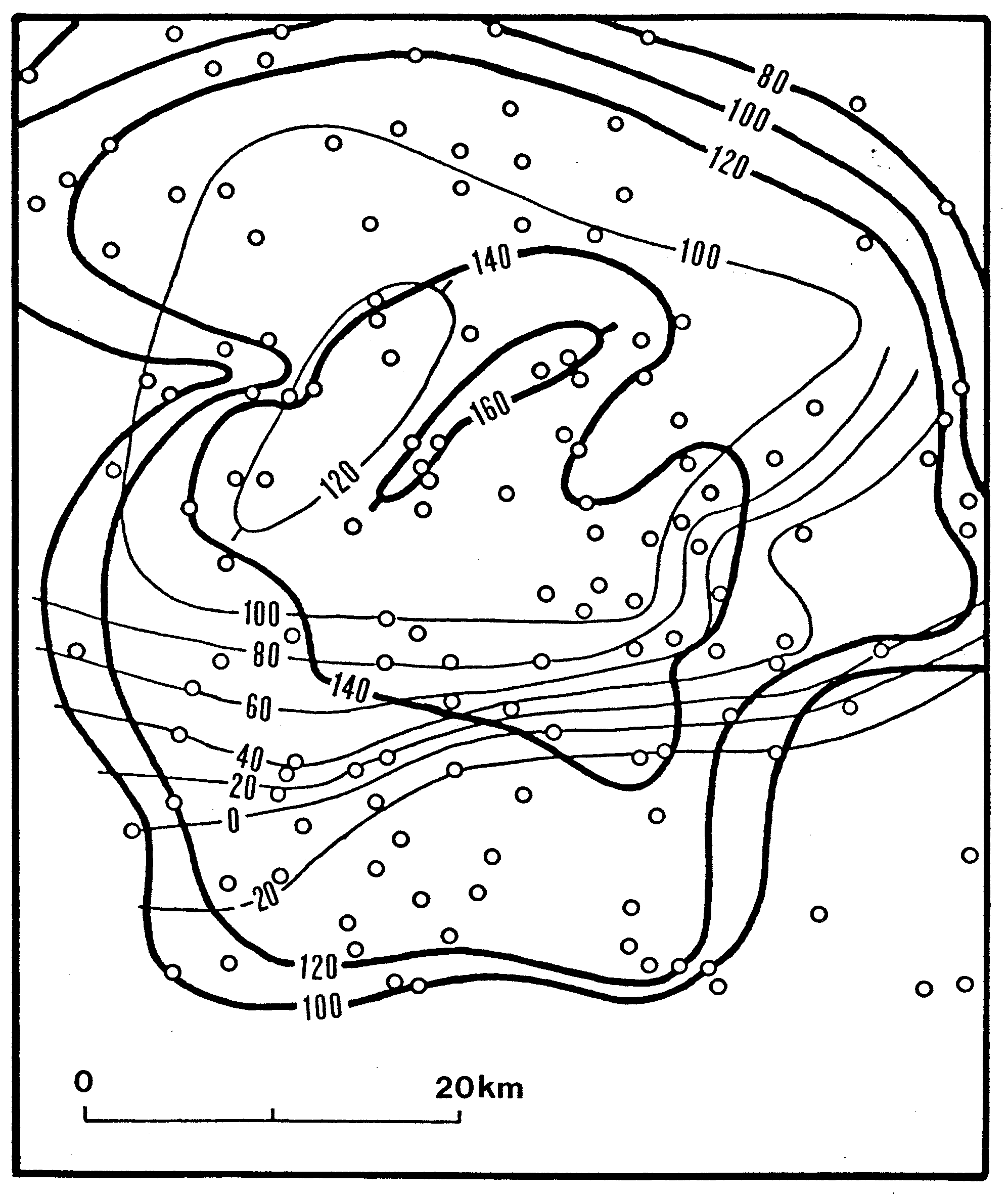
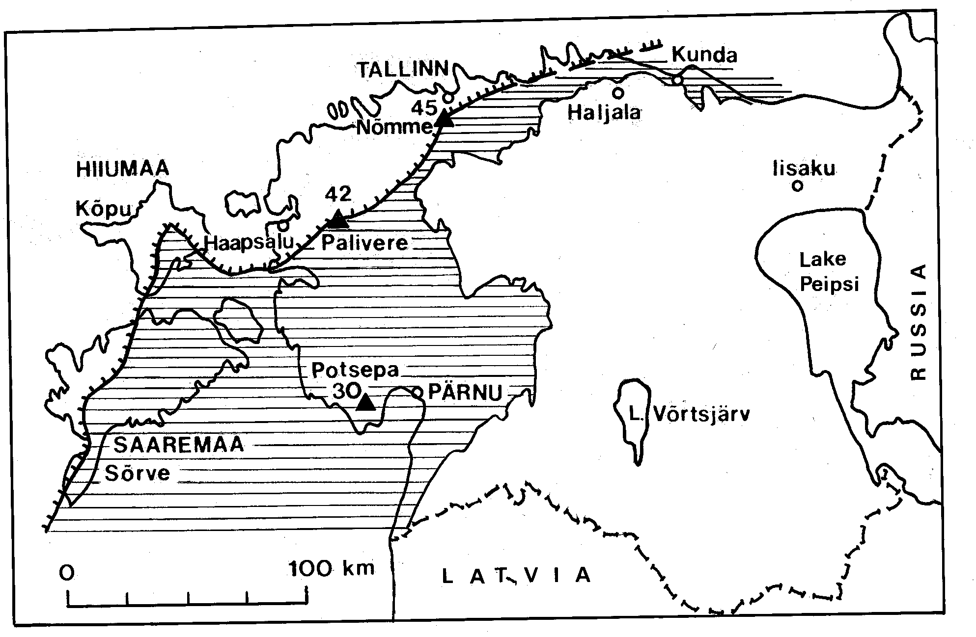
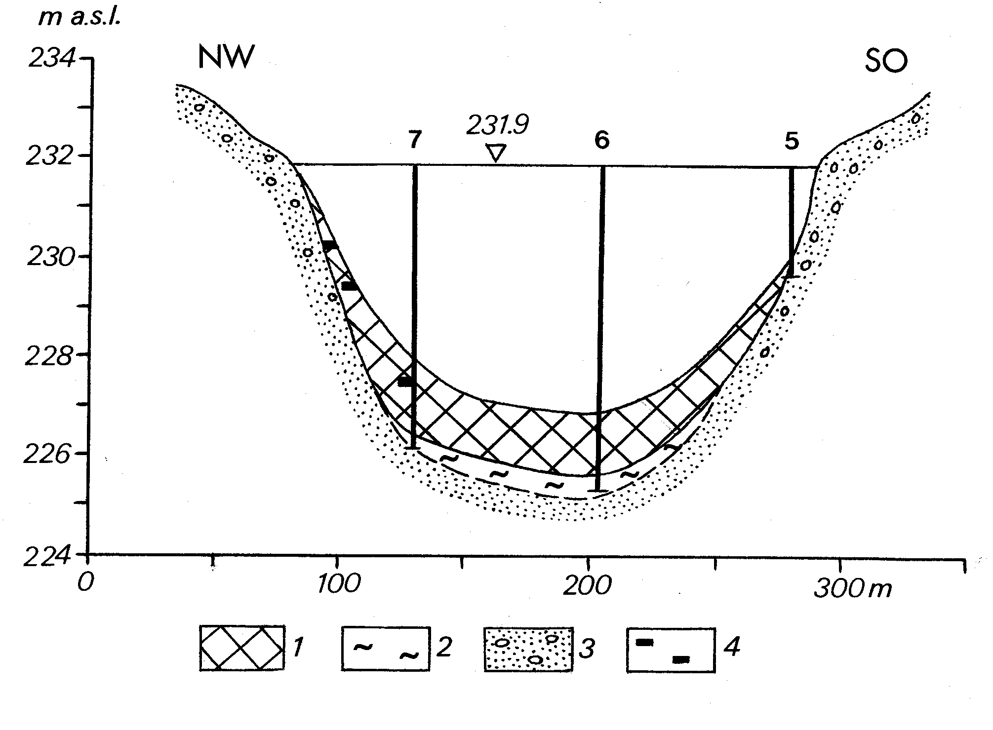
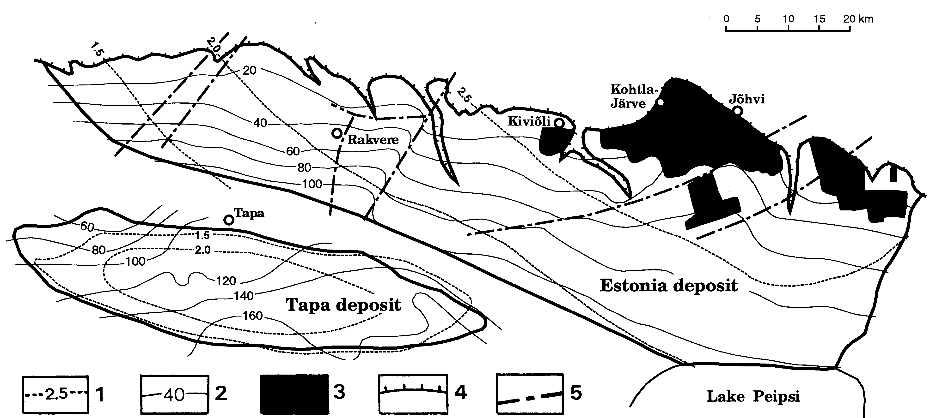
Fig. 117. Structure (thin lines) and topography (thick lines) of the bedrock of the Haanja Heights, southeastern Estonia. (Raukas et al. 1988). Contour interval 20 m. Small circles denote boreholes.
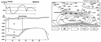
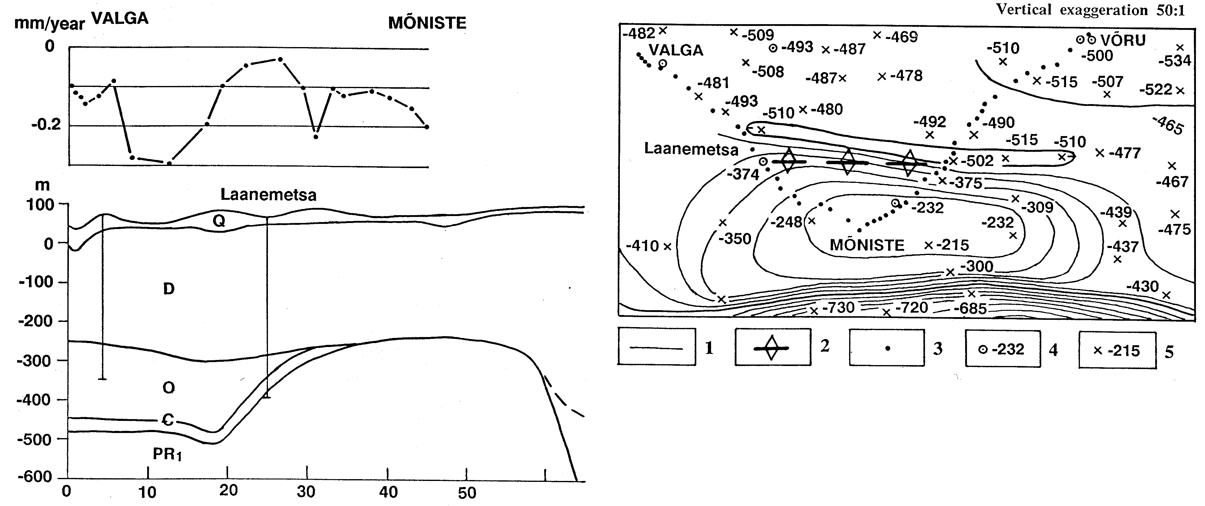
Fig. 118. Mõniste Uplift, southeastern Estonia; map and section (Sildvee & Vaher, 1995): 1 - contour on top of the Precambrian basement; 2 - axis of the recent uplift; 3 - repeated levelling set-up; 4,5 - height of the basement in metres above mean sea-level: in borehole (4), at depth point of refraction survey (5). Q - Quaternary, D - Devonian, O - Ordovician, C - Cambrian, PR1 - Palaeoproterozoic crystalline basement.
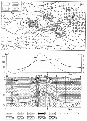
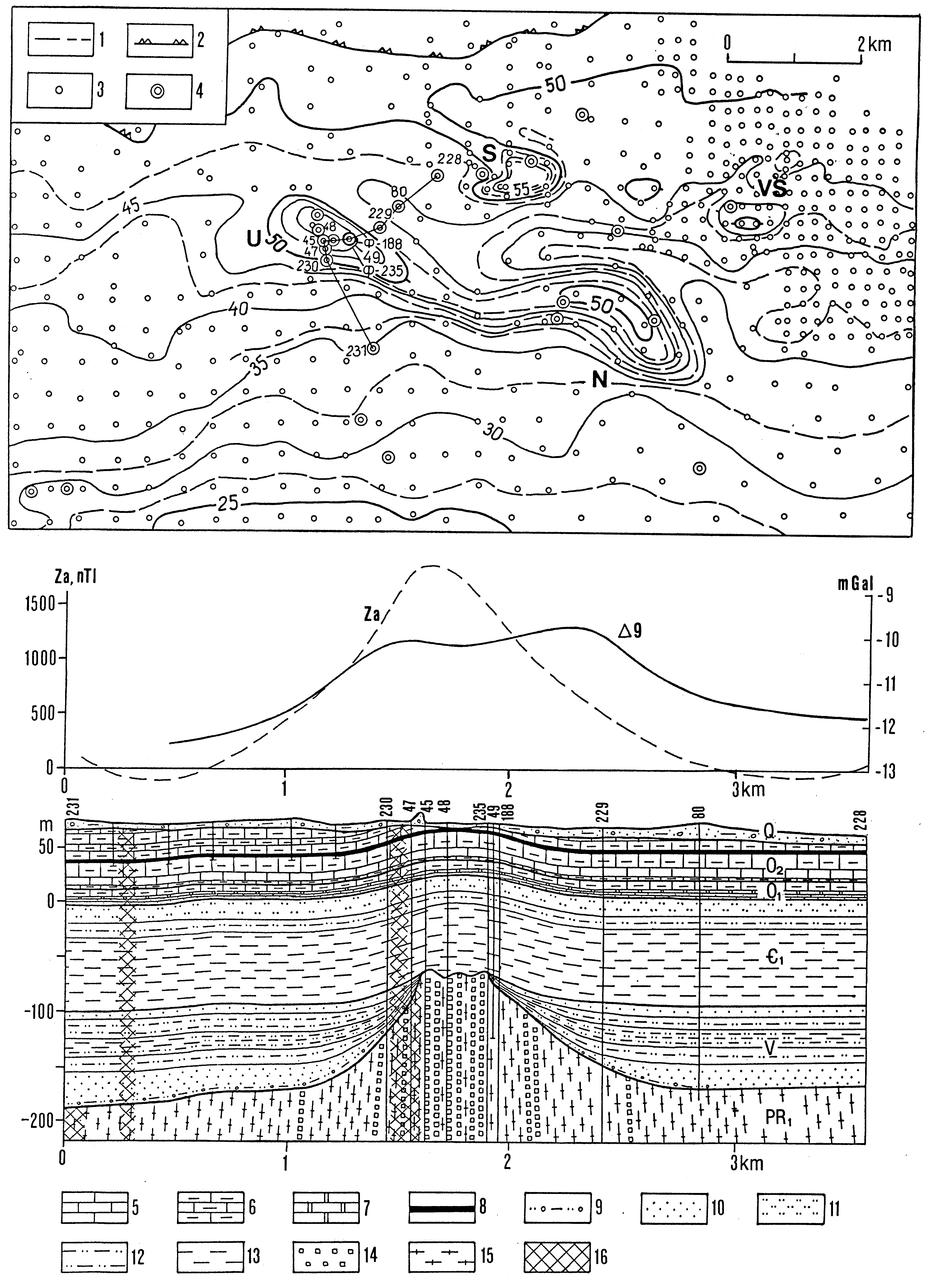
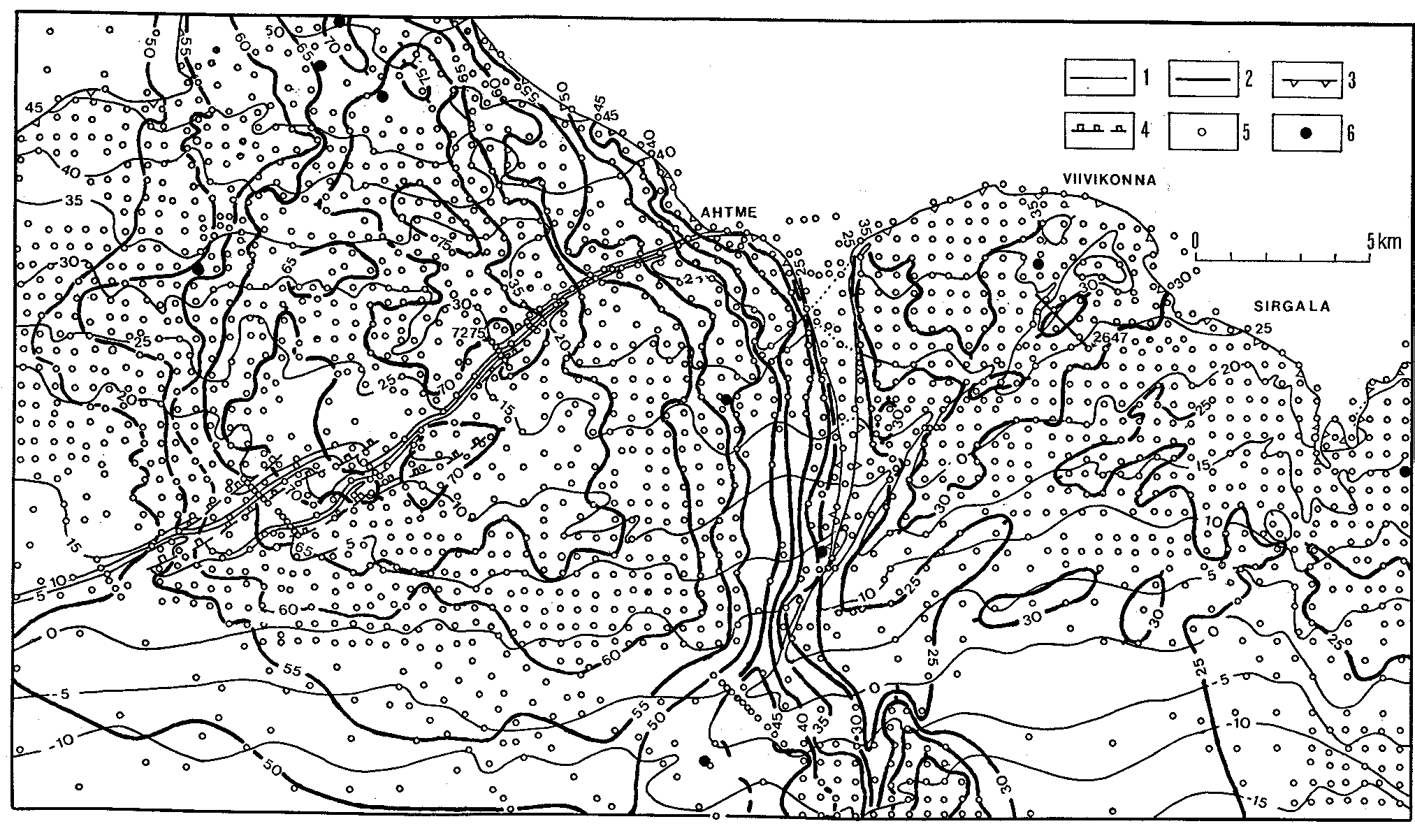
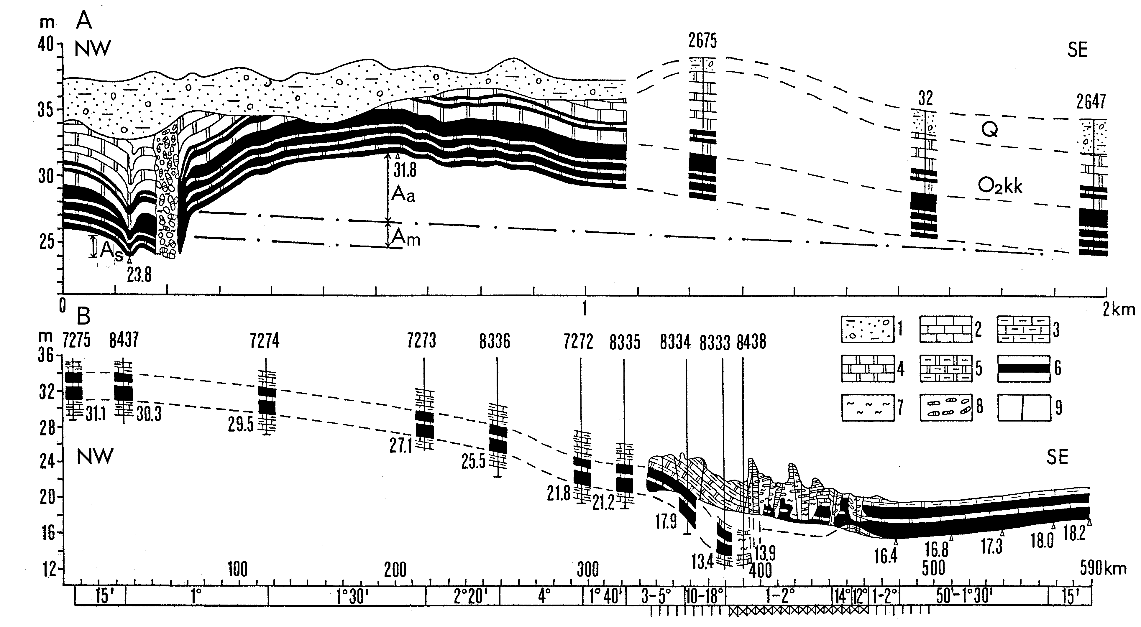
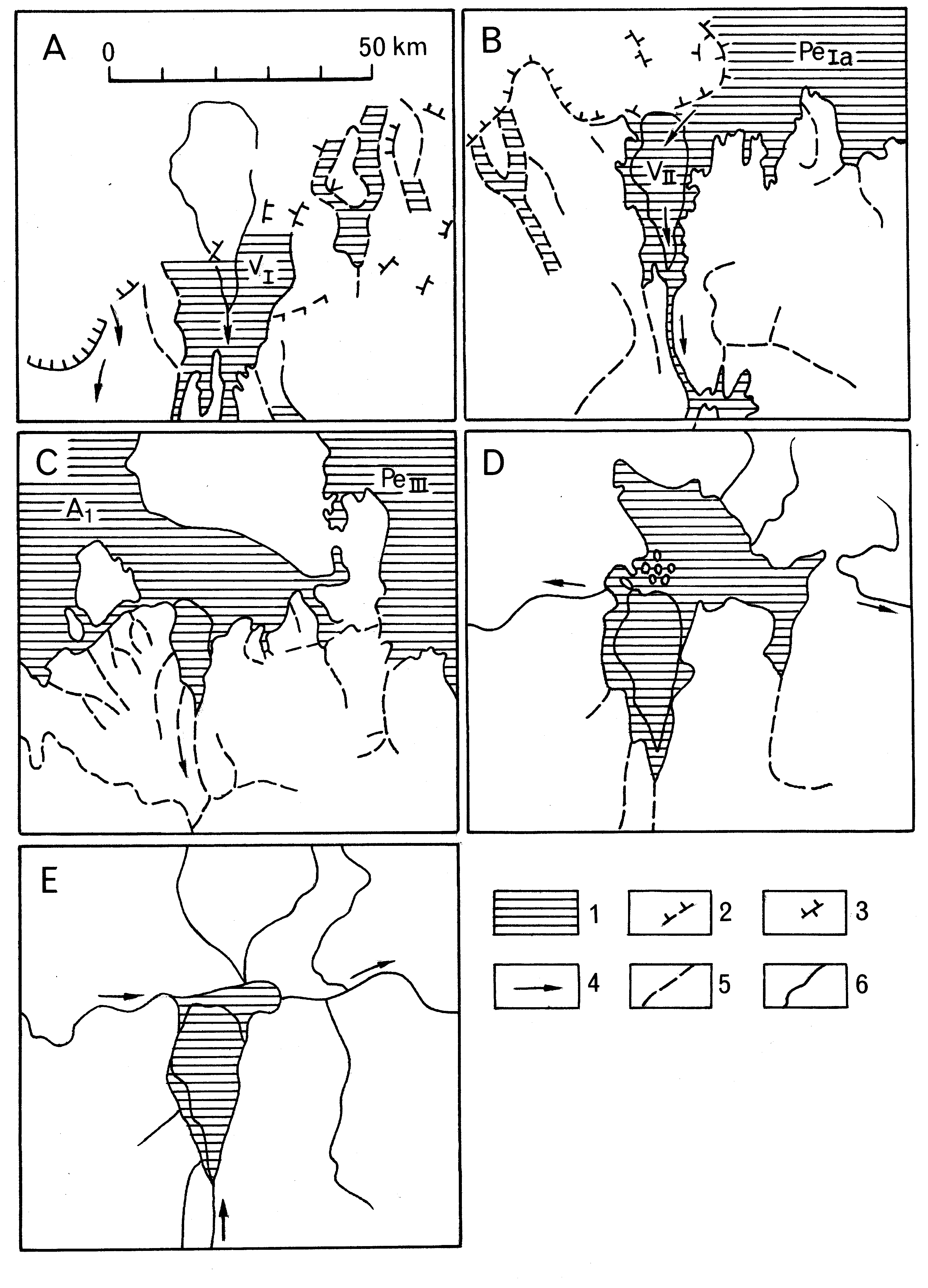
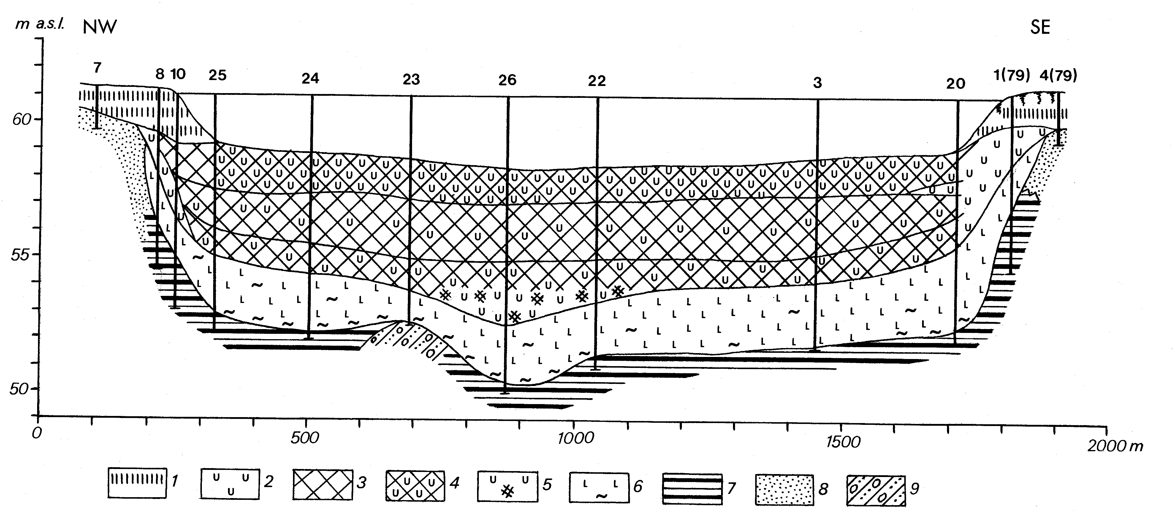
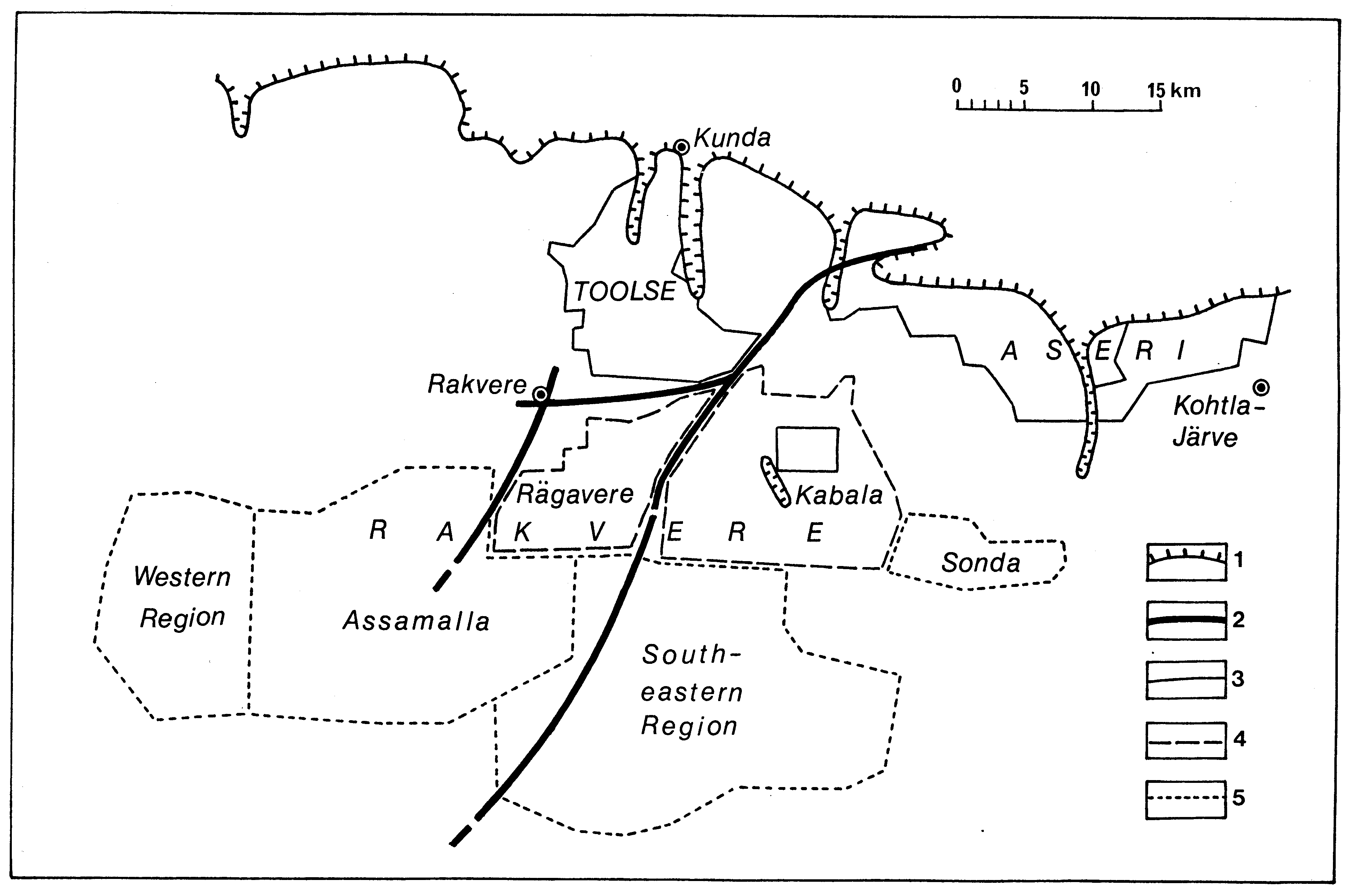
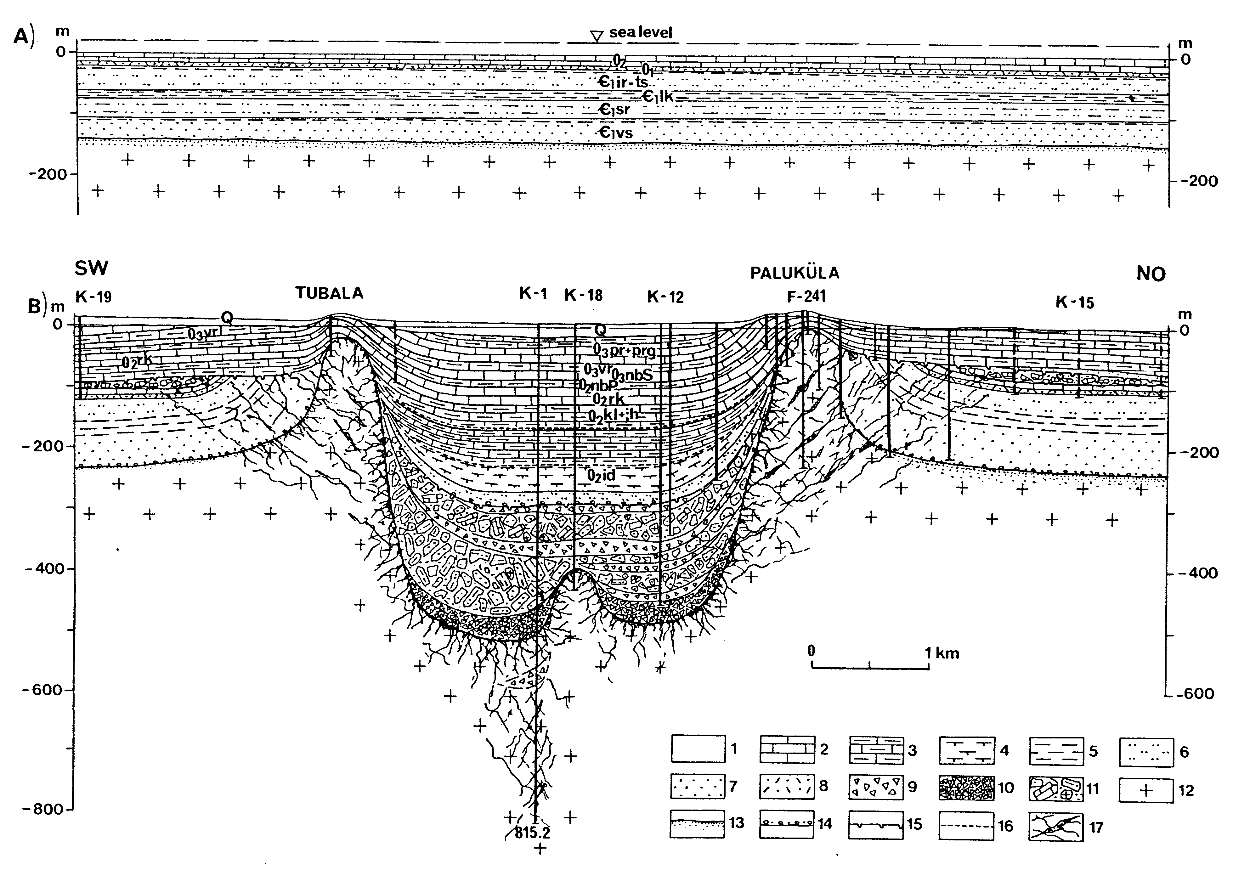
Fig. 119. Placanticlines of the Sonda-Uljaste area, northeastern Estonia; map (from Puura 1987) and section (from Vaher 1983): 1 - contour on bottom of the oil-shale seam; 2 - updip limit of the oil-shale seam; 3 - borehole finished in the sedimentary bedrock; 4 - borehole finished in the basement; 5 - limestone; 6 - argillaceous limestone; 7 - dolomite; 8 - oil-shale seam; 9 - mixtite; 10 - sandstone; 11 - siltstone; 12 - alternation of claystone, siltstone and sandstone; 13 - claystone; 14 - quartzite; 15 - gneiss; 16 - shatter zone. Placanticlines: N - Nüri, S - Sonda, U - Uljaste, VS - Vana-Sonda.
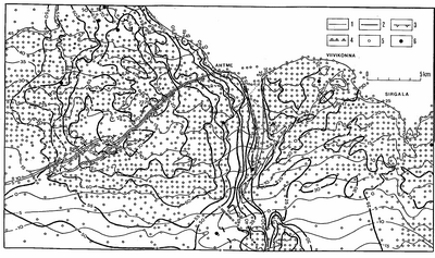
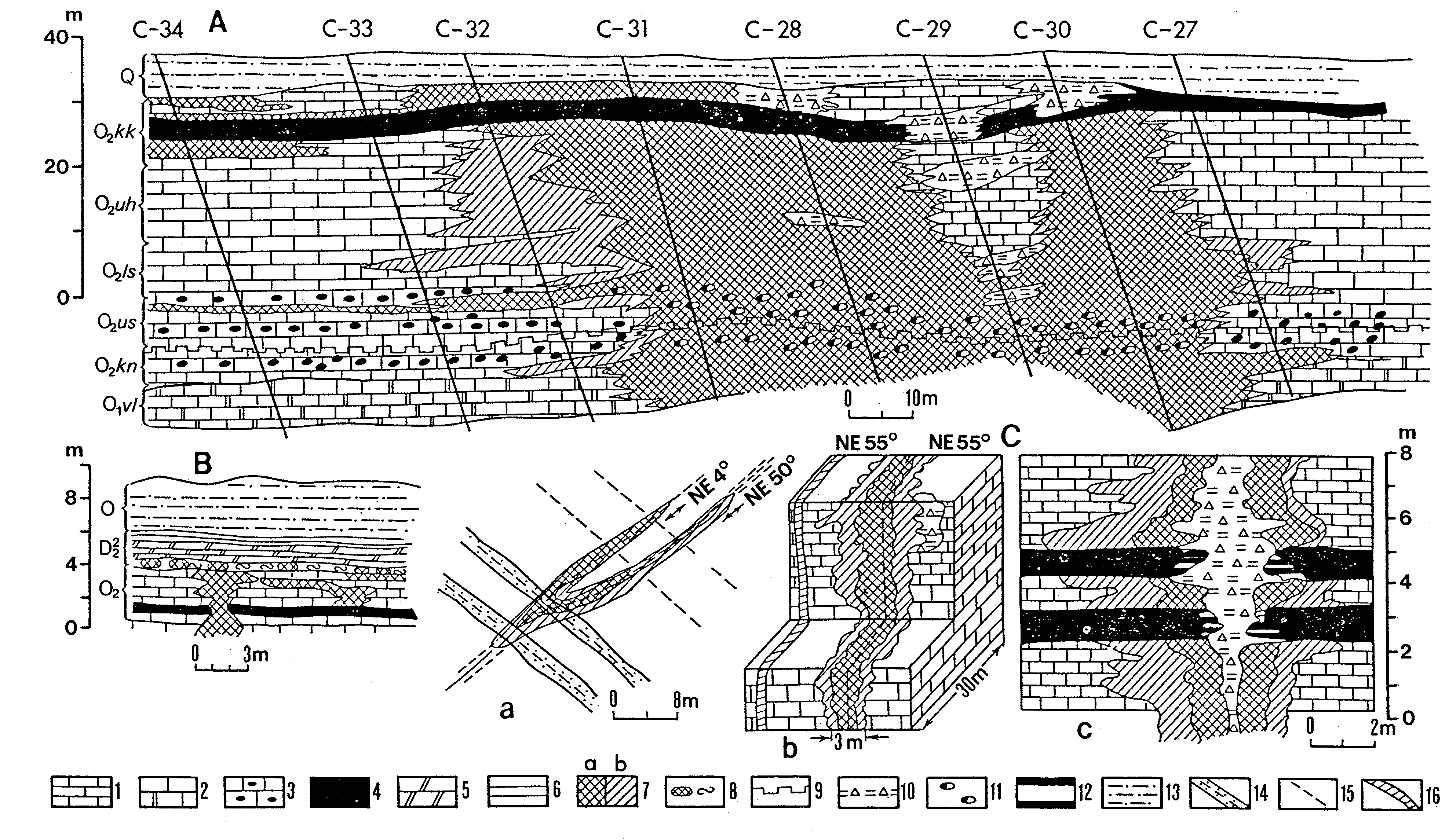
Fig. 120. Structure and topography of the sedimentary bedrock of the oil-shale mining area, northeastern Estonia. (After Vaher 1983, Raukas et al. 1988, Puura et al. 1987, Tuuling 1988a,b): 1 - contour on bottom of the oil-shale seam; 2 - contour on top of the bedrock; 3 - updip limit of the oil-shale seam; 4 fault; defined (solid), assumed (dashed); 5 - borehole finished in the sedimentary bedrock; 6 - borehole finished in the basement.
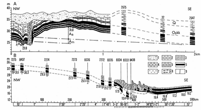
Fig. 121. Zones of disturbances: (A) Viivikonna (modified from Vaher 1983), (B) Ahtme (from Kattai & Vingisaar 1980): 1 - Quaternary deposits (Q); 2 - limestone; 3 - argillaceous limestone; 4 - dolomite; 5 - argillaceous dolomite; 6 - oil shale (kukersite); 7 - karstic clay; 8 - fragments of carbonate rocks; 9 - fracture. O2kk - Kukruse Stage. Components of the vertical displacement: Aa - anticlinal, Am - monoclinal, As - synclinal.
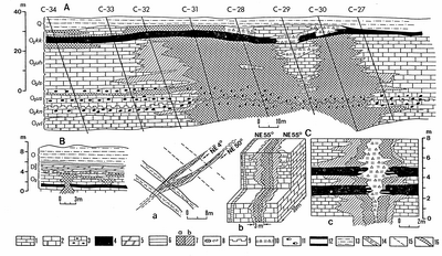
Fig. 122. Fracture zones (from Picugin et al. 1976): profile in the sector of Sirgala quarry (A); outcrops in Sirgala (B), Väo (C,a) and Aru quarries (C,b), and in Shaft No 2 of the Slantsy deposit (C,c): 1 - limestone; 2 - dolomitic limestone; 3 - limestone with ferruginous oolites; 4 - oil-shale seam; 5 - dolomitic marl; 6 - claystone; 7 - sectors of development of metasomatic dolomitization: intensive (a), weak (b); 8 - eluvium of metasomatic dolomite; 9 - erosion surfaces during sedimentation; 10 - karst fillings (clay and fragments of carbonate rocks); 11- decomposed ferruginous oolites; 12 - oxidized kukersite; 13 - Quaternary deposits; 14 - zones of intense ferruginization; 15 - tectonic joint; 16 - calcite vein.
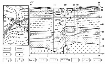
Fig. 123. Aseri Zone of disturbances, northeastern Estonia; map and section (modified from Vaher 1983): 1 - contour on bottom of Lower Ordovician carbonate rocks; 2 - updip limit of Lower Ordovician carbonate rocks; 3 - borehole finished in the sedimentary bedrock; 4 - borehole finished in the basement; 5 - limestone; 6 - dolomite; 7 - mixtite; 8 - sandstone; 9 - siltstone; 10 - alternation of claystone, siltstone and sandstone; 11 - claystone; 12 - gneiss; 13 - gabbro. Q - Quaternary, O - Ordovician, C - Cambrian, V - Vendian, PR1 - Palaeoproterozoic basement.

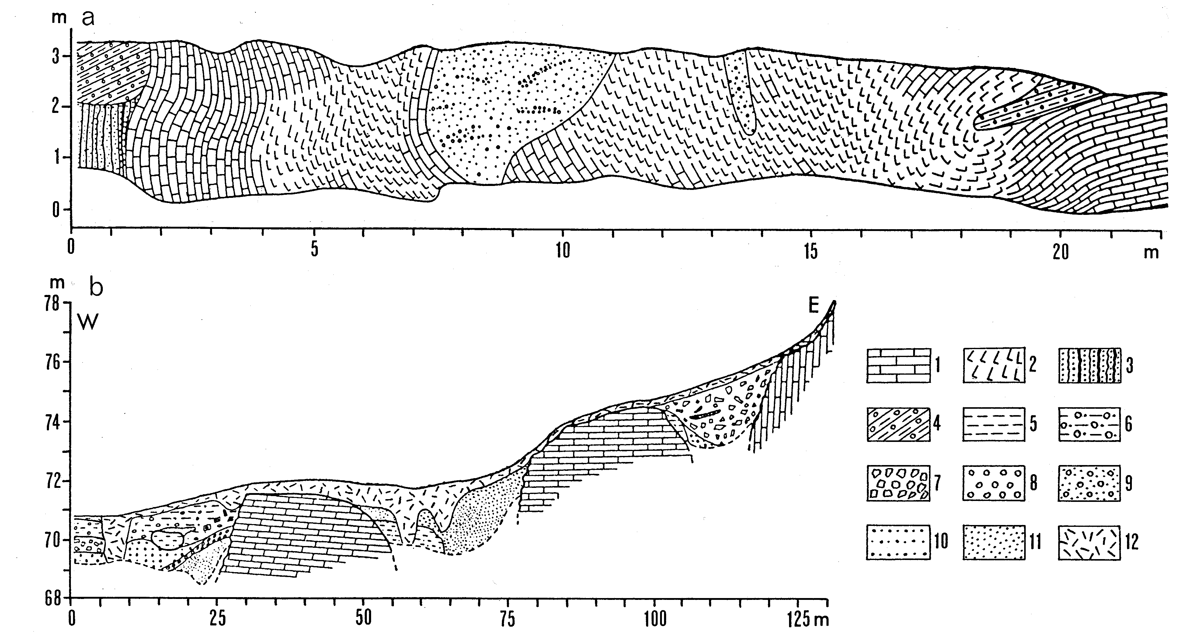
Fig. 124. Glaciotectonic structures at Vaivara, northeastern Estonia (from Miidel et al. 1969): Tornimägi Hill (a) and Pargimägi Hill (b): 1 - limestone; 2 - shattered limestone; 3 - sandstone with argillite beds; 4 - till; 5 - green clayey till; 6 - brown sandy till; 7 - grey carbonaceous till; 8 - pebbles; 9 - glaciofluvial gravel and pebbles; 10 - sandy gravel; 11 - cross-bedded sand; 12 - soil.
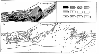
Fig. 125. Clay diapirs, northeastern Estonia; resistivity (a) and structure (b) maps (from Vaher & Mardla 1969): 1-5 resistivity in ohm m: <50 (1), 50-100 (2), 100-200 (3), 200-400 (4), >400 (5); 6-8 contour on top of the Pakerort Stage; 9 - klint; 10 - borehole finished in the sedimentary bedrock; 11 - borehole finished in the basement.

Fig. 126. Clay diapirs, northeastern Estonia; resistivity curve and cross section (from Vaher & Mardla 1969): 1 - Quaternary deposits (Q); 2 - limestone; 3 - argillaceous limestone; 4 - dolomite; 5 - argillite; 6 - sandstone. O1-2 - Lower and Middle Ordovician. ?a - apparent resistivity. Schlumberger array: C1, C2 - current electrodes; P1, P2 - potential electrodes; distance between electrodes in metres.
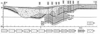
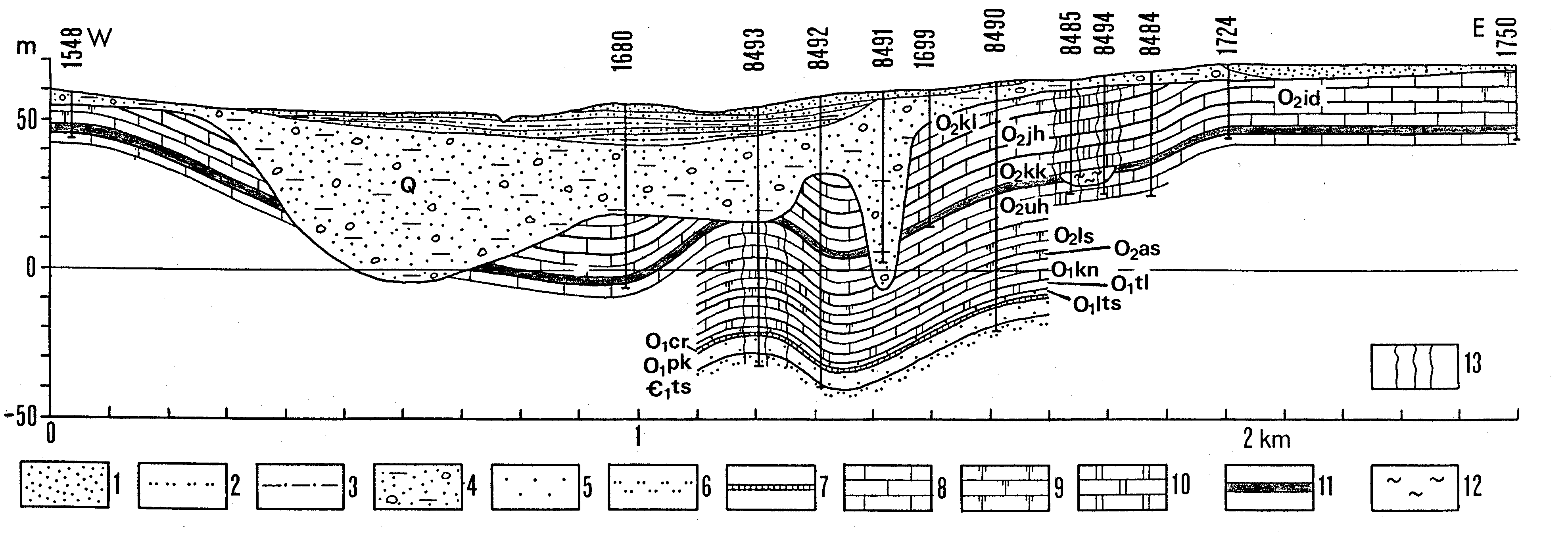
Fig. 127. Sämi Basin, northeastern Estonia (from Vaher 1983): 1 - sand; 2 - sandy loam; 3 - loam; 4 - till; 5 - sandstone; 6 - siltstone; 7- argillite; 8 - limestone; 9 - dolomitic limestone; 10 - dolomite; 11 - oil-shale seam; 12 - karstic clay; 13 - fracture zone. O2kl - Keila Stage, O2jh - Jõhvi Substage, O2id - Idavere Substage, O2kk - Kukruse Stage, O2uh - Uhaku Stage, O2ls - Lasnamägi Stage, O2as - Aseri Stage, O1kn - Kunda Stage, O1tl - Toila Formation, O1lt - Leetse Formation, O1pk - Pakerort Stage, C1ts - Tiskre Formation.
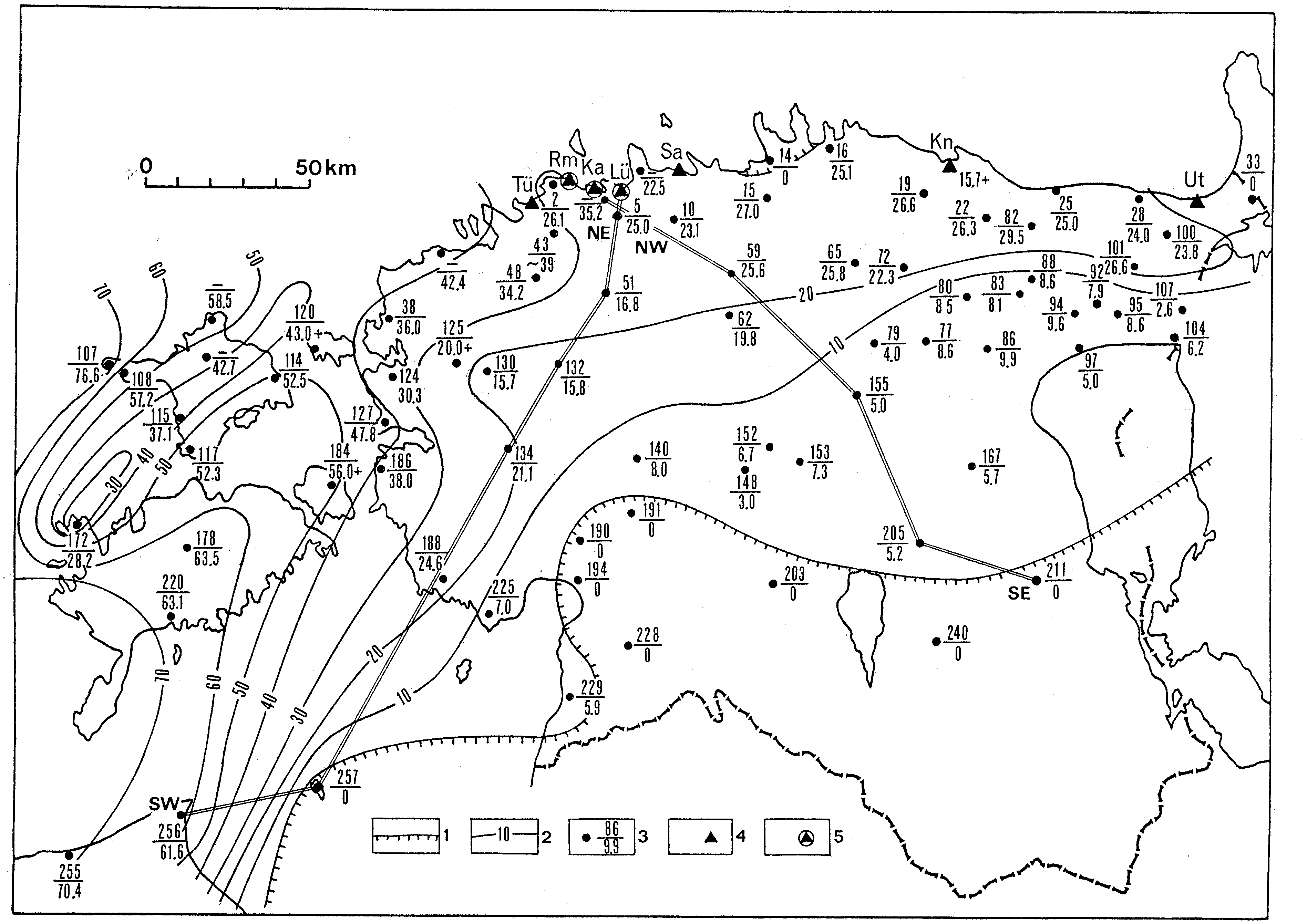
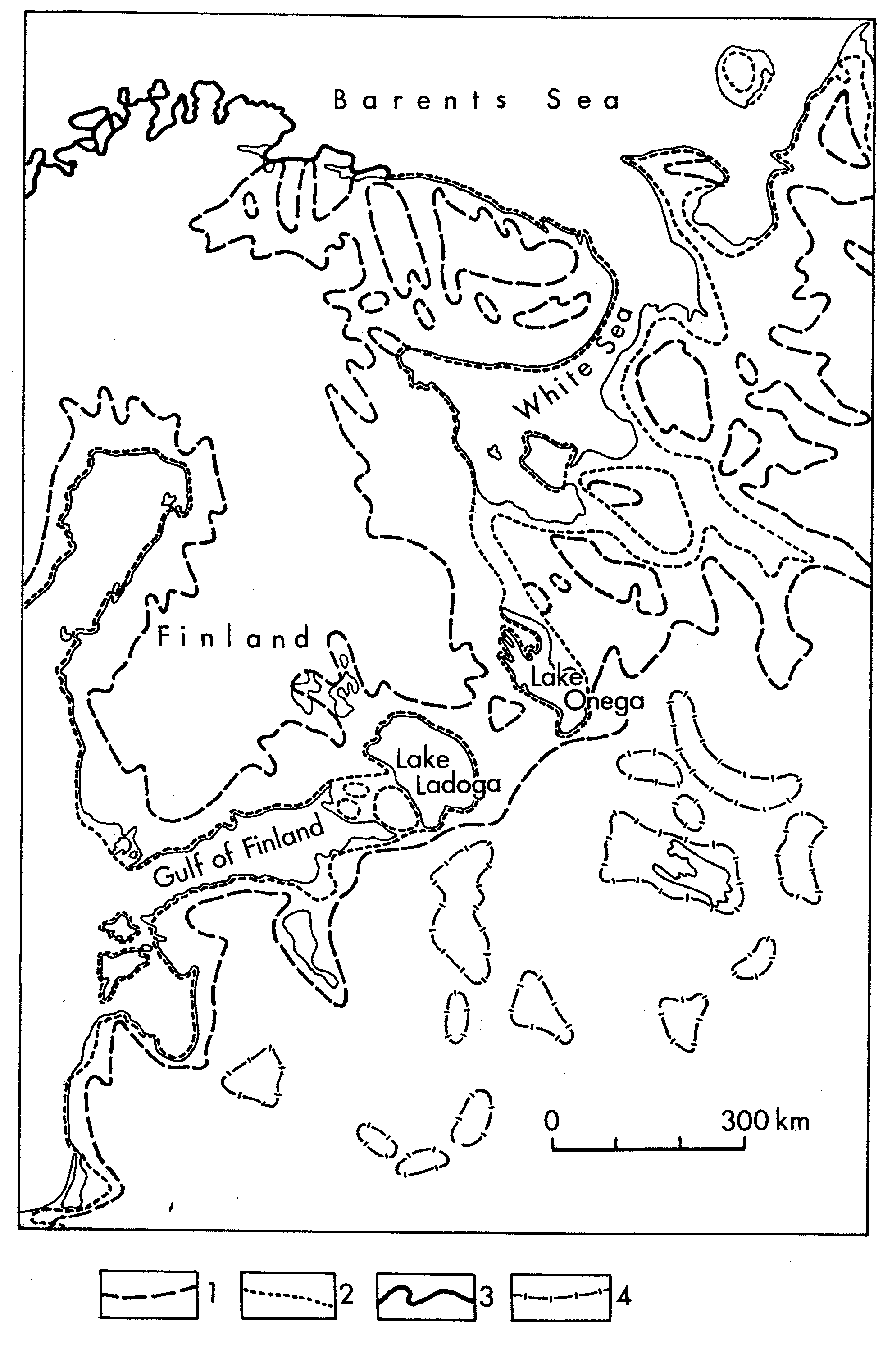
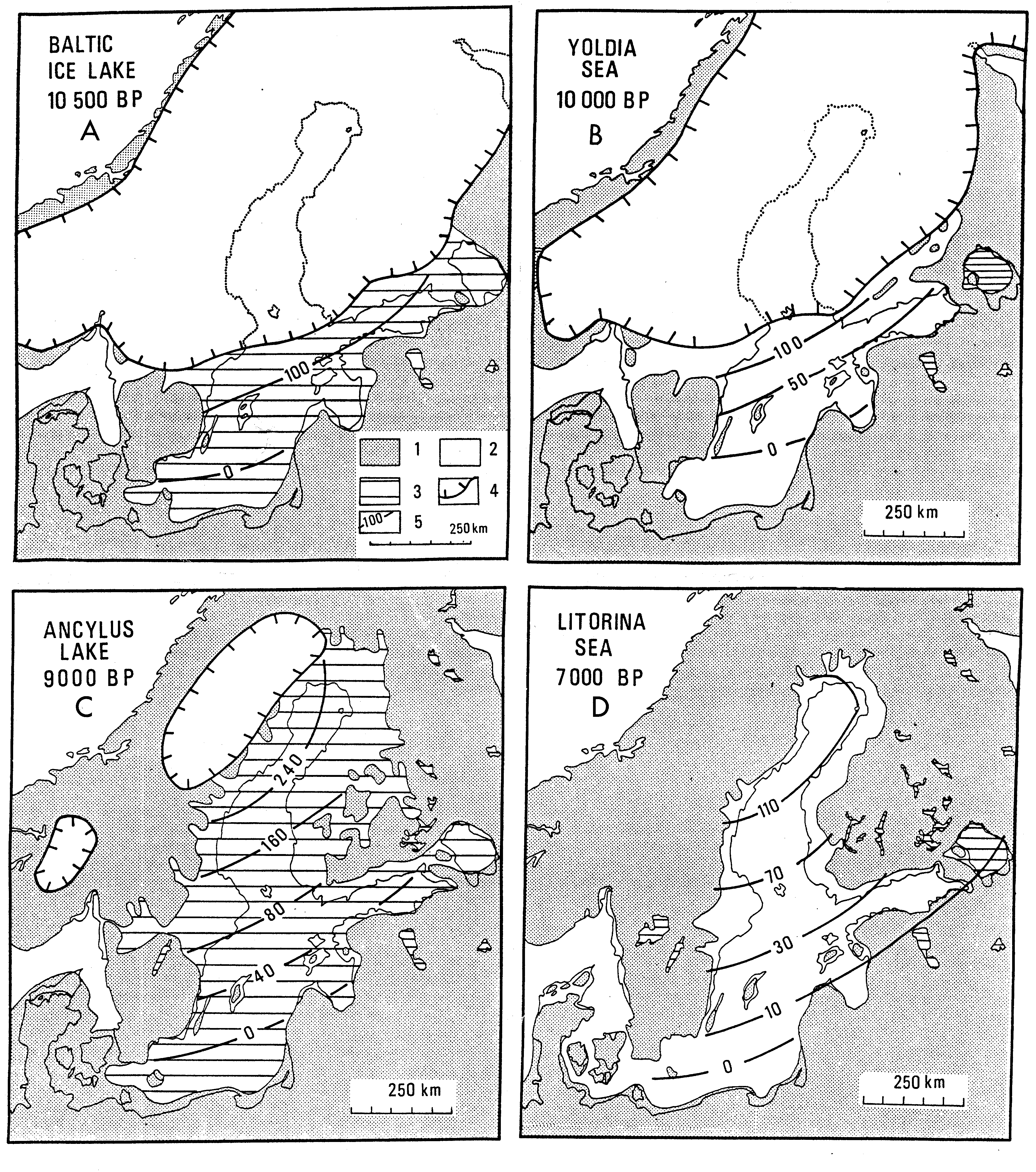
Fig. 128. Distance diagram of raised Late-glacial and Holocene shorelines of the Baltic Sea in Estonia (after Kessel & Raukas 1979): 1 - glaciofluvial delta; 2 - coastal landforms (beach ridges, bluffs and cliffs, bars, boulder fields a.o.); 3 - buried organic deposits; 4 - lagoons; 5 - Ancylus malacofauna; 6 - Litorina malacofauna; 7 - Limnea malacofauna; 8 - finds of Mya arenaria; 9 - margin of the glacier.
Fig. 129. Gradient/time curve of raised shorelines of the Baltic Sea (after Kessel & Miidel 1973, with supplements).
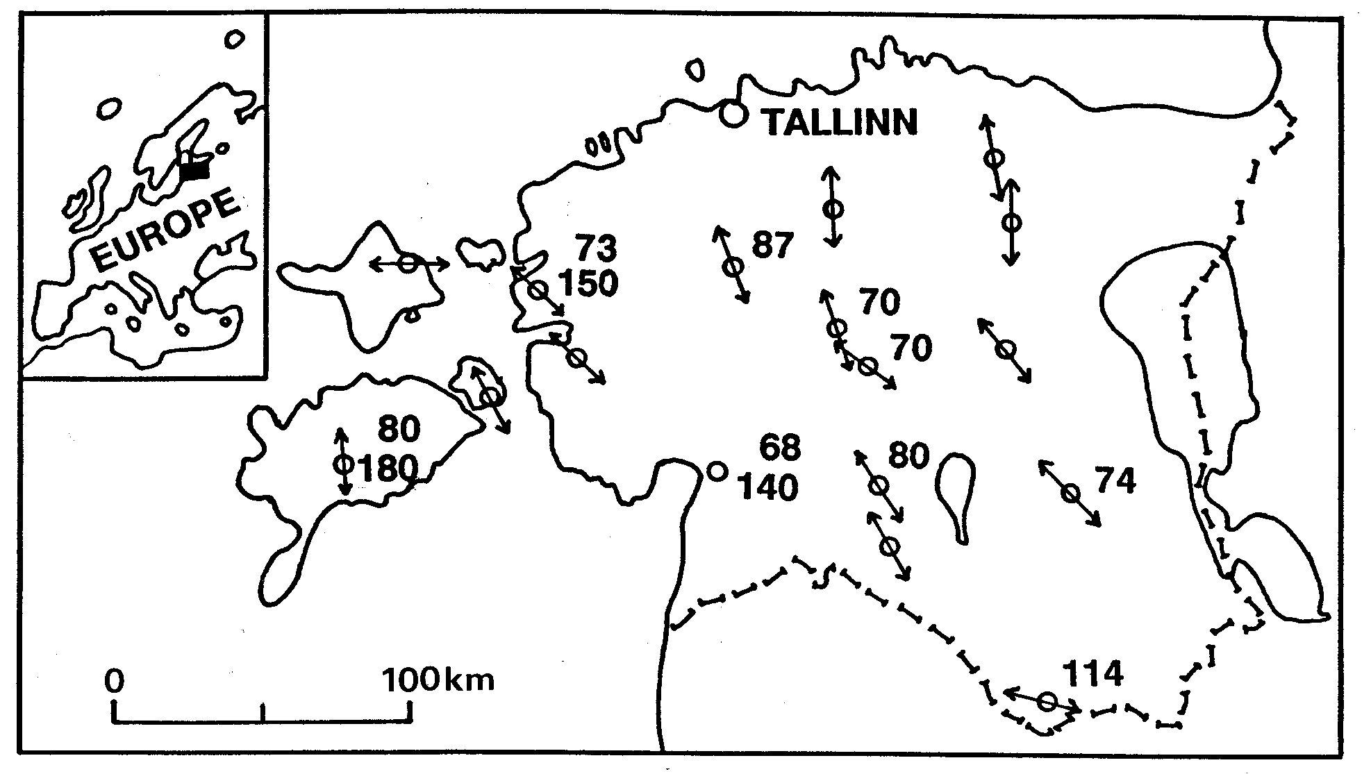
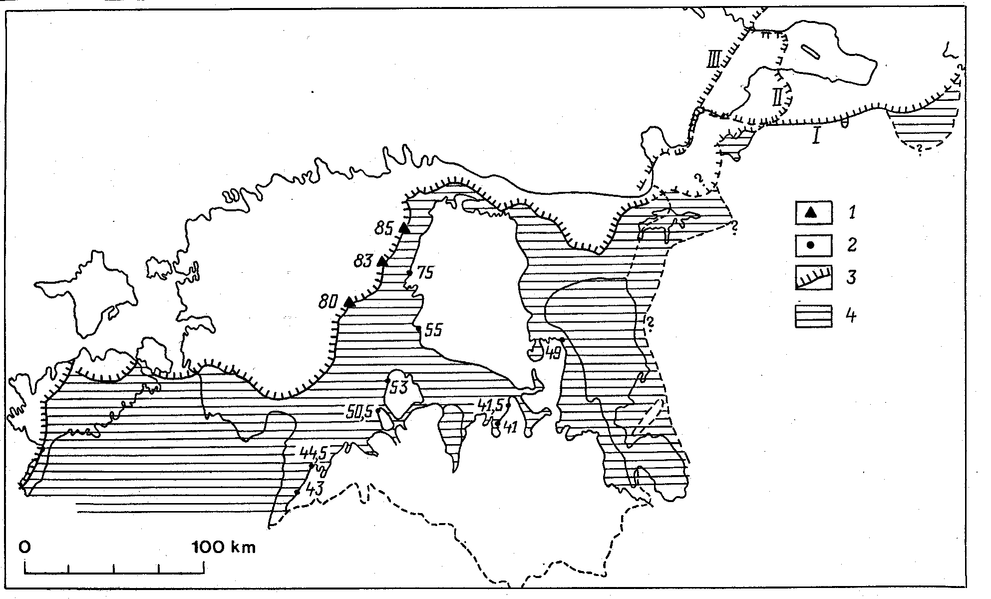
Fig. 130. Scheme of isobases and planes of annual velocities of recent vertical movements in Estonia (after Vallner et al. 1988): 1 - levelling netvork; 2 - isobases; 3 - boundaries of planes of annual velocities of recent vertical movements; 4 - local area of subsidence.
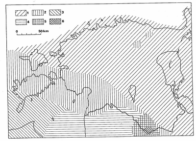
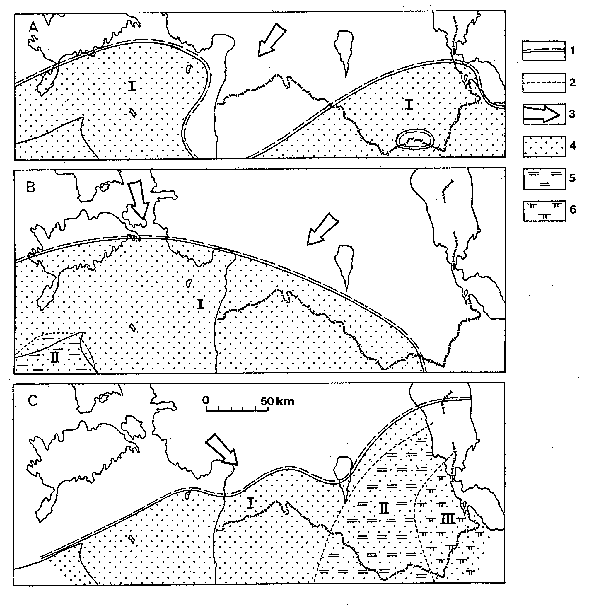
Fig. 131. Distribution pattern of basal deposits of the sedimentary cover in Estonia: 1 - Valdai; 2 - Baltic; 3 - Liivi; 4 - Aisciai; 5 - Middle Cambrian; 6 - Devonian.
Fig. 132. Distribution of Vendian and Cambrian rocks and hiata along the Närke (central Sweden) - Kostov (Leningrad Region) transect and their relationship with biozones: 1 - conglomerate, gritstone; 2 - sandstone; 3 - argillaceous rock; 4 - black shale (Alum Shale). White areas indicate hiata.
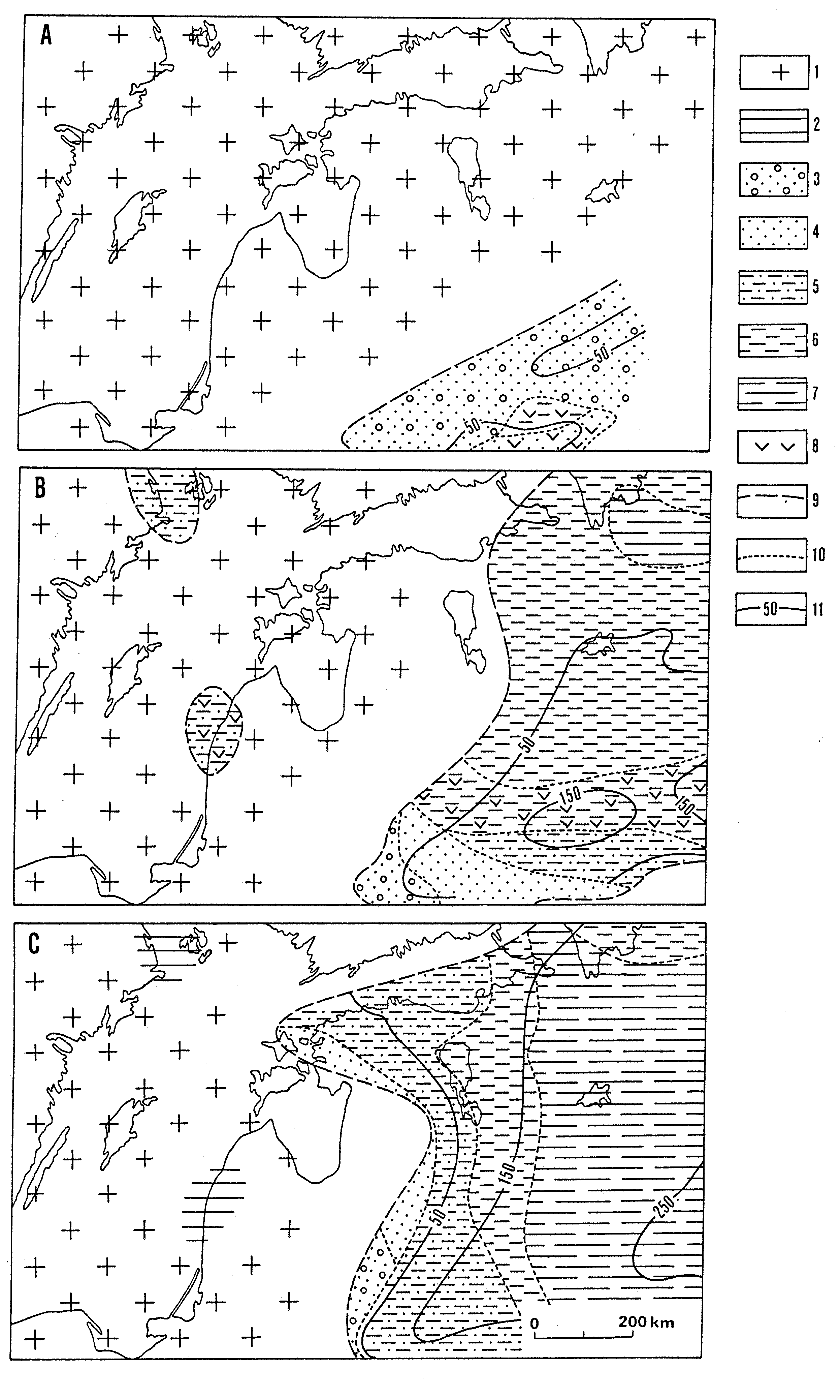
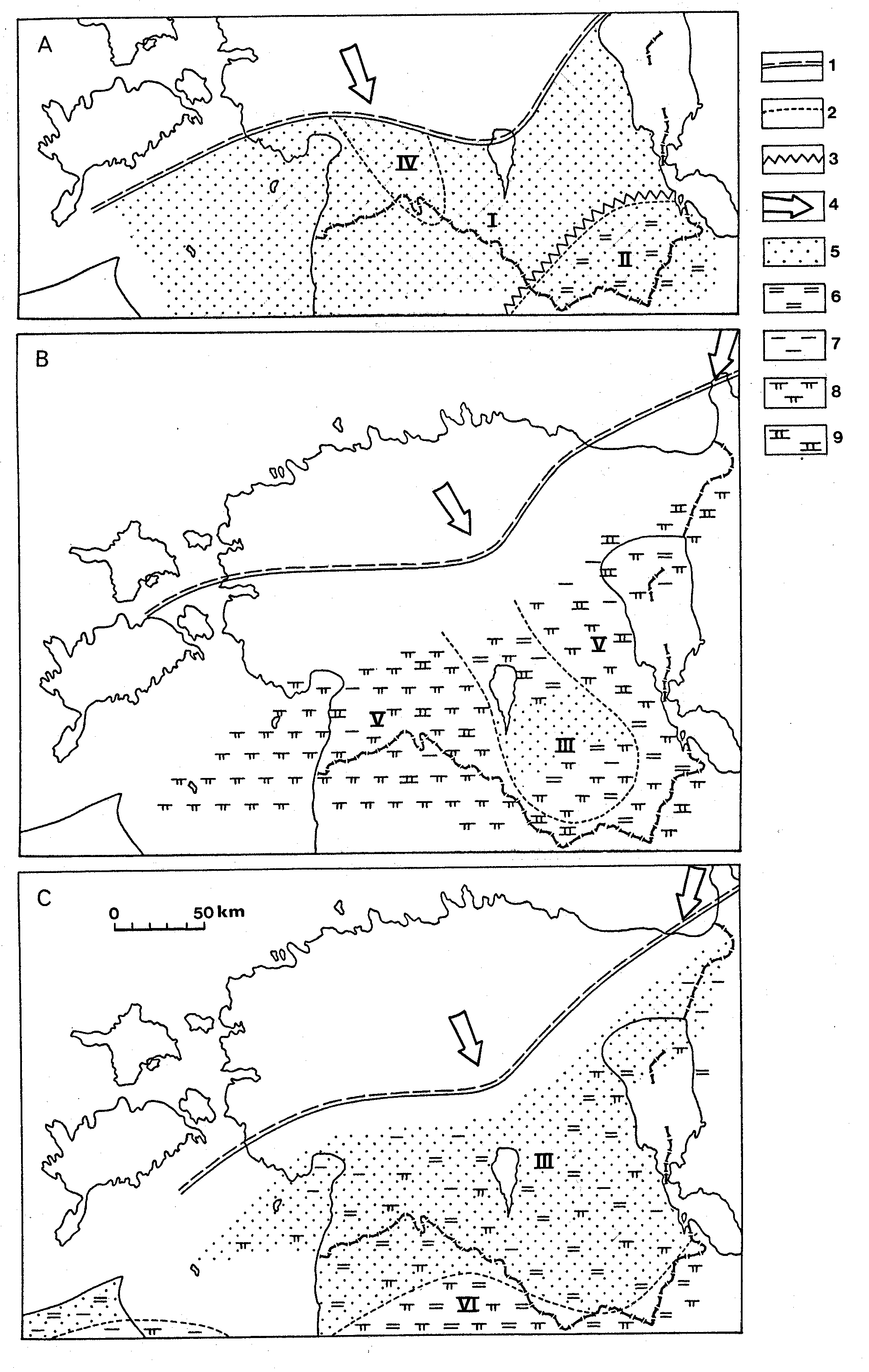
Fig. 133. Sketch-map summarizing the palaeoenvironmental development of Estonia and surrounding areas: A - during Drevljan Age; B - during Redkino Age; C - during Kotlin Age. The reconstruction of the adjacent territory is modified from Rozanov & Lydka (1987): 1 - land, represented by igneous and metamorphic rocks; 2 - land, covered with sedimentary rocks; 3 - area of dominating coarse-grained sediments; 4 - area of sandstones; 5 - area of alternating sandy and clayey sediments; 6 - area of 50-75% argillaceous rocks; 7 - area of >75% argillaceous rocks; 8 - volcanic admixtures; 9 - boundary of the present-day distribution of sediments; 10 - boundary of facies belts; 11 - isopachs.
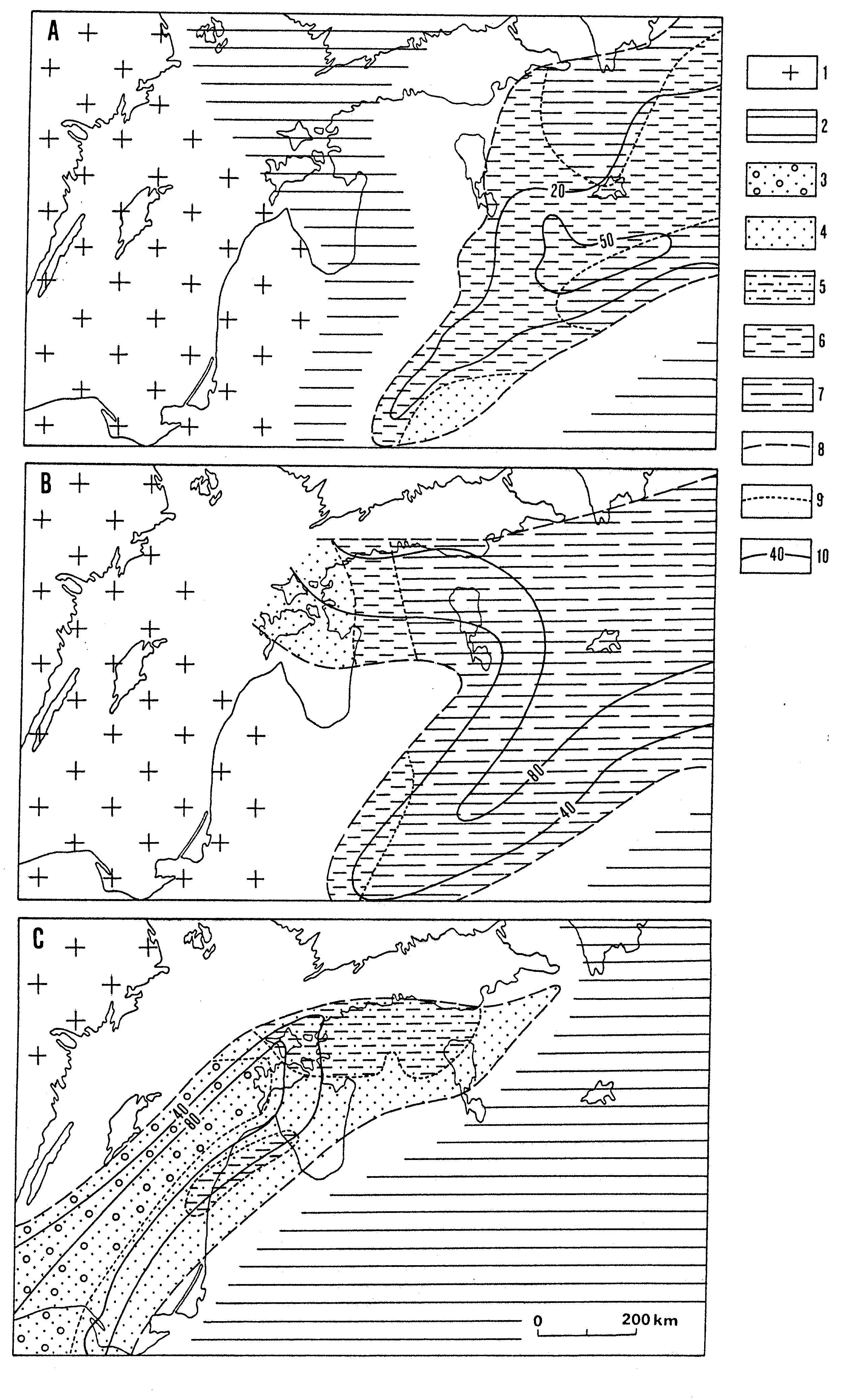
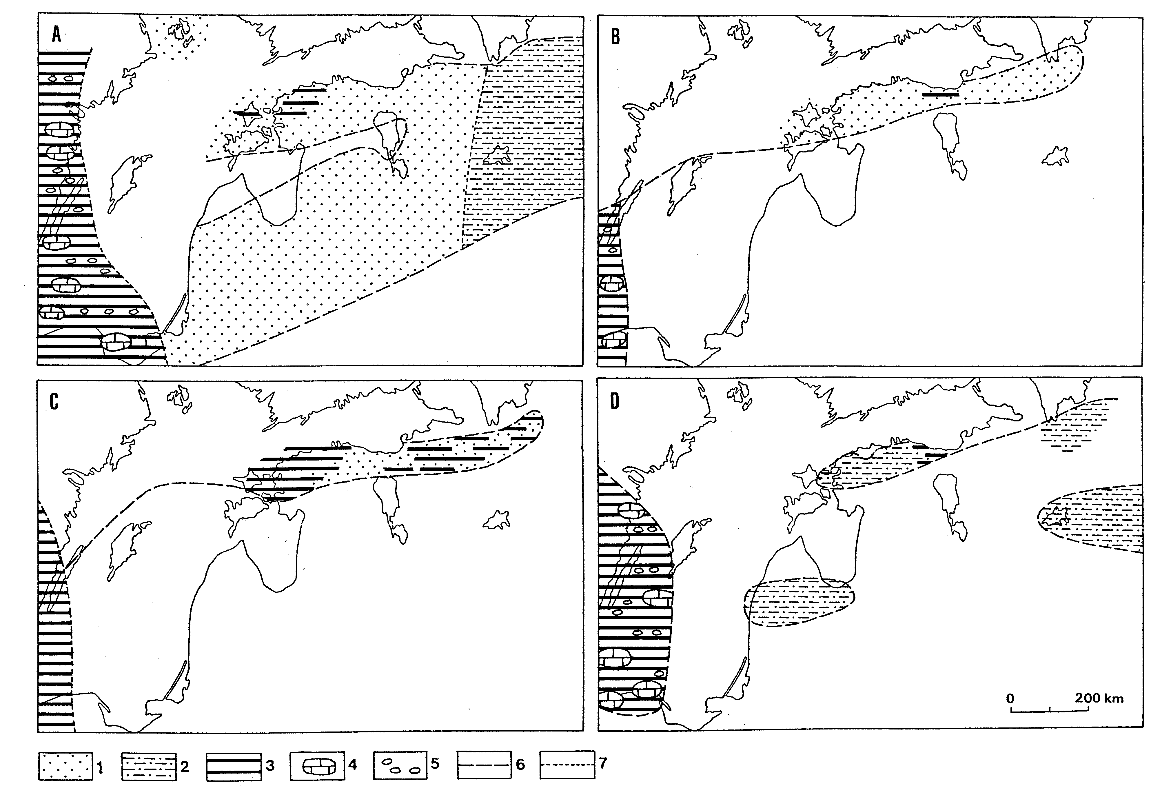
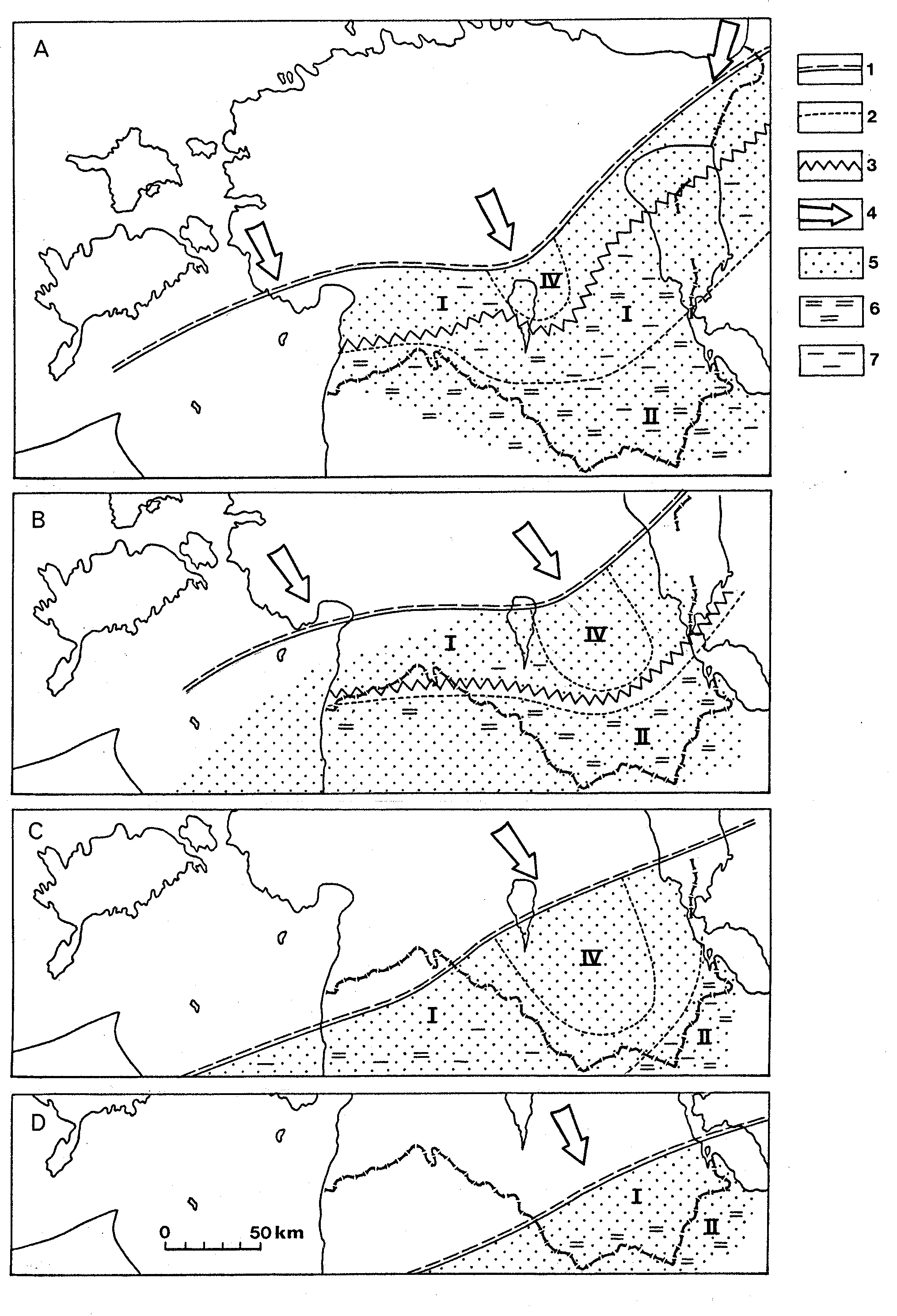
Fig. 134. Sketch-map summarizing the palaeoenvironmental development of Estonia and surrounding areas during: A - Rovno Age; B - Lontova Age; C - Dominopol Age. The reconstruction of the adjacent territory is modified from Rozanov & Lydka (1987): 1 - land, represented by igneous and metamorphic rocks; 2 - land, covered with sedimentary rocks; 3 - area of dominating sandy sediments with gravel admixture on several levels; 4 - area of sandstones; 5 - area of alternating sandy and clayey sediments; 6 - area of 50-75% argillaceous rocks; 7 - area of >75% argillaceous rocks; 8 - boundary of the present-day distribution of sediments; 9 - boundary of facies belts; 10 - isopachs.
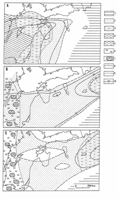
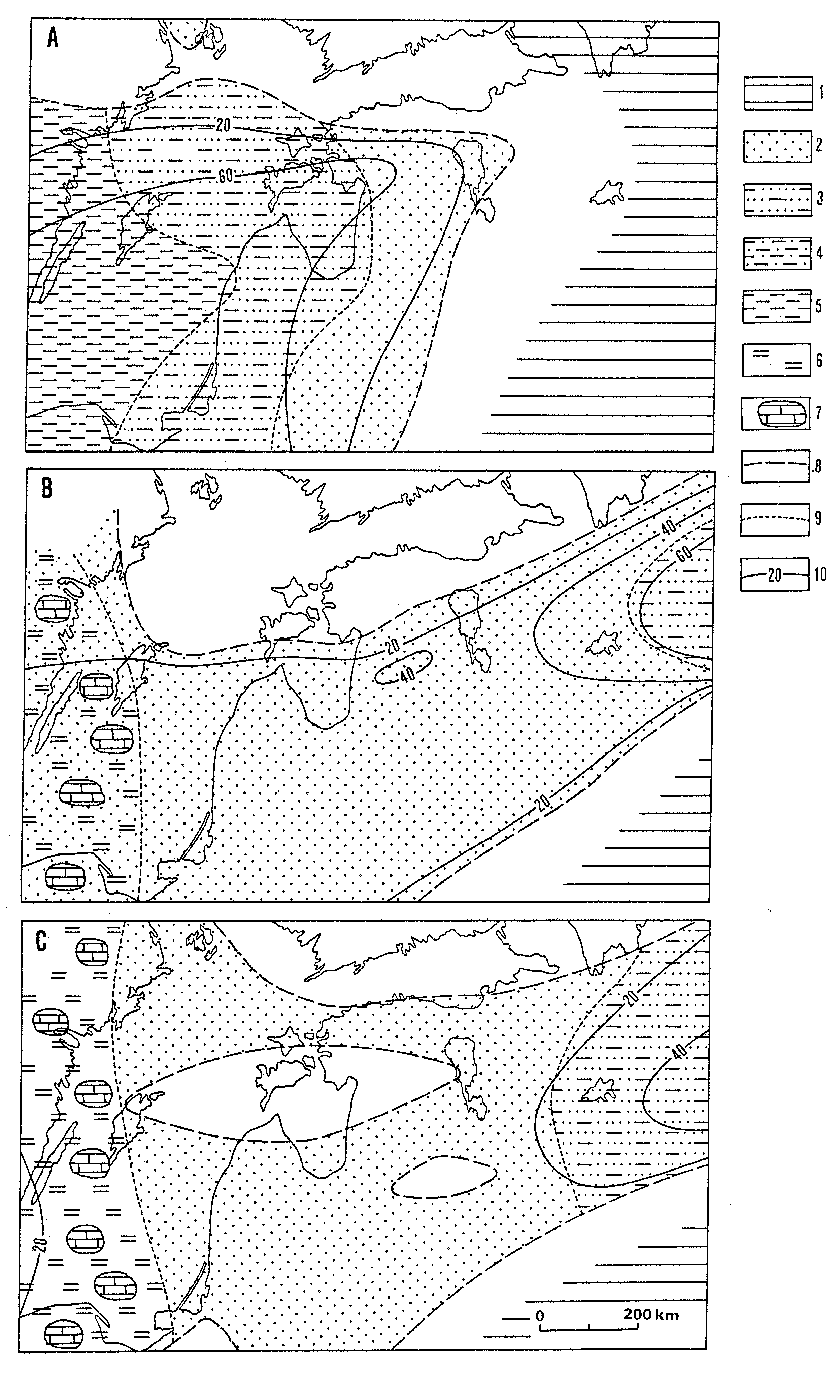
Fig. 135. Sketch-map summarizing the palaeoenvironmental development of Estonia and surrounding areas during: A - Ljuboml-Vergale time; B - Middle Cambrian; C - early Late Cambrian. The reconstruction of the adjacent territory in Fig. 135A is modified from Rozanov & Lydka (1987): 1 - land covered with sedimentary rocks; 2 - area of sandy sediments; 3 - area of sandy sediments with few clayey interlayers; 4 - area of alternating sandy and clayey sediments; 5 - area of clayey sediments with few sandy interlayers; 6 - area of organic rich muds (Alum Shale facies); 7 - lenses of limestone; 8 - boundary of the present-day distribution of sediments; 9 - boundary of facies belts; 10 - isopachs.
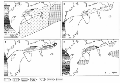
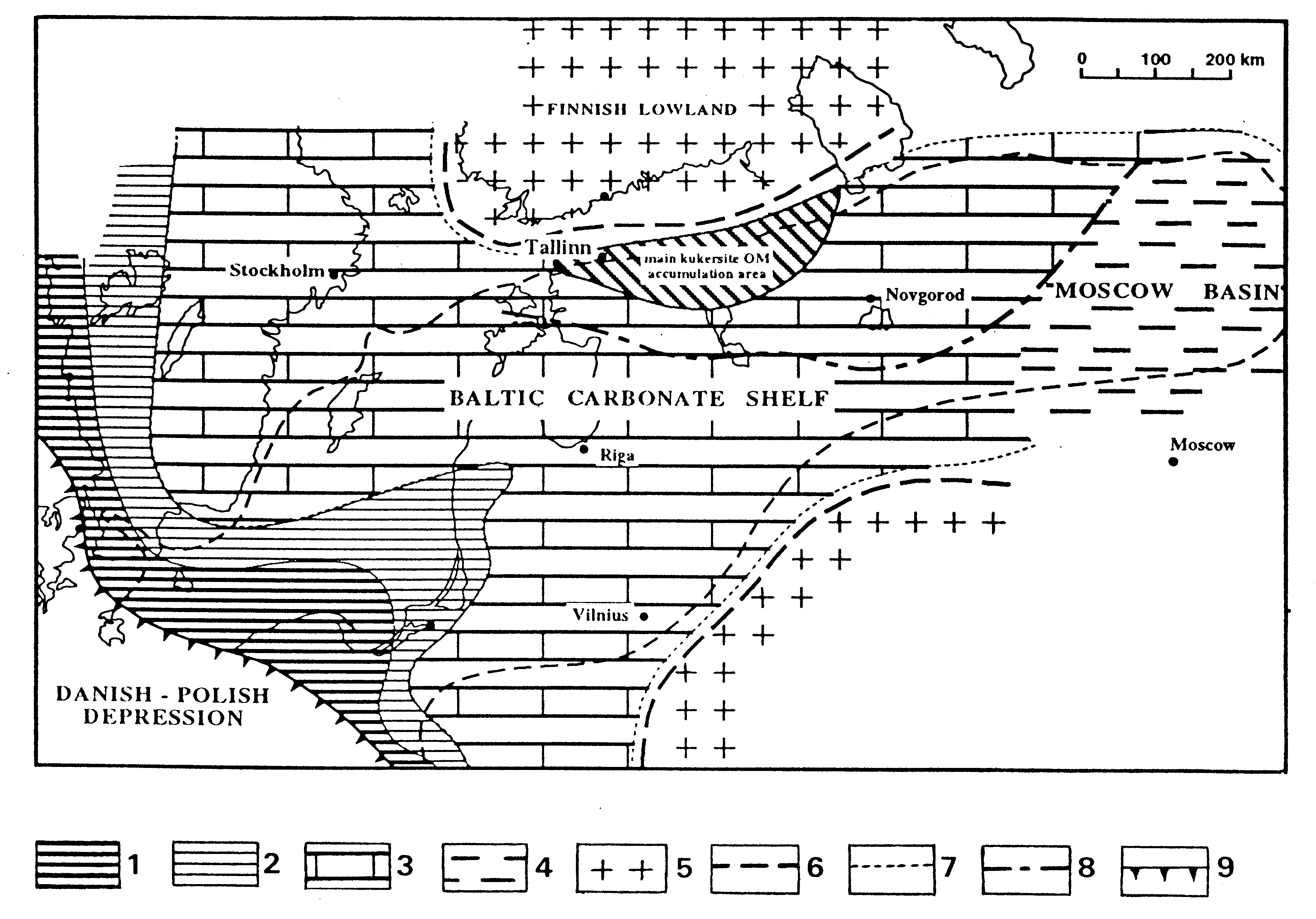
Fig. 136. Sketch-maps summarising the palaeoenvironmental development of Estonia and surrounding areas during the latest Late Cambrian and Tremadoc: A - the latest phase of the Late Cambrian; B - the beginning of the Early Tremadoc; C - Middle Tremadoc; D - Late Tremadoc: 1 - area of sandy sediments; 2 - area of alternating sandy and clayey sediments; 3 - areas of organic-rich muds (Alum Shale facies); 4 - lenses of limestone; 5 - lenses and/or interlayers of conglomerate; 6 - boundary of the present-day distribution of rocks; 7 - boundary of facies belts.
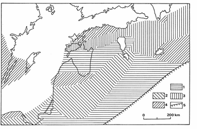
Fig. 137. Sketch-map of the pre-Arenig bedrock in Estonia and surrounding areas. Rocks of: 1 - Middle Cambrian; 2 - Upper Cambrian; 3 - Lower Tremadoc; 4 - Upper Tremadoc; 5 - boundary of the present-day distribution of the Upper Cambrian - Tremadoc rocks.
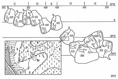
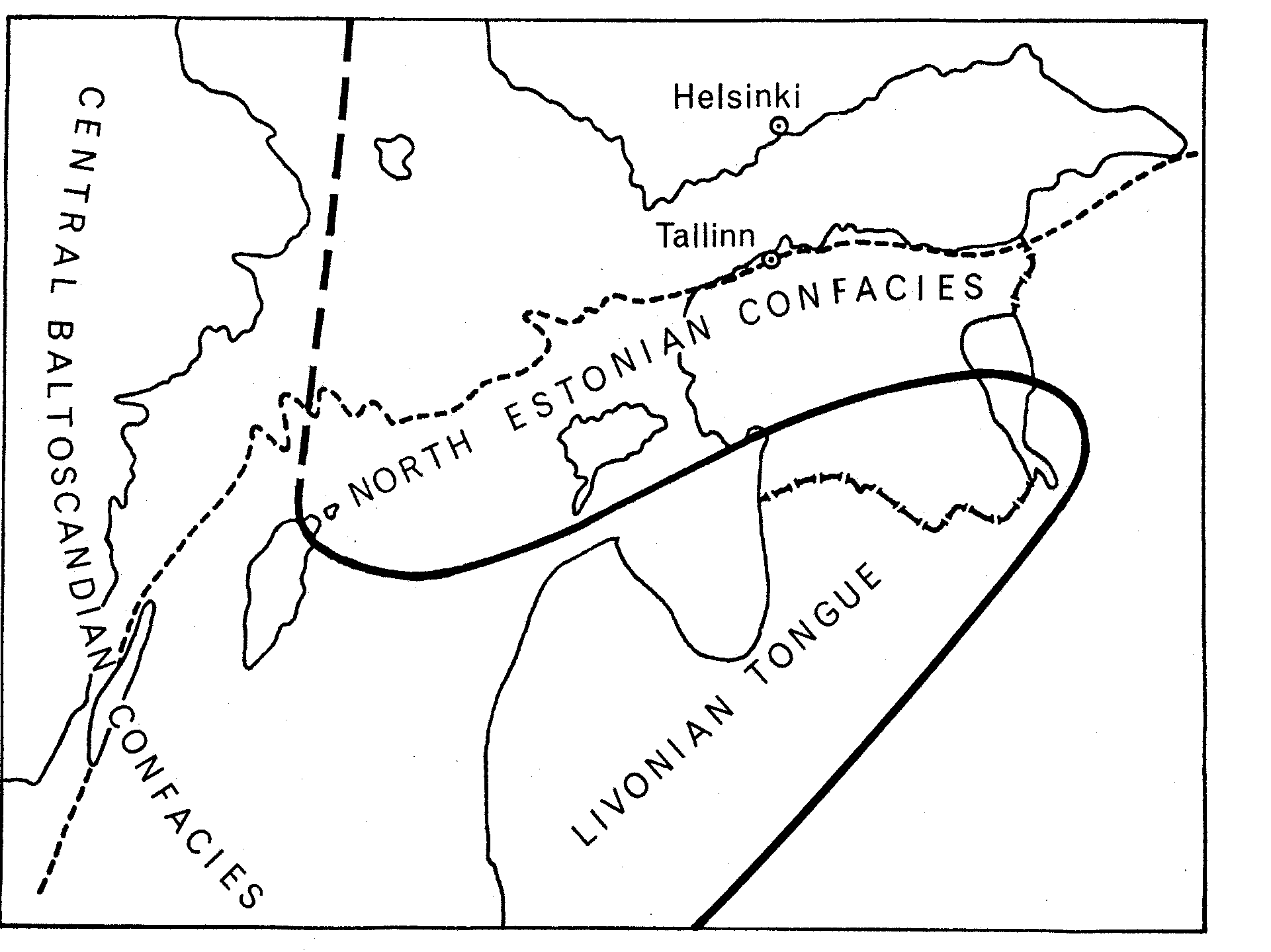
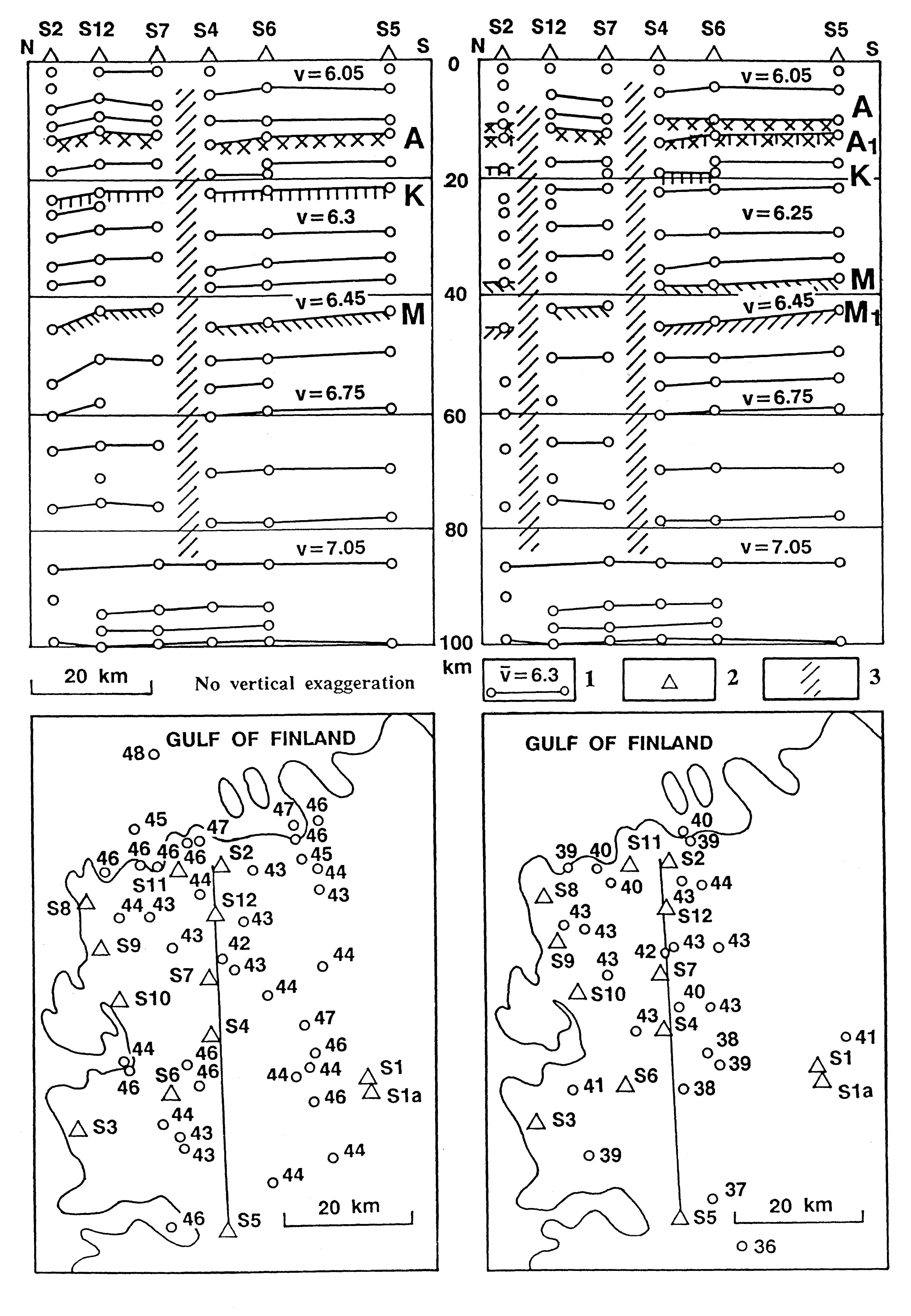
Fig. 138. The main structural elements of the Baltoscandian Ordovician and Silurian basin (after Männil 1966 and Jaanusson 1973a) and drift of the Baltica Continent during the Palaeozoic Era (after Torsvik et al. 1992): 1 - Skanian Confacies Belt; 2-3 - central or Swedish-Latvian Confacies Belt including Livonian Tongue or Baltic Syneclise (3a); 4 - marginal or Estonian-Lithuanian Confacies Belt; 5 - Moscow Syneclise; 6 - Fennoscandian Shield; 7 - Belarussian-Mazurian Anteclise (Massif).
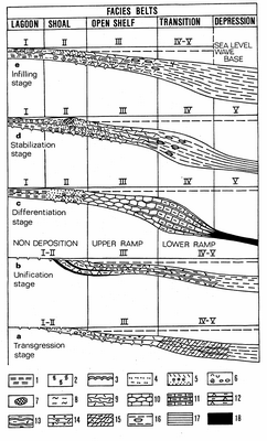
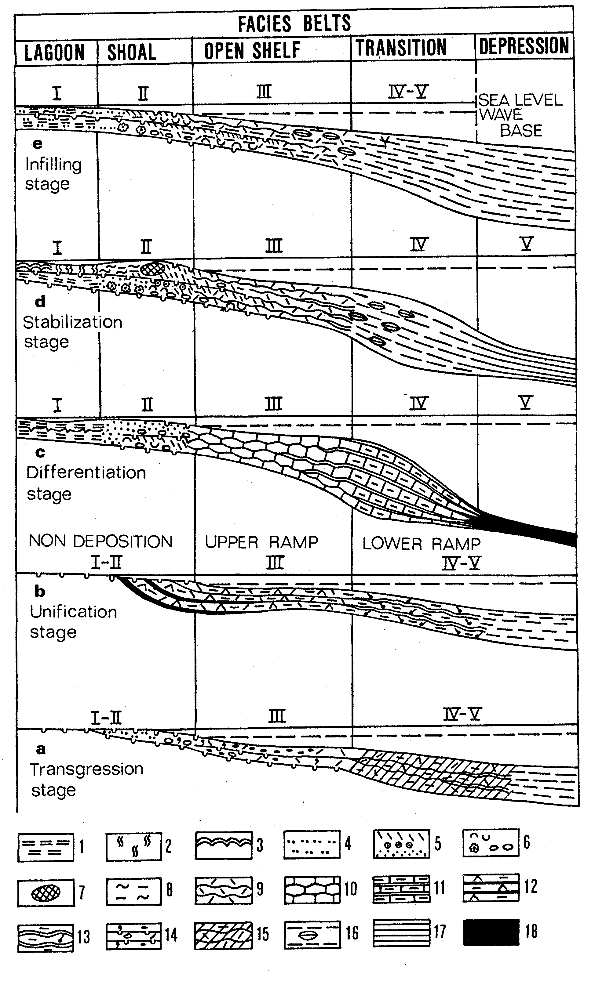
Fig. 139. Facies models for different stages of development of the post-Tremadoc Ordovician and Silurian Palaeobaltic Basin. Rock types: 1 - laminated argillaceous dolomites; 2 - bioturbated argillaceous dolomites; 3 - stratiform stromatolites; 4 - terrigenous silt- and sandstones; 5 - skeletal, oolitic and pelletal grainstones; 6 - coquinoid, oolitic and oncolitic rud- and floatstones; 7 - bioherms, carbonate mounds; 8 - bioturbated clayey wackestones; 9 - nodular biomicritic limestones (skeletal pack- and wackestones); 10 - wave-bedded micritic limestones; 11 - interbedded clayey micritic limestones and kerogenous graptolitic mudstones; 12 - biomicritic limestones with kukersite interlayers; 13 - interbedded argillaceous limestones and marls; 14 - limestones with glauconite, ferruginous ooids, lithoclasts and hardgrounds; 15 - purple argillaceous limestones; 16 - marlstones with limestone nodules; 17 - grey graptolitic mudstones; 18 - dark-brown kerogenous graptolitic shales.
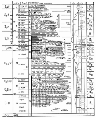
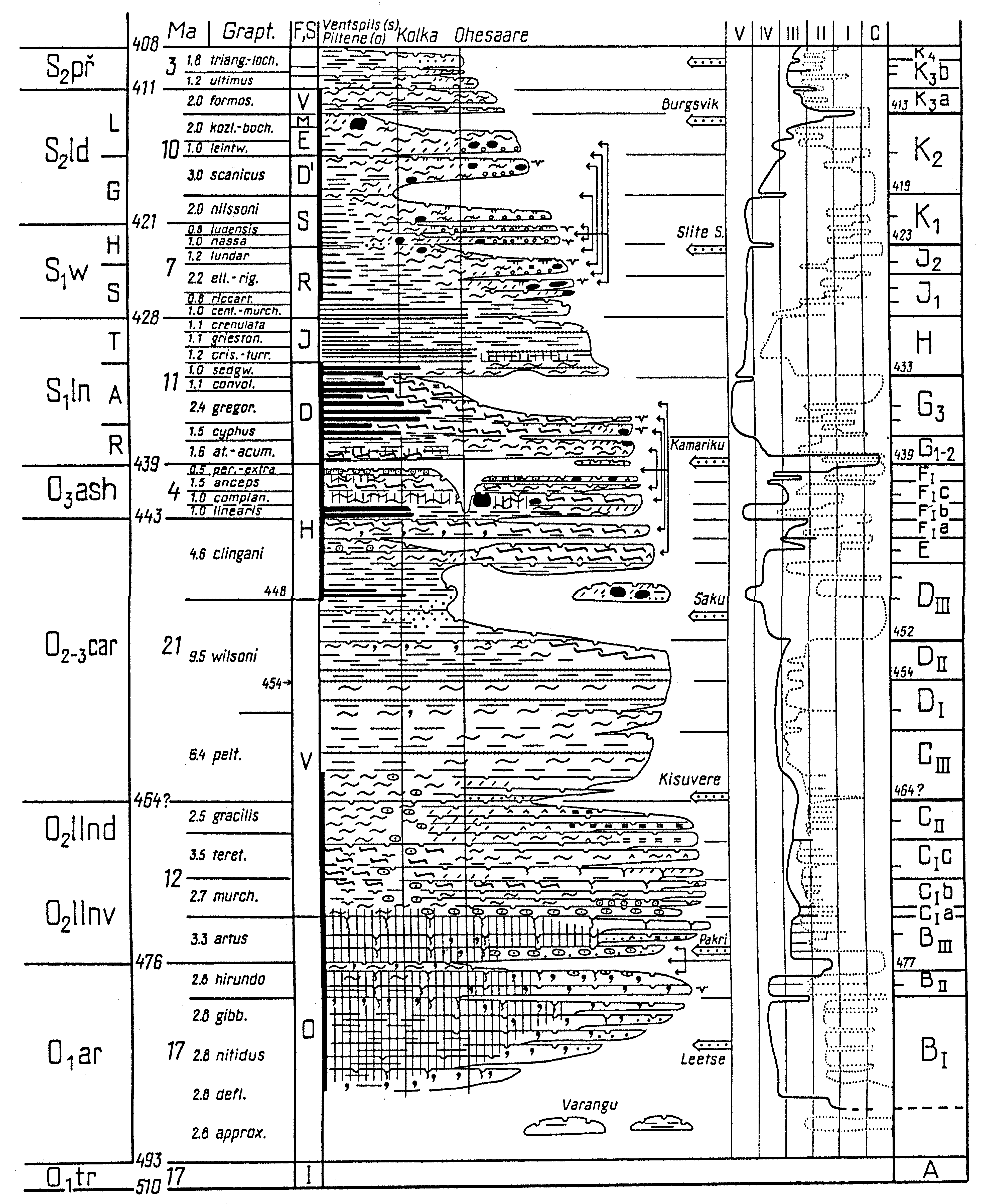
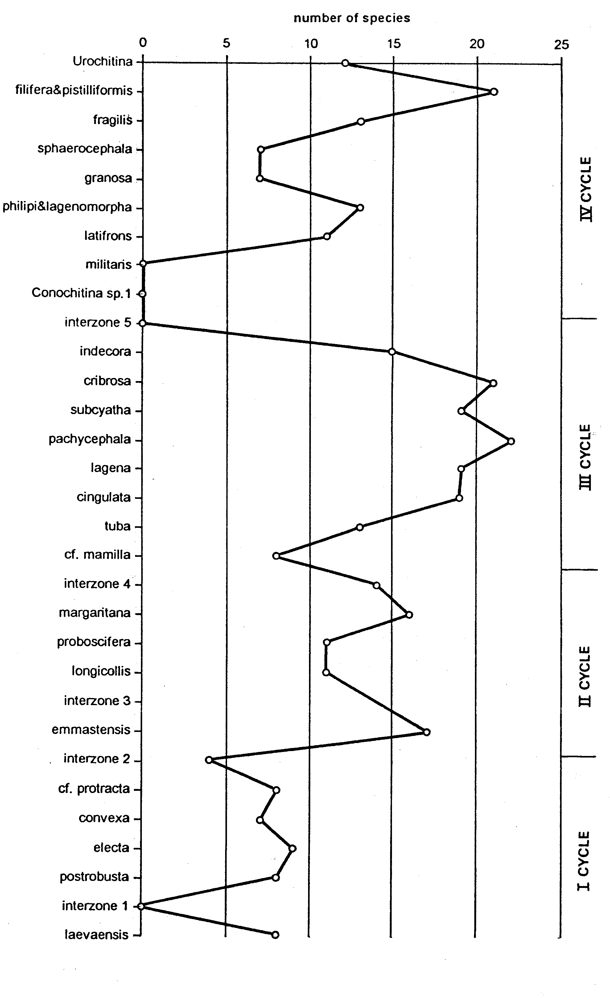
Fig. 140. A generalized sequence of the Ordovician and Silurian rocks in Estonia (by Einasto 1995) shown in time-scale (after Harland et al. 1990 a.o.) with eight higher rank stratigraphical breaks, separating nine eustatic macrocycles of basin development. On the right, two sea-level curves are shown - a dotted line for the marginal and a solid line for the central confacies belts. Facies belts: I - lagoonal, II - shoal, III - open shelf, IV - transitional, V - depression (see Table 27). For lithofacies legend see Fig. 141. Stratigraphical indices: Regional Series: I - Iru, O - Ontika, V - Viru, H - Harju; Silurian Formations: D - Dobele, J - Jurmala, R - Rìga, S - Siesartis, D - Dubysa, E - Engure, M - Mituva, V - Ventspils; Silurian Standard Stages: R - Rhuddanian, A - Aeronian, T - Telychian, S - Sheinwoodian, H - Homerian, G - Gorstian, L - Ludfordian; Baltic Regional Stages: BI - Latorp, BII -Volkhov, BIII - Kunda, Cia - Aseri, Cib - Lasnamägi, Cic - Uhaku, CII - Kukruse, CIII - Idavere, DI - Jõhvi, DII - Keila, DIII - Oandu, E - Rakvere, Fia - Nabala, FIb - Vormsi, Fic - Pirgu, FII - Porkuni, G1-2 - Juuru, G3 - Raikküla, H - Adavere, J1 - Jaani, J2 - Jaagarahu, K1 - Rootsiküla, K2 - Paadla, K3a - Kuressaare, K3b - Kaugatuma, K4 - Ohesaare.

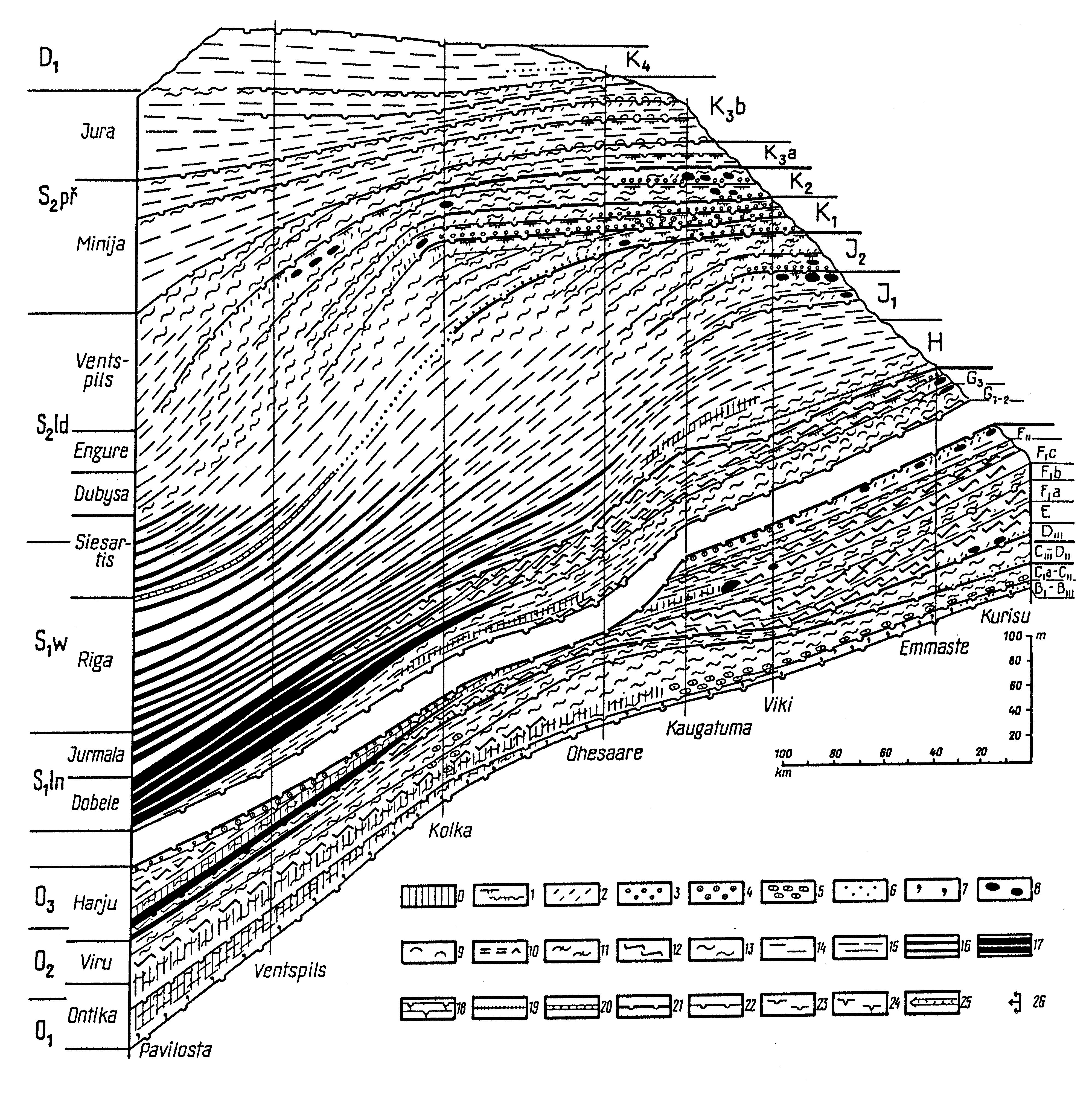
Fig. 141. A meridional cross section throughout the Ordovician and Silurian lithofacies in Hiiumaa and Saaremaa islands and the Kurzeme Peninsula by Einasto (1995), showing drastical differences in thicknesses and sedimentation rates between the Ordovician and Silurian. Lithological legend: 0 - marine redbeds; 1 - lagoonal dolomitic mud; 2 - skeletal sand; 3 - oncolitic and coquinoid gravel; 4 - calcareous ooids; 5 - ferrugenous ooids in calcareous matrix; 6 - terrigenous silt and sand; 7 - glauconitic deposits; 8 - bioherms and carbonate mounds; 9 - brachiopod and bivalve coquina; 10 - kukersine interlayers; 11 - argillaceous-calcareous muds of restricted shelf; 12 - pure lime muds of restricted and open shelf; 13 - bioclastic calcareous muds of open shelf; 14 - argillaceous-calcareous muds at shelf margin; 15 - calcareous-argillaceous muds of transitional belt; 16 - grey graptolitic muds; 17 - dark kerogenous graptolitic muds; 18 - numerous hardgrounds; 19 - metabentonites; 20 - laminated calcareous-argillaceous muds of basin depression; 21 - erosional surfaces and disconformities; 22 - significant discontinuities; 23 - brokened hardgrounds; 24 - mud-cracks, 25 - levels of silt and sand influx; 26 - symmetrical facies successions. Explanation of stratigraphical indices see Fig.140.
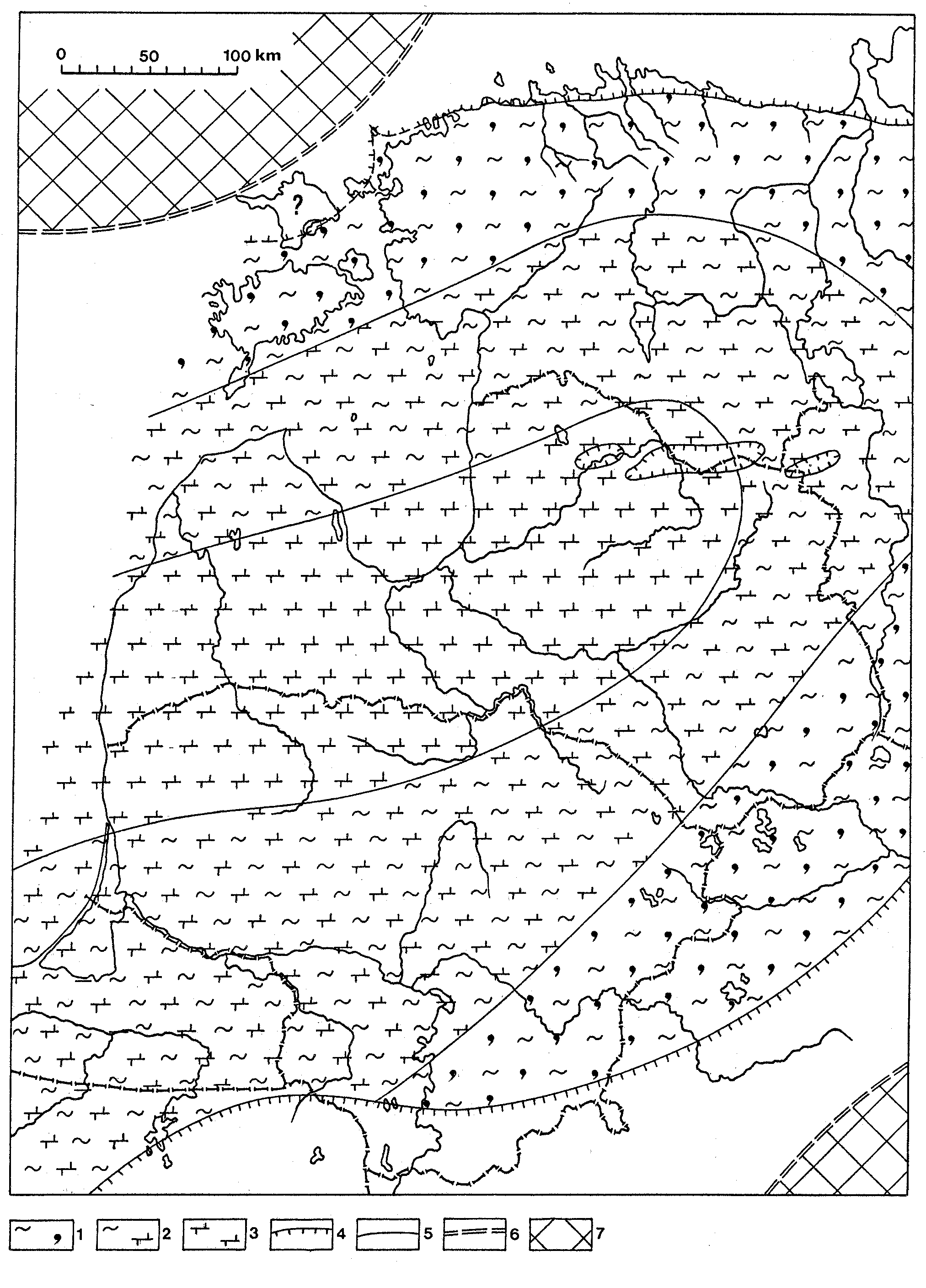
Fig. 142. Distribution of the Early Ordovician Volkhov Age sediments and facies belts in the Baltic Basin: 1 - grey glauconitic, bioclastic calcareous mud; 2 - variegated calcareous-argillaceous mud with bioclasts; 3 - purple calcareous- argillaceous mud; 4 - boundary of the present extension of rocks; 5 - facies boundaries; 6 - shoreline; 7 - presumable land.
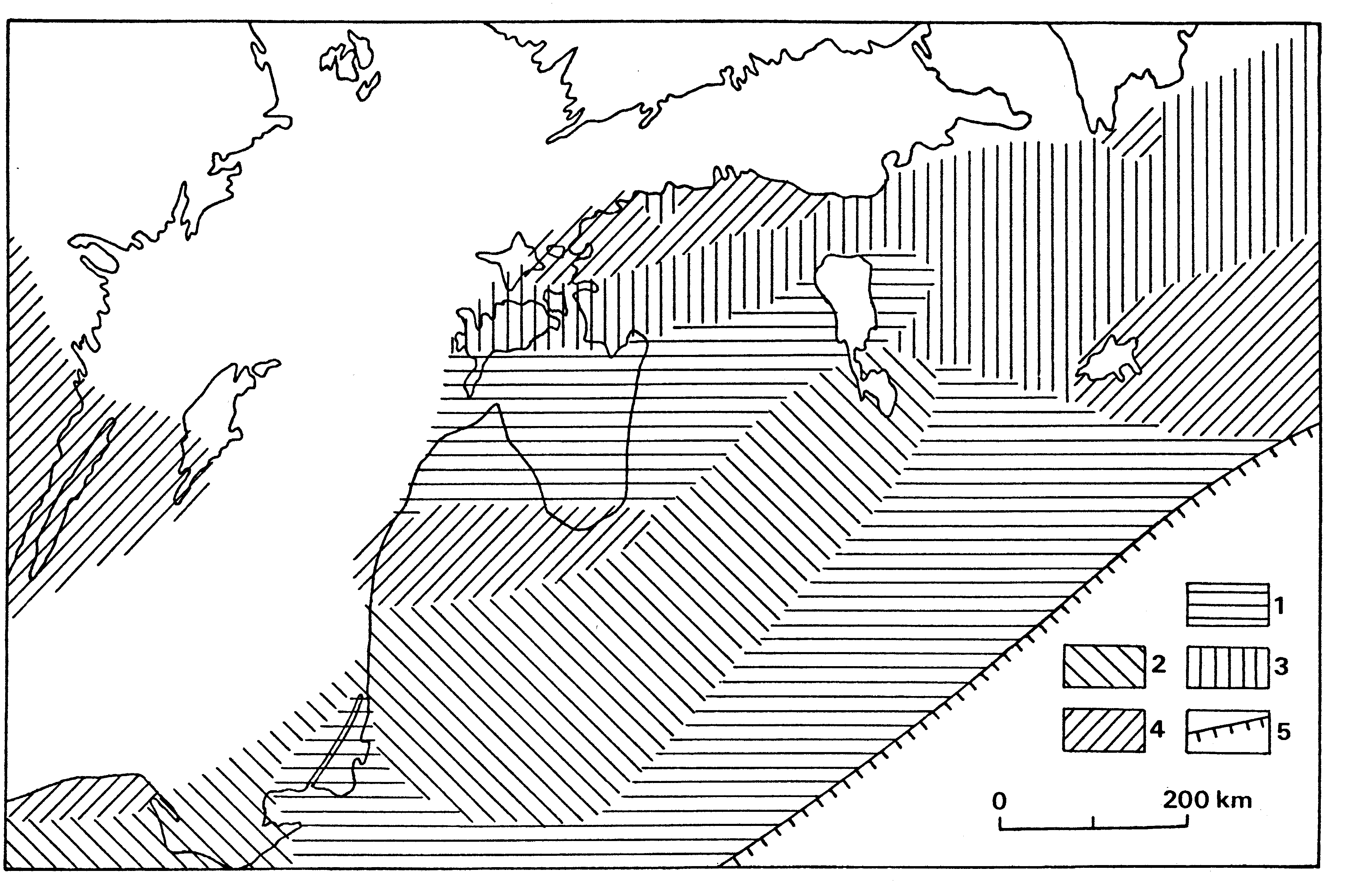
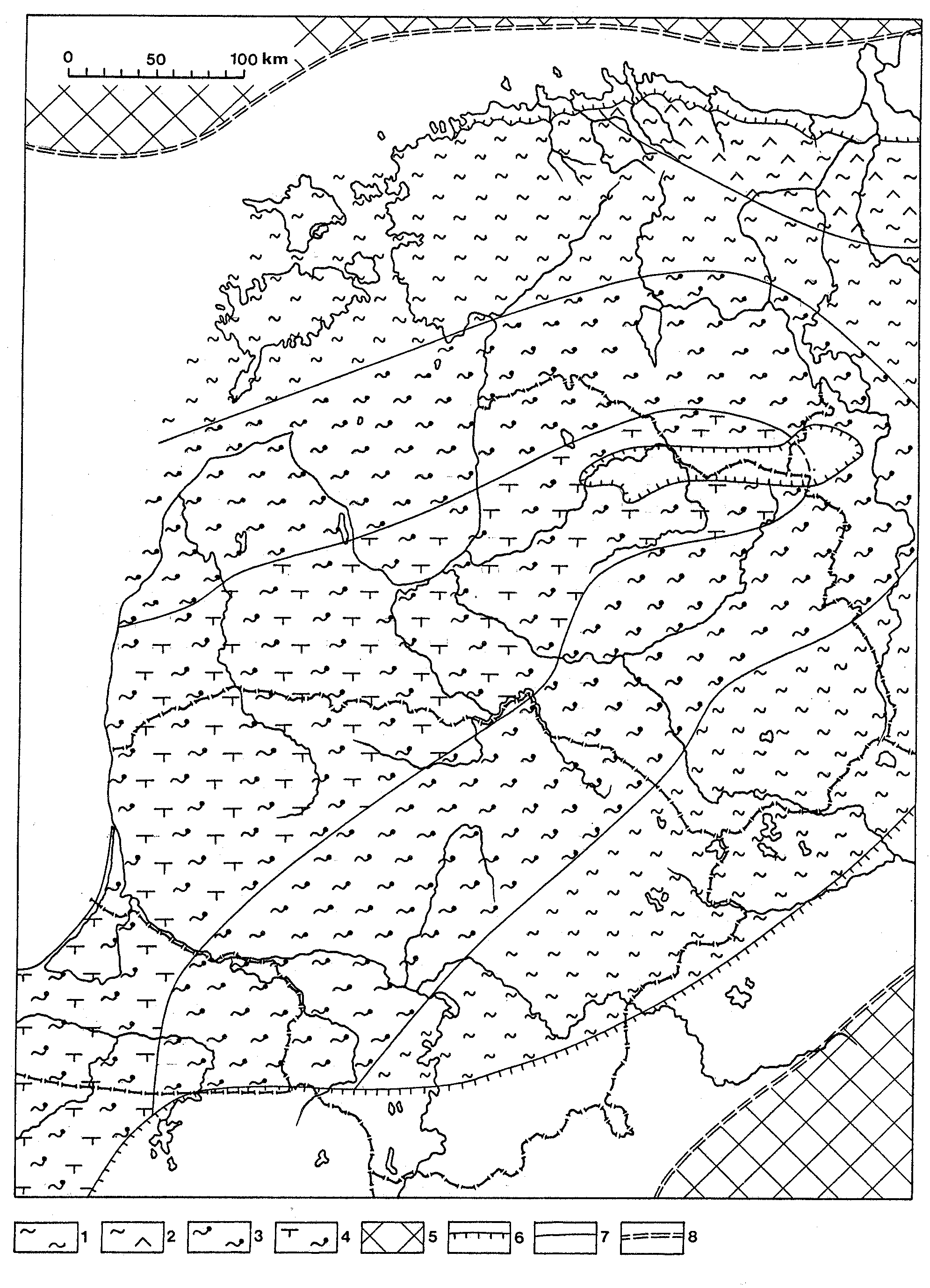
Fig. 143. Distribution of the Middle Ordovician Kukruse Age sediments and facies belts in the Baltic Basin: 1 - bioclastic calcareous mud; 2 - bioclastic calcareous mud with kukersine interlayers; 3 - bioclastic argillaceous-calcareous mud with pyritized skeleton particles; 4 - interbedded bioclastic argillaceous-calcareous and calcareous-argillaceous muds; 5 - presumable land; 6 - boundary of the present extension of rocks; 7 - facies boundaries; 8 - shoreline.
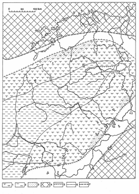
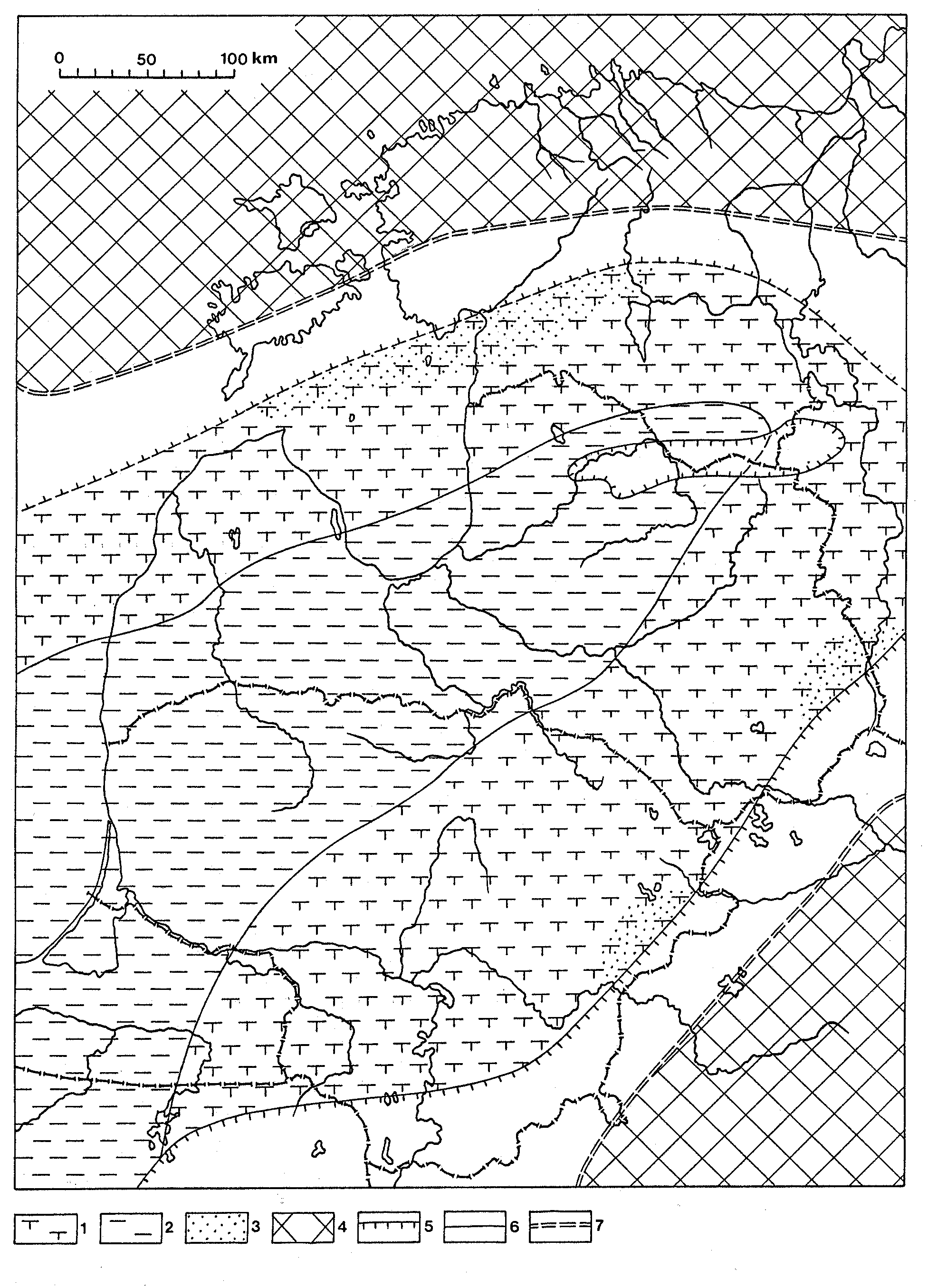
Fig. 144. Distribution of the late Middle Ordovician late Keila (top Pääsküla) sediments and facies belts in the Baltic Basin: 1 - calcareous-argillaceous mud; 2 - terrigenous mud; 3 - admixture of silt; 4 - presumable land; 5 - boundary of the present extention of rocks; 6 - facies boundaries; 7 - shoreline.
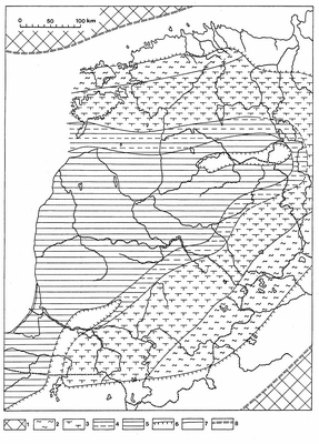
Fig. 145. Distribution of the Late Ordovician Vormsi Age sediments and facies belts: 1 - presumable land; 2 - bioclastic calcareous mud; 3 - calcareous-argillaceous mud; 4 -grey terrigenous mud; 5 - dark kerogenous argillaceous mud with graptolites; 6 - boundary of the present extension of rocks; 7 - facies boundaries; 8 - shoreline.

Fig. 146. Distribution of the end-Ordovician late Porkuni (Saldus Formation) sediments and facies belts: 1 - presumable land; 2 - calcareous sand with oolites; 3 - calcareous sand with siliciclastic admixture; 4 - microlayered silty calcareous and terrigenous muds; 5 - conglomerate; 6 - boundary of the present extension of rocks; 7 - boundaries of sediment types; 8 - shoreline; 9 - erosion channel.
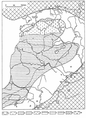
Fig. 147. Distribution of the Llandovery mid-Raikküla (Ikla Member) sediments and facies belts: 1 - land; 2 - pure lime mud; 3 - interbedded lime mud and dark kerogenous mud with graptolites; 4 - dark kerogenous graptolitic mud; 5 - grey graptolitic mud; 6 - boundary of the present extension of rocks; 7 - facies boundaries; 8 - shoreline; 9 - pelletal-skeletal sand and silt; 10 - dolomitized lime mud.
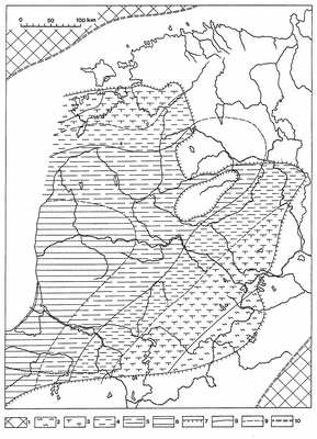
Fig. 148. Distribution of the Wenlock mid-Jaani (base of Ninase Member) sediments and facies belts: 1 - land; 2 - bioclastic calcareous mud; 3 - argillaceous-calcareous mud; 4 - green terrigenous mud; 5 - grey terrigenous mud with graptolites; 6 - dark kerogenous graptolitic mud; 7 - boundary of the present extension of rocks; 8 - main facies boundaries; 9 - boundary of sediment types; 10 - shoreline.
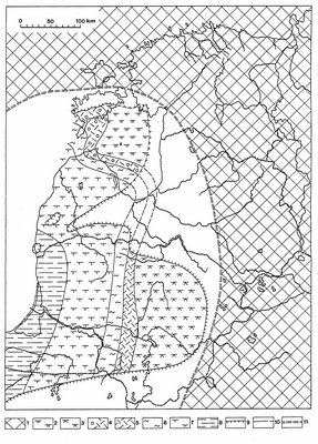
Fig. 149. Distribution of the Ludlow mid-Paadla (base of Himmiste beds) deposits and facies belts: 1 - presumable land; 2 - lagoonal dolomitic mud; 3 - high-salinity, gypsiferous dolomitic mud; 4 - pelletal-skeletal sand and silt; 5 - skeletal sand; 6 - bioclastic calcareous mud; 7 - calcareous-argillaceous mud; 8 - grey terrigenous mud with graptolites; 9 - boundary of the present extension of rocks; 10 - facies boundaries; 11 - shoreline.
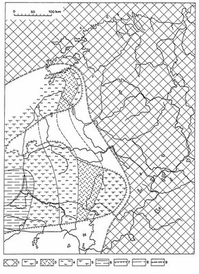
Fig. 150. Distribution of the Pridoli earliest Kaugatuma sediments and facies belts: 1 - land; 2 - lagoonal dolomitic mud; 3 - skeletal sand and gravel; 4 - bioclastic calcareous mud; 5 - green calcareous-argillaceous mud; 6 - grey terrigenous mud with graptolites; 7 - boundary of the present extension of rocks; 8 - facies boundaries; 9 - shoreline.
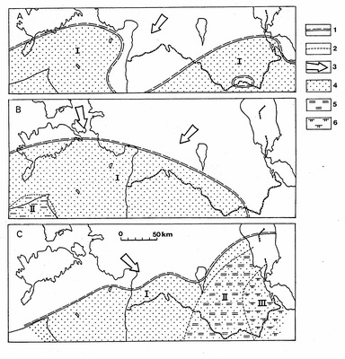
Fig. 151. Sketch-map showing the distribution of lithofacies during the Early Devonian: A - Tile Age, B - Kemeri Age, C - Rezekne Age. I - near-shore clastic sedimentation, II - shallow-marine sandy-silty sedimentation, III - shallow-marine clastic carbonate sedimentation. 1 - assumed boundary of the marine basin; 2 - boundary of deposition areas; 3 - main direction of the influx of clastic material; 4 - sandstone; 5 - siltstone; 6 - dolomitic marl.

Fig. 152. Sketch-map showing the distribution of lithofacies during the Eifelian: A - Pärnu Age, B - Vadja + Leivu subages, C - Kernavé Subage. I - near-shore clastic sedimentation, II - shallow-marine sandy-silty sedimentation, III - shallow-marine clastic-carbonate sedimentation, IV - estuarian clastic sedimentation, V - coastal plain and tidal carbonate sedimentation, VI - offshore carbonate sedimentation. 1 - assumed boundary of the marine basin; 2 - boundary of deposition areas; 3 - belt of garnet concentration; 4 - main direction of the influx of clastic material; 5 - sandstone; 6 - Ssiltstone; 7 - clay; 8 - dolomitic marl; 9 - dolomite.
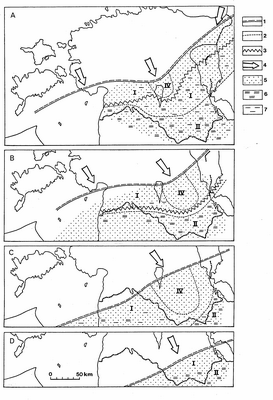
Fig. 153. Sketch-map showing the distribution of lithofacies at the end of the Eifelian (Aruküla Age) and during the Givetian: A - Aruküla Age, B - Burtnieki Age, C - Gauja Age, D - Amata Age. I - near-shore clastic sedimentation, II - shallow-marine sandy-silty sedimentation, IV - estuarine clastic deposits. 1 - assumed boundary of the marine basin; 2 - boundary of the deposition areas; 3 - belt of garnet concentration; 4 - main direction of the influx of clastic material; 5 - sandstone; 6 - siltstone; 7 - clay.
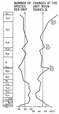
Fig. 154. The diversity of Ordovician chitinozoans in the Rapla core section. Stratigraphical column reflects natural thicknesses. Stratigraphical indices: FII - Porkuni Stage; FIc1, FIc2 - lower and upper parts of the Pirgu Stage; FIb - Vormsi Stage; FIa1, FIa2 - lower and upper parts of the Nabala Stage; F - Rakvere Stage; DIII - Oandu Stage; DII1, DII2 - lower and upper parts of the Keila Stage; DI - Jõhvi Substage, Haljala Stage; CIII - Idavere Substage, Haljala Stage; CII1, CII2 - lower and upper parts of the Kukruse Stage; CIc - Uhaku Stage; CIb - Lasnamägi Stage; CIa - Aseri Stage; BIII1, BIII2 - lower and upper parts of the Kunda Stage; BII - Volkhov Stage; m - mean value level.
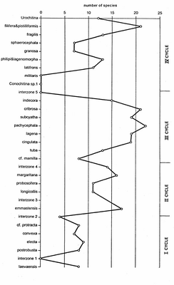
Fig. 155. Chitinozoan diversity changes and evolutionary cycles (A) and the percentage of appearing and disappearing species per chitinozoan biozone (B) in the Silurian of Estonia. The charts were compiled using data from the Ohesaare core and in the case of stratigraphic gap (the main part of the Middle Llandovery) from the Ikla core section. Stratigraphical indices of stages: C1a - Aseri; C1b - Lasnamägi; C1c - Uhaku; C2 - Kukruse; C3 - Idavere Substage (Haljala Stage); D1 - Jõhvi Substage (Haljala Stage); D2 - Keila; D3 - Oandu; E - Rakvere; F1a - Nabala; F1 b - Vormsi; F1c - Pirgu; F2 - Porkuni; G1-2 - Juuru; G3 - Raikküla; H - Adavere; J1 - Jaani; J2 - Jaagarahu; K1 - Rootsiküla; K2 - Paadla; K3a - Kuressaare.
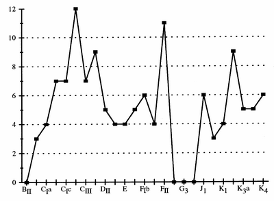
Fig. 156. Frequency dynamics of pelecypod genera in the Ordovician and Silurian of Estonia. Vertical axis - number of genera, horizontal axis - regional stages. Indices of stages: BII - Volkhov, CIa - Aseri, CIc - Uhaku, CIII - Idavere, DII - Keila, E - Rakvere, FIb - Vormsi, FII - Porkuni, G3 - Raikküla, J1 - Jaani, K1 - Rootsiküla, K3a - Kuressaare, K4 Ohesaare
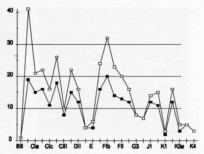
Fig. 157. Frequency dynamics of gastropod genera (black boxes) and species (white boxes) in the Ordovician and Silurian of Estonia. Vertical axis - number of taxa, horizontal axis - regional stages. Indices of the stages: BII - Volkhov, CIa - Aseri, CIc - Uhaku, CIII - Idavere, DII - Keila, E - Rakvere, FIb - Vormsi, FII - Porkuni, G3 - Raikküla, J1 - Jaani, K1 - Rootsiküla, K3a - Kuressaare, K4 - Ohesaare.
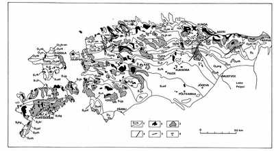
Fig. 158. Distribution of alvars (after Jürgenson & Tavast 1986, with complements): 1 - boundaries between outcrops of bedrock stages with stratigraphical indices of the stages (see Ch. IV 3.4); 2 - alvars; 3 - outcrops of the bedrock covered with a thin (up to 30 cm) layer of Quaternary deposits; 4 - zones of tectonical disturbances; 5- cliffs; 6 - karst forms.
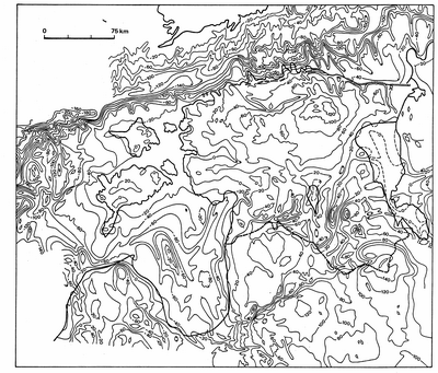
Fig. 159. Isolines of the bedrock topography, drawn after 20 m.
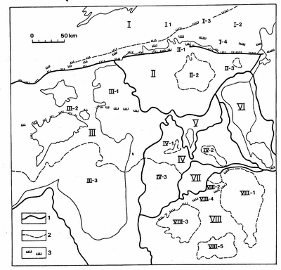
Fig. 160. Zonation of the bedrock topography (after Tavast 1992): 1 - boundaries of large bedrock forms; 2 - boundaries of medium bedrock forms; 3 - escarpments. I - Depression of the Gulf of Finland: 1 - Sub-Vendian Peneplain; 2 - Cambrian-Vendian Peneplain; 3 - Vendian Escarpment; 4 - Cambrian Escarpment. II - Viru-Harju Plateau: 1 - Ordovician Escarpment; 2 - Pandivere Elevation; 3 - Ahtme Eminence. III - Livonian Lowland: 1 - West-Estonian Lowland; 2 - Depression of the Gulf of Riga. IV - Middle-Devonian Plateau: 1 - South-Sakala Elevation; 2 - Otepää Elevation; 3 - North-Vidzeme Depression. V - Central-Estonian Lowland and Depression of Lake Võrtsjärv. VI - Lake Peipsi Depression. VII - Valga and South-Estonian lowlands. VIII - Upper-Devonian Plateau: 1 - Haanja-Aluksne Elevation; 2 - Karula Eminence; 3 - Vidzeme Elevation; 4 - Devonian Escarpment; 5 - East-Latvian Lowland.
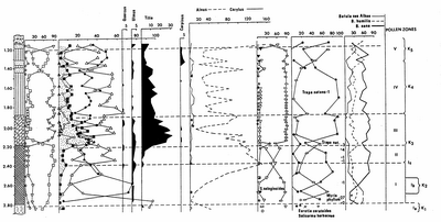
Fig. 161. Simplified palynological diagram of the Holsteinian continental sediments of the Karuküla section (after Liivrand 1984). For legend see Fig. 162.
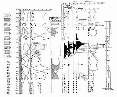
Fig. 162. Simplified palynological diagram of the Eemian marine sediments of the Prangli section (after Liivrand 1984): 1 - till; 2 - loam; 3 - sandy loam; 4 - clay; 5 - sand; 6 - silt; 7 - varved clay; 8 - sapropelite; 9 - forest peat; 10 - Phragmites peat; 11 - composite pollen of trees; 12 - composite pollen of herbaceous plants; 13 - spores; 14 - fir; 15 - pine; 16 - birch; 17 - composite pollen of broad-leaved trees; 18 - Abies; 19 - willow; 20 - Bryales; 21 - Sphagnum; 22 - ferns; 23 - Lycopodium; 24 - Equisetum; 25 - herbs; 26 - chenopods; 27 - Artemisia; 28 - Graminae; 29 - heather; 30 - Carex; 31 - molluscs; 32 - plant remains.
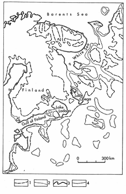
Fig. 163. Eemian shoreline and submerged areas : 1 - after Grichuk (Gricuk 1961) and Lavrova (Lavrova 1961); 2 - after Blagovolin, Leontjev and Muratov (Blagovolin et al. 1982); 3 - contemporary shorelines; 4 - Eemian inland bodies of water according to Grichuk (after Gerasimov & Velicko 1982) with complements.
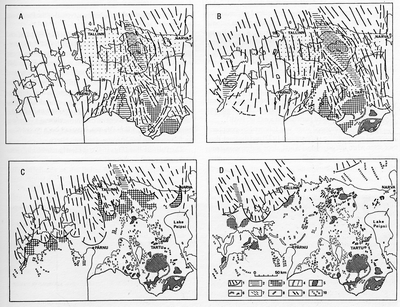
Fig. 164. Glacial dynamics and deglaciation of the Estonian territory against the background of the bedrock topography (dotted surfaces) with indications of its elevation above sea level (lines with numbers) after Raukas & Karukäpp 1979 with complements: A - stagnation of the glacier on the Haanja and Otepää heights; B - marginal formations of glacial lobes in southeastern Estonia; C - Pandivere Stadial of deglaciation; D - Palivere Stadial of deglaciation: 1 - margin of the active glacier and direction of the ice movement; 2 - ice-shed area; 3 - dead ice and formation of hummocky topography; 4 - foot lines of accumulative insular heights (a) and bedrock uplands (b); 5 - hummocky topography; 6 - marginal belts of hummocky topography; 7 - drumlins; 8 - end moraines and marginal eskers; 9 - radial eskers; 10 - orientation of elongated landforms.
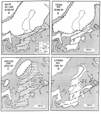
Fig. 165. Palaeogeographical reconstructions of the main stages of the Baltic Sea history after Hyvärinen (1991): 1 - dry land; 2 - sea; 3 - lake; 4 - ice margin; 5 - isolines for shore level altitudes in metres above the present sea level. A - Baltic Ice Lake; B - Yoldia Sea; C - Ancylus Lake; D - Litorina Sea.
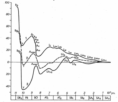
Fig. 166. Water level changes at Kõpu, Island of Hiiumaa (1), in western Latvia (2) and western Lithuania (3) with clear regressions of the Baltic Ice Lake and the Ancylus Lake.

Fig. 167. The initial point of the formation of the Baltic Sea after the retreat of the glacier from the Pandivere Upland. Roman numbers show the location of the ice margin in the St. Petersburg Region according to different scientists: I - K. Markov; II - I. Krasnov and E. Zarrina; III - M. Spiridonov with co-authors. Legend: 1 - elevation of aqueoglacial forms above the present sea level, m; 2 - elevation of coastal forms a.s.l.; 3 - ice margin; 4 - area occupied by ice-dammed lakes. Compiled by J. Vassiljev on the basis of data published by H. Kessel, E. Lõokene, K. Markov, K. Pärna, A. Raukas and E. Rähni.

Fig. 168. Palaeogeographic scheme showing the maximum extent of the glaciers of the Palivere Stadial after Kessel and Raukas (Kessel & Raukas 1982) with complements. The hatching denotes the area under the Palivere Ice-Dammed Lake. For legend see Fig. 167.

Fig. 169. Geological cross-section of the Partsi gravel pit in the Island of Hiiumaa after Raukas et al. 1996: 1 - sand; 2 - gravelly sand; 3 - varved clay; 4 - beige basal till; 5 - grey basal till; 6 - boreholes; 7 - sampling places of mollusc shells.

Fig. 170. Longitudinal profiles of Estonian rivers (Orviku 1960v): A - Valgejõgi (N Estonia): B - Pärnu (W Estonia); C - Väike Emajõgi (S Estonia). 1 - transgression limits of the Baltic Ice Lake (BIII), Ancylus Lake (Al), Litorina Sea (Ll-ll); 2 - rapid uplift; 3 - slow uplift; 4 - bottom erosion (a), considerable fluvial accumulation (b).
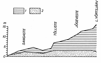
Fig. 171. Overbank (1) and channel (2) deposits in the Väike Emajõgi Valley (S Estonia). Compiled after Kajak (Kajak 1959).

Fig. 172. Geology and geomorphology of the Jägala River: 1 - till; 2 - carbonate rocks; 3 - sandstones; 4 - argillite; 5 - waterfall; 6 - the mouth of the Jõelähtme River; 7- canyon; 8 - the dam of the hydropower station. F - floodplain, Tl..TlV - terraces, arrows indicate the phases of the Baltic Sea and their horizontal extension (Blll- the Baltic Ice Lake, phase lll, Y - Yoldia Sea, A - Ancylus Lake, L - Litorina Sea). After Eberhards and Miidel (1984) with supplements.
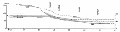
Fig. 173. Terraces (B, C, D) in the Piusa River valley. Glaciolacustrine terraces of the budget A are located in the ancient Võru-Petseri Valley (after Liblik 1966).
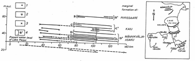
Fig. 174. Correlation of the altitudes of the river terraces and Late-Weichselian shorelines in the Peipsi Depression (after Hang 1995): 1 - river terraces; 2 - valley bottoms; 3 - shorelines (after Liblik 1966); 4 - group of terraces with similar ages and their correlation with the ice-marginal formations (B - E - terraces of the Ahja River, B-D - terraces of the Piusa River). The location of ice-marginal belts and valleys is shown on the scheme.
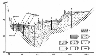
Fig. 175. Cross-section of the Piusa River, near Härma (after Hang 1995): 1 - overbank deposits; 2 - oxbow deposits; 3 - channel deposits; 4 - glaciofluvial sand and gravel; 5 - glaciofluvial gravel with pebbles; 6 - glaciolacustrine sand; 7 - terrigenous Devonian rocks; 8 - borehole; 9 - 14C datings (yr BP).
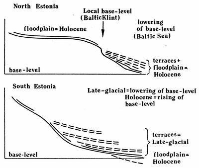
Fig. 176. Principal scheme of age relations of terraces and floodplain with base-level changes in Estonian rivers (after Eberhards and Miidel 1984, with supplements).
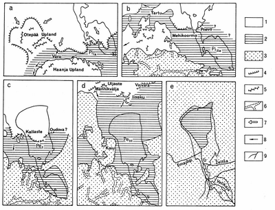
Fig. 177. The development of Lake Peipsi (Raukas & Rähni 1969): a) Pihkva Ice Lake I (phase PiIa); b) Pihkva Ice Lake II (Phase PiIIa); c) Peipsi Ice Lake (Phase PeI); d) Peipsi ice-dammed lake (phase PeIII); e) Lake Small Peipsi. 1 - glacier; 2 - proglacial lake; 3 - dry land; 4 - margins of the active glacier; 5 - field of dead ice; 6 - meltwater valleys; 7 - direction of the ice movement; 8 - direction of the meltwater flow; 9 - rivers.

Fig. 178. Shore types of Lake Peipsi (after Raukas & Tavast 1989): 1 - Devonian sandstone; 2 - till; 3 - sand; 4 - clay; 5 - peat; 6 - cliff; 7-9 - bluffs in Quaternary loose deposits: 7 - active; 8 - passive, vegetated; 9 - dead; 10 - erratic boulders; 11 - beach ridge; 12 - bulrush and reed zone.

Fig. 179. Lake-level changes in the southern part of Lake Peipsi (Hang et al. 1995). A., B, C - altitudes of the groups of Late-glacial terraces in the Piusa Valley (see also Fig. 174).
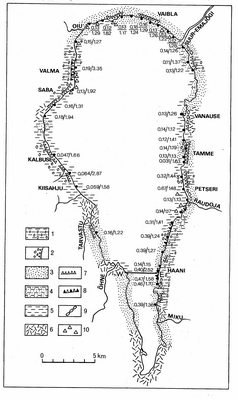
Fig. 180. Shore types and grain-size of beach deposits (numerator - medium diameter, denominator - coefficient of sorting) after Tavast (Tavast 1990) with complements: 1 - till; 2 - cliff in sandstones; 3 - medium size sand; 4 - silty sand; 5 - silt; 6 - peat; 7 - dead bluff; 8 - passive bluff; 9 - beach ridge; 10 - boulders; 11 - line of cross-section (Fig. 182).
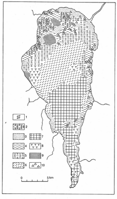
Fig. 181. Bottom sediments of Lake Võrtsjärv after Pirrus, Raukas and Tavast (Raukas & Tavast 1990, with complements): 1 - Devonian sandstone; 2 - till; 3 - sand, silty sand and gravelly sand; 4 - silt and sandy silt; 5 - silty clay; 6 - sandy sapropel (gyttja); 7 - sapropel (gyttja); 8 - lake marl; 9 - (varved) clay; 10 - boulder and cobble ridges (rewashed drumlins).

Fig. 182. Cross-section of lake sediments between Sula and Haani after Pirrus and Raukas (1984): 1 - water; 2 - sapropel (gyttja); 3 - sapropelic lake marl and limy sapropel; 4 - lake marl; 5 - silty sand; 6 - sand; 7 - till; 8 - boreholes.
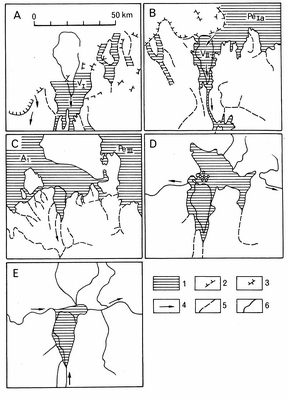
Fig. 183. The development of Lake Võrtsjärv during late- and post-glacial time after Orviku (Orviku L. F. 1958), Raukas, Rähni and Miidel (Raukas et al. 1971), Raukas and Tavast (1990): A - Ice Võrtsjärv during the Otepää Stadial about 12,600 yr BP; B - Ice Võrtsjärv during the Sakala Stadial about 12,250 yr BP when it had a connection with Peipsi Ice Lake PeIa; C - Ice Võrtsjärv during the Pandivere Stadial about 12,050 yr BP when the Peipsi Depression was occupied by Ice Lake PeIII and in western Estonia there was Voose Ice Lake AI; D - Big-Võrtsjärv in the Early Holocene; E - Lake in the beginning of the Middle Holocene in Atlantic time after the formation of outflow via the Emajõgi Valley to the east: 1 - water bodies; 2 - ice margin; 3 - dead ice; 4 - supposable direction of the water flow; 5 - valleys; 6 - rivers.

Fig. 184. Location of lakes mentioned in the text: 1 - end moraine and marginal esker; 2 - radial esker; 3 - morainic topography; 4 - kame field; 5 - drumlin field; 6 - limit of the Limnea Sea; 7 - limit of the Litorina Sea; 8 - limit of the Ancylus Lake; 9 - limit of the Baltic Ice Lake BIII; 10 - limit of the Baltic Ice Lake BI; 11 - boundary of heights and uplands. Location of lakes: 1 - Kirikumäe; 2 - Punso; 3 - Kurg-; 4 - Väik-; 5 - Mäetilga; 6 - Vaskna; 7 - Tuul-; 8 - Pulli; 9 - Saar-; 10 - Tamula; 11 - Vagula; 12 - Koobassaare; 13 - Päidla Suur; 14 - Mähe; 15 - Ahven-; 16 - Räbi-; 17 - Juusa-; 18 - Pangodi; 19 - Püha-; 20 - Neitsi-; 21 - Viljandi; 22 - Mäeküla; 23 - Parika; 24 - Pärsti; 25 - Võistre; 26 - Kariste; 27 - Veis-; 28 - Sinialliku; 29 - Päidre; 30 - Elistvere; 31 - Pikk-; 32 - Raigastvere; 33 - Prossa; 34 - Soits-; 35 - Kuremaa; 36 - Kaiu; 37 - Saad-; 38 - Äntu Sini-; 39 - Äntu Valge-; 40 - Linaleo; 41 - Neeruti Ees-; 42 - Viitna Pikk-; 43 - Lina-; 44 - Vohnja Kõver-; 45 Niker-; 46 - Matsimäe Püha-; 47 - Kiruvere; 48 - Udriku Suur-; 49 - Räätsma; 50 - Haug-; 51 - Räätsma; 52 - Martiska; 53 - Konsu; 54 - Liiv-; 55 - Lina-; 56 - Ümar-; 57 - Kalli; 58 - Lahepera; 59 - Imsi; 60 - Kaisma; 61 - Järlepa; 62 - Järveotsa; 63 - Must-; 64 - Valge-; 65 - Kahala; 66 - Rummu; 67 - Ülemiste; 68 - Käsmu; 69 - Maardu; 70 - Ermistu; 71 - Tõhela; 72 - Karu-; and 73 - Mustjärv.

Fig. 185. Cross-section of L. Kurgjärv: 1- gyttja; 2 - peat; 3 - gravel; 4 - macroremains.
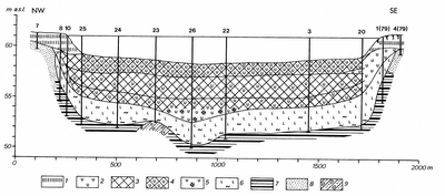
Fig. 186. Cross-section of L. Prossa with two carbonate-rich gyttja layers: 1 - fen peat; 2 - lacustrine lime; 3 - gyttja; 4 - calcareous gyttja; 5 - organic rich lime; 6 - silt with moss remains; 7 - varved clay; 8 - sand; 9 - till.
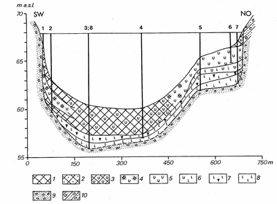
Fig. 187. Cross-section of L. Kiruvere: 1 - gyttja; 2 - sandy gyttja; 3 - calcareous gyttja; 4 - organic rich lacustrine lime; 5 - lacustrine lime; 6 - silty lacustrine lime; 7 - silt with plant remains; 8 - silt; 9 - sandy gravel; 10 - till.

Fig. 188. Cross-section of L. Käsmu: 1 - gyttja; 2 - silty gyttja; 3 - silt with gyttja;4 - alternation of sand and silt; 5 - silt; 6 - sand.
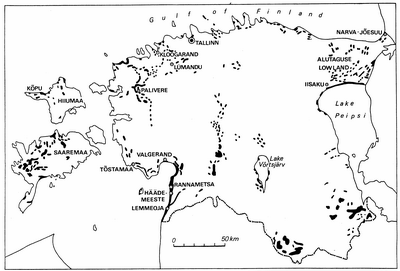
Fig. 189. The biggest dunes and main areas of aeolian sand.
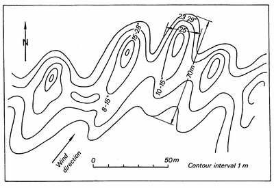
Fig. 190. Ridge-like dunes usually parallel one another in echelon-like series. The Aavasoo Dune Field of the Ancylus transgressive shoreline (after Eltermann & Raukas 1966).
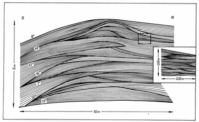
Fig. 191. Litorina dune at Sininõmme displays a typical lamination in the longitudinal direction (after Raukas 1968).
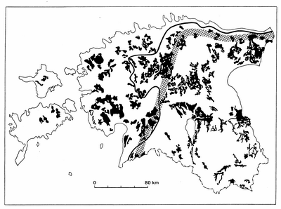
Fig. 192. Distribution pattern of mires larger than 1000 ha in Estonia (after Allikvee & Ilomets 1995, with complements). Solid line indicates the maximum distribution limit of the Baltic Ice Lake B3 and divides Estonias territory into Lower and Upper Estonia. The cross-striped belt follows the approximate boundary between the East- and West-Estonian geobotanical provinces (after Laasimer 1965) and corresponds well with the distributional pattern of the West-Estonian type of plateau bogs and the East-Estonian type of convex bogs.
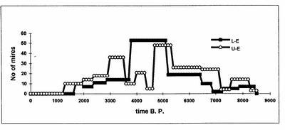
Fig. 193. Temporal changes in mire initialisation by paludification. Symbols: L-E - Lower Estonia, U-E - Upper Estonia.
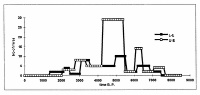
Fig. 194. Temporal changes in mire initialisation by terrestrialisation. Symbols as in Fig. 193.
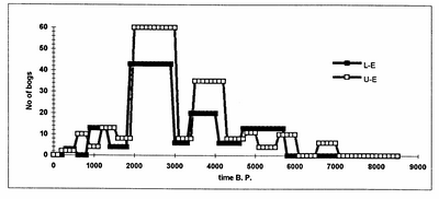
Fig. 195. Temporal dynamics of raised bog initialisation. Symbols as in Fig. 193.
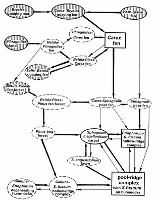
Fig. 196. Developmental pattern of limnogeneous mires in Estonia. Arrows: thick line - more common sequences, thin line - less common sequences. Ellipsoids: striped - initial states, white - serial states, continuous line - most common states, broken line - less common states. Rectangulas - climax states.

Fig. 197. Developmental pattern of topogeneous mires in Estonia. Symbols as in Fig. 196.
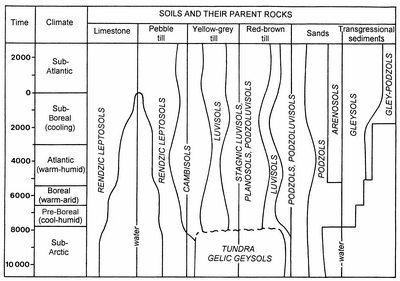
Fig. 198. Progress of soils in the postglacial period.
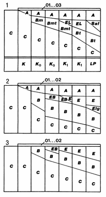
Fig. 199. Formation of soil sections on different parent materials:1 - mineralogically and chemically rich till; 2 - mineralogically and chemically poor till; 3 - sands. K - Rendzic Leptosols, Ko - Cambisols, KI - Luvisols, LP - Stagnic Luvisols and/or Planosols. 01-03, A,E, EL, Bm, etc. - soil horizons (FAO 1985, 1994; Reintam 1995).

Fig. 200. Soil progress and genetic connections.

Fig. 201. Location of biostratigraphical (dots) and archaeological sites (triangles), mentioned in the text. Biostratigraphical sites: 1 - Surusoo (Veski 1996b), 2 - Tuiu (Jõhvikasoo, Hansson et al. 1996), 3 - Vedruka, 4 - Pitkasoo, 5 - Kaali, 6 - Tondi (Kimmel et al. 1996), 7 - Maardu (Veski 1992, 1996a), 8 - Saha (Veski, unpublished), 9 - Kahala, 10 - Velise (Veski, unpublished), 11 - Kiilaspere (Veski, unpublished), 12 - Tõhela (Veski, unpublished), 13 - Ermistu (Veski, unpublished), 14 - Kunda Arusoo, 15 - Leekovo (Lepland et al. 1996), 16 - Võhma (Kimmel 1994), 17 - Raigastvere (Pirrus et al. 1987), 18 - Akali (Moora et al. 1988); 19 - Saviku (Sarv & Il´ves 1975), 20 - Kalsa (Kimmel 1994), 21 - Ulila (Il´ves & Sarv 1970), 22 - Vaskna (Ilves & Mäemets 1987), 23 - Tuuljärv (Ilves & Mäemets 1987). Archaeological sites (Jaanits et al. 1982): I - Võhma, II - Loona, III - Naakamäe, IV - Kõnnu, V - Kõpu, VI - Pulli, VII - Kunda, VIII - Narva, IX - Akali, X - Kullamäe, XI - Moksi, XII - Umbusi, XIII - Siimusaare, XIV - Lepakose, XV - Tamme, XVI - Jälevere.

Fig. 202. Palaeogeographic reconstruction of Baltoscandia for Nemagraptus gracilis time (Middle Ordovician). Modified from Männil et al. (Männil et al. 1986): 1 - black graptolitic shale; 2 - calcareous marl; 3 - biomicritic limestone, variably argillaceous; 4 - clayey marl; 5 - emerged areas; 6 - supposed margin of sedimentation area; 7 - present-day margin of Nemagraptus gracilis age rocks; 8 - margin of kukersite OM accumulation area; 9 - Tornquist lineament.
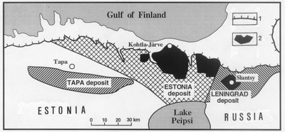
Fig. 203. Location of oil shale deposits in the Baltic Oil Shale Basin: 1 - Recent erosional boundary of kukersite oil shale; 2 - mined out areas and fields of active mines.
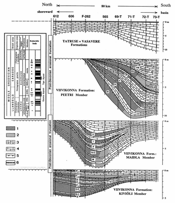
Fig. 204. North-south profile of the main kukersite sequence (Viivikonna Formation) with the overlying Tatruse and Vasavere limestones through the Tapa oil shale deposit. For location of cross-section see Fig. 206. 1 - kukersite or kerogen-rich limestone; 2 - kerogen-lean limestone; 3 - biomicritic limestone with a low content of organic matter; 4 - variously argillaceous limestone; 5 - hardground; 6 - K-bentonite bed.
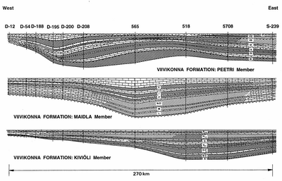
Fig. 205. East-west cross-section of the Kiviõli, Maidla and Peetri members of the Viivikonna Formation through the Tapa and central part of the Estonia deposits. For location of cross-sections see Fig. 206, for legend Fig. 204.
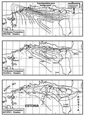
Fig. 206. Thickness maps of the Kiviõli, Maidla and Peetri members of the Viivikonna Formation in northern and central Estonia with locations of N-S and E-W cross-sections.

Fig. 207. Output of kukersite oil-shale in Estonia since 1919 (A), including list of all present and past open-cast pits and underground mines (B). Black bars show the years of activity.
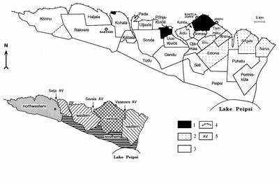
Fig. 208. Subdivisions of the Estonia deposit: 1 - closed mines; 2 - fields of active mines and open-cast pits; 3 - explored fields for further mining; 4 - recent erosional boundary of the kukersite oil shale formation; 5 - ancient valleys.
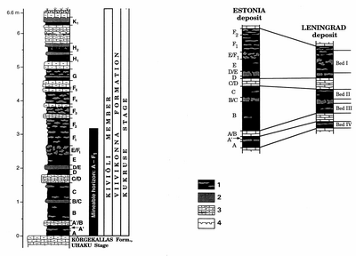
Fig. 209. Typical lithology of the Kiviõli Member beds at the Kohtla open-cast pit (modified from Kõrts & Einasto 1990): 1 - kukersite with kerogenous limestone nodules; 2 - kerogenous limestone; 3 - variably argillaceous limestone with kukersite lenses; 4 - hardground.
Fig. 209a. Nomenclature and correlation of mineable beds between the Estonia and Leningrad deposits. For legend see Fig. 209.
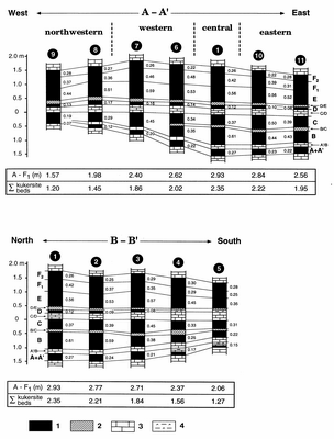
Fig. 210. West-east (A-A) and north-south (B-B) cross-sections of the commercial bed A-F1 through the Estonia deposit. Kukersite bed F2 is not mined because of its low organic matter content. Location of both cross-sections is shown in Fig. 211. 1 - Kukersite oil shale; 2 - kerogenous limestone; 3 - variably argillaceous limestone; 4 - kerogenous marlstone.
Fig. 211. Characteristics of the commercial bed A-F1 of the Estonia deposit and the mineable bed III of the Tapa deposit: 1 - Thickness isolines for commercial bed A-F1 (Estonia deposit), II kukersite oil shale bed (Tapa deposit); 2 - oil yield by Fisher Assay (T, %) and calorific value (Q, MJ/kg) isolines (calorific values are given in brackets); 3 - location of cross-sections shown on Fig. 210.
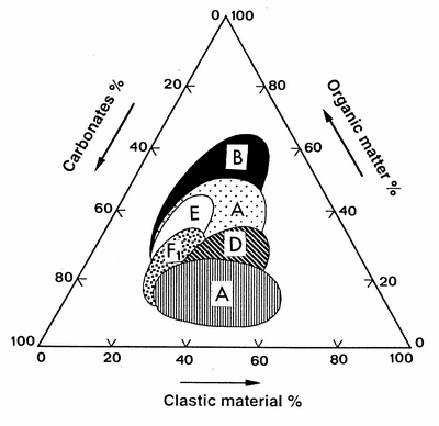
Fig. 212. Composition of oil shale seams in the commercial bed A-F1 of the Estonia deposit (Kattai & Puura 1988).
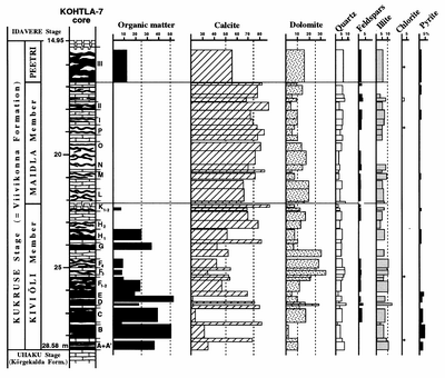
Fig. 213. Semiquantitative X-ray diffractometry data on the mineral composition of the Viivikonna Formation carbonate rocks and oil shale beds. The borehole Kohtla-7 was drilled in the central area of the Kohtla mine; for location of the mine see Fig. 208. Asterisks denote traces of chlorite. Average concentrations in shales and clays are from the paper by Vinogradov (Vinogradov 1962) and average concentrations in limestones are from Turekian and Wedepohl (1961). Ef - enrichment/¬impoverishment factor: relative to average clays/shales and relative to average limestones. Shaded rows show elements which have Ef-shales>1.
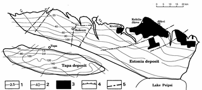
Fig. 214. Depths from the surface and thickness isolines (in metres) for kukersite oil shale bed III (Tapa deposit) and for the commercial bed A-F1 (Estonia deposit): 1 - thickness isolines; 2 - depth from the surface; 3 - mined-out areas; 4 - post-Devonian erosional cut; 5 - linear zones of main tectonic disturbances.

Fig. 215. Location of water and nature reserves in the area of the Estonia oil shale deposit. The dashed lines indicate the extent of water depression formed because of extensive pumping from open-cast pits and from underground mines. Landscape reserves: 1 - Kurtna; 2 - Porkuni; 3 - Uljaste; 4 - Võlumäe; 5 - Mõdriku-Roela. Bog reserves: 6 - Agusalu; 7 - Muraka; 8 - Sirtsi; 9 - Sämi-Kuristiku; 10 - Tudu-Järvesoo.

Fig. 216. Scheme of the occurrence of Dictyonema argillite in Estonia: 1 - isopachyte of the stratum, m; 2 - isobath of the stratums upper surface, m; 3 - erosional northern boundary of the strata; 4 - boreholes in Fig. 217.
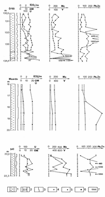
Fig. 217. Distribution of OM and (CO2)m and microelements in Dictyonema argillite: 1 - Dictyonema argillite; 2 - carbonate-rich interlayer; 3 - sampling interval; 4 - CO2 (%); 5 - OM (%), V and Pb (ppm); 6 - U, Mo and Zn (ppm); 7 - the highest contents (ppm). For location of boreholes see Fig. 216.
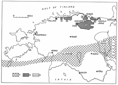
Fig. 218. Phosphorite deposits of Estonia: 1 - area where Obolus sandstone is lacking; 2 - phosphorite deposits: 1 - Maardu, 2 - Tsitre, 3 - Toolse, 4 - Aseri, 5 - Rakvere; 3 - klint.
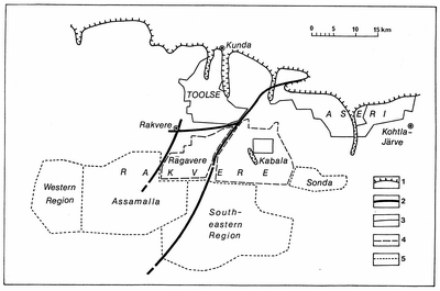
Fig. 219. Rakvere Phosphorite Region: 1 - northern limit of the present distribution of phosphorite; 2 - zones of disturbances; 3 - cat. T; 4 - cat. R; 5 - cat. P.
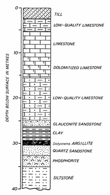
Fig. 220.Generalized section of the Toolse phosphorite deposit (Raudsep 1994).
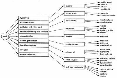
Fig. 221. Options for peat conversion (after Sipila 1986).
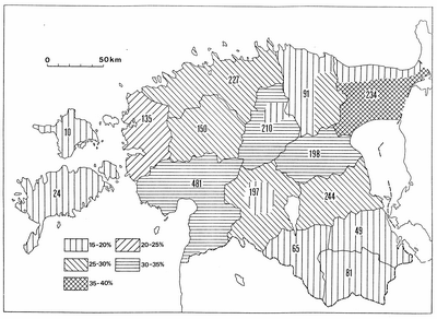
Fig. 222. Paludification (%) and the total amount of peat resources (million tonnes at 40% moisture content) in Estonia by counties (after Orru 1996).
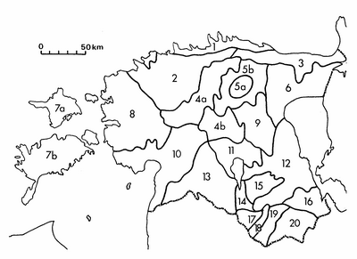
Fig. 223. Estonian peat districts: 1 - North-Estonian Coastal Lowland; 2 - North-West Estonian Plateau; 3 - North-East Estonian Plateau; 4 - Kõrvemaa (4a - watershed area, 4b - upper course of the Pärnu River); 5 - Pandivere Upland (5a - central part, 5b - slopes); 6 - Alutaguse; 7 - West-Estonian Archipelago (7a - Hiiumaa, 7b - Saaremaa); 8 - West-Estonian Lowland; 9 - Vooremaa; 10 - Pärnu Lowland; 11 - Võrtsjärv Lowland; 12 - South-East Estonian Plateau; 13 - Sakala Upland; 14 - Väike-Emajõgi Valley; 15 - Otepää Heights; 16 - Palumaa; 17 - Valga Lowland; 18 - Karula Upland; 19 - Võru-Hargla Depression; 20 - Haanja Heights.
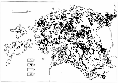
Fig. 224. Estonian peat deposits: 1 - fen, 2 - raised bog, 3 - number of the peat deposit in use; 4 - number of the protected mire. Peat deposits in use: 1 - Pääsküla; 2 - Hara; 3 - Rae; 4 - Kostivere; 5 - Peningi; 6 - Ohtu; 7 - Sausti; 8 - Vääna; 9 - Ääsmäe; 10 - Mahtra; 11 - Ellamaa; 12 - Uuemõisa; 13 - Varudi; 14 - Peetla; 15 - Hiiesoo; 16 - Peeri; 17 - Puhatu; 18 - Pihla; 19 - Koigi; 20 - Piila; 21 - Pelisoo; 22 - Laiküla; 23 - Kõverdama; 24 - Niibi; 25 - Turvalepa; 26 - Õmma; 27 - Hagudi; 28 - Keava; 29 - Hõreda; 30 - Orgita; 31 - Tõnumaa; 32 - Päärdu; 33 - Epu-Kakerdi; 34 - Retla; 35 - Lokuta; 36 - Tondissaare; 37 - Epa-Vassaare; 38 - Ohepalu; 39 - Kallissaare; 40 - Endla; 41 - Umbusi; 42 - Kivijärve; 43 - Visusti; 44 - Lavassaare; 45 - Mõrdama; 46 - Pööravere; 47 - Kõrsa; 48 - Rääma; 49 - Tolkuse; 50 - Kavasoo; 51 - Viirasoo; 52 - Möksi; 53 - Soosaare; 54 - Pätsi; 55 - Ikepera; 56 - Parika; 57 - Napsi; 58 - Õisu; 59 - Sangla; 60 - Laukasoo; 61 - Keressaare; 62 - Tuurapera; 63 - Meelva; 64 - Meenikunno; 65 - Helme; 66 - Kantsi; 67 - Lagesoo; 68 - Roosa; 69 - Põdrasoo; 70 - Kungjärve; 71 - Kurgsoo; 72 - Pindi. Main protected mires: 1 - Emajõe-Suursoo; 2 - Muraka; 3 - Kuresoo; 4 - Emajõe-Pedja; 5 - Ördi; 6 - Suursoo; 7 - Tolkuse; 8 - Avaste; 9 - Endla; 10 - Valgaraba; 11 - Kikepera; 12 - Koigi; 13 - Nigula; 14 - Kellamäe (Vanamõisa), 15 - Laukasoo.

Fig. 225. Peat types profile of the Hagudi Mire, Rapla County: 1 - Fuscum peat; 2 - complex peat; 3 - cotton-grass - Sphagnum peat; 4 - heath peat; 5 - fen wood peat; 6 - fen sedge peat; 7 - transitional sedge peat; 8 - fen reed-sedge peat; 9 - fen wood-reed-sedge peat; 10 - fen sedge-Hypnum peat; 11 - fen Hypnum peat; 12 - fen wood-Hypnum peat; 13 - transitional grass peat; 14 - loam; 15 - sandy loam; 16 - clay.
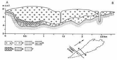
Fig. 226. Peat type profile of the Tolkuse Mire, Pärnu County: 1 - Sphagnum-Fuscum peat; 2 - heath-Sphagnum peat; 3 - fen wood peat; 4 - fen wood-Sphagnum peat; 5 - transitional wood-Sphagnum peat; 6 - loamy sand; 7 - sand.
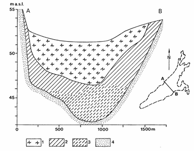
Fig. 227. Peat type profile of the Napsi Raised Bog, Viljandi County: 1 - Sphagnum-Fuscum peat; 2 - fen sedge peat; 3 - fen Hypnum peat; 4 - sand.
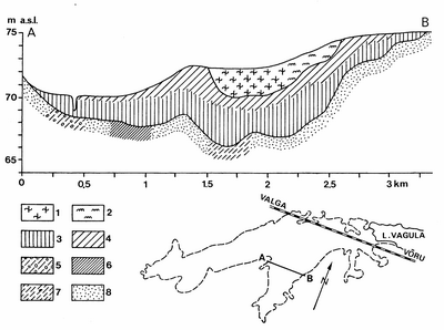
Fig. 228. Peat type profile of the Kerreti Mire, Võru County: 1 - Sphagnum-Fuscum peat; 2 - Sphagnum-Medium peat; 3 - fen wood peat; 4 - fen sedge peat; 5 - till; 6 - sandy loam; 7 - loamy sand; 8 - sand.
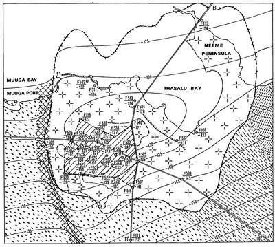
Fig. 229. Sketch-map of the Maardu deposit. For legend see Fig. 230.

Fig. 230. Geological sections of the Maardu granite deposit: 1 - porphyry-potassium-granite; 2-5 - metamorphic rocks: 2 - amphibolite- and biotite-amphibolegneiss; 3 - quartz-feldspar and granite gneiss; 4 - sillimanite-, cordierite- and garnet-bearing biotitegneiss; 5 - biotite- and amphibole-biotitegneiss; 6 - weathered crystalline rocks; 7-10 - sedimentary rocks: 7 - sandstone and siltstone; 8 - clay; 9 - Dictyonema argillite; 10 - limestone; 11 - Quaternary sediments; 12 - waste rocks of the phosphorite quarry; 13 - area of calculated granite reserves; 14 - boundary of the Neeme intrusive; 15 - isohyps of the crystalline surface, m below sea level; 16 - zone of tectonic disturbances; 17 - boundary of the Maardu phosphorite quarry; 18 - line of geological section (Fig. 230); 19 - phosphorite layer; 20 - borehole, its number and the depth of the crystalline basement; 21 - escarpment. Geological indices: PR2V - Vendian, C1ln-lk - Lontova and Lükati formations, C1ts- Tiskre Formation, O1kl - Kallavere Formation, O1-2 - Lower and Middle Ordovician.

Fig. 231. General distribution of limestone and dolomite resources in Estonia: 1- deposit and its name; 2 - deposit in exploitation; 3 - limestone deposit; 4 - dolomite deposit. Promising areas: 5 - for construction purposes; 6 - for cement production; 7 - for lime production; 8 - for facing and ornamental purposes; 9 - zones of disturbances. Stratigraphical indices of regional stages: O1 - Pakerort, Varangu, Volkhov, Kunda; O2 as-uh - Aseri, Lasnamäe, Uhaku; O2 kk-vr - Kukruse, Idavere, Jõhvi, Keila, Oandu, Rakvere; O2-3 nb - O3pk - Nabala, Vormsi, Pirgu, Porkuni; S1 jr - Juuru; S1rk - Raikküla; S1ad - Adavere; S1 jn - Jaani; S1 jg - Jaagarahu; S1-2 rt - Rootsiküla; S2 pd - Paadla; S2kr - Kuressaare; S2 kg-oh - Kaugatuma, Ohesaare; D2 - Middle Devonian.
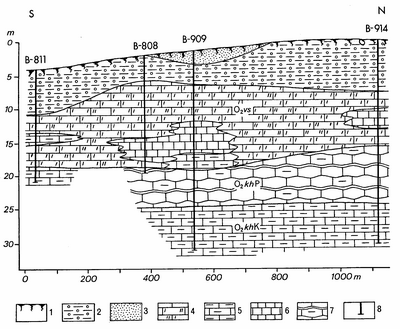
Fig. 232. Geological section of the Vasalemma deposit (after the exploration report by I. Barankina): 1 - soil; 2 - till; 3 - loamy sand; 4 - fine to coarse crystalline bioclastic limestone - marble of Vasalemma; 5 - argillaceous limestone; 6 - aphanitic (micritic) limestone; 7 - seminodular limestone with intercalations of marl; 8 - number of borehole. Stratigraphical indices: O2 vs - Vasalemma Formation, O2 khP - Pääsküla Member, O2khK - Kurtna Member.
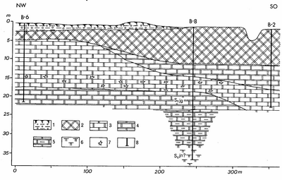
Fig. 233. Geological section of the Kurevere deposit (after the exploration report by S. Korbut): 1 - soil and till; 2 - reef dolomite, 3 - fine to microcrystalline horizontal-bedded dolomite; 4 - dolomite with intercalations of domerite; 5 - argillaceous dolomite with intercalations of domerite; 6 - domerite; 7 - caverns; 8 - number of borehole. Stratigraphical indices: S1 jg - Jaagarahu Stage, S1 jn - Jaani Stage.

Fig. 234. The most important sand and gravel deposits: 1 - sand; 2 - gravel; 3 - quartzose sandstone; 4 - main perspective areas of sand and gravel (after Karukäpp 1988).
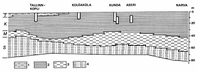
Fig. 235. Mined levels of Cambrian blue clays of the Lontova Formation. The lithologically differing subdivisions (members) of the deposits are marked with letters. 1 - clay and silt; 2 - clay; 3 - silty clay; 4 - sandstone and clay.
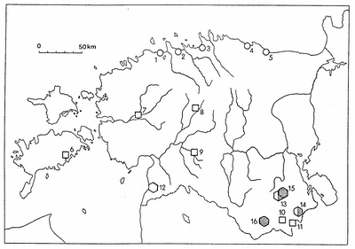
Fig. 236. Clay deposits in Estonia. 1-5 - Cambrian clays (circles): 1 - Kopli; 2 - Kallavere; 3 - Kolgaküla; 4 - Kunda; 5 - Aseri. 6-11 - Quaternary clays (squares): 6 - Sakla; 7 - Vana-Vigala; 8 - Türi; 9 - Tohvri; 10 - Perametsa; 11 - Määsi. 12-16 - Devonian clays (hexagons): 12 - Arumetsa; 13 - Joosu; 14 - Küllatova; 15 - Süvahavva; 16 - Sänna. Shaded symbols denote refractory clays.
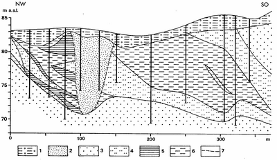
Fig. 237. The complicated mode of occurrence of Devonian clays in the Joosu deposit (after Tallinn et al. 1970): 1 - till; 2 - sand; 3 - sandstone; 4 - silt; 5 - red clay; 6 - grey clay; 7 - contour of buried valley.
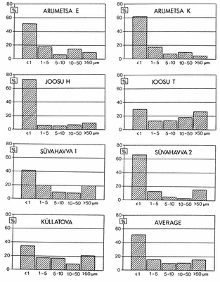
Fig. 238. Granulometric composition of Devonian clays in some deposits.
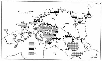
Fig. 239. Distribution of glaciolacustrine clays with different texture (after Pirrus & Saarse 1979): 1 - clays of large proglacial lakes with weakly differentiated summer and winter varves; 2 - clays of small glacial lakes with well-differentiated varves; 3 - clays, mostly unstratified or with unclear deposition of annual layers. Dotted line marks the boundary of marked increase in the carbonate admixture (after Pirrus 1964).
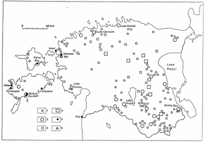
Fig. 240. Investigated mud reserves in Estonian lakes, mires and offshore sea: 1 - deposits in lakes with reserves under 1 million tonnes; 2 - deposits in lakes with reserves over 1 million tonnes; 3 - deposits in mires with lake mud reserves under 1 million tonnes; 4 - deposits in mires with lake mud reserves over 1 million tonnes; 5 - sea mud deposits; 6 - deposits in exploitation.
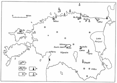
Fig. 241. Mineral occurrences: 1 - iron ore; 2 - polymetallic ore; 3 - ochre; 4 - diatomite; 5 - gas.

Fig. 242. Compilation of the Book of Primeval Nature as of January 1, 1997. In the shaded areas the studies of the first stage have been completed. Figures mark: total number of recorded inanimate nature monuments (lower row), the number of big erratic boulders and boulder fields (middle row), the number of other nature monuments (upper row): I - Ida-Viru County; II - Lääne-Viru County; III - Tallinn; IV - Harju County; V - Järva County; VI - Rapla County; VII - Lääne County; VIII - Hiiu County; IX - Saare County.
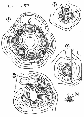
Fig. 244. Morphologically better preserved Holocene meteorite craters in Estonia (in comparable measure): 1 - Kaali main crater (100 m); 2 - Ilumetsa Põrguhaud (76 m); 3 - Ilumetsa Sügavhaud (47 m); 4 - Tsõõ¬rikmägi (40 m); 5 - Simuna (9 m, after Pirrus 1995).
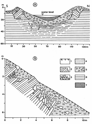
Fig. 245. The geological cross section of the Kaali main crater (A) and detailed geological cross section of its south wall (B) after Aaloe ( 1963): 1 - soil; 2 - uplifted dolomite; 3 - shattered dolomite; 4 - dolomitic powder; 5 - filling-breccia; 6 - dolomite; 7 - gyttia and peat.

Fig. 246. The scheme of dolomite layers crushed by the explosion in the rim of the Kaali main crater.
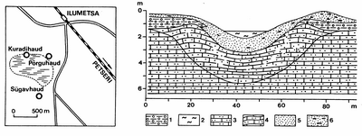
Fig. 247. Location of Ilumetsa craters and the cross section of the Põrguhaud Crater after Aaloe (1979): 1 till; 2 peat and sapropel; 3 Devonian sandstone; 4 disturbed sandstone; 5 glaciofluvial sand; 6 the same with till lenses.
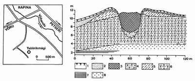
Fig. 248. Location and geological cross-section of the Tsõõrikmägi Crater (Pirrus & Tiirmaa 1984): 1 - soil; 2 - sand; 3 - peat; 4 - silty filling material; 5 - till-like crater-wall sediments; 6 - till; 7 - Devonian clay; 8 - Devonian sandstone.

Fig. 249. Cross section of the Kärdla Crater: (a) reconstruction of the pre impact stratigraphy; (b) present configuration (after Puura & Suuroja 1992): 1 Quaternary deposits (Q); 2 limestone; 3 clayey limestone; 4 marl; 5 clay; 6 silt and siltstone; 7 sand and sandstone; 8 sandstone with phosphate debris; 9 11 breccias: 9 containing mostly crystalline rocks, 10 crater bottom breccia containing crystalline rocks, 11 consisting mostly of sedimentary rocks with admixture of crystalline rocks; 12 crystalline rocks; 13 weathered crystalline rocks; 14 basal conglomerate; 15 main discontinuity surface; 16 metabentonite layer; 17 fractured rocks with breccia dikes.

Fig. 250. Big boulders, boulder accumulations and boulder fields currently under the state nature protection (after Viiding 1960 with some modifications).

Fig. 251. Distribution of rapakivi (marked with triangles or in % of all counted boulders) after unpublished data of H. Viiding with authors complements. The continuous line denotes the westernmost boundary of the Vyborg rapakivi; the dashed line marks the glacial advance of the Palivere Stadial and the distribution of rapakivi from the Åland islands and from the massifs of southwestern Finland. The big arrows show the main direction of the ice movement (Raukas 1995b).
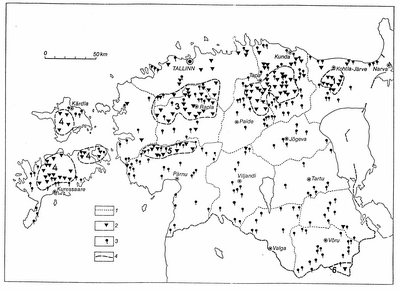
Fig. 252. Karst forms and springs in Estonia: 1 - boundary of the county; 2 - karst; 3 - spring; 4 - karst region and its number.
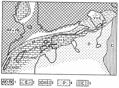
Fig. 253. Location of the Baltic (BK) and Silurian (SK) klints. Outcrops: 1 - crystalline Archaean and Proterozoic; 2 - Vendian and Cambrian; 3 - Ordovician and Silurian; 4 - Devonian; 5 - Carboniferous.
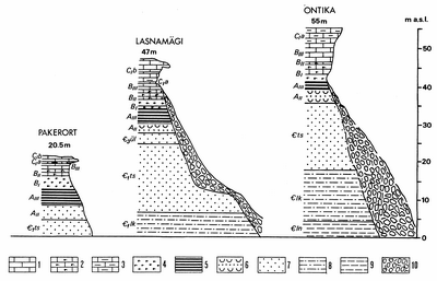
Fig. 254. Sections of the North-Estonian Klint (after Einasto & Saadre 1991). Legend: 1 - limestone; 2 - glauconitic limestone; 3 - oolitic limestone; 4 - glauconitic sand and sandstone; 5 - graptolitic argillite (Dictyonema shale); 6 - Obolus sandstone; 7 - fine-grained quartzose sandstone; 8 - siltstone; 9 - blue clay; 10 - talus.
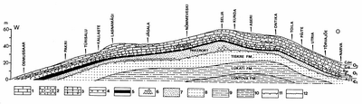
Fig. 255. Geological section along the edge of the Baltic Klint (compiled by R. Einasto). Legend: 1 - limestone; 2 - oolitic limestone; 3 - glauconitic limestone; 4 - glauconitic sand and sandstone; 5 - graptolitic argillite (Dictyonema shale); 6 - Obolus conglomerate; 7 - Obolus sandstone; 8 - fine-grained quartzose sandstone; 9 - siltstone; 10 - blue clay; 11 - discontinuity surface; 12 - bedrock surface.
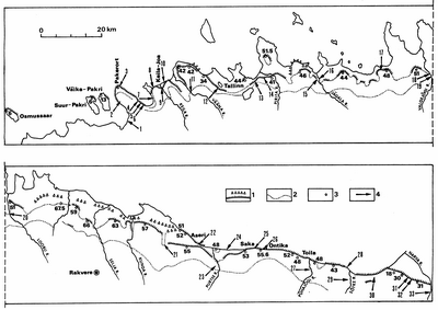
Fig. 256. Sites of waterfalls: 1 - Madise (1.5); 2 - Paldiski; 3 - Pakri (5.5-5.8); 4 - Valli (2.2); 5 - Põllküla (2.0-2.5); 6 - Kersalu (2.5-3.0); 7 - Treppoja (5.6); 8 - Tornimäe (2.0-3.0); 9 - Keila (5.7); 10 - Türisalu (2.5); 11 - Vahiküla (Vääna) (4.5); 12 - Harku (1.3); 13 - Hundikuristik (3.8); 14 - Purde (4.5); 15 - Jõelähtme (2.1); 16 - Jägala (8.1); 17 - Turjekelder (4.0); 18 - Vasaristi (3.6); 19 - Nõmmeveski (1.2); 20 - Joaveski (5.1); 21 - Kohina-Linnamäe (2.5); 22 - Aseri (1.5); 23 - Uhaku (1.2), 24 - Ahermu (1.2); 25 - Karjaoru (8.0); 26 - Valaste (26.1); 27 - Aluoja (5.0-5.8); 28 - Ukuoru (4-5); 29 - Langevoja (3.9); 30 - Utria (3.2), 31 - Orasoja (1.1); 32 - Tõrvajõe (2.2); 33 - Narva (6.5). Legend: 1 - North-Estonian Klint (white triangles - lower escarpment); 2 - outcrop area boundary of the so-called klint stages (BII - CIb); 3 - height of the klint (a.s.l.); 4 - site of waterfall, in brackets - total height of the waterfall in metres.

Fig. 257. Mire reserves (underlined) and mires in protected areas as of January 1, 1997. Harju County: 1 - Suursoo; 2 - Aabla; 3 - Hara; 4 - Kahala; 5 - Suru, 6 - Viru; 7 - Koitjärve; 8 - Salu; 9 - Muki; 10 - Lille; 11 - Salgu. Lääne-Viru County: 12 - Kiku; 13 - Kõrbse; 14 - Laukasoo; 15 - Luusaare (Venevere); 16 - Neeruti; 17 - Sämi-Kuristiku; 18 - Tudu-Järvesoo; 19 - Tuksmani; 20 - Udriku; 21 - Uuesmõisa; 22 - Vohnja. Ida-Viru County: 23 - Uljaste; 24 - Sirtsi; 25 - Muraka; 26 - Agusalu. Hiiu County: 27 - Eiste; 28 - Kodeste; 29 - Kõivasoo; 30 - Kõrigu; 31 - Pihla; 32 - Määvli. Lääne County: 33 - Nehatu; 34 - Marimetsa; 35 - Tuhu. Rapla County: 36 - Aela-Viirika; 37 - Loosalu; 38 - Mahtra; 39 - Keava; 40 - Palasi; 41 - Kodila-Linnuraba; 42 - Hagudi. Järva County: 43 - Piiumetsa (Rumbi); 44 - Epu-Kakerdi. Jõgeva County: 45 - Endla; 46 - Kaiavere; 47 - Lava; 48 - Ulpe; 49 - Umbusi. Saare County: 50 - Viidumäe (Lümanda); 51 - Pelisoo; 52 - Koigi. Pärnu County: 53 - Avaste; 54 - Kikepera; 55 - Lindi; 56 - Nigula; 57 - Rongu; 58 - Ruuna; 59 - Tolkuse; 60 - Tõhela; 61 - Tõrga; 62 - Võlla; 63 - Kodesma; 64 - Soometsa; 65 - Ojasaare. Viljandi County: 66 - Kuresoo; 67 - Valgeraba; 68 - Ördi; 69 - Parika. Tartu County: 70 - Emajõe-Pedja (Laeva); 71 - Emajõe-Suursoo; 72 - Punnasjärve; 73 - Sirnuvere; 74 - Valguta; 75 - Vasula; 76 - Laukasoo. Põlva County: 77 - Meenikunno; 78 - Meelva; 79 - Valgeraba; 80 - Ahijärve; 81 - Jõe. Valga County: 82 - Nuustaku; 83 - Pori; 84 - Rebaste; 85 - Vidrike; 86 - Pühajärve; 87 - Köstrejärve; 88 - Palu; 89 - Koobassaare; 90 - Väike-Apja; 91 - Lauksilla. Võru County: 92 - Kellamäe (Vanamõisa); 93 - Kaugjärve; 94 - Murati; 95 - Ubajärve.

Fig. 258. Pandivere Upland: 1 - roof; 2 - zones of disturbances; 3 - outcrop boundary of Ordovician and Silurian rocks; 4 - towns and settlements; 5 - mires.
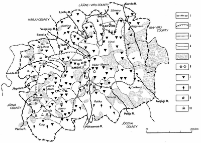
Fig. 259. Geological monuments and water reserves under protection. Boundaries of the: 1 -water protection area; 2 - roof of the upland; 3 - counties; 4 - communes; 5 - forests; 6 - towns and settlements; 7 - karst forms; 8 - springs; 9 - outcrops; 10 - erratic boulders.

Fig. 260. National parks: 1 - Lahemaa; 2 - Vilsandi; 3 - Karula; 4 - Soomaa. Nature reserves: 5 - Matsalu; 6 - Viidumäe; 7 - Nigula; 8 - Endla; 9 - Alam-Pedja. Landscape reserves: 10 - Kõrvemaa (the northern part was a former military area); 11 - Kurtna; 12 - Otepää; 13 - Paganamaa; 14 - Vooremaa. Mire reserve: 15 - Meenikunno. Nature park: 16 - Haanja. Programme areas: 17 - West-Estonian Archipelago Biosphere Reserve; 18 - Pandivere Water Protection Area.
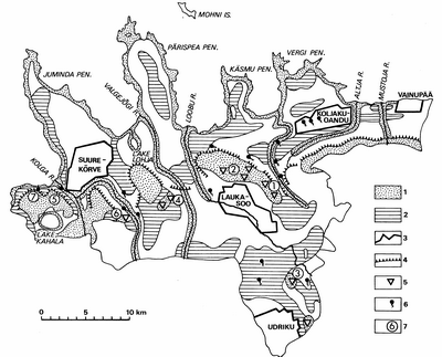
Fig. 261. Lahemaa National Park. Ground and surface water protection: 1 - unprotected area; 2 - weakly protected area; 3 - boundary of nature reserves; 4 - klint; 5 - karst forms; 6 - spring; 7 - water protection areas.